It looks like you're using an Ad Blocker.
Please white-list or disable AboveTopSecret.com in your ad-blocking tool.
Thank you.
Some features of ATS will be disabled while you continue to use an ad-blocker.
share:
These guys got a better picture.
twitter.com...
twitter.com...
originally posted by: EndtheMadnessNow
a reply to: Caled
More about that guy...
originally posted by: RookQueen
a reply to: NightFlight
The total numbers are astounding to me and at the same time it makes me laugh that they thought we wouldn’t notice!
I wonder how close the no match % is to the recent 3rd party estimate of 'ghost' or 'excess' votes in each state was.
Might have to research that one later.
edit on 19-9-2021 by Nunyabizisit because: (no reason given)
Our old friends at the economist with more Q related symbolism.
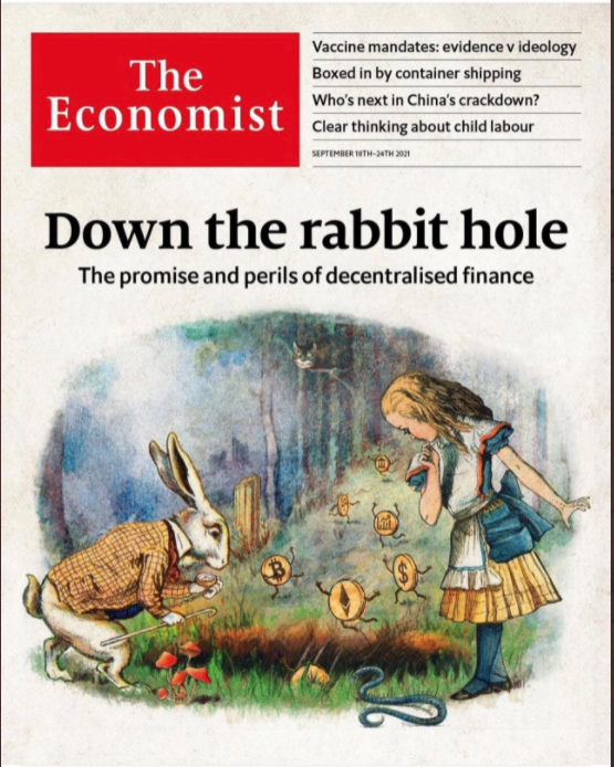
Up front we have BTC, ETH, $, FED all going down the rabbit hole with one already in.
Folks went to a lot of effort on the snake. 316655ae-0099 465e-8429. . OX9498+752x088re-
It has been 33 years since this cover.


Up front we have BTC, ETH, $, FED all going down the rabbit hole with one already in.
Folks went to a lot of effort on the snake. 316655ae-0099 465e-8429. . OX9498+752x088re-
It has been 33 years since this cover.

originally posted by: RookQueen
From McAfee tgram......I've never seen this one
t.me...
This actually appeared in these threads way back.
I have the impression that it was kind of dismissed as fake at the time.
No one who is aware that virtually all communications are monitored would spell this out is such unequivocally damning detail.
Huma is not stupid. Confess on YAHOO.COM? Um, no.
.
edit on 9/19/2021 by cimmerius because: Tweak
La Palma volcano, it seriously looks like a fisure eruption now! It's growing fast!
Rainbows
Jane
Rainbows
Jane
originally posted by: Guyfriday
a reply to: cimmerius
No but Huma is a tool for the Muslim Brotherhood, so her giving herself up for the cause isn't surprising in the least.
I don't doubt that the scenario described could be true. It's just unlikely that she would be dumb enough to put it in writing.
Not for a cheap brag. Not on a YAHOO email.
ETA I also wanted to point out that the McAfee tgram is posting more really old "info."
.
edit on 9/19/2021 by cimmerius because: ETA
edit on 9/19/2021 by cimmerius because: clarity
edit on
9/19/2021 by cimmerius because: Typo
a reply to: cimmerius
I agree she is not dumb. I do find the email address odd though. I have a yahoo address from '98 that required lower case letters mixed with numbers. It appears that has been left off of this letter so I'm curious if the publisher (McAfee) left it off and typed her name in. Could she have believed she was sending an email from a secure email? If not then I agree it is fake but should speak to the validity of the rest of the stuff released by McAfee......
I agree she is not dumb. I do find the email address odd though. I have a yahoo address from '98 that required lower case letters mixed with numbers. It appears that has been left off of this letter so I'm curious if the publisher (McAfee) left it off and typed her name in. Could she have believed she was sending an email from a secure email? If not then I agree it is fake but should speak to the validity of the rest of the stuff released by McAfee......
Joe the psychopath, seriously there is no “intelligent” context or mature perspective on these issues other than men like Joe who are bought and
paid for prostitutes. The scum of the earth who deserve neither benefit of the doubt or sympathy for their comeuppance. And it’s coming Joe, a day
of Reckoning is coming.

twitter.com...

twitter.com...
Corey @Corey'digs
Covid-19 Resources: Medical, Legal, Forms, Jobs & Other Critical
Information has pretty much the definitive Rona Resource Page.
Do you think if the legendary ObamaPhone lady was asked if she'd be willing to change the death certificate of a family member to "dead by Corona-Chan" she'd do it? If that change paid her 9k in cash, what then? Did that increase the anemic numbers death toll numbers?
COVID-19 Funeral Assistance
Look at that date. May 16, just two months after the so called "pandemic" was declared. FEMA, OSHA, and so many others were in charge of the scam and the scam implementation. Did they do this for any other "disaster" in a wholesale manner?
This is interesting on so many levels it is hard to pick out just one to attack. So I'll hit the least obvious. The government, we'll the banking goons, have insurance policies on the population. When born money is printed in your name and loaned to the government, and YOU have to pay it back until death = taxes. They keep track.
If one fails to pay it all back, and their death fits the standard, insurance pays up. We've also seen in this thread that the elite gamble on deaths, both time of death and type, so it begs the question... Who gambled on Wu-Flu deaths? Who is paying out?
Even sicker. Who at the top levels of the hidden has bets on how many jabs will be delivered? Who is trying to make that bet a winner? Who is trying to make that bet a loser? What bets derive from the jabs themselves, as in "how many will die?"
In Canada it is all about "doing the right thing" to get your Freedoms BACK. Castro Clip
In Australia it isn't about health, it is about showing continued compliance at future markers. Clip
Watch a head explode: What "freedoms" has the government ever given back after taking them away through violence, coercion or deceit? If they are confused, ask them if they still take off their shoes at the airport. Then stand back.
So it would seem the goons don't get the same talking points now, it is a free for all, all they care about is closing the spiritual gates no matter what. This is what PANIC looks like when those in charge are effed in the A.
Do you think if the legendary ObamaPhone lady was asked if she'd be willing to change the death certificate of a family member to "dead by Corona-Chan" she'd do it? If that change paid her 9k in cash, what then? Did that increase the anemic numbers death toll numbers?
COVID-19 Funeral Assistance
For deaths that occurred after May 16, 2020, the death certificate must indicate the death was attributed to COVID-19.
Look at that date. May 16, just two months after the so called "pandemic" was declared. FEMA, OSHA, and so many others were in charge of the scam and the scam implementation. Did they do this for any other "disaster" in a wholesale manner?
This is interesting on so many levels it is hard to pick out just one to attack. So I'll hit the least obvious. The government, we'll the banking goons, have insurance policies on the population. When born money is printed in your name and loaned to the government, and YOU have to pay it back until death = taxes. They keep track.
If one fails to pay it all back, and their death fits the standard, insurance pays up. We've also seen in this thread that the elite gamble on deaths, both time of death and type, so it begs the question... Who gambled on Wu-Flu deaths? Who is paying out?
Even sicker. Who at the top levels of the hidden has bets on how many jabs will be delivered? Who is trying to make that bet a winner? Who is trying to make that bet a loser? What bets derive from the jabs themselves, as in "how many will die?"
In Canada it is all about "doing the right thing" to get your Freedoms BACK. Castro Clip
In Australia it isn't about health, it is about showing continued compliance at future markers. Clip
Watch a head explode: What "freedoms" has the government ever given back after taking them away through violence, coercion or deceit? If they are confused, ask them if they still take off their shoes at the airport. Then stand back.
So it would seem the goons don't get the same talking points now, it is a free for all, all they care about is closing the spiritual gates no matter what. This is what PANIC looks like when those in charge are effed in the A.
a reply to: crankyoldman
I have to take a moment to thank everyone here, and apologize on behalf of so many otherwise intelligent folks that throw so much abuse your way before AZ Audit results are released and my mission here comes to an end.
Most of what is discussed in your threads is over my head so I only visit every month or so because reading about things like that is easier to do after someone else asks all the questions that I would have needed to ask.
But I also visit just random pages on these threads whenever I'm having such a bad day that only a Mad Cranky Queen Caled meme can cheer me up.
Thank you for that!
Everyone here!
WIB:
Whatever happens, Better happen quickly. Things are getting pretty bad up here in Canada. Our fearless leader is speaking like literal hitler, And i'm
afraid too many people are dumb to the fact that fascism is literally here.
Good to know you, I'll be one of the first dragged out of my home for refusing this b/s
Good to know you, I'll be one of the first dragged out of my home for refusing this b/s
a reply to: MetalThunder
MT, I'd forgotten it was HARVEST MOON tomorrow!
1) I've been thinking of the implications of a tsunami and on sea levels after the event...
a) If the 3 city states have access to the deepest "Ancient tunnels" then those need flooding too, and because of their depth would require a LOT of water?
b) If, say, that caused a drop of 100ft in sea-levels, then it would expose a lot of ruins of older civilisations; such as Dwarka and in the Mediterranean?
c) Now consider what would happen to the water that flooded the very deep tunnels - it would be heated from being below the outer mantle, therefore it would erupt as geysers from tunnel entrances, causing a more humid tropical atmoshphere in, say, deserts?
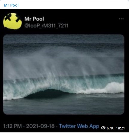
2) Your La Palma youtube led me off down another rabbit hole because I let youtube play the next video which, synchronistically, seems to link to a Mr Pool picture from yesterday, 18th at 1:12pm on twitter and 18:21 on Telegram (it also links to at least 2 other Mr Pool pictures):
a) I'll be posting THUMBNAILS below because there are several screenscrapes, with subtitles and times, that tie into key symbols or Mr Pool pictures. Firstly tho, here's the youtube though Lord Howe Island - Garden of Eden between Australia and New Zealand - "Garden of Eden"... getting Biblical!
b) At 1:55 is the wave that appears to be the same spot as Mr Pool's picture in (2) above - note thestraightness of the wave and the lingering mist above it:
c) The most recent Lord Howe was Geoffrey Howe, who was Margaret Thatcher's Chancellor and ended up in the House of Lord's as a life peer. He also held the title Lord President of the Council, in which role he presided over meetings of the Queens Privy Council!
So we have an island bearing the same name as the head of the Queen's Privy Council - but then we ALSO have a Mr Pool picture of the current UK Chancellor, Rishi Sunak:

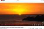
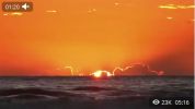
d) This sunset from the video is similar to these 2 Mr Pool videos and 1 picture:


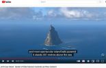
e) There is a BALL'S PYRAMID mountain, 551 metres high, at Lord Howe Island - a pyramid of black balls weighed up against a single red ball is shown in another Mr Pool picture. Recall also the Matrix 4 decode that included 155/551:

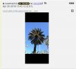
f) The main product of Lord Howe Island is the Kentia Palm, endemic to the island but now also grown or nearby Norfolk Island. Here are similar palm pictures from the video and Mr Pool's pictures and KU posts:

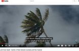
g) The island has rare MOSSes abundant on the plateau - Mr pool posted a picture with abundant moss also:
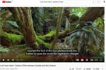
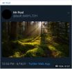
h) The island has a lot of Norfolk Pine trees. It is these trees that are supposed to provide the best pine tree tea medicine against covid.
i) The island is much like an Eastern Galapagos because it has so many unique species of flora and fauna. It is a World Heritage site (Wiki):
I think there's more to find out here:
a) As the island only has 400 inhabitants and limited boat/air traffic - Is it a "safe house" for either White Hats (JFK Jr, or Black Hats?
b) Consider it's position:
Between China/Japan and the Antarctic,
Between Australia and New Zealand,
c) Is the AUKUS treaty anything to do with this territory too?
MT, I'd forgotten it was HARVEST MOON tomorrow!
1) I've been thinking of the implications of a tsunami and on sea levels after the event...
a) If the 3 city states have access to the deepest "Ancient tunnels" then those need flooding too, and because of their depth would require a LOT of water?
b) If, say, that caused a drop of 100ft in sea-levels, then it would expose a lot of ruins of older civilisations; such as Dwarka and in the Mediterranean?
c) Now consider what would happen to the water that flooded the very deep tunnels - it would be heated from being below the outer mantle, therefore it would erupt as geysers from tunnel entrances, causing a more humid tropical atmoshphere in, say, deserts?
2) Your La Palma youtube led me off down another rabbit hole because I let youtube play the next video which, synchronistically, seems to link to a Mr Pool picture from yesterday, 18th at 1:12pm on twitter and 18:21 on Telegram (it also links to at least 2 other Mr Pool pictures):

a) I'll be posting THUMBNAILS below because there are several screenscrapes, with subtitles and times, that tie into key symbols or Mr Pool pictures. Firstly tho, here's the youtube though Lord Howe Island - Garden of Eden between Australia and New Zealand - "Garden of Eden"... getting Biblical!
b) At 1:55 is the wave that appears to be the same spot as Mr Pool's picture in (2) above - note thestraightness of the wave and the lingering mist above it:

c) The most recent Lord Howe was Geoffrey Howe, who was Margaret Thatcher's Chancellor and ended up in the House of Lord's as a life peer. He also held the title Lord President of the Council, in which role he presided over meetings of the Queens Privy Council!
In his resignation speech in the Commons on 13 November 1990, he attacked Thatcher for running increasingly serious risks for the future of the country and criticised her for undermining the policies on EMU proposed by her own chancellor and governor of the Bank of England.
So we have an island bearing the same name as the head of the Queen's Privy Council - but then we ALSO have a Mr Pool picture of the current UK Chancellor, Rishi Sunak:

d) This sunset from the video is similar to these 2 Mr Pool videos and 1 picture:


e) There is a BALL'S PYRAMID mountain, 551 metres high, at Lord Howe Island - a pyramid of black balls weighed up against a single red ball is shown in another Mr Pool picture. Recall also the Matrix 4 decode that included 155/551:


f) The main product of Lord Howe Island is the Kentia Palm, endemic to the island but now also grown or nearby Norfolk Island. Here are similar palm pictures from the video and Mr Pool's pictures and KU posts:


g) The island has rare MOSSes abundant on the plateau - Mr pool posted a picture with abundant moss also:


h) The island has a lot of Norfolk Pine trees. It is these trees that are supposed to provide the best pine tree tea medicine against covid.
i) The island is much like an Eastern Galapagos because it has so many unique species of flora and fauna. It is a World Heritage site (Wiki):
Lord Howe Island ... is an irregularly crescent-shaped volcanic remnant in the Tasman Sea between Australia and New Zealand, part of the Australian state of New South Wales. It lies 600 km (320 nmi) directly east of mainland Port Macquarie, 780 km (420 nmi) northeast of Sydney, and about 900 km (490 nmi) southwest of Norfolk Island. It is about 10 km (6.2 mi) long and between 0.3 and 2.0 km (0.19 and 1.24 mi) wide with an area of 14.55 km2 (3,600 acres), though just 3.98 km2 (980 acres) of that comprise the low-lying developed part of the island.
...
Most of the population lives in the north, while the south is dominated by forested hills rising to the highest point on the island, Mount Gower (875 m, 2,871 ft).[6] The Lord Howe Island Group[6] comprises 28 islands, islets, and rocks. Apart from Lord Howe Island itself, the most notable of these is the volcanic and uninhabited Ball's Pyramid about 23 km (14 mi; 12 nmi) to the southeast of Howe. To the north lies a cluster of seven small uninhabited islands called the Admiralty Group.
...The Lord Howe Island Group is part of the state of New South Wales and is regarded legally as an unincorporated area administered by the Lord Howe Island Board,
...
The island's standard time zone is UTC+10:30, or UTC+11 when daylight saving time applies.
...
UNESCO records the Lord Howe Island Group as a World Heritage Site of global natural significance. Most of the island is virtually untouched forest, with many of the plants and animals found nowhere else in the world. Other natural attractions include the diversity of the landscapes, the variety of upper mantle and oceanic basalt
I think there's more to find out here:
a) As the island only has 400 inhabitants and limited boat/air traffic - Is it a "safe house" for either White Hats (JFK Jr, or Black Hats?
b) Consider it's position:
Between China/Japan and the Antarctic,
Between Australia and New Zealand,
c) Is the AUKUS treaty anything to do with this territory too?
edit on 19-9-2021 by RelSciHistItSufi because: (no reason given)
Would usually just move along, away from this sort of reply because, it is okay to not know or comprehend something like the noosphere but your a in Q
thread asking these type of Questions Q wise ?, can only imagine the response to our world being 50 50 instead of 80 20 regards whats going on in our
world. One potential is this just keeps going on and we never really get the meat n bones but the world dramatically chamges, am ok with that, knowing
what was coming, no need for a told you so, if one cannot see, sense n feel that we about to have one of the biggest event-s ever, lotta shocks coming
along for one, gosh it may even still be 80 20, imo everything is carefully organised and precision scales wise for the benefit of all, while many are
still in the movie, more are simply watching though creating greatly as they see n seize their moment-s and this winds swaying the noosphere
bigely.
Blessings Das, will not answer Q's like that from you again.
Blessings Das, will not answer Q's like that from you again.
originally posted by: daskakik
originally posted by: 13Kiwi20qYes
Q may be the actual Noosphere
Why would they have needed to post on 8chan if we are all connected?
Why would the noosphere worry itself with a bunch of memes to get conservatives to get out and vote to insure republican wins during the mid-terms?
So, while the idea of the noosphere might seem appealing to some, there is much in Q's MO that says they were not it.
edit on 19-9-2021
by 13Kiwi20qYes because: (no reason given)
originally posted by: RelSciHistItSufi
e) There is a BALL'S PYRAMID mountain, 551 metres high, at Lord Howe Island - a pyramid of black balls weighed up against a single red ball is shown in another Mr Pool picture. Recall also the Matrix 4 decode that included 155/551:

What's on the other side of the planet from this island?
The planet Mercury has a feature like this that was created when a massive impact hit one side of the planet, and the force of the impact caused a mountain like this to form on the other side.
From: WIKI
The giant impact believed to have formed Caloris may have had global consequences for the planet. At the exact antipode of the basin is a large area of hilly, grooved terrain, with few small impact craters that are known as chaotic terrain (also "weird terrain"). It is thought by some to have been created as seismic waves from the impact converged on the opposite side of the planet. Alternatively, it has been suggested that this terrain formed as a result of the convergence of ejecta at this basin's antipode. This hypothetical impact is also believed to have triggered volcanic activity on Mercury, resulting in the formation of smooth plains. Surrounding Caloris is a series of geologic formations thought to have been produced by the basin's ejecta, collectively called the Caloris Group.
and airandspace.si.edu
This is one of the largest impact basins in the solar system and the largest feature on Mercury. The Caloris Basin is 1300 kilometers (810 miles) in diameter. Only half of the basin was imaged by Mariner 10 in the 1970s, but the picture was completed by the MESSENGER mission. After the impact, the basin was flooded by lava. Ridges and fractures formed when the volcanic rock contracted and stretched as it settled under its own weight.
Could this island be pointing us at something else? Something to do with the Chicxulub crater in Mexico?
Also from WIKI
The Chicxulub crater lends support to the theory postulated by the late physicist Luis Alvarez and his son, geologist Walter Alvarez, that the extinction of numerous animal and plant groups, including non-avian dinosaurs, may have resulted from a bolide impact (the Cretaceous–Paleogene extinction event). Luis and Walter Alvarez, at the time both faculty members at the University of California, Berkeley, postulated that this enormous extinction event, which was roughly contemporaneous with the postulated date of formation for the Chicxulub crater, could have been caused by just such a large impact. The age of the rocks marked by the impact shows that this impact structure dates from roughly 66 million years ago, the end of the Cretaceous period, and the start of the Paleogene period. It coincides with the K–Pg boundary, the geological boundary between the Cretaceous and Paleogene. The impact associated with the crater is thus implicated in the Cretaceous–Paleogene extinction event, including the worldwide extinction of non-avian dinosaurs. This conclusion has been the source of controversy.
maybe this is why people coming from that area of the globe are being allowed in to the US?
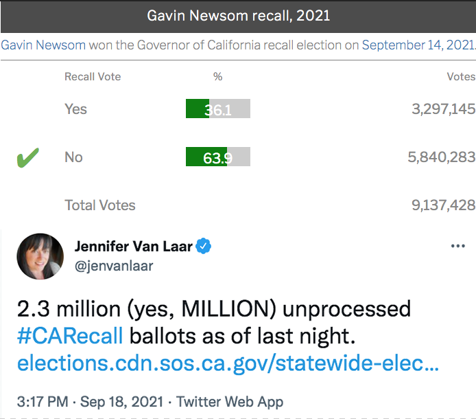
Officials are elected through math manipulation not voter choice. See the math.

new topics
-
President-elect TRUMP Picks MATT GAETZ for his ATTORNEY GENERAL - High Level PANIC Ensues.
2024 Elections: 2 hours ago -
Mike Tyson returns 11-15-24
World Sports: 7 hours ago -
HHS Spent Hundreds of Millions of Dollars on DEI Initiatives Under Biden, Watchdog Finds
US Political Madness: 8 hours ago -
Breaking: FBI Agents Raid Polymarket CEO After Betting Site Predicts Trump Win
General Conspiracies: 8 hours ago -
The Guardian quits Elon Musk's X social media platform
Mainstream News: 9 hours ago -
Thune selected as Senate Republican Leader
US Political Madness: 11 hours ago -
Band of Brothers 2001 Classic
Television: 11 hours ago
top topics
-
Breaking: FBI Agents Raid Polymarket CEO After Betting Site Predicts Trump Win
General Conspiracies: 8 hours ago, 18 flags -
The Guardian quits Elon Musk's X social media platform
Mainstream News: 9 hours ago, 16 flags -
US warship Edsall Lost after Pearl Harbor Attack Found 80 Years Later ... by Accident
Mainstream News: 12 hours ago, 14 flags -
Thune selected as Senate Republican Leader
US Political Madness: 11 hours ago, 13 flags -
HHS Spent Hundreds of Millions of Dollars on DEI Initiatives Under Biden, Watchdog Finds
US Political Madness: 8 hours ago, 11 flags -
WATCH LIVE: US Congress hearing on UFOs, unidentified anomalous phenomena
Aliens and UFOs: 14 hours ago, 7 flags -
Band of Brothers 2001 Classic
Television: 11 hours ago, 7 flags -
President-elect TRUMP Picks MATT GAETZ for his ATTORNEY GENERAL - High Level PANIC Ensues.
2024 Elections: 2 hours ago, 6 flags -
Worlds Behind You…
Short Stories: 14 hours ago, 4 flags -
Mike Tyson returns 11-15-24
World Sports: 7 hours ago, 3 flags
active topics
-
Mike Tyson returns 11-15-24
World Sports • 11 • : Lumenari -
Thune selected as Senate Republican Leader
US Political Madness • 68 • : WeMustCare -
President-elect TRUMP Picks MATT GAETZ for his ATTORNEY GENERAL - High Level PANIC Ensues.
2024 Elections • 23 • : WeMustCare -
WATCH LIVE: US Congress hearing on UFOs, unidentified anomalous phenomena
Aliens and UFOs • 33 • : WeMustCare -
-@TH3WH17ERABB17- -Q- ---TIME TO SHOW THE WORLD--- -Part- --44--
Dissecting Disinformation • 3258 • : 777Vader -
Fired FEMA Employee Says It Was Not ‘Isolated’ Incident: ‘Colossal Event Of Avoidance’
US Political Madness • 43 • : 777Vader -
On Nov. 5th 2024 - AMERICANS Prevented the Complete Destruction of America from Within.
2024 Elections • 153 • : WeMustCare -
President-Elect DONALD TRUMP's 2nd-Term Administration Takes Shape.
Political Ideology • 169 • : WeMustCare -
New York State Government Kills Peanut the Squirrel and Fred the Raccoon
US Political Madness • 70 • : rickymouse -
Trump picks Gov. Kristi Noem to serve as homeland security secretary
2024 Elections • 40 • : Lumenari

