It looks like you're using an Ad Blocker.
Please white-list or disable AboveTopSecret.com in your ad-blocking tool.
Thank you.
Some features of ATS will be disabled while you continue to use an ad-blocker.
share:
originally posted by: BrokenCircles
I think it's just dirt. The rock that caused it is buried. All that we're looking at is dirt. The supposed curved part of the 'saucer' looks exactly the same as the other dunes, except for the curvature which was caused by the slight landslide/collapse of the untouched dirt that fell down sometime later, after the initial rock had impacted. Since the collapse occurred in the center, it fell into a nice curved shape. If we were down there close to it, it would probably not be anywhere near as smooth or as perfect as it appears in this super-zoomed in image.
maybe. maybe not. I don't know. But that's what it looks like to me.
If there was a hill or anything else that would have let gravity move a 15 meter rock, then it would have to be sitting at the bottom of a hill too steep for the dunes to form the way they did.
It looks like that is sand thats crusted over from something. Similar things appear in deserts where you get a transition from one material to the next.
Without knowing where to find this raw image, you cant see enough of the landscape around to say much at all, but it looks like a transition area from mountain or rock to sand.
a reply to: TrollMagnet
There's a link to the raw images earlier in the thread.
Again, I think regional context helps - looking at the feature (which I am certain is a dune formed in a channel head) in isolation doesn't.

The red arrows show the continuity of the feature of which this channel is a part. The yellow arrows show the edges of the channel that continues unseen.
The dune feature is roughly 12 metres across.
There's a link to the raw images earlier in the thread.
Again, I think regional context helps - looking at the feature (which I am certain is a dune formed in a channel head) in isolation doesn't.

The red arrows show the continuity of the feature of which this channel is a part. The yellow arrows show the edges of the channel that continues unseen.
The dune feature is roughly 12 metres across.
Looking in the opposite direction, we can see how those channel edges emerge on another lump of higher ground, beyond which are further indications
that the strata continue.

Looking less and less like a crashed UFO and more and more like a natural geological formation covered by dune formations. Unless you really don't want it to be that

Looking less and less like a crashed UFO and more and more like a natural geological formation covered by dune formations. Unless you really don't want it to be that
edit on 12/12/2021 by OneBigMonkeyToo because: (no reason given)
originally posted by: OneBigMonkeyToo
Looking in the opposite direction, we can see how those channel edges emerge on another lump of higher ground, beyond which are further indications that the strata continue.
Looking less and less like a crashed UFO and more and more like a natural geological formation covered by dune formations. Unless you really don't want it to be that
But you don't want it to be a crashed UFO. So you make up this convoluted, far-fetched explanation in order to avoid admitting that this is a set of features that self-consistently point towards a crashed UFO. OK, it is not proof. But this interpretation is far more convincing than all the special pleading that you came up with.
a reply to: OneBigMonkeyToo
Thanks for that image, it shows better what I see in the anaglyph I posted.
Unfortunately, I can't find a way of converting an anaglyph into a 3D model that I can use to make a video showing a flyover of that area.
Thanks for that image, it shows better what I see in the anaglyph I posted.
Unfortunately, I can't find a way of converting an anaglyph into a 3D model that I can use to make a video showing a flyover of that area.
originally posted by: micpsi
But you don't want it to be a crashed UFO. So you make up this convoluted, far-fetched explanation in order to avoid admitting that this is a set of features that self-consistently point towards a crashed UFO. OK, it is not proof. But this interpretation is far more convincing than all the special pleading that you came up with.
It's not far fetched, is supported by what we know of common geological features.
Saying that an unknown object crashed there when it doesn't look like it when seen in 3D is not looking at all the possibilities.
If you have a pair of red/blue 3D glasses you can see what I mean by looking at the anaglyph I posted.
Unfortunately, the image is too big to make a direct view stereo image.
a reply to: micpsi
What I want the answer to be is right.
I've given some evidence, outlined my interpretation using an understanding of geology and geomorphological processes, and used 3D modles instead of looking it from above. If you have anything that actually confirms it to be a crashed spaceship, other than "looks a bit like what I think one should look like", then you go right ahead and provide it.
a reply to: ArMaP
a reply to: OneBigMonkeyToo
Thanks to the both of you👍🏼
Really helped to get a lay of the land.
a reply to: OneBigMonkeyToo
Thanks to the both of you👍🏼
Really helped to get a lay of the land.
a reply to: micpsi
Want is not involved do you even realize the scale if this was an actual UFO its like 300 k wide see the mountains this supposed UFO would be huge. And that ridge is very close to the size of the grand canyon. Even if a 300k ship crashed its not going to skid for 3000 kilometers. The physics just isn't possible
Want is not involved do you even realize the scale if this was an actual UFO its like 300 k wide see the mountains this supposed UFO would be huge. And that ridge is very close to the size of the grand canyon. Even if a 300k ship crashed its not going to skid for 3000 kilometers. The physics just isn't possible
a reply to: dragonridr
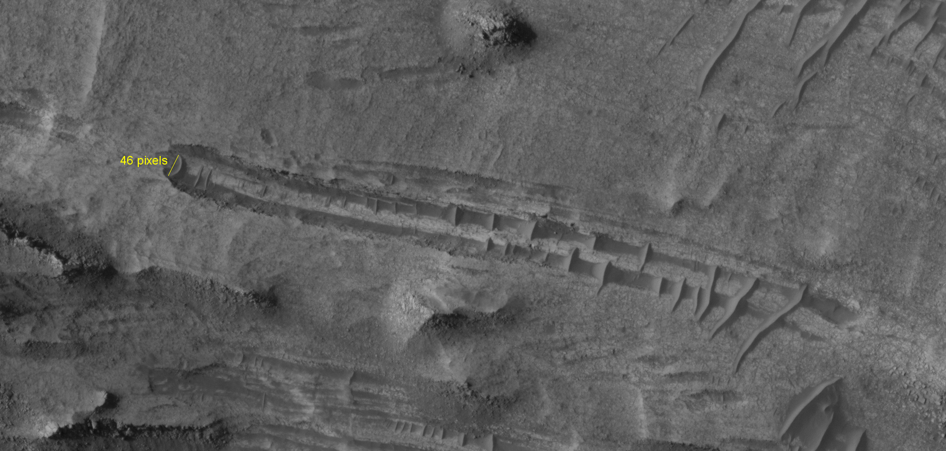
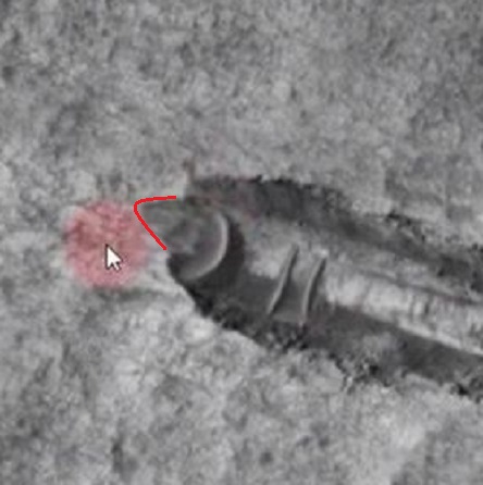
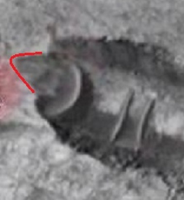
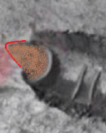
You got the scale wrong, the "crescent" at the end of the "trench" is some 46 pixels at 100% zoom on the map projected image, which, at 25 cm per pixel, means something like 11.5 metres wide.

(click for full size)
You got the scale wrong, the "crescent" at the end of the "trench" is some 46 pixels at 100% zoom on the map projected image, which, at 25 cm per pixel, means something like 11.5 metres wide.

(click for full size)
edit on 12/12/2021 by ArMaP because: (no reason given)
originally posted by: dragonridr
a reply to: micpsi
Want is not involved do you even realize the scale if this was an actual UFO its like 300 k wide see the mountains this supposed UFO would be huge. And that ridge is very close to the size of the grand canyon. Even if a 300k ship crashed its not going to skid for 3000 kilometers. The physics just isn't possible
The alleged disk would be about 35-40 ft. in diameter.
Bob Lazar said the 'Sport Model' disk was about 45 ft. in diameter.
edit on 12-12-2021 by IAMTAT because: (no reason given)
I personally debunk it with simple reasoning. 'Alien' tech cannot fail in physical sense. Even if it were then 'salvage' mission would clean up the
scene of debris short after, I suppose.
edit on 12-12-2021 by Encounter because: (no reason given)
originally posted by: ArMaP
a reply to: dragonridr
You got the scale wrong, the "crescent" at the end of the "trench" is some 46 pixels at 100% zoom on the map projected image, which, at 25 cm per pixel, means something like 11.5 metres wide.
(click for full size)
You got me curious as to the scale of the image so I checked. Original image scale range
26.2 cm/pixel (with 1 x 1 binning) so objects ~79 cm across are resolved, That means the saucer is 1205.2 CM or 12.052 meters. So I stand corrected the imaging was better than I thought. However, the crash site is over 3 kilometers the image shows a 5 k stretch of mars. So it's impossible for a craft to create a trench that long
a reply to: dragonridr
Also, as well as something being strong enough to somehow gouge out a trench that length and still somehow remain intact, where is the excavated material? It should be piled up either side of the trench and in a big mound at the end.
Also, as well as something being strong enough to somehow gouge out a trench that length and still somehow remain intact, where is the excavated material? It should be piled up either side of the trench and in a big mound at the end.
edit on 13/12/2021 by OneBigMonkeyToo because: (no
reason given)
new topics
-
They Know
Aliens and UFOs: 3 hours ago -
Drones (QUESTION) TERMINATOR (QUESTION)
General Chit Chat: 4 hours ago -
Canada Banning more Shovels
General Chit Chat: 8 hours ago
top topics
-
They Know
Aliens and UFOs: 3 hours ago, 10 flags -
Canada Banning more Shovels
General Chit Chat: 8 hours ago, 9 flags -
The goal of UFO's/ fallen angels doesn't need to be questioned - It can be discerned
Aliens and UFOs: 13 hours ago, 6 flags -
A priest who sexually assaulted a sleeping man on a train has been jailed for 16 months.
Social Issues and Civil Unrest: 13 hours ago, 2 flags -
Drones (QUESTION) TERMINATOR (QUESTION)
General Chit Chat: 4 hours ago, 0 flags
active topics
-
They Know
Aliens and UFOs • 22 • : ChaoticOrder -
Biden pardons 39 and commutes 1500 sentences…
Mainstream News • 23 • : crayzeed -
A priest who sexually assaulted a sleeping man on a train has been jailed for 16 months.
Social Issues and Civil Unrest • 17 • : Oldcarpy2 -
Top Sci Fi/Horror Crossover Movies
Movies • 12 • : Owlwatcher -
Magic Vaporizing Ray Gun Claim - More Proof You Can't Believe Anything Hamas Says
War On Terrorism • 18 • : Coelacanth55 -
A Bunch of Maybe Drones Just Flew Across Hillsborough County
Aircraft Projects • 36 • : Owlwatcher -
Drones everywhere in New Jersey
Aliens and UFOs • 96 • : DaydreamerX -
Drones (QUESTION) TERMINATOR (QUESTION)
General Chit Chat • 5 • : Flyingclaydisk -
I See a Different Attitude This Time Around with Congress
US Political Madness • 17 • : Coelacanth55 -
Jan 6th truth is starting to leak out.
US Political Madness • 24 • : xuenchen


