It looks like you're using an Ad Blocker.
Please white-list or disable AboveTopSecret.com in your ad-blocking tool.
Thank you.
Some features of ATS will be disabled while you continue to use an ad-blocker.

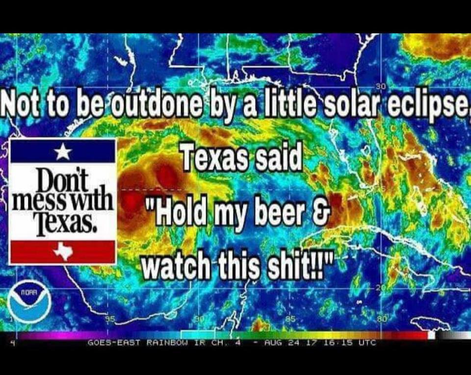
Catastrophic rainfall predicted for TX, LA, gulf coast region.
page: 9share:
a reply to: roadgravel
How close to the coast or tide water roadgravel?? Hopefully high and dry and not near matagorda bay.
Stay vigilant, stay safe!!!!
How close to the coast or tide water roadgravel?? Hopefully high and dry and not near matagorda bay.
Stay vigilant, stay safe!!!!
edit on 25-8-2017 by GuidedKill because: (no reason given)
edit on 25-8-2017 by GuidedKill because:
(no reason given)
a reply to: GuidedKill
I am about 55 - 60 miles inland, NE of Victoria. The prediction is TS level winds here tonite. The county next door has hurricane wind warning.
edit:
North of Matagorda Bay by about 45 miles.
I am about 55 - 60 miles inland, NE of Victoria. The prediction is TS level winds here tonite. The county next door has hurricane wind warning.
edit:
North of Matagorda Bay by about 45 miles.
edit on 8/25/2017 by roadgravel because: (no reason given)
A good resource for those who want to stay up-to-the-minute with conditions where Harvey is having an effect.
forums.accuweather.com...
forums.accuweather.com...
I haven't posted in a while, but I felt the need to recover my password now just to stop by and wish good luck to all those facing Harvey. Going to
bed now and I hope I don't wake up to a stronger, cat4 hurricane threatening you. The news I watched said something about this system continuing until
Wednesday, that's crazy. Stay safe!
They have it at a 4 now but hopefully drops before actual land fall. Man this thing ramped up quickly!!!
Stay safe everyone!! Shelter in place If you didn't evacuate!!! She's gonna blow!!
Stay safe everyone!! Shelter in place If you didn't evacuate!!! She's gonna blow!!
originally posted by: roadgravel
a reply to: GuidedKill
I am about 55 - 60 miles inland, NE of Victoria. The prediction is TS level winds here tonite. The county next door has hurricane wind warning.
edit:
North of Matagorda Bay by about 45 miles.
I wish you the best of luck friend!! Tornados are still a real threat, I hope for nothing but the best for you and yours!!
Just upgraded to Cat 4 130mph 941mb. Prayers to all esp our members
originally posted by: GuidedKill
They have it at a 4 now but hopefully drops before actual land fall. Man this thing ramped up quickly!!!
Stay safe everyone!! Shelter in place If you didn't evacuate!!! She's gonna blow!!
Oh, wow...I'm in total awe.
There is a nuclear power plant on the north shore of Matagorda bay that will be close to the northeastern eyewall.


a reply to: Cauliflower
Never mind. It is pretty close.
edit:
It's still a pretty good ways from projected landfall.
Never mind. It is pretty close.
edit:
It's still a pretty good ways from projected landfall.
edit on 8/25/2017 by roadgravel because: (no reason given)
originally posted by: Cauliflower
There is a nuclear power plant on the north shore of Matagorda bay that will be close to the northeastern eyewall.
The nuclear plant is 125 miles north of Corpus Christi.
a reply to: TXTriker
Its a big storm..
The northernmost of the three bays is Matagordo and the nuclear power plant sticks down in the bay.
Highest winds might miss it by 25 miles but Matagordo looks like it will get the worst storm surge.
I'm not sure what effect the barrier islands will have on storm surge further south but the tide at Matagorda bay will likely pile up and flood at the northern end
The plant is designed to withstand 157 mph winds and it takes a while shut a nuclear power plant down.
I would be more worried about the high tension power lines near the plant.
edit on 25-8-2017 by Cauliflower because: (no reason
given)
3 Hours ago they planned to keep running.
Source
There's this at a newer report but say they aren't shutting down .
Source
WADSWORTH – The South Texas Project nuclear power plant in Wadsworth has plans in place as Hurricane Harvey creeps towards the Texas Gulf Coast. Up to 250 employees will endure Hurricane Harvey from inside the plant.
At press time, both units at the nuclear power facility continue to operate at full power as Hurricane Harvey approaches.
STP’s Corporate Communications and External Affairs manager Buddy Eller anticipates as many as members of a pre-planned storm crew to hunker down inside the plant and closely monitor it for any damage.
Source
There's this at a newer report but say they aren't shutting down .
If sustained winds exceed 73 mph, officials said they will take steps to shut down the units.
Source
ed
it on 25-8-2017 by DancedWithWolves because: (no reason given)
originally posted by: Cauliflower
a reply to: TXTriker
Its a big storm..
The northernmost of the three bays is Matagordo and the nuclear power plant sticks down in the bay.
Highest winds might miss it by 25 miles but Matagordo looks like it will get the worst storm surge.
It is big but I don't think they will see the damage. It is a pretty well run and well maintained facility. It is closer to Palacios, according to google maps they are almost 20 miles from East Matagorda Bay and 17 miles from Tres Palacios Bay. I don't think they draw any water from the Bay. They are next to the Colorado River.
ETA: News just said the hurricane wind band has grown and will affect Palacios so they may get some higher winds.
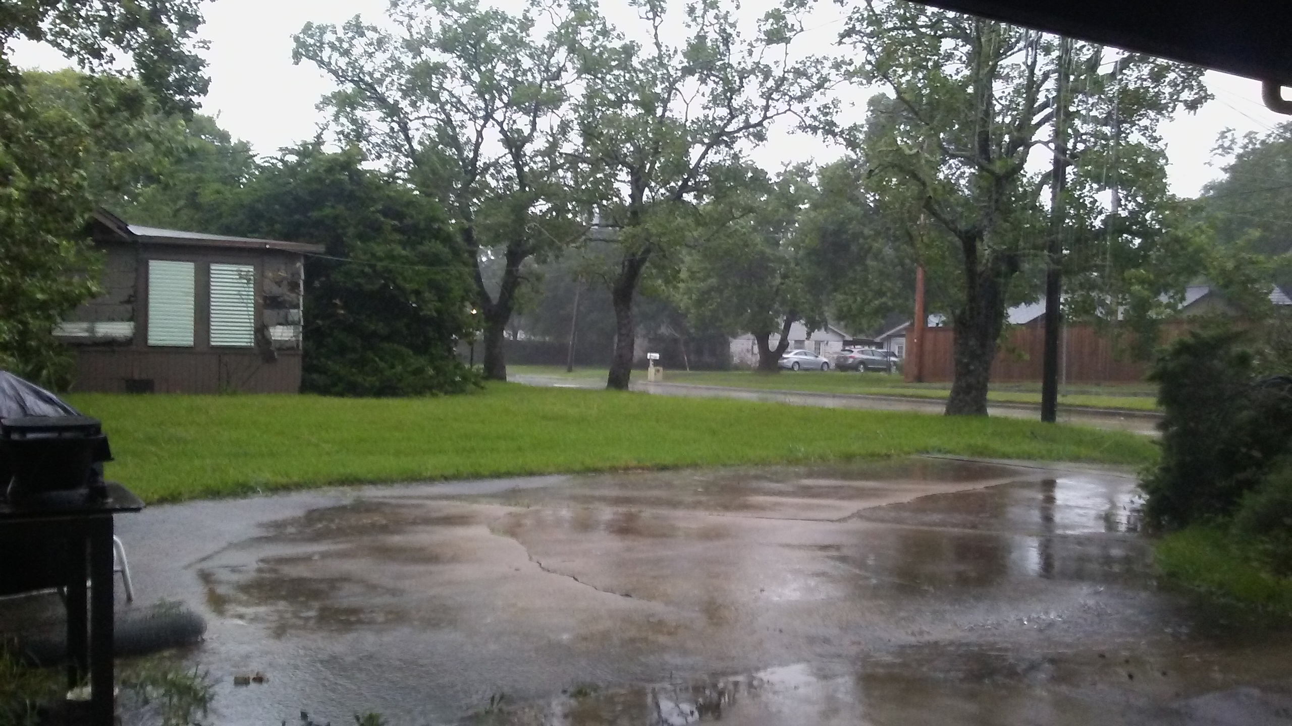
I am west of Houston and work in town so it is pretty much non stop reporting. It supposed to rain until Thursday.
edit on 8/25/2017 by
TXTriker because: (no reason given)
originally posted by: liveandlearn
a reply to: GuidedKill
My station just said forward movement was slowing.
That's the really scary part... you don't want her parked on top of ya. Even a 1-2 parked over you can float your eyeballs. Stay safe my Gulf Coast friends!!!
new topics
-
To become president, Zelensky had to learn Ukrainian
Political Conspiracies: 5 hours ago -
Green Grapes
General Chit Chat: 9 hours ago
top topics
-
S.C. Jack Smith's Final Report Says Trump Leads a Major Conspiratorial Criminal Organization!.
Political Conspiracies: 16 hours ago, 11 flags -
Advice for any young Adult .
General Chit Chat: 17 hours ago, 10 flags -
Green Grapes
General Chit Chat: 9 hours ago, 6 flags -
To become president, Zelensky had to learn Ukrainian
Political Conspiracies: 5 hours ago, 5 flags -
Those Great Fresh Pet Commercials
Television: 14 hours ago, 3 flags
active topics
-
Trump says ownership of Greenland 'is an absolute necessity'
Other Current Events • 66 • : bastion -
To become president, Zelensky had to learn Ukrainian
Political Conspiracies • 5 • : Dalamax -
Los Angeles brush fires latest: 2 blazes threaten structures, prompt evacuations
Mainstream News • 120 • : Lazy88 -
Gravitic Propulsion--What IF the US and China Really Have it?
General Conspiracies • 37 • : Lazy88 -
The Truth about Migrant Crime in Britain.
Social Issues and Civil Unrest • 34 • : angelchemuel -
Russia Ukraine Update Thread - part 3
World War Three • 6905 • : Arbitrageur -
Planned Civil War In Britain May Be Triggered Soon
Social Issues and Civil Unrest • 22 • : Freeborn -
Labour Plotting to Postpone May's Council Elections ?
Regional Politics • 21 • : angelchemuel -
What Comes After January 20th
Mainstream News • 34 • : charlest2 -
Some sausage, some chicken, some sauce, some onions and some garlic...and some peppers!
Food and Cooking • 4 • : putnam6