It looks like you're using an Ad Blocker.
Please white-list or disable AboveTopSecret.com in your ad-blocking tool.
Thank you.
Some features of ATS will be disabled while you continue to use an ad-blocker.
share:
a reply to: muzzy
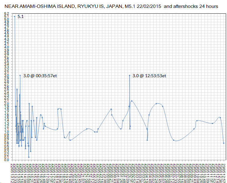
Graph for the record, looks like a short lived aftershock series with low magnitudes
see how that 2nd M3.0 popped about 12-13hrs after the main shock, this seems to be a common occurance.
No big deal here but worth keeping in mind for the bigger quakes, to be prepared for it.
deleted graph images, doing some more digging
here is one from 2014 .......... close match
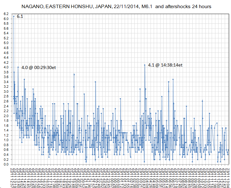
Graph for the record, looks like a short lived aftershock series with low magnitudes
see how that 2nd M3.0 popped about 12-13hrs after the main shock, this seems to be a common occurance.
No big deal here but worth keeping in mind for the bigger quakes, to be prepared for it.

deleted graph images, doing some more digging
edit on 05u14314315 by muzzy because: (no reason given)
here is one from 2014 .......... close match

edit on 0500000014314315 by muzzy because: (you have 2 minutes remaining to edit this post): so I'll come back to
this, I'll do some more
originally posted by: muzzy
a reply to: crappiekat
thanks.
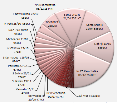
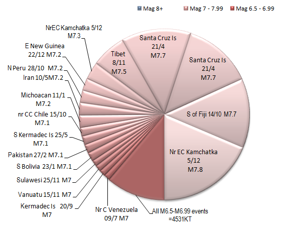
That graph doesn't mean to diminish the damage and loss of life a smaller quake can do (sic Christchurch M6.2), or even the accumulation of all the M6's that is still a lot of energy released. 2015 is only half way, so I'm sure the graph will change by the end of the year.
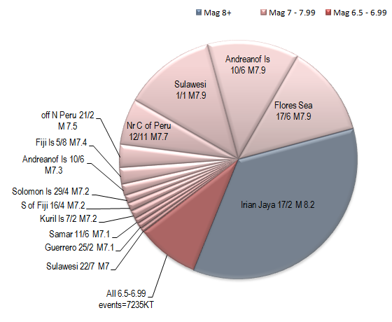
I did 1997 to see what they may look like, its a bit messier
before I go too far with these I wonder if I should put the magnitude in there, as well as/instead of the KT number, or maybe make a "key" to put on each page??
Color code them for magnitude and to make them less busy, lump all of the smaller quakes together and call it 'less than mag 3'
P
edit on 24/5/2015 by pheonix358 because: (no reason given)
a reply to: pheonix358
thanks for the reply
They are colour coded already, pink for M7+ and Red for M6.5-6.99, as per my map icons
There are none less than 6.5.
I liked the fan layout as it kind of shows how many events (segments)
The way you answered makes me think I need to put the magnitude of each segment on there, at least the M7's
a reply to: muzzy
Yes, good idea. I am having problems understanding.
People will be people and are interested in big quakes.
What I am getting at is a visual understanding of how piddly the lower level quakes are in terms of the big ones.
IOf there was a single segment for all lesser quakes that said "1251 quakes M6.4 or less, or maybe even M6.9 or less it would show graphically how insignificant they are.
I hope my ramblings help.
P
M5.3 - 2km NNW of Hasuda, Japan
35.994°N 139.642°E depth=35.0 km (21.7 mi)
Time
2015-05-25 05:28:07 (UTC)
2015-05-25 00:28:07 (UTC-05:00) in your timezone
Times in other timezones
Nearby Cities
2km (1mi) NNW of Hasuda, Japan
3km (2mi) SW of Shiraoka, Japan
5km (3mi) ENE of Ageo, Japan
7km (4mi) NW of Iwatsuki, Japan
34km (21mi) N of Tokyo, Japan
USGS
Hakone is not done yet, activity has moved to the west side of Lake Ashi for the first time in this swarm series.
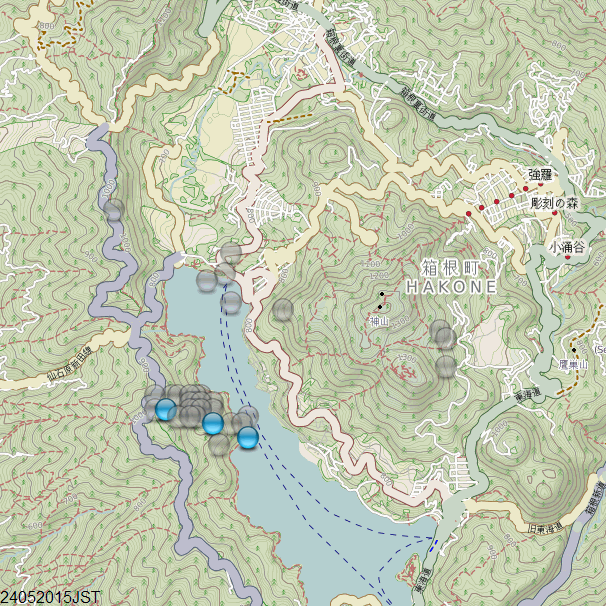
24/05/2015JST
mag~1= 39
mag1= 3

24/05/2015JST
mag~1= 39
mag1= 3
a reply to: crappiekat
I will keep experimenting, keeping in mind these pies are just for thumbnails on the main page, the key may just be a list of magnitude=KT conversions on the page beside the pie chart.
I hear what pheonix is saying about the colours, will try a few things out,
Thanks for the feedback.
I will keep experimenting, keeping in mind these pies are just for thumbnails on the main page, the key may just be a list of magnitude=KT conversions on the page beside the pie chart.
I hear what pheonix is saying about the colours, will try a few things out,
Thanks for the feedback.
a reply to: muzzy
Hmmmm
maybe not in this case, only 6 aftershocks so far showing on the preliminary data
will have to wait a couple of days to see the reviewed data.
JMA have it at 5.6
www.jma.go.jp...
Hmmmm
maybe not in this case, only 6 aftershocks so far showing on the preliminary data
will have to wait a couple of days to see the reviewed data.
JMA have it at 5.6
www.jma.go.jp...
a reply to: muzzy
only 3 aftershocks on review after 12 hours (latest data)
may be due to the depth, 55.7km
finished up at 5.5
this one started at 5.9 on the preliminary data!
Lat/Long: 41.772, 135.82
UTC: 25/05/2015 06:37:40
JST: 25/05/2015 15:37:40
Depth: 418.5
Mag: 5.1 ML
Location: SEA OF JAPAN
Source: JMA Status: reviewed
TTNT's are all wrong for 24th and 25th maps, wrong formula, I'll have to fix it later, gotta go to work.
Strange 1.6 richter quake happened at northern Finland last week. Explanation from seismic center was "it was caused be explosion of some sort". I
heard it myself too, a really loud THUMP. Not an ordinary earthquake.
Now the tremors at Hakone have shifted to the Botanical Gardens, and some still on the Western edge of Lake Ashi
Been a month of activity now.
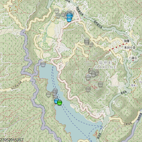
Been a month of activity now.

M6.8 - 102km NNW of Chirikof Island, Alaska
56.694°N 156.530°W depth=61.7 km (38.3 mi)
Time
2015-05-29 07:00:00 (UTC)
2015-05-29 02:00:00 (UTC-05:00) in your timezone
Times in other timezones
Nearby Cities
102km (63mi) NNW of Chirikof Island, Alaska
639km (397mi) SW of Anchorage, Alaska
674km (419mi) SW of Knik-Fairview, Alaska
1033km (642mi) SSW of Fairbanks, Alaska
1319km (820mi) W of Whitehorse, Canada
USGS
6.8 EMSC
No TSUNAMI Threat
edit on 29-5-2015 by lurksoften because: 5.1 in Cali taken Down
edit on 29-5-2015 by lurksoften because: (no reason
given)
M5.1 - 11km NNE of Lewiston, California
quakes.globalincidentmap.com...#
Time
2015-05-29 07:05:34 (UTC)
2015-05-29 00:05:34 (UTC-07:00) in your timezone
Times in other timezones
Nearby Cities
11km (7mi) NNE of Lewiston, California
36km (22mi) WNW of Shasta Lake, California
40km (25mi) NW of Redding, California
82km (51mi) NNW of Red Bluff, California
269km (167mi) NNW of Sacramento, California
edit on 7/30/2012 by dreamfox1 because: (no reason given)
a reply to: dreamfox1
Is it unusual for the quakes to be so close together time wise? The 6.7 Alaska, the Northern Cali 5+ and the smaller 3.4 central Cali, and the small one in Washington State, all within a few minutes of each other?
STM
Is it unusual for the quakes to be so close together time wise? The 6.7 Alaska, the Northern Cali 5+ and the smaller 3.4 central Cali, and the small one in Washington State, all within a few minutes of each other?
STM
edit on 29-5-2015 by seentoomuch because: (no reason given)
M6.8 - 102km NNW of Chirikof Island, Alaska
Dang it, Didn't feel a thing. I wouldn't have even known about this one if I didnt decide to check ATS just now.
edit on 29-5-2015 by GoShredAK because: (no reason given)
a reply to: dreamfox1
It has to go sometime. The rest of the circle of fire has been letting go. When that segment does go, it will be awful. There is just so much stored energy there now.
Nothing else to say really. I don't like to think of what will happen ... but it will.
P
It has to go sometime. The rest of the circle of fire has been letting go. When that segment does go, it will be awful. There is just so much stored energy there now.
Nothing else to say really. I don't like to think of what will happen ... but it will.
P
new topics
-
Former ‘GMA Producer’ Sues NPR-Legacy Media Exposed
Propaganda Mill: 30 minutes ago -
New Footage - Randy Rhoads 1979 LIVE Guitar Solo Footage at the Whisky - Pro Shot
Music: 1 hours ago -
Happy Hanukkah…
General Chit Chat: 1 hours ago -
A Merry Christmas.
General Chit Chat: 8 hours ago
top topics
-
Cold Blooded Killers on Christmas!! GRRRRrrr!!
Pets: 15 hours ago, 10 flags -
A Merry Christmas.
General Chit Chat: 8 hours ago, 6 flags -
Happy Hanukkah…
General Chit Chat: 1 hours ago, 3 flags -
Former ‘GMA Producer’ Sues NPR-Legacy Media Exposed
Propaganda Mill: 30 minutes ago, 3 flags -
New Footage - Randy Rhoads 1979 LIVE Guitar Solo Footage at the Whisky - Pro Shot
Music: 1 hours ago, 2 flags
active topics
-
Plane Crash Today --Azerbaijanian E190 passenger jet
Mainstream News • 31 • : Springbok -
Former ‘GMA Producer’ Sues NPR-Legacy Media Exposed
Propaganda Mill • 2 • : MuddyPaws2 -
Happy Hanukkah…
General Chit Chat • 1 • : FeeshJefe -
It's Offical Now
US Political Madness • 24 • : Lazy88 -
Dutch Investigators Give Results of MH17 Probe to Families
Breaking Alternative News • 294 • : Lazy88 -
New Footage - Randy Rhoads 1979 LIVE Guitar Solo Footage at the Whisky - Pro Shot
Music • 0 • : gortex -
Post A Funny (T&C Friendly) Pic Part IV: The LOL awakens!
General Chit Chat • 7958 • : underpass61 -
London Christmas Market BANS Word ‘Christmas’
Social Issues and Civil Unrest • 54 • : BernnieJGato -
Statements of Intent from Incoming Trump Administration Members - 2025 to 2029.
2024 Elections • 55 • : Xtrozero -
Orange County Makes Shoplifting a Felony
Other Current Events • 24 • : Xtrozero

