It looks like you're using an Ad Blocker.
Please white-list or disable AboveTopSecret.com in your ad-blocking tool.
Thank you.
Some features of ATS will be disabled while you continue to use an ad-blocker.
share:
reply to post by PuterMan
I don't see White Island, NZ on that list, its currently erupting, Orange Alert
www.geonet.org.nz...
11 minutes ago,
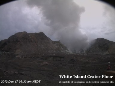
I don't see White Island, NZ on that list, its currently erupting, Orange Alert
www.geonet.org.nz...
11 minutes ago,

edit on 16-12-2012 by muzzy because: (no reason given)
Originally posted by muzzy
reply to post by PuterMan
I don't see White Island, NZ on that list, its currently erupting, Orange Alert
www.geonet.org.nz...
11 minutes ago,
edit on 16-12-2012 by muzzy because: (no reason given)
That list was for the 27th November so it would not have been on that.
Can you give some more details. I have mentioned that.
On 12 December the GeoNet Data Centre posted a report describing a new lava dome at White Island that volcanologists recently noticed. The spiny lava dome was 20-30 m in diameter and grew in a crater formed during an eruption on 5 August. A prominent steam plume rose from the dome. Comments from tour operators at White Island suggested that the dome may have been visible two weeks earlier, but not as clearly as on 10 December. The Alert Level was raised to 2 (on a scale of 0-5), and the Aviation Colour Code was raised to Orange (second highest on a four-color scale).
(Smithsonian)
but I don't have any further information. I am not counting a steam plume as an eruption. If there is ash > 1 km then that qualifies and erupting so any further info would be useful. GeoNet don't really say very much.
ETA I see that they classify Orange differently. Is this counted as an eruption. In other words there is no ash but is there lava? No ash - no lava - no eruption as far as I am concerned. Plenty of VT on the seismo I notice!
I can back date if Smithsonian show it as erupting on Wednesday.
edit on 16/12/2012 by PuterMan because: (no reason given)
T-4 Days and counting
Earthquakes
Listing for the 16 December. 13 x 4.5/4.9, 2 x 5.0/5.9
Prov,Date/Time UTC,Latitude,Longitude,Magnitude,Depth(Km),Location
usgs,2012-12-16 22:46:11, -33.762, -71.432, 4.8, 54.9, Valparaiso. Chile
usgs,2012-12-16 20:39:24, -19.812, -69.509, 4.9, 108.5, Tarapaca. Chile
usgs,2012-12-16 16:49:05, 5.905, -78.024, 4.6, 10.0, South Of Panama
usgs,2012-12-16 16:10:09, -6.631, 154.893, 4.6, 91.1, Bougainville Region. P.N.G
usgs,2012-12-16 15:52:01, 14.190, 146.787, 5.3, 24.4, Rota Region. N. Mariana Isls.
usgs,2012-12-16 11:46:27, -24.776, -70.158, 4.8, 39.2, Antofagasta. Chile
usgs,2012-12-16 10:29:32, 39.984, 77.896, 4.9, 8.6, Southern Xinjiang. China
usgs,2012-12-16 10:23:42, 10.525, -86.158, 4.6, 44.4, Off Coast Of Costa Rica
usgs,2012-12-16 10:07:12, 14.752, -91.382, 5.2, 113.5, Guatemala
usgs,2012-12-16 09:17:17, 52.721, -167.068, 4.6, 21.3, Fox Isls.
usgs,2012-12-16 08:04:41, 29.103, 140.768, 4.8, 99.6, Izu Isls. Japan Region
usgs,2012-12-16 06:04:17, -10.709, 166.101, 4.7, 153.7, Santa Cruz Isls.
usgs,2012-12-16 05:52:08, -33.606, -179.298, 4.7, 41.5, South Of The Kermadec Isls.
usgs,2012-12-16 03:06:53, 14.094, -91.901, 4.8, 72.3, Offshore Guatemala
usgs,2012-12-16 02:30:55, 18.215, 146.973, 4.8, 55.5, Pagan Region. N. Mariana Isls.
All Magnitudes trend 4.5+
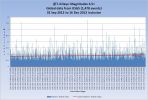
Mag 4.5 to 4.9 magnitudes trend.
The average magnitude of quakes in the 4.5 to 4.9 band continues to rise slighly. Most odd.
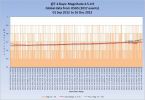
Mag 5.0 to 5.9 magnitudes trend.
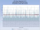
Mag 6.0 to 6.9 magnitudes trend.
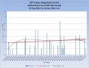
Mag 7.0 to 7.9 magnitudes trend.
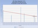
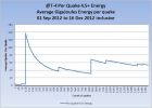
Average energy per quake Mag 4.5+
(These merely indicate the average per quake which is only useful as a 'trend' of overall energy, which if the end is nigh should ramp up one would presume )
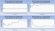
And each Magnitude band
Volcanoes
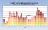
Tungurahua volcano (Ecuador) is in full eruption today. Heavy ashfall and pyroclastic flows.EPN reports at least two large explosions today which generated ash clouds that rose to above 7 km height.
White Island (New Zealand) as mentioned in a post above is exhibiting VT and emitting steam. A full eruption there seems imminent.
Volcano Chart
Australian VAAC
Commonwealth of Australia, Bureau of Meteorology VAAC
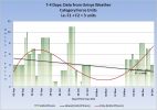
Category 1+ storms
Evan reached max Cat 4.
Cat 1+ Storms Chart
That concludes the report of yesterday 16 December 2012 UTC.
Thank you puterman,for all this info.
To me,I really don't see a trend in anything building up,unless it's a quiet before the storm scenario.
What do you see?
And BTW,hope you are doing ok.
Peace,
K
To me,I really don't see a trend in anything building up,unless it's a quiet before the storm scenario.
What do you see?
And BTW,hope you are doing ok.
Peace,
K
T-3 Days and counting
Earthquakes
Just three days to go now or two if you don't count the rest of the 18th. Oceania will go first, either totally destroyed by massive waves, earthquakes and volcanoes, or will lose all it's enlightened souls as they transcend to the next plane or is it the higher dimension? Not being one of the enlightened I don't know about these things. My vibrational frequencies are, well just whatever they are and not about to increase as I see the light. That happens each day at dawn or when I wake up!
Of course with so many ATS members who are enlightened, or live in the land of the Great Satan, I guess there are not going to be that many of us left here to carry on or perish in other ways. Never mind. I an sure will will get over it somehow.
Listing for the 17 December. 2 x 4.5/4.9, 4 x 5.0/5.9, 1 x 6.0/6.9
Very low incidence of 4.5/4.9 range. One Mag 6
Magnitude 6.1 - Sulawesi. Indonesia
Location in Google Maps
- Date-Time: Monday, December 17, 2012 @ 09:16:28 UTC
- Earthquake location: 0.709°S, 123.837°E,
- Earthquake depth: 18.5 km
- Distances:
119km (73mi) ENE of Luwuk, Indonesia
163km (101mi) SSE of Gorontalo, Indonesia
251km (155mi) SSW of Tomohon, Indonesia
252km (156mi) SSW of Tondano, Indonesia
889km (552mi) NNW of Dili, East Timor
- Event ID: usc000eb6k
Derived from Event Data Source: USGS
Powered by QVSData
Prov,Date/Time UTC,Latitude,Longitude,Magnitude,Depth(Km),Location
usgs,2012-12-17 22:52:23, 37.765, 143.597, 5.0, 47.3, Off E. Coast Of Honshu. Japan
usgs,2012-12-17 17:46:48, -3.968, -104.037, 5.1, 15.7, Central East Pacific Rise
usgs,2012-12-17 17:41:36, -4.107, -104.416, 5.1, 35.7, Central East Pacific Rise
usgs,2012-12-17 13:13:09, 37.721, 143.841, 4.5, 35.0, Off E. Coast Of Honshu. Japan
usgs,2012-12-17 11:28:37, -30.993, -176.588, 4.7, 41.4, Kermadec Isls. Region
usgs,2012-12-17 09:16:28, -0.708, 123.837, 6.1, 18.5, Sulawesi. Ind.
usgs,2012-12-17 00:28:55, 49.749, 155.952, 5.6, 38.9, Kuril Isls.
All Magnitudes trend 4.5+
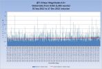
Mag 4.5 to 4.9 magnitudes trend.
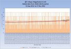
Mag 5.0 to 5.9 magnitudes trend.
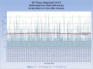
Mag 6.0 to 6.9 magnitudes trend.
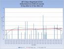
Mag 7.0 to 7.9 magnitudes trend.
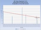
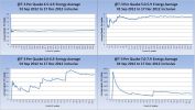
Average energy per quake Mag 4.5+
(These merely indicate the average per quake which is only useful as a 'trend' of overall energy, which if the end is nigh should ramp up one would presume )
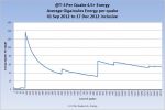
And each Magnitude band
Volcanoes
Tungurahua volcano (Ecuador) is assumed to be continuing it's eruptin.
White Island (New Zealand) as mentioned in a post above is exhibiting VT and emitting steam. A full eruption there seems imminent.
Volcano Chart
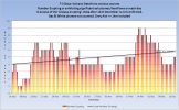
Australian VAAC
Commonwealth of Australia, Bureau of Meteorology VAAC
Category 1+ storms
Cat 1+ Storms Chart
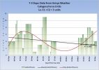
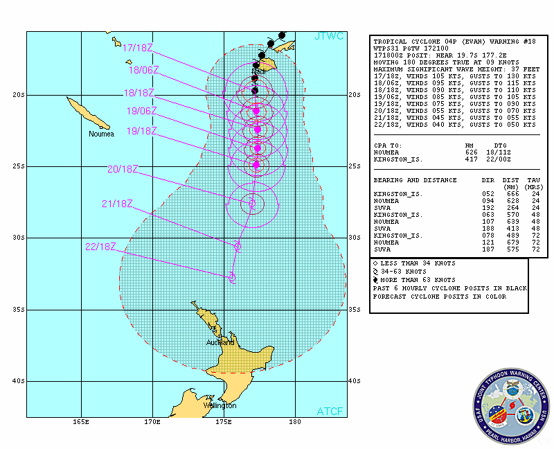
Evan continues....
Source
Satellite image @17:30Z on 17 Dec
That concludes the report of yesterday 17 December 2012 UTC.
reply to post by kdog1982
Me neither. There is absolutely no increasing trend so I guess it is just going to go BANG sometime on the 21st and we won't know exactly when
We have one mag 7 and a bout 8 mag 6 left to go to make my prediction for 2012 correct. I think we should make that more or less spot on. I had the tail end of 2011 predicted to within 2 x Mag 6 and spot on the Mag 7 so with that and this one I guess it must have been a fluke as I am sure i could not possibly be right with a prediction for 2013 - which won't exist anyway.
It will be interesting to see.
reply to post by PuterMan
I'm not a believer in the whole doomsday scenario for 21/12, but if I was, I reckon I would be more paranoid if things were more unusually quiet, rather than unusually active....kind of like the whole calm before the storm thing.
I'm not a believer in the whole doomsday scenario for 21/12, but if I was, I reckon I would be more paranoid if things were more unusually quiet, rather than unusually active....kind of like the whole calm before the storm thing.
After the
Siberian traps
Deccan traps
Emeishan traps
In three days the
PUTERMAN TRAPS
What will PM traps?
All the doomsayers of course!
Siberian traps
Deccan traps
Emeishan traps
In three days the
PUTERMAN TRAPS
What will PM traps?
All the doomsayers of course!
edit on 18-12-2012 by Nidwin because: (no reason given)
Originally posted by PuterMan
Volcanoes
Tungurahua volcano (Ecuador) is assumed to be continuing it's eruptin.
She still looks to be going strong...when I first looked at the helicorder, I thought it was the spectrogram for a few seconds, lol.
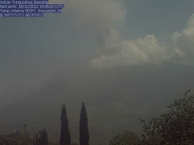
Bayushig webcam image
This is the current heicorder from RETU SHZ EC. Here is a link to the Ecuadorian helicorders.
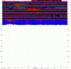 (click to enlarge)
 For those that may be looking for Nibiru? Whatever it may be. SLOOH the space camera will be searching in a few hours. Who Knows? spooky music...
events.slooh.com...
events.slooh.com...
edit on 18-12-2012 by ericblair4891 because: (no reason given)
reply to post by Olivine
Thanks for that Olivine. I am away most of the day at present and this has to get done in the wee small hours so I don't have the time to search fully.
One should of course observe that VT/HT does not always mean a current eruption, although obviously in this case it does.
Either way boom or nothing, I shall be glad when this silly date has passed (so we can get to work on the next one? )
While explanations from scientists and religious leaders have allayed apprehension of a doomsday over the end of the Mayan Long Count Calendar, two events that happened in the past few days may arouse again fears of an end-of-the-world scenario.
These are the eruption of the Tungurahua Volcano in Ecuador and the discovery by the Chinese spacecraft Chang'e-2 that the 4179 Toutatis asteroid is a potentially hazardous asteroid because of its repeated passes by the Earth.
........
Meanwhile, Chang'e-2, which made a deep space fly-by on an asteroid 4.5 million miles away from Earth, reported on Monday that the 4179 Toutatis asteroid flew 4.3 miles from the Earth.
[url=http://au.ibtimes.com/articles/416149/20121218/doomsday-december-21-2012-will-ecuadorian-volcano.htm#.UND7eFIerm1
4.3 miles from the Earth Eh? What/ Beg pardon? It would have burnt up and the whole world would be screaming about it.
Perfect example of why business parers should stick to business, which they are not particularly good at either!
NASA said that a massive asteroid strike on earth the size of 4179 Toutatis would wipe out anything living on Earth, but added it poses no hazard to the plant at this time.
no hazard to the plant eh! Me cabbages are safe then.
T-2 Days and counting
Earthquakes
The tension is palpable NOT!
Listing for the 18 December. 9 x 4.5/4.9, 2 x 5.0/5.9
Prov,Date/Time UTC,Latitude,Longitude,Magnitude,Depth(Km),Location
usgs,2012-12-18 23:56:55, -17.932, 168.442, 4.8, 131.3, Vanuatu
usgs,2012-12-18 22:54:09, -7.250, 144.060, 4.9, 33.5, Nr. S. Coast Of New Guinea. P.N.G
usgs,2012-12-18 18:36:24, 36.678, 142.013, 5.1, 33.5, Off E. Coast Of Honshu. Japan
usgs,2012-12-18 18:13:51, 12.845, -88.742, 4.6, 74.7, Offshore El Salvador
usgs,2012-12-18 11:51:58, 25.354, 96.577, 4.6, 39.6, Myanmar
usgs,2012-12-18 10:49:41, -9.072, 111.358, 4.5, 13.2, South Of Java. Ind.
usgs,2012-12-18 10:26:02, 38.637, 140.006, 4.6, 77.2, Eastern Honshu. Japan
usgs,2012-12-18 08:27:05, -6.255, 120.684, 4.7, 40.1, Flores Sea
usgs,2012-12-18 08:12:24, 13.028, -89.991, 5.1, 57.5, Offshore El Salvador
usgs,2012-12-18 01:38:28, 16.417, -95.400, 4.8, 60.9, Oaxaca. Mexico
usgs,2012-12-18 01:32:46, 19.353, 95.784, 4.6, 41.0, Myanmar
All Magnitudes trend 4.5+
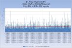
Mag 4.5 to 4.9 magnitudes trend.
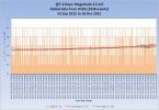
Mag 5.0 to 5.9 magnitudes trend.
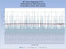
Mag 6.0 to 6.9 magnitudes trend.
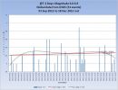
Mag 7.0 to 7.9 magnitudes trend.
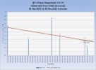
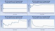
Average energy per quake Mag 4.5+
(These merely indicate the average per quake which is only useful as a 'trend' of overall energy, which if the end is nigh should ramp up one would presume )
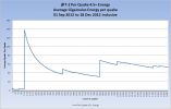
And each Magnitude band
Volcanoes
Tungurahua volcano (Ecuador) contimues as does Tolbachik.
Volcano Chart
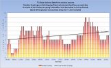
Australian VAAC
Commonwealth of Australia, Bureau of Meteorology VAAC
Category 1+ storms
Cat 1+ Storms Chart
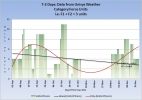
One active storm - Evan - Cat 4
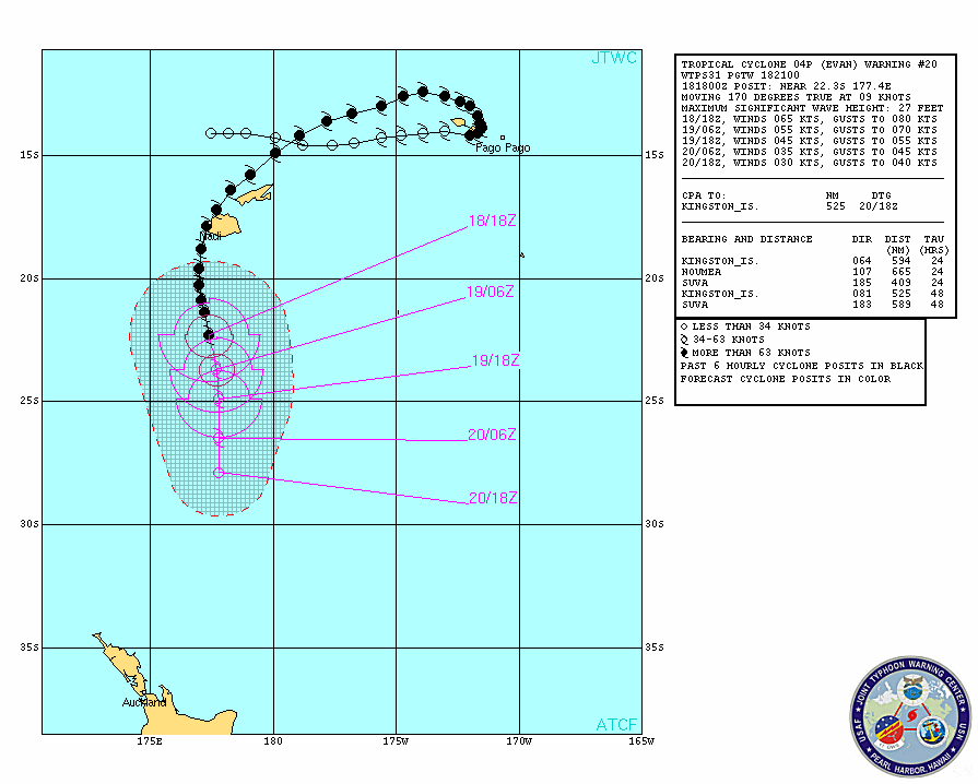
Source
Satellite image @17:30Z on 18 Dec
That concludes the report of yesterday 18 December 2012 UTC.
T-1 Days and counting
Earthquakes
The Mag 5s have gone very quiet. This often happens before a large earthquake so don't be surprised if we get a 7 today or tomorrow (and an 8, 9, and 10??? ). New Zealand is standing by to let us know if the world starts ending down there first.

Listing for the 19 December. 11 x 4.5/4.9, 1 x 5.0/5.9
Prov,Date/Time UTC,Latitude,Longitude,Magnitude,Depth(Km),Location
usgs,2012-12-20 05:56:04, 22.924, 96.103, 4.7, 9.7, Myanmar
usgs,2012-12-20 03:17:04, 37.466, 143.765, 4.9, 27.9, Off E. Coast Of Honshu. Japan
usgs,2012-12-20 02:11:19, -7.494, 128.677, 4.6, 151.4, Kepulauan Barat Daya. Ind.
usgs,2012-12-19 22:40:15, 39.654, 143.293, 4.6, 39.8, Off E. Coast Of Honshu. Japan
usgs,2012-12-19 16:08:08, 40.658, 139.152, 4.7, 34.8, Nr. W. Coast Of Honshu. Japan
usgs,2012-12-19 16:02:20, -20.472, -174.331, 5.0, 9.9, Tonga
usgs,2012-12-19 15:19:53, -52.315, 139.389, 4.7, 10.0, West Of Macquarie Island
usgs,2012-12-19 14:00:19, 9.054, 123.982, 4.6, 91.3, Negros - Cebu Region. Philippines
usgs,2012-12-19 11:51:52, -19.008, -175.660, 4.9, 226.5, Tonga
usgs,2012-12-19 11:14:52, 51.923, 173.678, 4.7, 25.7, Nr. Isls.
usgs,2012-12-19 10:25:57, -28.923, 61.992, 4.8, 10.0, S.West Indian Ridge
usgs,2012-12-19 08:03:57, -34.432, -109.269, 4.6, 10.0, Southern East Pacific Rise
All Magnitudes trend 4.5+
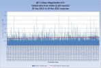
Mag 4.5 to 4.9 magnitudes trend.
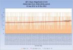
Mag 5.0 to 5.9 magnitudes trend.
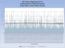
Mag 6.0 to 6.9 magnitudes trend.
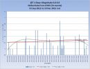
Mag 7.0 to 7.9 magnitudes trend.
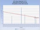
Average energy per quake Mag 4.5+
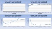
(These merely indicate the average per quake which is only useful as a 'trend' of overall energy, which if the end is nigh should ramp up one would presume )
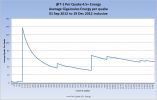
And each Magnitude band
Volcanoes
Tungurahua volcano (Ecuador) continues as does Tolbachik.
Volcano Chart
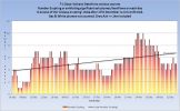
PETROPAVLOVSK-KAMCHATSKY, Russia, Dec. 19 (UPI) -- An eruption of a volcano in Russia's Far Eastern Kamchatka Peninsula is expected to last for at least two more weeks, an expert says.
Gennady Karpov, deputy head of the Institute of Volcanology and Seismology under the Russian Academy of Sciences, said the Plosky Tolbachik volcano is in an ongoing eruption with consistent intensity.
The 10,100-foot volcano, one of several in a volcanic complex 210 miles from the regional capital of Petropavlovsk-Kamchatsky, first erupted on Nov. 27, its first activity in 36 years, RIA Novosti reported.
Read more here
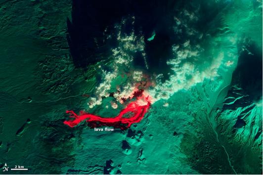
SVERT reported that a thermal anomaly was detected over Snow, a volcano of Chirpoi, during 11 and 13-15 December.
Australian VAAC
Commonwealth of Australia, Bureau of Meteorology VAAC
Category 1+ storms
Cat 1+ Storms Chart
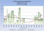
Evan - Cat 4 max - is dissipating
That concludes the report of yesterday 19 December 2012 UTC.
If the world does end on the 21st then the report for the 20th will probably not get produced.
edit on 20/12/2012 by PuterMan because: I am having a bad tag day.
You're over in Ireland aren't you? It doesn't kick off until 11:11 our time, so just post same time tomorrow it'll be all good Puterman, cheers
for all the updates though.
I have a feeling tomorrow is going to be very busy on ATS.
I have a feeling tomorrow is going to be very busy on ATS.
Although this report is for T-0 (or T-11 Hours) it is of course the last day of the World today and as I write this post there are about 2 hours and
40 minutes left.
As I said yesterday the Mag 5s have gone very quiet. This often happens before a large earthquake so don't be surprised if we get a 7 today or tomorrow. My money is on Tonga at the moment.
Listing for the 20 December. 11 x 4.5/4.9, 1 x 5.0/5.9
All Magnitudes trend 4.5+
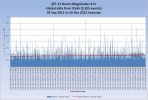
Mag 4.5 to 4.9 magnitudes trend.
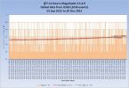
Mag 5.0 to 5.9 magnitudes trend.
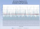
Mag 6.0 to 6.9 magnitudes trend.
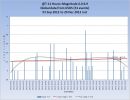
Mag 7.0 to 7.9 magnitudes trend.
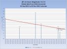
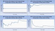
Average energy per quake Mag 4.5+
(These merely indicate the average per quake which is only useful as a 'trend' of overall energy, which if the end is nigh should ramp up one would presume )
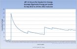
And each Magnitude band
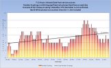
Volcano Chart
Read more here

SVERT reported that a thermal anomaly was detected over Snow, a volcano of Chirpoi, during 11 and 13-15 December.
Australian VAAC
Commonwealth of Australia, Bureau of Meteorology VAAC
Cat 1+ Storms Chart
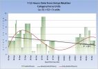
There are no 'Category' force storms in the wolrd on this day.
That concludes the report of yesterday 20 December 2012 UTC.
T-0 Days (T-11 Hours and 11 Minutes) and counting
Earthquakes
As I said yesterday the Mag 5s have gone very quiet. This often happens before a large earthquake so don't be surprised if we get a 7 today or tomorrow. My money is on Tonga at the moment.
Listing for the 20 December. 11 x 4.5/4.9, 1 x 5.0/5.9
Prov,Date/Time UTC,Latitude,Longitude,Magnitude,Depth(Km),Location
usgs,2012-12-20 21:47:30, 0.546, 126.232, 5.6, 31.2, Molucca Sea
usgs,2012-12-20 19:38:46, -20.773, -174.088, 5.0, 45.1, Tonga
usgs,2012-12-20 15:31:15, 37.087, 141.146, 4.8, 58.6, Nr. E. Coast Of Honshu. Japan
usgs,2012-12-20 15:00:18, -22.805, -63.706, 4.7, 525.2, Salta. Argentina
usgs,2012-12-20 13:38:05, -7.103, 129.238, 4.8, 162.1, Kepulauan Babar. Ind.
usgs,2012-12-20 10:54:27, 42.179, 142.622, 4.7, 9.8, Hokkaido. Japan Region
usgs,2012-12-20 09:31:40, 37.909, 143.856, 4.8, 33.5, Off E. Coast Of Honshu. Japan
usgs,2012-12-20 09:03:19, 53.079, 170.887, 4.6, 27.7, Nr. Isls.
usgs,2012-12-20 05:56:04, 22.924, 96.103, 4.7, 9.7, Myanmar
usgs,2012-12-20 03:17:04, 37.466, 143.765, 4.9, 27.9, Off E. Coast Of Honshu. Japan
usgs,2012-12-20 02:11:19, -7.494, 128.677, 4.6, 151.4, Kepulauan Barat Daya. Ind.
All Magnitudes trend 4.5+

Mag 4.5 to 4.9 magnitudes trend.

Mag 5.0 to 5.9 magnitudes trend.

Mag 6.0 to 6.9 magnitudes trend.

Mag 7.0 to 7.9 magnitudes trend.

Average energy per quake Mag 4.5+
(These merely indicate the average per quake which is only useful as a 'trend' of overall energy, which if the end is nigh should ramp up one would presume )

And each Magnitude band

Volcanoes
Volcano Chart

PETROPAVLOVSK-KAMCHATSKY, Russia, Dec. 19 (UPI) -- An eruption of a volcano in Russia's Far Eastern Kamchatka Peninsula is expected to last for at least two more weeks, an expert says.
Gennady Karpov, deputy head of the Institute of Volcanology and Seismology under the Russian Academy of Sciences, said the Plosky Tolbachik volcano is in an ongoing eruption with consistent intensity.
The 10,100-foot volcano, one of several in a volcanic complex 210 miles from the regional capital of Petropavlovsk-Kamchatsky, first erupted on Nov. 27, its first activity in 36 years, RIA Novosti reported.
Read more here

SVERT reported that a thermal anomaly was detected over Snow, a volcano of Chirpoi, during 11 and 13-15 December.
Australian VAAC
Commonwealth of Australia, Bureau of Meteorology VAAC
Category 1+ storms
Cat 1+ Storms Chart

There are no 'Category' force storms in the wolrd on this day.
That concludes the report of yesterday 20 December 2012 UTC.
edit on 21/12/2012 by PuterMan because: (no reason given)
reply to post by woogleuk
Yup I shall post the final 11 hours just after 11:11 - if we are all still here!
I kind of have the feeling that we will be.
Yup I shall post the final 11 hours just after 11:11 - if we are all still here!
I kind of have the feeling that we will be.
Provided we survive the next few hours I have decided to create a weekly geophysical report along the lines of these daily one I have been
creating.
I will probably do it as a rolling year or maybe rolling 6 months rather than from a fixed point (day).
Sound like a good idea?
I will probably do it as a rolling year or maybe rolling 6 months rather than from a fixed point (day).
Sound like a good idea?
new topics
-
Australian mercenary caught and crying as he is a prisoner of war.
Other Current Events: 1 hours ago -
JILL BIDEN Wants JOE to Punish Democrats Who Forced Him to Leave Office in Disgrace on 1.20.2025.
2024 Elections: 2 hours ago -
Panamanian President-“every square meter” of the Panama Canal belongs to Panama.
New World Order: 3 hours ago -
NYPD arrests migrant who allegedly set woman on fire on subway train, watched her burn to death
Breaking Alternative News: 5 hours ago -
Chef Gerald R. Ford
Food and Cooking: 8 hours ago -
The clotting is not going away latest
Medical Issues & Conspiracies: 8 hours ago -
F-18 shot down over Red Sea....by our own Destroyer?
Other Current Events: 10 hours ago -
California Business Owners Blindsided by Surprise Payroll Taxes
US Political Madness: 10 hours ago
top topics
-
California Business Owners Blindsided by Surprise Payroll Taxes
US Political Madness: 10 hours ago, 20 flags -
The Effects of Electric Fields and Plasma on Plant Growth
Science & Technology: 16 hours ago, 9 flags -
The clotting is not going away latest
Medical Issues & Conspiracies: 8 hours ago, 9 flags -
F-18 shot down over Red Sea....by our own Destroyer?
Other Current Events: 10 hours ago, 7 flags -
Anti-Government Protest in Serbia
Social Issues and Civil Unrest: 15 hours ago, 6 flags -
NYPD arrests migrant who allegedly set woman on fire on subway train, watched her burn to death
Breaking Alternative News: 5 hours ago, 6 flags -
Panamanian President-“every square meter” of the Panama Canal belongs to Panama.
New World Order: 3 hours ago, 6 flags -
JILL BIDEN Wants JOE to Punish Democrats Who Forced Him to Leave Office in Disgrace on 1.20.2025.
2024 Elections: 2 hours ago, 3 flags -
Chef Gerald R. Ford
Food and Cooking: 8 hours ago, 2 flags -
Australian mercenary caught and crying as he is a prisoner of war.
Other Current Events: 1 hours ago, 2 flags
active topics
-
JILL BIDEN Wants JOE to Punish Democrats Who Forced Him to Leave Office in Disgrace on 1.20.2025.
2024 Elections • 4 • : BernnieJGato -
Panamanian President-“every square meter” of the Panama Canal belongs to Panama.
New World Order • 5 • : FullHeathen -
Just spotted an unusual aircraft Melbourne Australia
Aliens and UFOs • 9 • : Cavemannick -
The Daily Mail trying to imply “it’s aliens”
Dissecting Disinformation • 10 • : Cavemannick -
Australian mercenary caught and crying as he is a prisoner of war.
Other Current Events • 0 • : Cavemannick -
The clotting is not going away latest
Medical Issues & Conspiracies • 10 • : rickymouse -
The Effects of Electric Fields and Plasma on Plant Growth
Science & Technology • 7 • : rickymouse -
F-18 shot down over Red Sea....by our own Destroyer?
Other Current Events • 9 • : berbofthegreen -
Stark Contrast - BIDEN vs TRUMP Interaction With Military GOLD STAR Families.
2024 Elections • 44 • : WeMustCare -
NYPD arrests migrant who allegedly set woman on fire on subway train, watched her burn to death
Breaking Alternative News • 10 • : WeMustCare
