It looks like you're using an Ad Blocker.
Please white-list or disable AboveTopSecret.com in your ad-blocking tool.
Thank you.
Some features of ATS will be disabled while you continue to use an ad-blocker.
share:
Reading this thread feels like an Erotic doom fantasy countdown...
UPDATE to post by PuterMan
Smithsonian have now posted a message on their site.
I guess that resolves that then!
Smithsonian have now posted a message on their site.
The Global Volcanism Program apologizes for the error message that was displayed this past week. Due to holidays and staff health concerns, the weekly report upload was not accomplished properly, and then no staff was available to fix the problem. Please view the reports using the RSS Feed link to the left, or on our Facebook page's RSS tab. The next report is expected to be posted on Wednesday as usual.
Sally Kuhn Sennert - Weekly Report Editor
URL: www.volcano.si.edu...
I guess that resolves that then!
edit on 26/11/2012 by PuterMan because: (no reason given)
Originally posted by PuterMan
T-25 Days and counting
VERY quiet yesterday (25th Nov) Only 4 Mag 4 quakes, and if you use EMSC only 6.
Alysha.angel stated
below normal amount of mag 4p+ quakes globally
In the past 365 days just over 5,500 recorded by USGS. The USGS average of Mag 4 quakes per year is 13,000 however I just wonder if the reason it seems low is because of the recent USGS policy of not reporting under 4.5 and the fact that they really cover very little in Europe of the lower range.
Having said that EMSC have even fewer!! 5,268 over the same period so I guess Alysha.angel is right.
whadda ya mean, you guess i am right???? even tho i dont post often i do still follow but in the backround
lmfao
edit on 26/11/12 by alysha.angel because: (no reason given)
T-24 Days and counting
Earthquakes
Busier day today with average number of Mag 5s but still light on the Mag 4s. Vanuatu one interests me since, as I have said, I think this is due a biggie. Maybe this first one after 9 days which works out as ~Mag 5.1 Mw (the 4.7 is mb) is a foreshock?
Listing for the 26th November. 7 x 4.5/4.9, 6 x 5.0/5.9
Prov,Date/Time UTC,Latitude,Longitude,Magnitude,Depth(Km),Location
usgs,2012-11-26 23:13:51, 13.850, 93.654, 5.1, 42.2, Andaman Isls. India Region
usgs,2012-11-26 22:24:18, 25.366, 125.051, 4.7, 5.3, S.Western Ryukyu Isls. Japan
usgs,2012-11-26 17:35:41, 36.581, 27.938, 5.0, 10.4, Dodecanese Isls. Greece
usgs,2012-11-26 15:52:53, -19.132, 169.729, 4.7, 10.0, Vanuatu
usgs,2012-11-26 12:38:10, 29.898, 142.967, 4.6, 20.6, Izu Isls. Japan Region
usgs,2012-11-26 12:27:52, 12.041, -88.276, 4.5, 28.6, Nr. Coast Of Nicaragua
usgs,2012-11-26 10:19:41, -23.445, -179.752, 4.8, 483.0, South Of The Fiji Isls.
usgs,2012-11-26 07:58:24, -20.803, -179.170, 4.5, 607.8, Fiji Region
usgs,2012-11-26 07:23:38, 10.446, 126.789, 5.1, 42.8, Philippine Isls. Region
usgs,2012-11-26 05:49:14, 33.250, 141.936, 4.6, 17.3, Off E. Coast Of Honshu. Japan
usgs,2012-11-26 05:33:50, 40.418, 90.374, 5.5, 19.9, Southern Xinjiang. China
usgs,2012-11-26 00:17:15, -9.062, -108.319, 5.1, 9.9, Central East Pacific Rise
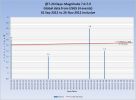
All Magnitudes 4.5+
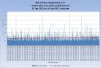
Mag 4.5 to 4.9
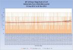
Mag 5.0 to 5.9
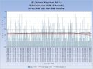
Mag 6.0 to 6.9
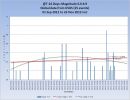
Mag 7.0 to 7.9
Volcanoes
No change from yesterday as far as I am aware.
Category 1+ storms
Tropical Storm BOPHA 25-27 NOV - Active (Western Pacific)
That concludes the report of yesterday 26th November 2012 UTC.
T-23 Days and counting
New: 2 volcanoes today, but one may have actually been on the 22nd. One tropical storm upgraded to cyclone. Quakes trends are all very slightly down. Sorry, I am not finding any doom yet!!!
Earthquakes
Busier day today with average number of Mag 5s but still light on the Mag 4s. Vanuatu one interests me since, as I have said, I think this is due a biggie. Maybe this first one after 9 days which works out as ~Mag 5.1 Mw (the 4.7 is mb) is a foreshock?
Listing for the 27th November. 10 x 4.5/4.9, 5 x 5.0/5.9
Prov,Date/Time UTC,Latitude,Longitude,Magnitude,Depth(Km),Location
usgs,2012-11-27T00:09:34.000Z,3.39760,128.05020,4.5000,134.5000,north of Halmahera. Indonesia
usgs,2012-11-27T02:59:08.000Z,-2.93300,129.24430,5.6000,25.0000,Seram. Indonesia
usgs,2012-11-27T04:27:29.000Z,-21.40860,-66.65860,4.5000,205.1000,Potosi. Bolivia
usgs,2012-11-27T06:22:29.000Z,33.19760,49.21280,4.7000,24.5000,western Iran
usgs,2012-11-27T07:34:27.000Z,17.71460,145.70410,5.3000,207.7000,Alamagan region. Northern Mariana Islands
usgs,2012-11-27T10:15:28.000Z,13.68400,-91.95930,4.6000,42.8000,offshore Guatemala
usgs,2012-11-27T11:58:20.000Z,-2.75530,138.74190,5.2000,59.0000,Papua. Indonesia
usgs,2012-11-27T12:15:18.000Z,31.01420,78.52990,4.5000,35.0000,western Xizang-India border region
usgs,2012-11-27T12:38:47.000Z,-2.94020,129.38020,4.5000,35.0000,Seram. Indonesia
usgs,2012-11-27T13:37:10.000Z,5.69030,-82.58850,4.6000,10.0000,south of Panama
usgs,2012-11-27T14:42:15.000Z,48.19710,154.94090,5.2000,41.7000,Kuril Islands
usgs,2012-11-27T15:40:56.000Z,-56.08000,-27.30620,5.1000,91.0000,South Sandwich Islands region
usgs,2012-11-27T17:39:47.000Z,51.69630,-179.70940,4.7000,110.9000,Andreanof Islands
usgs,2012-11-27T19:06:21.000Z,40.78710,19.66110,4.5000,18.8000,Albania
usgs,2012-11-27T20:30:35.000Z,4.09810,126.30390,4.8000,74.2000,Kepulauan Talaud. Indonesia
All Magnitudes 4.5+
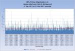
Mag 4.5 to 4.9
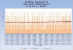
Mag 5.0 to 5.9
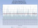
Mag 6.0 to 6.9
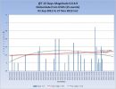
Mag 7.0 to 7.9
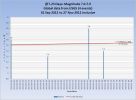
Volcanoes
One or possibly 2 new volcanoes. Definitely 2 as far as this thread is concerned. Mount Lokon in Indonesia and Plosky Tolbachik in Kamchatka, Russia.
More details here
The volcano chart is getting closer to complete. I will post it later.
Category 1+ storms
BOPHA is now classified as a Category 1 cyclone so for consistency the previous days of tropical storm ar re-classified as Cat 1.
Tropical Cyclone BOPHA 25-28 NOV - Active (Western Pacific)
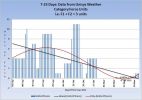
That concludes the report of yesterday 27th November 2012 UTC.
Originally posted by PuterMan
T-24 Days and counting
Earthquakes
Busier day today with average number of Mag 5s but still light on the Mag 4s. Vanuatu one interests me since, as I have said, I think this is due a biggie. Maybe this first one after 9 days which works out as ~Mag 5.1 Mw (the 4.7 is mb) is a foreshock?
.
yeah good old super active Vanuatu is overdue for another biggie ,but not this year ...... expect it to happen after new years ( i cant wait for this year to be over)
edit on 28/11/12 by alysha.angel because: (no reason given)
T-22 Days and counting
Nothing new yesterday. The trend for mag 4 is very slightly down and for mag 5 very slightly up. Overall the trend id very slightly down. A Mag 6+ has to happen VERY soon.
Earthquakes
Busier day today with average number of Mag 5s but still light on the Mag 4s. Vanuatu one interests me since, as I have said, I think this is due a biggie. Maybe this first one after 9 days which works out as ~Mag 5.1 Mw (the 4.7 is mb) is a foreshock?
Listing for the 28th November. 9 x 4.5/4.9, 4 x 5.0/5.9
Date/Time UTC,Latitude,Longitude,Magnitude,Depth(Km),Location
2012-11-28T01:42:22.000Z,-2.29420,138.23240,4.6000,35.4000,Papua. Indonesia
2012-11-28T03:09:49.000Z,-4.50760,-76.05110,5.6000,120.0000,northern Peru
2012-11-28T04:31:29.000Z,15.50460,-92.48710,4.5000,152.4000,Chiapas. Mexico
2012-11-28T05:28:25.000Z,12.51100,-88.31100,4.8000,40.2000,offshore El Salvador
2012-11-28T05:30:13.000Z,41.84930,77.73730,4.6000,46.4000,Kyrgyzstan
2012-11-28T06:46:36.000Z,12.54960,-88.35130,4.5000,42.5000,offshore El Salvador
2012-11-28T08:36:10.000Z,-15.43630,-172.96880,4.5000,27.5000,Samoa Islands region
2012-11-28T08:56:16.000Z,-5.40410,131.11230,5.5000,56.0000,Banda Sea
2012-11-28T10:22:01.000Z,18.98180,121.20110,4.8000,16.3000,Luzon. Philippines
2012-11-28T15:07:43.000Z,27.25330,143.16820,5.1000,61.3000,Bonin Islands. Japan region
2012-11-28T18:05:30.000Z,-27.84860,-66.40480,4.8000,154.4000,Catamarca. Argentina
2012-11-28T22:56:48.000Z,21.15780,145.01540,4.6000,69.0000,Mariana Islands region
2012-11-28T23:15:29.000Z,36.83900,5.42160,5.0000,10.2000,northern Algeria
All Magnitudes 4.5+
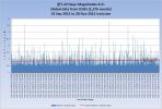
Mag 4.5 to 4.9
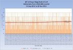
Mag 5.0 to 5.9
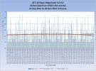
Mag 6.0 to 6.9
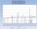
Mag 7.0 to 7.9
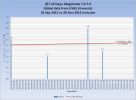
Volcanoes
Plosky Tolbachik in Kamchatka, Russia continues. No new volcanoes that I am aware of but Smithsonian is still down and showing the error message again.
The volcano chart is (still) getting closer to complete. I will post it in the next day or two.
Category 1+ storms
BOPHA continues. No new storms.
Tropical Cyclone BOPHA 25-29 NOV - Active (Western Pacific)
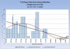
That concludes the report of yesterday 28th November 2012 UTC.
edit on 29/11/2012 by PuterMan because: (no reason given)
T-21 Days and counting
Overall the trend is very slightly up again. Santa Maria had a little puff yesterday but ths is one of the 16 always erupting volcanoes so not counted as a new eruption.
Earthquakes
The Magnitude 5.9 on the coast of Papua New Guinea is recorded as a Mag 6 by EMSC and GFZ Potsdam. I find it very off that no phase data is available for this one even now nearly 24 hours after the event.
Listing for the 29th November. 10 x 4.5/4.9, 6 x 5.0/5.9
Prov,Date/Time UTC,Latitude,Longitude,Magnitude,Depth(Km),Location
usgs,2012-11-30 09:02:51, -15.256, -72.764, 4.5, 117.1, Southern Peru
usgs,2012-11-30 06:48:20, 48.142, 155.003, 4.8, 45.4, Kuril Isls.
usgs,2012-11-30 02:36:07, -38.170, 176.771, 4.5, 183.9, N. Isl Of Nz
usgs,2012-11-29 23:22:35, 52.630, 172.410, 5.0, 33.2, Nr. Isls.
usgs,2012-11-29 19:32:34, 13.720, -92.164, 5.2, 32.1, Offshore Guatemala
usgs,2012-11-29 12:41:35, 26.117, 125.138, 4.9, 148.7, N.East Of Taiwan
usgs,2012-11-29 11:12:53, 37.832, 143.916, 4.6, 26.4, Off E. Coast Of Honshu. Japan
usgs,2012-11-29 11:10:27, -3.706, 145.439, 5.9, 10.0, Nr. N. Coast Of New Guinea. P.N.G
usgs,2012-11-29 10:37:38, -20.623, -177.048, 5.4, 247.5, Fiji Region
usgs,2012-11-29 08:11:05, -28.179, -178.356, 4.8, 206.0, Kermadec Isls. Region
usgs,2012-11-29 07:09:13, -6.576, -80.938, 5.5, 12.1, Nr. Coast Of Northern Peru
usgs,2012-11-29 05:41:28, -21.021, 169.996, 4.8, 82.4, S.East Of The Loyalty Isls.
usgs,2012-11-29 03:12:49, 22.396, 121.310, 4.5, 81.1, Taiwan Region
usgs,2012-11-29 02:23:59, 71.024, -6.529, 4.6, 13.5, Jan Mayen Island Region
usgs,2012-11-29 00:30:32, -21.093, -178.703, 5.0, 557.4, Fiji Region
usgs,2012-11-29 00:09:39, -32.829, -68.962, 4.9, 10.0, Mendoza. Argentina
All Magnitudes 4.5+
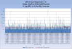
Mag 4.5 to 4.9
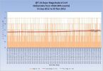
Mag 5.0 to 5.9
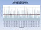
Mag 6.0 to 6.9
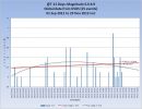
Mag 7.0 to 7.9
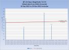
Volcanoes
Plosky Tolbachik in Kamchatka, Russia continues. You can see images of the eruption here. This has previous images as well.
Seismic activity of the volcano continues but a magnitude of volcanic tremor decreased. Strombolian activity and an effuse of lava flows continues at the Tolbachinsky Dol. A large thermal anomaly was noted at the northern part of Tolbachinsky Dol.
Source
There are 4 orange alert volcanoes on the Kamchatka peninsula now
Alaid, YELLOW
Gorely, YELLOW
Karymsky, ORANGE
Kizimen, ORANGE
Tolbachik, ORANGE
Bezymianny, YELLOW
Kliuchevskoi, YELLOW
Sheveluch, ORANGE
Santa Maria gave a little spurt yesterday, Basically a continuation of the ongoing activity last reported upon by Smithsonian on 21st November.
INSIVUMEH reported in a special bulletin on 21 November that collapses of the fronts of lava flows on the NE, SE, S, and SW flanks of Santa María's Santiaguito lava-dome complex generated pyroclastic flows and ash plumes that rose 1 km. Ash plumes drifted 15 km S and SE, producing ashfall in Las Marías, Calaguache (9 km S), and Nuevo Palmar (12 km S). During 24-27 November incandescence was observed, lava flows were active on the SW and SE flanks, and ash plumes rose 500 m and drifted 15 km SW. On 27 November pyroclastic flows traveled short distances, and generated ash plumes that rose 500 m and drifted 10 km S and SE.
Source: Instituto Nacional de Sismologia, Vulcanologia, Meteorologia, e Hidrologia (INSIVUMEH)
I can't link the source for this at present as the site is sending all web address for the reports to an RSS feed. Not really the desired effect!
Category 1+ storms
BOPHA continues. No new storms.
Tropical Cyclone BOPHA 25-30 NOV - Active (Western Pacific)
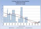
That concludes the report of yesterday 29th November 2012 UTC.
I know it has nothing to do with quakes, eruptions and so on but I think it has it's place in this thread for a brider view of the subject. D-day
incoming
Maya Calendar
source
en.wikipedia.org...
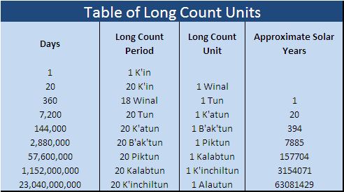
The Maya name for a day was k'in. Twenty of these k'ins are known as a winal or uinal. Eighteen winals make one tun. Twenty tuns are known as a k'atun. Twenty k'atuns make a b'ak'tun.
The Long Count calendar identifies a date by counting the number of days from the Mayan creation date 4 Ahaw, 8 Kumk'u (August 11, 3114 BC in the proleptic Gregorian calendar or September 6 in the Julian calendar). But instead of using a base-10 (decimal) scheme like Western numbering, the Long Count days were tallied in a modified base-20 scheme. Thus 0.0.0.1.5 is equal to 25, and 0.0.0.2.0 is equal to 40. As the winal unit resets after only counting to 18, the Long Count consistently uses base-20 only if the tun is considered the primary unit of measurement, not the k'in; with the k'in and winal units being the number of days in the tun. The Long Count 0.0.1.0.0 represents 360 days, rather than the 400 in a purely base-20 (vigesimal) count.
There are also four rarely used higher-order cycles: piktun, kalabtun, k'inchiltun, and alautun.
Since the Long Count dates are unambiguous, the Long Count was particularly well suited to use on monuments. The monumental inscriptions would not only include the 5 digits of the Long Count, but would also include the two tzolk'in characters followed by the two haab' characters.
Misinterpretation of the Mesoamerican Long Count calendar is the basis for a popular belief that a cataclysm will take place on December 21, 2012. December 21, 2012 is simply the day that the calendar will go to the next b'ak'tun, at Long Count 13.0.0.0.0. The date on which the calendar will go to the next piktun (a complete series of 20 b'ak'tuns), at Long Count 1.0.0.0.0.0, will be on October 13, 4772.
Sandra Noble, executive director of the Mesoamerican research organization Foundation for the Advancement of Mesoamerican Studies, Inc. (FAMSI), notes that "for the ancient Maya, it was a huge celebration to make it to the end of a whole cycle". She considers the portrayal of December 2012 as a doomsday or cosmic-shift event to be "a complete fabrication and a chance for a lot of people to cash in."[23]
Table of Long Count units
Days Long Count period Long Count unit Approximate Solar Years
1 1 K'in
20 20 K'in 1 Winal
360 18 Winal 1 Tun 1
7,200 20 Tun 1 K'atun 20
144,000 20 K'atun 1 B'ak'tun 394
2,880,000 20 B'ak'tun 1 Piktun 7885
57,600,000 20 Piktun 1 Kalabtun 157704
1,152,000,000 20 Kalabtun 1 K'inchiltun 3154071
23,040,000,000 20 K'inchiltun 1 Alautun 63081429
edit
Fail for the table content
edit on 30-11-2012 by Nidwin because: (no reason given)
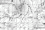
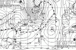
I have just found out that there is actually a hurricane off the East coast of Canada. I spotted it on the UK et Office map but it did not mention
hurricane. At 954 mb if pretty much had to be. Found a NOAA map for it. Yes it is a hurricane. Add 1 to the count.
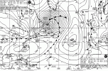
©www.weathercharts.org
North Atlantic - Eastern USA

©www.weathercharts.org
North Atlantic - Eastern USA
reply to post by Nidwin
Yes very suitable for the thread and thaks for posting it. Shows that the world was not coming to an end according to the Maya.
Re did your table to look pretty!
Yes very suitable for the thread and thaks for posting it. Shows that the world was not coming to an end according to the Maya.
Re did your table to look pretty!

S&F
Just a quick post for easy following.
Thankyou for doing this.
Just a quick post for easy following.
Thankyou for doing this.
T-20 Days and counting
Overall the trend is very slightly up again but the numbers are down even with my error yesterday.
No one it seems spotted the (un)intentional error yesterday. I inadvertantly included 3 events from the 30th.
Earthquakes
It is VERY quiet at this time. The calm before the storm?. It is rare to see the LISS recorders in a flat calm so I had to preserve the current image.
Listing for the 30th November. 7 x 4.5/4.9, 1 x 5.0/5.9
Prov,Date/Time UTC,Latitude,Longitude,Magnitude,Depth(Km),Location
usgs,2012-11-30 19:39:29, 27.187, 88.209, 4.7, 15.9, Sikkim. India
usgs,2012-11-30 17:18:52, 43.801, 147.285, 4.9, 61.8, Kuril Isls.
usgs,2012-11-30 11:42:58, 39.162, 143.668, 4.8, 26.2, Off E. Coast Of Honshu. Japan
usgs,2012-11-30 11:20:36, -18.793, -175.588, 5.5, 181.8, Tonga
usgs,2012-11-30 11:00:38, 55.590, 160.193, 4.6, 49.0, Kamchatka Peninsula. Russia
usgs,2012-11-30 09:02:51, -15.256, -72.764, 4.5, 117.1, Southern Peru
usgs,2012-11-30 06:48:20, 48.142, 155.003, 4.8, 45.4, Kuril Isls.
usgs,2012-11-30 02:36:07, -38.170, 176.771, 4.5, 183.9, N. Isl Of Nz
All Magnitudes 4.5+
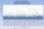
Mag 4.5 to 4.9
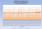
Mag 5.0 to 5.9
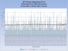
Mag 6.0 to 6.9
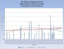
Mag 7.0 to 7.9
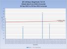
Volcanoes
CHIRPOI Kuril Islands (Russia) 46.525°N, 150.875°E; summit elev. 742 m
SVERT reported that a thermal anomaly was detected over Snow, a volcano of Chirpoi, on 20, 22, and 25 November, possibly indicating a lava flow on the SE flank.
Smithsonian
No counting it as an eruption until it has been confirmed.
There are 4 orange alert volcanoes on the Kamchatka peninsula now
Alaid, YELLOW
Gorely, YELLOW
Karymsky, ORANGE
Kizimen, ORANGE
Tolbachik, ORANGE
Bezymianny, YELLOW
Kliuchevskoi, YELLOW
Sheveluch, ORANGE
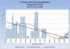
Category 1+ storms
BOPHA continues and has been upgraded to Category 2.
Tropical Cyclone BOPHA 25-30 NOV - Active (Western Pacific)
The New Atlantic Hurricane I posted after the last report still has not appeared on the lists.
That concludes the report of yesterday 30th November 2012 UTC.
Thank you for all the time and effort you put into this. I'll be monitoring this daily right up until "the day."
T-19 Days and counting
Earthquakes
Overall the trend is very slightly down.
It was VERY quiet on the 1st December, but we know at the time of writing (02:45 UTC) that the Mag 6 expected did happen. The details will be on tomorrow's report.
Listing for the 01 December. 7 x 4.5/4.9, 1 x 5.0/5.9
Prov,Date/Time UTC,Latitude,Longitude,Magnitude,Depth(Km),Location
usgs,2012-12-01 22:08:52, 27.537, 53.671, 4.5, 10.0, Southern Iran
usgs,2012-12-01 20:52:06, 45.788, 26.812, 4.6, 90.5, Romania
usgs,2012-12-01 19:06:43, -0.540, 123.716, 4.6, 26.3, Sulawesi. Ind.
usgs,2012-12-01 18:39:37, -23.978, -66.815, 4.5, 208.0, Jujuy. Argentina
usgs,2012-12-01 15:16:47, 31.892, 104.293, 4.8, 40.4, Eastern Sichuan. China
usgs,2012-12-01 13:04:05, -30.123, -111.176, 4.6, 10.0, Easter Island Region
usgs,2012-12-01 10:36:26, -12.936, 169.244, 4.6, 636.4, Santa Cruz Isls. Region
usgs,2012-12-01 08:00:57, 58.533, -154.180, 5.3, 88.2, Alaska Peninsula
All Magnitudes 4.5+
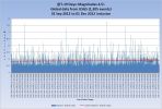
Mag 4.5 to 4.9
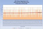
Mag 5.0 to 5.9
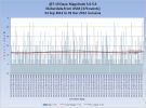
Mag 6.0 to 6.9
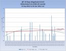
Mag 7.0 to 7.9
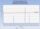
Volcanoes
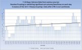
Plosky Tolbachik may be on red alert now but as is often the case with these remote volcanoes it can take some time for correct information to filter through. Currently KVERT is down and AVO still shows Orange. As far as I am aware it is still erupting lava (fissure eruption)
There are 4 orange alert volcanoes on the Kamchatka peninsula now
Alaid, YELLOW
Gorely, YELLOW
Karymsky, ORANGE
Kizimen, ORANGE
Tolbachik, ORANGE
Bezymianny, YELLOW
Kliuchevskoi, YELLOW
Sheveluch, ORANGE
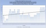
Paluweh, 0604-15=, Lesser Sunda Islands is putting out ash
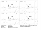
Manam 0501-02= (Papua New Guinea) is not erupting but is putting out ash.
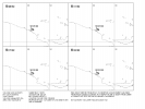
Ash images from BOM Australia
©Commonwealth of Australia, Bureau of Meteorology (ABN 92 637 533 532)
Also for 01 Dec
VOLCANO: Langila 0502-01=
PSN: S0531 E14825
AREA: New Britain-SW Pac
SUMMIT ELEV: 1330M
ADVISORY NR: 2012/1
INFO SOURCE: AIREP
AVIATION COLOUR CODE: ORANGE
ERUPTION DETAILS: PLUME REPORTED TO FL050 AT 01/0130Z
OBS VA DTG: 01/0130Z
OBS VA CLD: VA NOT IDENTIFIABLE FM SATELLITE DATA WIND SFC/FL050
140/15KT
Recent VA advisories BOM Darwin
Category 1+ storms
BOPHA continues and has been upgraded again from 2 to Category 4.
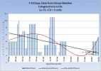
Super Typhoon-4 BOPHA, 25 NOV-02 DEC, 135 kts, 4 - Active (Western Pacific)
The New Atlantic Hurricane I posted still has not appeared on the lists.
That concludes the report of yesterday 01 December 2012 UTC.
edit on 2/12/2012 by PuterMan because: To add the volcanoes chart
Just wait PM...
It's all going to happen at the 11th hour. The big KABOOM.
You just wait and see.
And by the way, for blowing my cover you no longer have a seat reserved on our Starscape modular lifepod. His holiness, the chief and headmaster himself, just tweeted me the updated list and you've been stricken off my fine feathered friend... yes, that's right... stricken off !
reply to post by CranialSponge
I look forward to the 11th hour with interest and shall be watching it from afar. You see I do not need an escape pod as I live on one. The Emerald Isle, God's own territory, will be spared any cataclysms.
Being as you are a banker your seat has probably been leveraged 30 times over.
By the way volcanoes on alert look as if they might be on the increase so maybe, maybe..................

ETA: I have it on the highest authority that the Holy Emerald Isle is safe.
I look forward to the 11th hour with interest and shall be watching it from afar. You see I do not need an escape pod as I live on one. The Emerald Isle, God's own territory, will be spared any cataclysms.
Being as you are a banker your seat has probably been leveraged 30 times over.
By the way volcanoes on alert look as if they might be on the increase so maybe, maybe..................

ETA: I have it on the highest authority that the Holy Emerald Isle is safe.
edit on 2/12/2012 by PuterMan because: (no reason given)
T-18 Days and counting
Earthquakes
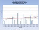
Overall the trend is very slightly up.
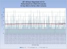
The Mag 6 expected did happen after what was a fairly long period without a Mag 6.
Listing for the 02 December. 6 x 4.5/4.9, 2 x 5.0/5.9, 1 x 6.4
Prov,Date/Time UTC,Latitude,Longitude,Magnitude,Depth(Km),Location
usgs,2012-12-02 23:45:14, 45.754, 151.487, 4.9, 38.0, Kuril Isls.
usgs,2012-12-02 21:00:51, -21.716, -179.487, 4.8, 605.1, Fiji Region
usgs,2012-12-02 19:43:30, 23.950, 121.606, 4.7, 9.6, Taiwan
usgs,2012-12-02 17:45:38, 23.936, 121.604, 4.8, 21.3, Taiwan
usgs,2012-12-02 15:10:53, -60.087, -19.000, 4.8, 10.0, East Of The South Sandwich Isls.
usgs,2012-12-02 14:23:08, 2.447, 89.789, 4.7, 13.4, North Indian Ocean
usgs,2012-12-02 13:32:43, -20.633, -174.234, 5.1, 6.0, Tonga
usgs,2012-12-02 04:44:37, 11.816, -89.005, 5.1, 50.9, Off Coast Of Central America
usgs,2012-12-02 00:54:23, -17.012, 167.626, 6.4, 34.1, Vanuatu
All Magnitudes 4.5+
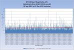
Mag 4.5 to 4.9
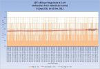
Mag 5.0 to 5.9
Mag 6.0 to 6.9
Mag 7.0 to 7.9
Volcanoes
Volcano Chart
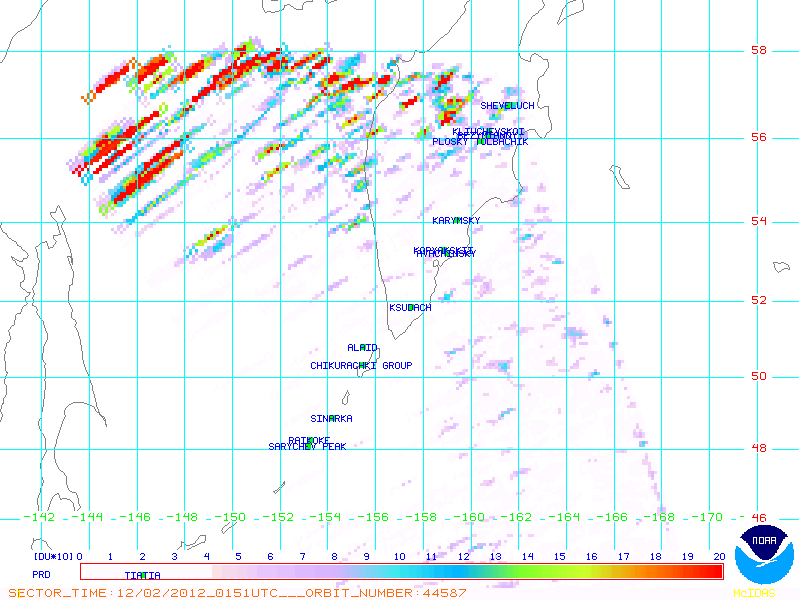
Plosky Tolbachik may be on red alert now but as is often the case with these remote volcanoes it can take some time for correct information to filter through. Currently KVERT is down and AVO still shows Orange. As far as I am aware it is still erupting lava (fissure eruption)
There is still no information available but recent satellite imagery may be finally detecting the low (atmospheric) level plume generated by the basaltic-andesite fissure eruption.
There are 4 orange alert volcanoes on the Kamchatka peninsula now
Alaid, YELLOW
Gorely, YELLOW
Karymsky, ORANGE
Kizimen, ORANGE
Tolbachik, ORANGE
Bezymianny, YELLOW
Kliuchevskoi, YELLOW
Sheveluch, ORANGE
Paluweh ash plume may have stopped
Manam: No further information. Assumed to be continuing.
Commonwealth of Australia, Bureau of Meteorology
Category 1+ storms
Cat 1+ Storms Chart
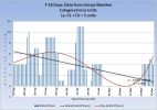
BOPHA continues and is Category 4.
Super Typhoon-4 BOPHA, 25 NOV-02 DEC, 135 kts, 4 - Active (Western Pacific)
That concludes the report of yesterday 02 December 2012 UTC.
reply to post by PuterMan
Shouldn't this include data from previous years to quantify? (Hurricane data)
I am impressed with the amount of effort you have put into this thread, I can appreciate the graphs are not easy to do.
Thank you. BAW33
Shouldn't this include data from previous years to quantify? (Hurricane data)
I am impressed with the amount of effort you have put into this thread, I can appreciate the graphs are not easy to do.
Thank you. BAW33
edit on 12/3/2012 by BrokenAngelWings33 because: Edit
new topics
-
Those Great Fresh Pet Commercials
Television: 3 hours ago -
S.C. Jack Smith's Final Report Says Trump Leads a Major Conspiratorial Criminal Organization!.
Political Conspiracies: 5 hours ago -
Advice for any young Adult .
General Chit Chat: 6 hours ago -
Joe meant what he said about Hunter's pardon....
US Political Madness: 7 hours ago -
Regent Street in #London has been evacuated due to a “bomb threat.”
Other Current Events: 8 hours ago -
It’s Falling…
Philosophy and Metaphysics: 9 hours ago
top topics
-
Steering the Titantic from the Drydock.
Rant: 12 hours ago, 10 flags -
Joe meant what he said about Hunter's pardon....
US Political Madness: 7 hours ago, 10 flags -
Advice for any young Adult .
General Chit Chat: 6 hours ago, 10 flags -
S.C. Jack Smith's Final Report Says Trump Leads a Major Conspiratorial Criminal Organization!.
Political Conspiracies: 5 hours ago, 8 flags -
It’s Falling…
Philosophy and Metaphysics: 9 hours ago, 4 flags -
Regent Street in #London has been evacuated due to a “bomb threat.”
Other Current Events: 8 hours ago, 3 flags -
Those Great Fresh Pet Commercials
Television: 3 hours ago, 2 flags
active topics
-
Advice for any young Adult .
General Chit Chat • 16 • : grey580 -
S.C. Jack Smith's Final Report Says Trump Leads a Major Conspiratorial Criminal Organization!.
Political Conspiracies • 30 • : TzarChasm -
Los Angeles brush fires latest: 2 blazes threaten structures, prompt evacuations
Mainstream News • 55 • : burntheships -
Claim: General Mark Milley Approved Heat and Sound Directed Energy Weapons During 2020 Riots
Whistle Blowers and Leaked Documents • 31 • : fringeofthefringe -
Those Great Fresh Pet Commercials
Television • 3 • : nerbot -
House Passes Laken Riley Act
Mainstream News • 20 • : matafuchs -
Remember These Attacks When President Trump 2.0 Retribution-Justice Commences.
2024 Elections • 140 • : matafuchs -
What Comes After January 20th
Mainstream News • 27 • : NoCorruptionAllowed -
Post A Funny (T&C Friendly) Pic Part IV: The LOL awakens!
General Chit Chat • 8004 • : KrustyKrab -
Planned Civil War In Britain May Be Triggered Soon
Social Issues and Civil Unrest • 18 • : AdultMaleHumanUK
