It looks like you're using an Ad Blocker.
Please white-list or disable AboveTopSecret.com in your ad-blocking tool.
Thank you.
Some features of ATS will be disabled while you continue to use an ad-blocker.
share:
I am still confused as to why it would have been announced that Malaysia had given India a search region based on radar from an un-named source
country just two days ago....same day Australia announced they had an area of interest. I can't even find anything about it anymore and the source
country did not want to be named for security reasons. Malaysia told ONLY India to use the information for the search. Anyone else have any info on
this or remember it being announced?
Splodge
reply to post by judydawg
Former Opposition Leader Anwar Ibrahim is a moderate. The current government are fairly autocratic. It's widely known that the government charges of sodomy were a beat up and that the government used them to discredit him and get him out of their way. He was causing their administration problems. I doubt that his supporters were likely to fly a plane into the sea because of his sentencing, he doesn't incite that kind of fanaticism but i guess anything's possible.
My point is the pilot was at this trail hours before he took off in the triple 7. He was a Lbrahim supporter, so the government sent them a message and loaded the plane with explosives, as it changed from Malaysian air to turning everything off they blew it up.
I would be looking In the area of the Arabian Sea and Indian Ocean. Closer to Malaysia. Just MHO
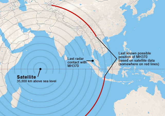
Here are the two arcs one one map:
qmantoo
I want you all to have a look at the australian maritime images on this page please.
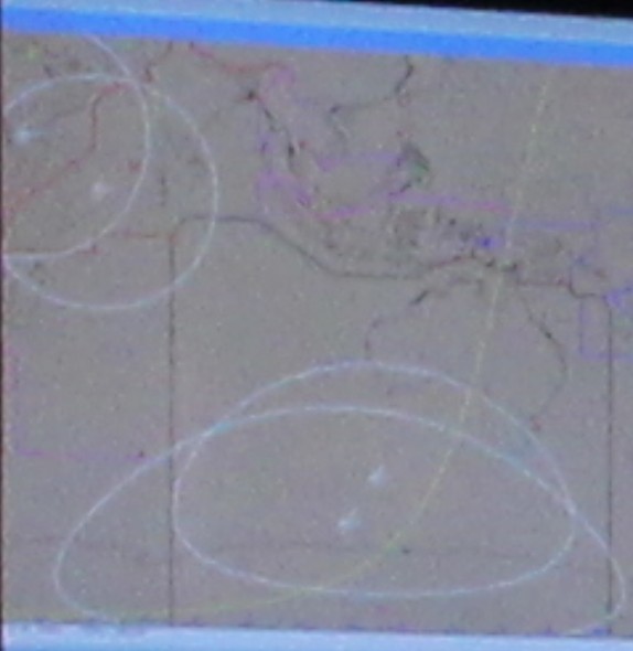
Number 3 & Number 4 have a map under the digital clocks showing the search area south and south south west of Perth but also a couple of places marked up near Africa. What do you think this means?
The avioniationist website has a nice map here but it shows the search area quite a lot more west of Perth. Maybe it is due to the wind and drift parameters?
I am really asking about the points near NW Africa as there was speculation the plane went up there at the start of things.
www.cnn.com...
It's showing the satellite over the sea off the Eastern coast of Africa. I can't really tell where the images in your links under the digital clocks is pointing to.
I don't see where there are places marked up near Africa, but I think the map is so distorted that's probably why you mis-read it. If you're talking about the two circles in the upper left of this image, I don't think that's Africa, it looks more like India.

Compare the coastline to the other map I posted.
edit on 21-3-2014 by Arbitrageur because: clarification
judydawg
My point is the pilot was at this trail hours before he took off in the triple 7. He was a Lbrahim supporter, so the government sent them a message and loaded the plane with explosives, as it changed from Malaysian air to turning everything off they blew it up.
Ibrahim has a large number of supporters and a lot of them would have been at the trial, i'd say. Unless they're killing them off one-by-one (watch out for those bizarre gardening accidents!), I don't see why they'd pick on the pilot. Besides, they'd be destroying their own property in the process, as Malaysia Airlines is a government held airline.
Arbitrageur
Here are the two arcs one one map:
qmantoo
I want you all to have a look at the australian maritime images on this page please.
Number 3 & Number 4 have a map under the digital clocks showing the search area south and south south west of Perth but also a couple of places marked up near Africa. What do you think this means?
The avioniationist website has a nice map here but it shows the search area quite a lot more west of Perth. Maybe it is due to the wind and drift parameters?
I am really asking about the points near NW Africa as there was speculation the plane went up there at the start of things.
It's showing the satellite over the sea off the Eastern coast of Africa. I can't really tell where the images in your links under the digital clocks is pointing to.
I don't see where there are places marked up near Africa, but I think the map is so distorted that's probably why you mis-read it. If you're talking about the two circles in the upper left of this image, I don't think that's Africa, it looks more like India.
Compare the coastline to the other map I posted.edit on 21-3-2014 by Arbitrageur because: clarification
No. If you follow the coastline of Indonesia past Banda Aceh, it runs into India, well east of those two circles. Those circles in upper left are above Africa.
Edit to Add: AND a portion of Yemen, Saudi Arabia, and a large portion of the ME
edit on 21-3-2014 by Seek_Truth because: (no reason
given)
edit on 21-3-2014 by Seek_Truth because: (no reason given)
How do you know they are above Africa?
Seek_Truth
No. If you follow the coastline of Indonesia past Banda Aceh, it runs into India, well east of those two circles. Those circles in upper left are above Africa.
reply to post by Tallone
Thanks for the link to that article. I find it hard to believe that this retired general is suggesting that hijacked airliners are a threat to U.S. aircraft carriers. That is an exaggeration if I've ever heard one. I do believe he's laying the foundation for the public to expect MH370 to reappear in a 911 type attack. But against a U.S. carrier? I don't think so...
Israel and other U.S. allies in the Persian Gulf region? Yes, I could see that happening as the result of a government orchestrated attack.
And the "fall guy" will be either Iranian or Syrian government operatives.
nation.foxnews.com...
MCINERNEY: Well, and the airplane would have landed 8:00 Kuala Lumpur time, 3:00 Pakistani time in the morning -- excuse me, 5:00. There's a three hour difference, so it would have been dark. Anyone who says they saw this overfly the Maldives or whatever, it was dark. I don't see how anybody could say that. There's been a lot of strange information put out on altitudes and a whole host of things, and a lot of it's come from the Malaysian government, so we've got to be able to sort through this. My concern is, if this airplane could be used as a weapon of mass destruction or even conventional munitions that could attack a carrier, the Israelis, other allies, American forces, for instance, we have to be very alert until we know exactly where this airplane is.
Hey I found wreckage in the ocean on tomnod.com, massive section of billowing black smoke.... potentially MAS MH370?
www.tomnod.com...
www.tomnod.com...
Also...
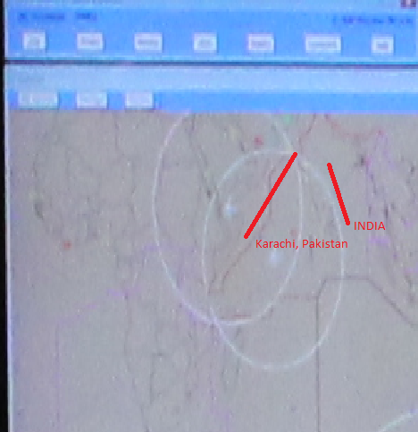
The intersection of the two circles at the top are right above Karachi, Pakistan.
The intersection of the two circles at the top are right above Karachi, Pakistan.
Arbitrageur
How do you know they are above Africa?
Seek_Truth
No. If you follow the coastline of Indonesia past Banda Aceh, it runs into India, well east of those two circles. Those circles in upper left are above Africa.
Can you not see the outline of the Continent??

edit on 21-3-2014 by Seek_Truth because: Figured out how to upload image
I can see it in the image you posted, not the one I posted. Thanks.
Seek_Truth
Can you not see the outline of the Continent??
I also have no idea what that signifies since it's nowhere near either of the arcs. It looks too far away for a search area consistent with the arcs even assuming the plane flew the last hour off the arc and with current drift.
Maybe they aren't so confident in the arcs?
edit on 21-3-2014 by Arbitrageur because: clarification
reply to post by Arbitrageur
just watched the morning news...nothing new to report...............................................................................when will this end???????
just watched the morning news...nothing new to report...............................................................................when will this end???????
Now this....
Earthquakes Tsunamis @NewEarthquake 7m
6.5 earthquake, 113km E of Mohean, India. Mar 21 19:41 at epicenter (34m ago, depth 10km).
Earthquakes Tsunamis @NewEarthquake 7m
6.5 earthquake, 113km E of Mohean, India. Mar 21 19:41 at epicenter (34m ago, depth 10km).
Almost 2 weeks after the disappearance: ''Oh didn't we mention it was carrying cargo of lithium-ion batteries'' which aren't exactly flaming
MANGOSTEENS.
So much unbelievable reporting that this 'information' perhaps isn't even believable, seeing as it is just being put out there NOW. Wouldn't it be the FIRST hypothesis?
Meanwhile nothing found in the search areas at Australia, no surprise there then, seeing as it is probably elsewhere. Anyone got a good lithium ion bomb recipe, let's hope it isn't winging it's way to a building anytime soon.
www.theguardian.com...
On Friday it emerged that, according to the MH370 cargo manifest, the plane was carrying On Friday it emerged that, according to the MH370 cargo manifest, the plane was carrying lithium-ion batteries. These are categorised as "dangerous cargo" as they can be unstable at altitude and can catch fire if not transported correctly.. These are categorised as "dangerous cargo" as they can be unstable at altitude and can catch fire if not transported correctly.
edit on 21-3-2014 by theabsolutetruth because: (no reason given)
research100
reply to post by Arbitrageur
just watched the morning news...nothing new to report...............................................................................when will this end???????
Bill Neely @BillNeelyNBC 6m
US Navy Poseidon searching for #MH370 returns to Perth. Crew say they found nothing in the search area & that weather conditions were clear
reply to post by theabsolutetruth
Is this type of cargo a bit odd for a passenger aircraft ? Legitimet question there
Is this type of cargo a bit odd for a passenger aircraft ? Legitimet question there
reply to post by ThePeaceMaker
Lithium-based Batteries
In 2009, 3.3 billion Li-ion batteries were transported by air. Such air shipment is an ongoing concern, and an airline-pilot union has asked the Federal Aviation Administration (FAA) to ban them on passenger aircraft. From March 1991 to August 2010, batteries and battery-powered devices caused 113 recorded incidents with smoke, fire, extreme heat or explosion on passenger and cargo planes. The Portable Rechargeable Battery Association (PRBA) is aware of possible hazards and opposes any revisions in transportation rules, arguing that the restrictions would cost shippers and manufacturers billions of dollars.
SOURCE
reply to post by ThePeaceMaker
Generally they are shipped via ships not planes...
I can't believe it. A few days ago when I was looking at mangosteens (as hazardous material lol) I saw the thing about lithium ion batteries being baaad for planes.
Wait. Legitimate question here, but why were they transporting the batteries to China?? Aren't they like... made there???
reply to post by rockflier
That's infuriating.
The Portable Rechargeable Battery Association (PRBA) is aware of possible hazards and opposes any revisions in transportation rules, arguing that the restrictions would cost shippers and manufacturers billions of dollars.
That's infuriating.
searcherboy
Hey I found wreckage in the ocean on tomnod.com, massive section of billowing black smoke.... potentially MAS MH370?
www.tomnod.com...
Looks like clouds to me. just MHO
new topics
-
Nvm
General Chit Chat: 4 hours ago -
OK this is sad but very strange stuff
Paranormal Studies: 10 hours ago -
Islam And A Book Of Lies
Religion, Faith, And Theology: 11 hours ago
top topics
-
Sorry to disappoint you but...
US Political Madness: 13 hours ago, 13 flags -
OK this is sad but very strange stuff
Paranormal Studies: 10 hours ago, 7 flags -
Islam And A Book Of Lies
Religion, Faith, And Theology: 11 hours ago, 5 flags -
Nvm
General Chit Chat: 4 hours ago, 2 flags
active topics
-
-@TH3WH17ERABB17- -Q- ---TIME TO SHOW THE WORLD--- -Part- --44--
Dissecting Disinformation • 3947 • : Crazierfox -
Here we again... CHINA having mass outbreak of something
Diseases and Pandemics • 29 • : BeyondKnowledge3 -
Matthew Livelsberger said he was being followed by FBI
Political Conspiracies • 73 • : 38181 -
Islam And A Book Of Lies
Religion, Faith, And Theology • 5 • : BeyondKnowledge3 -
OK this is sad but very strange stuff
Paranormal Studies • 4 • : chiefsmom -
Musk calls on King Charles III to dissolve Parliament over Oldham sex grooming gangs
Mainstream News • 184 • : ufoorbhunter -
Can we be certain that Jesus Christ was born on December 25th?
Religion, Faith, And Theology • 35 • : covent -
What Is 'Quad Demic'? Mask Mandate Returns In These US States
Diseases and Pandemics • 41 • : Cracka -
Tesla Cybertruck Explodes in Front of Trump Hotel in Las Vegas
Mainstream News • 230 • : imitator -
Remember when Iraq invaded Kuwait
History • 31 • : Cracka

