It looks like you're using an Ad Blocker.
Please white-list or disable AboveTopSecret.com in your ad-blocking tool.
Thank you.
Some features of ATS will be disabled while you continue to use an ad-blocker.
share:
reply to post by Arken
Oh, please! Those are Jpeg compressed images!
Ever heard of artifacts from that kind of compression?
Oh, please! Those are Jpeg compressed images!
Ever heard of artifacts from that kind of compression?
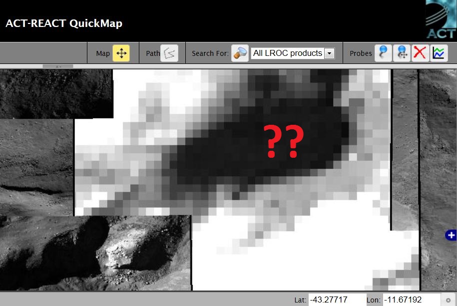
As I said, in the LROC QuikMap, the specific Area of the presumed "Alien Base", is completely blank.
www.abovetopsecret.com...

A BIG PIXELLATED BLACK AREA.
A disgraceful coincidence!
www.abovetopsecret.com...

A BIG PIXELLATED BLACK AREA.
A disgraceful coincidence!
reply to post by Arken
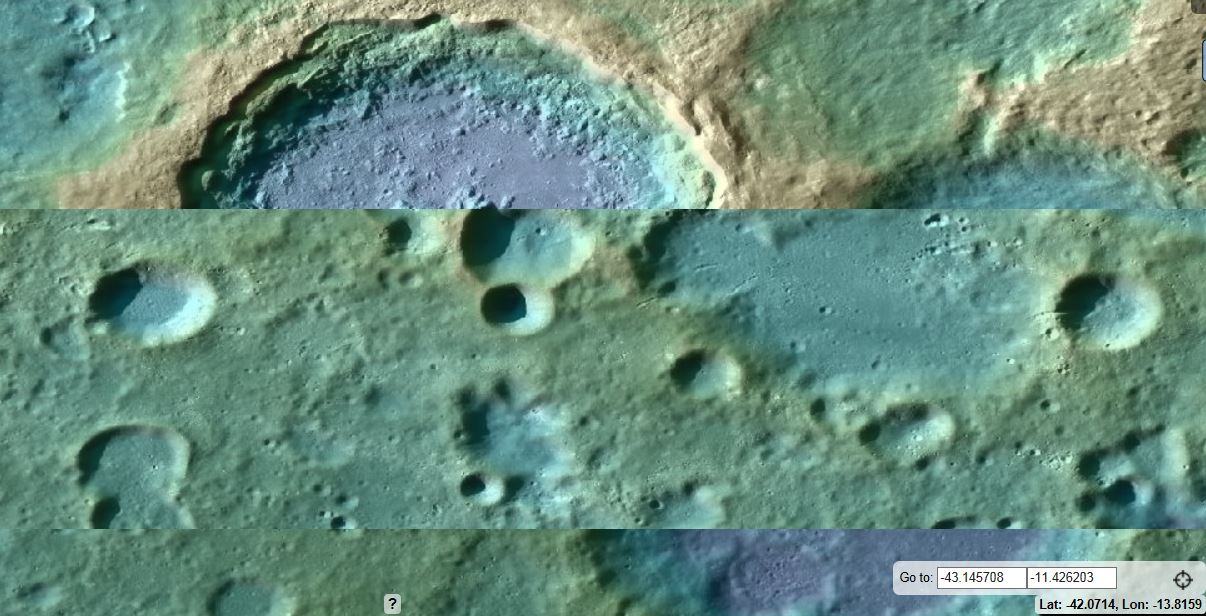
Arken, The coordinates from your first image are not in the location that is not mapped properly. You can clearly see the coordinates in your first image are Lat -43.1457, Lon -11.4226 and that area is clearly imaged.
Then when nothing is there, you notice another area, hundreds of meters away from the original area is pixelated and are now suddenly claiming THAT IS THE AREA!!!
Originally posted by ZetaRediculian
no its not
Originally posted by Unity_99
The entire inner moon is a network of tubes and bases.
Yes it is
Originally posted by Arken
reply to post by qmantoo
Yes, it is suspicious that the Quickmap does not have this area imaged yet, but you could always ask the LRO team when they intend to fill in the gaps to Tycho crater and see what the answer is. Also, there may be other less pixellated images out there.
I've already emaild LRO Team, one year ago, when I stumbled upon that thread of Tycho and after my own research in LRO... and find "nothing": ONLY a Black AREA.
I'm still waiting their answer on WHY, exactly that AREA inside Tycho (THE CENTRAL PEAK) was, NOT IMAGED.
Maybe Today.... or Tomorrow... I will recieve their answer...? I'm confident....
The LRO and all satellites like that image the surface in strips as they pass over the Moon, Mars,Earth etc as a camera has a certain field of view only so much can be imaged at any time, also as the light conditions change due to position of the Sun etc t will take time to completely image the surface.
YOU know that Arken but being your usual self you try to make out there is something suspicious when there is not, I cant wait till all the surface has been imaged then we can have a good laugh about claims made by many members on here.
Originally posted by raifordko
reply to post by Arken
Arken, The coordinates from your first image are not in the location that is not mapped properly. You can clearly see the coordinates in your first image are Lat -43.1457, Lon -11.4226 and that area is clearly imaged.
Then when nothing is there, you notice another area, hundreds of meters away from the original area is pixelated and are now suddenly claiming THAT IS THE AREA!!!
Are you talking of another Moon on a different solar system?
Both lat. Long. Coodinates on the images of google moon and lroc are the same and so the area.
reply to post by wmd_2008
Look, there is something up, we can't stop denying it, we have to TRY HARDER and identify it....
whatever it is, its....old....very old....ancient.....I can feel it....
Look, there is something up, we can't stop denying it, we have to TRY HARDER and identify it....
whatever it is, its....old....very old....ancient.....I can feel it....
reply to post by Arken
Your attempt at deception is funny.
Here is your original post:
www.abovetopsecret.com...
The coordinates listed in that image are Lat -43.1457, Lon -11.4226 at an elevation of 3000 meters.
Going to that loc in the quick map shows a fully mapped area.
Now if you zoom out, you will see that about 3000 ft away from that area is a pixelated area. So you basically moved your target location almost a mile away, because you know that the original location is mapped and clearly shows nothing but rocks.
Here is the Screenshot of you original area:
dl.dropboxusercontent.com...
Notice the coordinates MATCH your original image.
reply to post by raifordko
This is how The magnificent Tycho Crater appear in your LROC Quick Map!

A Good TOOL for DECEPTION....
FUNNY!
This is how The magnificent Tycho Crater appear in your LROC Quick Map!

A Good TOOL for DECEPTION....
FUNNY!
edit on 18-7-2013 by Arken because: (no reason given)
wmd_2008
You are correct and I was wrong - the bottom left is a scale NOT an elevation.
How do we get from scale to elevation then, there must be a way somehow?
You are correct and I was wrong - the bottom left is a scale NOT an elevation.
How do we get from scale to elevation then, there must be a way somehow?
Originally posted by raifordko
reply to post by Arken
Your attempt at deception is funny.
Here is your original post:
www.abovetopsecret.com...
The coordinates listed in that image are Lat -43.1457, Lon -11.4226 at an elevation of 3000 meters.
Going to that loc in the quick map shows a fully mapped area.
Now if you zoom out, you will see that about 3000 ft away from that area is a pixelated area. So you basically moved your target location almost a mile away, because you know that the original location is mapped and clearly shows nothing but rocks.
Here is the Screenshot of you original area:
dl.dropboxusercontent.com...
Notice the coordinates MATCH your original image.
Actually the coordinates that Arken has listed on his image are incorrect, most likely because he had his mouse to the left of the area when he did a screen capture.
The correct coordinates for his image is:
S 43 deg 15' 03"
W 11 deg 40' 35"
translated to decimal coordinates they would be:
-43.293
-11.5611
And if you look, the LROC has not done a high resolution imaging of that area.
Don't worry, they'll get around to it, just like they did where the supposed "Apollo 20 Alien Wreck" was, which revealed more rocks, hills and trenches.
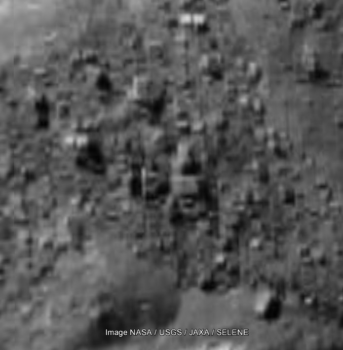
Many on here love to use Google Maps to show over pixelated areas, like this one in Tycho:

Located at:
S 43 deg 28' 29"
W 12 deg 37' 22"
Or digital
-43.4747
-12.6227
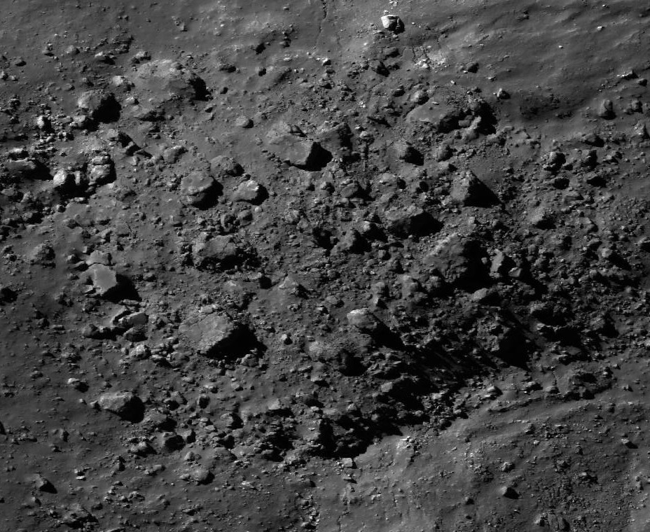
and claim it's buildings, artificial structures, etc. But when the LROC does get around to scanning those areas, the truth comes out:

So just be patient. Right now Arken is having a good laugh at your expense. The area will be scanned eventually.
yes, Erik, but in other areas they are duplicating the ground images, so what's with
that? If they think this is acceptable, then they will never ever get around to imaging the areas they have not covered. So I guess either your
assumption is incorrect that they will get around to it soon, or else they will just post a duplicate image of the next-door slice.
You can see why there are so many people who believe that NASA are hiding something if they do this kind of thing.
Actually, I reckon many of the areas are not over pixellated but just plain poor quality when they have far better quality ones available. These days (and in those days when they launched the satellite) they can photograph a spot on a gnats bum if the want to, but from a security point of view, it is not acceptable to release images of that clarity.
edit on 19 Jul 2013 by qmantoo because: pixellated images
Originally posted by qmantoo
yes, Erik, but in other areas they are duplicating the ground images, so what's with that? If they think this is acceptable, then they will never ever get around to imaging the areas they have not covered. So I guess either your assumption is incorrect that they will get around to it soon, or else they will just post a duplicate image of the next-door slice.
You can see why there are so many people who believe that NASA are hiding something if they do this kind of thing.
Actually, I reckon many of the areas are not over pixellated but just plain poor quality when they have far better quality ones available. These days (and in those days when they launched the satellite) they can photograph a spot on a gnats bum if the want to, but from a security point of view, it is not acceptable to release images of that clarity.edit on 19 Jul 2013 by qmantoo because: pixellated images
That would be the handful of students and staff at the Arizona State University that have done that......not NASA.
There was a very interesting article posted on here about how they don't have enough people to scan all the new images that come in to them somewhere here on ATS from several months ago.
That's whom you'd have to complain to as they are the ones that publish and maintain all the images located at the quick maps.
The government uses students as well as professors to do their work for them. I have been a moderator on other forums where the IP address of a shill clearly comes from a well known university. They often get grant money from the government etc so it is quite possible and likely that there are paid disinformers working at universities. Obviously not all students/professors work for the gov but clearly some do. There is no distiction between NASA and the universities unfortunately.
That would be the handful of students and staff at the Arizona State University that have done that......not NASA.
In my opinion, I have seen evidence which shows there are still doctored basemaps not just due to overlaying tiles and satellite strips like this but also blacked-out areas on the ground. The honest thing to do would be to include lesser resolution strips of the areas. At least that would provide some coverage. There is no excuse for covering up areas with duplicates.
Originally posted by qmantoo
The government uses students as well as professors to do their work for them. I have been a moderator on other forums where the IP address of a shill clearly comes from a well known university. They often get grant money from the government etc so it is quite possible and likely that there are paid disinformers working at universities. Obviously not all students/professors work for the gov but clearly some do. There is no distiction between NASA and the universities unfortunately.
That would be the handful of students and staff at the Arizona State University that have done that......not NASA.
In my opinion, I have seen evidence which shows there are still doctored basemaps not just due to overlaying tiles and satellite strips like this but also blacked-out areas on the ground. The honest thing to do would be to include lesser resolution strips of the areas. At least that would provide some coverage. There is no excuse for covering up areas with duplicates.
Write them and complain then. They are a university.
Write them and show them the images that you say are doctored. Write them and show how they should be doing a better job.
Write the university staff, there in Arizona, and tell them that they, academics, are no better than a government controlled organization. That they are the one and the same.
Seriously, write them. All I ever see on here is people making these claims..........you're making an accusation against them. Surely they should have a chance to refute your claims against them?
I know if someone accused me of such things, I certainly would want to defend myself against someone trying to smear my claims.
But then, if I was covering up something on the moon.....I would certainly do a better job of it. If there were things I didn't want people to see, I certainly would not release ANY of it to the public, blurry, out of focus or not. The images would not ever see the light of day. As a mater of fact.....if the moon truly had things I didn't want you to see, I would make sure that the probe itself (the LROC) when it started to scan a certain area with something secret, instead sends back a pre-made image in it's memory, that had been created quite carefully here on earth and loaded into before launch. The image is transmitted right here to Earth and came from the LROC....see? That must be what is there.....and there would never.....ever....be anything other than rocks and craters.
No blurry images. No suggestive shadows. After all: I'm controlling all that, right? It would only make sense, correct?
Instead....it would seem that NASA and our governments are the most incompetent, stupid, idiotic morons the world has ever seen, and consistently loose control and release things that they shouldn't have. And they've been doing this for decades......
So either they, NASA are the most incompetent boobs the world has ever seen (the Three Stoogies could run better security black outs)........or people are just seeing things that are not really there, and wanting a conspiracy so, so bad, that they'll convience themselves that a conspiracy MUST exist.....
In my opinion (and it's just my opinion, which is like belly buttons, everyone has one), the the government didn't want you to see something.....you never will see it, nor anything to make you think that something is there. Ever.
To be honest Erik, I dont really care if they cover it up or not. I know what I know and I dont need to convince anyone. I have seen enough to
convince myself, and it is only going through the motions of being outraged at the cover up. I go through phases when I get interested in showing
anomalies and phases when I cannot be bothered with it.
Now, for me, it is just a matter of waiting until the day when the aliens themselves make some kind of move to show of their existence. In fact, mostly these aliens have kept themselves to themselves and knowing what we humans are like, we would definitely want to bomb them out of existence like we have with the lunar water experiments already. Trigger-happy humans are a real danger to the rest of us. I suspect that this is the reason why we have sent a laser-lugging Curiosity robot to Mars, to fight off and avenge the dismantling by aliens of Phoenix and Spirit. This is why there are no real good current images of these rovers from the Mars Orbiter.
Yes, there are some aliens(far too many) who want to probe and poke and collect our human DNA, but there are also aliens who appear just to want to mind their own business on Earth, asteroids and other planets and moons. These are the ones I feel sorry for, since they are living for a time when we just wake up and want to know who has been living in our back yard for thousands of years.
reply to post by eriktheawful
Hi there EriK
This kind of statements by NASA are deceptive. Really DECEPTIVE.
Do you/we really think that NASA funds missions for billions of dollars to map the Moon/Mars, and they left to complete their work, a bunch of newbie students of University?
This is totally False...or...if real, totally Mad!
So,The things are two:
1) Or NASA (or who really rule NASA) lie, and then the next missions must be close,
2) Or It is False and NASA (or Who really rule NASA) must show publicly all the (clear/not doctorized) data/images.
Hi there EriK
That would be the handful of students and staff at the Arizona State University that have done that......not NASA.
There was a very interesting article posted on here about how they don't have enough people to scan all the new images that come in to them somewhere here on ATS from several months ago.
That's whom you'd have to complain to as they are the ones that publish and maintain all the images located at the quick maps.
This kind of statements by NASA are deceptive. Really DECEPTIVE.
Do you/we really think that NASA funds missions for billions of dollars to map the Moon/Mars, and they left to complete their work, a bunch of newbie students of University?
This is totally False...or...if real, totally Mad!
So,The things are two:
1) Or NASA (or who really rule NASA) lie, and then the next missions must be close,
2) Or It is False and NASA (or Who really rule NASA) must show publicly all the (clear/not doctorized) data/images.
edit on 20-7-2013 by Arken
because: (no reason given)
new topics
-
Potter to WHU
World Sports: 5 hours ago -
Dr. Demento
Music: 7 hours ago -
The elephant in the room (wearing a hoodie)
US Political Madness: 7 hours ago
top topics
-
The elephant in the room (wearing a hoodie)
US Political Madness: 7 hours ago, 12 flags -
Green Grapes
General Chit Chat: 17 hours ago, 7 flags -
To become president, Zelensky had to learn Ukrainian
Political Conspiracies: 13 hours ago, 7 flags -
Dr. Demento
Music: 7 hours ago, 5 flags -
Potter to WHU
World Sports: 5 hours ago, 2 flags
active topics
-
Los Angeles brush fires latest: 2 blazes threaten structures, prompt evacuations
Mainstream News • 179 • : Mantiss2021 -
The Fight for Election Integrity Continues -- Audits, Criminal Investigations, Legislative Reform
2024 Elections • 4372 • : IndieA -
What Comes After January 20th
Mainstream News • 35 • : JadedGhost -
Potter to WHU
World Sports • 3 • : gortex -
The Truth about Migrant Crime in Britain.
Social Issues and Civil Unrest • 42 • : gortex -
Post A Funny (T&C Friendly) Pic Part IV: The LOL awakens!
General Chit Chat • 8007 • : underpass61 -
Planned Civil War In Britain May Be Triggered Soon
Social Issues and Civil Unrest • 29 • : AdultMaleHumanUK -
President Carter has passed
Mainstream News • 47 • : xuenchen -
The elephant in the room (wearing a hoodie)
US Political Madness • 19 • : xuenchen -
Trump says ownership of Greenland 'is an absolute necessity'
Other Current Events • 85 • : Oldcarpy2


