It looks like you're using an Ad Blocker.
Please white-list or disable AboveTopSecret.com in your ad-blocking tool.
Thank you.
Some features of ATS will be disabled while you continue to use an ad-blocker.
share:
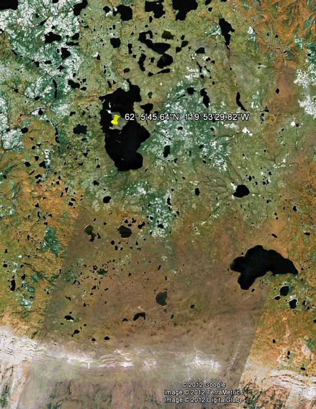
From time to time I like to hunt around using Google Earth. This morning I was concentrating on the northern most regions of Canada and came upon
this strange formation. What adds to it's oddity is they fall withing a patch of detailed mapping. (I'm sure I'm not explaining this correctly) The
shaded area, not visible from different zoom levels, is more detailed and has a greater zoom potential than do areas outside of this region.
Hopefully the next pic illustrates what I mean. When attempting to zoom in outside of this region, the detail falls off and ground detail is
lost..

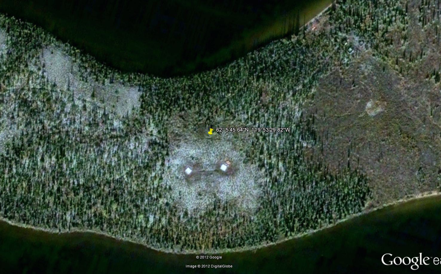
This is what I found inside of that area. It has the appearance of being constructed and not a natural formation. It is in a very remote region where access looks to be only by air. It's also on an island in this remote region. dding to their oddity is that they are on a bias. Any ideas on what these can possibly be?


This is what I found inside of that area. It has the appearance of being constructed and not a natural formation. It is in a very remote region where access looks to be only by air. It's also on an island in this remote region. dding to their oddity is that they are on a bias. Any ideas on what these can possibly be?

edit on 17-8-2012 by Bilk22 because: (no reason given)
Can you circle what you are looking at. In the second picture I see spruce trees, a small, fairly clear area near the shore, and some game trails.
I hike areas like these for the government up north doing animal surveys so I'm quite used to comparing satellite images like this to what I end up seeing when I'm actually on the ground. I don't see anything particularly unusual here.
I hike areas like these for the government up north doing animal surveys so I'm quite used to comparing satellite images like this to what I end up seeing when I'm actually on the ground. I don't see anything particularly unusual here.
edit on 17-8-2012 by dainoyfb because: I added the game trails.
if you save the 2nd picture on your desktop and look at it , you can see what he is talking about. Looks very strange, and no guesses on what it
is.
Ryan
or just scroll the 2nd picture over
Ryan
or just scroll the 2nd picture over
edit on 17-8-2012 by ryan2s because: added to post
Originally posted by dainoyfb
Can you circle what you are looking at. In the second picture I see spruce trees, a small, fairly clear area near the shore, and some game trails.
I hike areas like these for the government up north doing animal surveys so I'm quite used to comparing satellite images like this to what I end up seeing when I'm actually on the ground. I don't see anything particularly unusual here.
edit on 17-8-2012 by dainoyfb because: I added the game trails.
At the bottom of the second pic in the OP is a slide bar. Slide it to the center and you will see two, what appear to be square manmade structures...
reply to post by Bilk22
My first guess would be solar panels, but way up there, and no buildings around? Unless there is something underground. hmmmmmm
Very nice find
My first guess would be solar panels, but way up there, and no buildings around? Unless there is something underground. hmmmmmm
Very nice find
My guess: Hunter's cabins in the woods. The orangish object is a pick up truck, the whites squares are the cabins. Canada is well known for remote
hunting and fishing locations. My ex FIL used to fly up there all the time to hunt for moose and bear.
If you look in the upper right of the pic, you will see what looks to be 3 buildings and what could be taken as a road leading off the pic to the
right. Also seems to be a beach landing there as well.
Originally posted by dainoyfb
Can you circle what you are looking at. In the second picture I see spruce trees, a small, fairly clear area near the shore, and some game trails.
I hike areas like these for the government up north doing animal surveys so I'm quite used to comparing satellite images like this to what I end up seeing when I'm actually on the ground. I don't see anything particularly unusual here.
edit on 17-8-2012 by dainoyfb because: I added the game trails.
Yes you need to use the scroll bar at the bottom of the pic to see them. They're roughly 16' x 16' and spaced about 90' apart. They don't appear to be casting a shadow, so can't tell how tall they might be. They just seem out of place in that remote region.
Man you hike that area? You get choppered in? Access seems very limited. Must be there for extended times I guess.
If you are referring to the fairly clear area near the shore in the northern part of he image, these are common and natural. They are usually the
result of a wetland area that is too wet and or alkaline for trees to grow. These are the types of spots that we use to land the helicopter for drop
off and pickup.
Here is an picture I took of the same thing after a landing last year.
Here is an picture I took of the same thing after a landing last year.
Originally posted by MidKnight
If you look in the upper right of the pic, you will see what looks to be 3 buildings and what could be taken as a road leading off the pic to the right. Also seems to be a beach landing there as well.
Yes there do appear to be some type of structures in that area .
Wow, that is remote indeed.
So, are those cabins by the 'beach landing'? I wonder if one person owns the whole island.
Good find btw
So, are those cabins by the 'beach landing'? I wonder if one person owns the whole island.
Good find btw
edit on 17-8-2012 by Starcrossd because: added note
Originally posted by dainoyfb
If you are referring to the fairly clear area near the shore in the northern part of he image, these are common and natural. They are usually the result of a wetland area that is too wet and or alkaline for trees to grow. These are the types of spots that we use to land the helicopter for drop off and pickup.
Here is an picture I took of the same thing after a landing last year.
Link not working. Well I understand what you're saying about the ground being alkaline and killing vegetation, but what are those rectilinear objects?
The Island that is in the middle of that lake reminds me of being ancient volcano that collapsed in upon it self. My guess is once upon a time there
was a massive volcano there that blew up and when it collapsed the thing filled with water and the current island is the new cone of the volcano.
Could the two buildings be earthquake monitoring stations?
Could the two buildings be earthquake monitoring stations?
reply to post by dainoyfb
Did you go to the bottom of the image and use the scroll bar? Took me a minute. I do see them.
I will go back and look further...
I was beaten to it...
Did you go to the bottom of the image and use the scroll bar? Took me a minute. I do see them.
I will go back and look further...
I was beaten to it...
edit on 17-8-2012 by exdog5 because: someone addressed the scroll bar
Sorry, I'm using an iPad and the scroll bar doesn't show up.
From my experience of flying over things like this all the time it at first glance looks like hunting camp or helicopter fuel stop (don't see the usual scattered barrels though) These are common too and are only accessable by air and or snowmobile. The different offset of the two structures suggests a hunting camp.
If you email the nearest helicopter company, they are probably used to flying over it on a regular basis and pilots generally have a strong knowledge of all of the structures in their area.
Originally posted by Bilk22
Man you hike that area? You get choppered in? Access seems very limited. Must be there for extended times I guess.
Check this out:
www.abovetopsecret.com...
Originally posted by dainoyfb
Originally posted by Bilk22
Man you hike that area? You get choppered in? Access seems very limited. Must be there for extended times I guess.
Check this out:
www.abovetopsecret.com...
Wow! Thanks for directing me to the link of your ordeal. That was pretty intense I bet. Even though your in that environment often, and even though you have the training, it was a new and unknown experience for you. I'm sure there must have been some moments of uncertainty. Maybe not panic as you really let your training kick in, but maybe the uncertainty of the situation caused some fear and survival instincts kicked in forcing you to be extra diligent in your efforts. Well maybe I should ask, did you experience any fear? You talked about realizing the desolation of the area.
On a side note, the area I was looking at is close to 400k farther north. It's northwest of Great Silver Lake.
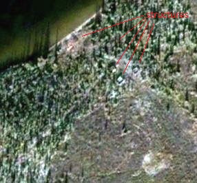
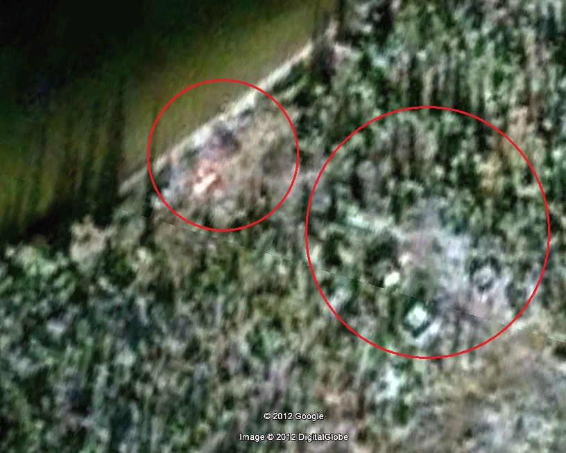
Just to add a little more to this mystery, I'm posting these
*text in red says "structures"


The intriguing one is the top left. Almost looks like some type of pyramid structure with a pipe or something coming out of it and heading south west. This all appears to be out of place in such a region of the world, but who knows? The "artifacts" in this area certainly look to be constructed and not natural formations. Maybe they're of North American Indian design?
*text in red says "structures"


The intriguing one is the top left. Almost looks like some type of pyramid structure with a pipe or something coming out of it and heading south west. This all appears to be out of place in such a region of the world, but who knows? The "artifacts" in this area certainly look to be constructed and not natural formations. Maybe they're of North American Indian design?
new topics
-
The trial on kids was stopped
Medical Issues & Conspiracies: 26 minutes ago -
Orbs Appear And Form Triangle On Live Cam.
Aliens and UFOs: 2 hours ago -
Biden Has New Bizarre Injuries to His Face
Politicians & People: 3 hours ago -
Something is not adding up in regards to the H-1B commotion
General Conspiracies: 4 hours ago -
Elon Musk Calls for Tommy Robinson to be Freed - and Takes a Dig at Starmer
Politicians & People: 4 hours ago -
Biden to award Presidential Citizens Medal to Liz Cheney and Bennie Thompson
US Political Madness: 5 hours ago -
Just learned a really helpful trick for internet searches
Computer Help: 10 hours ago
top topics
-
Biden to award Presidential Citizens Medal to Liz Cheney and Bennie Thompson
US Political Madness: 5 hours ago, 9 flags -
Biden Has New Bizarre Injuries to His Face
Politicians & People: 3 hours ago, 9 flags -
Just learned a really helpful trick for internet searches
Computer Help: 10 hours ago, 7 flags -
Not off to a good start
General Chit Chat: 12 hours ago, 6 flags -
Elon Musk Calls for Tommy Robinson to be Freed - and Takes a Dig at Starmer
Politicians & People: 4 hours ago, 5 flags -
Something is not adding up in regards to the H-1B commotion
General Conspiracies: 4 hours ago, 5 flags -
Orbs Appear And Form Triangle On Live Cam.
Aliens and UFOs: 2 hours ago, 3 flags -
The trial on kids was stopped
Medical Issues & Conspiracies: 26 minutes ago, 2 flags
active topics
-
Vehicle Strikes people in New Orleans
Mainstream News • 276 • : WeMustCare -
Orbs Appear And Form Triangle On Live Cam.
Aliens and UFOs • 2 • : ARM19688 -
How we've changed in 100 years
Ancient & Lost Civilizations • 33 • : KrustyKrab -
Tesla Cybertruck Explodes in Front of Trump Hotel in Las Vegas
Mainstream News • 111 • : Flyingclaydisk -
The trial on kids was stopped
Medical Issues & Conspiracies • 0 • : annonentity -
-@TH3WH17ERABB17- -Q- ---TIME TO SHOW THE WORLD--- -Part- --44--
Dissecting Disinformation • 3895 • : IndieA -
Strange fog all over the northern hemisphere
General Conspiracies • 43 • : annonentity -
The Acronym Game .. Pt.4
General Chit Chat • 1033 • : tinkerbell99 -
Ukraine halts transit of Russian gas to Europe after a prewar deal expired
Political Conspiracies • 111 • : Oldcarpy2 -
Post A Funny (T&C Friendly) Pic Part IV: The LOL awakens!
General Chit Chat • 7979 • : chiefsmom
