It looks like you're using an Ad Blocker.
Please white-list or disable AboveTopSecret.com in your ad-blocking tool.
Thank you.
Some features of ATS will be disabled while you continue to use an ad-blocker.
share:
reply to post by Jadette
yo!
i thought the same thing about the previous post, but ya know, everyone's tryin', eh?
i'm wondering...about the compression you speak of. supposedly these photos are what has been found AFTER the original images have been 'cleaned up'...i.e. - the 'fog' removed.
my question to you is: would the same compression you speak of happen in the same way. meaning, whether the image was compressed before the clean-up, or afterwards? would we get the same results?
personally, i sure am tempted to see a lot more than simple compression going on, but what doesn't make sense to (assuming this to be a genuine artifact) me is how could such a huge city be expected to survive on a comet pummeled planet...i mean, it was even built inside an impact crater!?!?
thanks!
reply to post by spikedmilk
yo!
hm-m-m-m...
if you ask me, this is by far the most interesting, artificial looking object i've seen yet, and what...NOBODY seems to find it of much interest????
this is a fun site.
yo!
hm-m-m-m...
if you ask me, this is by far the most interesting, artificial looking object i've seen yet, and what...NOBODY seems to find it of much interest????
this is a fun site.
reply to post by shug7272
yo!
actually, there are other sites on the web that supposedly show the remains of underwater cties in various lakes around the world. i've also seen the same type of imagery in other places. these images DON'T impress me at all with being ancient, underwater ruins...they're the result of the imaging process! it's odd, but they also seem to show very irregular shapes, etc. that are suggestive of city-like structures.
i definitely feel that when we went from the old 35 mm camera to the digital/pixel process we lost as much as we gained.
we now send cameras all over the solar system to view the planets, and then claim that we can't trust the images because they're digital!!! i mean, how absurd! where is our money going?
i also really resent the notion that nasa can simply airbrush stuff out that it doesn't want us to see...like what? it's supposed to be a dead planet! what could then be enough of a security issue as to justify airbrushing things (anything!) out? it's the same with the moon!
it reminds me of the first mars missions when nasa sent all this fancy equipment up to test for 'life', and then claimed that they couldn't trust the results due to this reason, or that. then why did we even bother? it cost billions upon billions of dollars to run tests that then couldn't be trusted...absolutely absurd, and in my estimation, criminal. that was our money that was spent. we deserve more than being shucked, and jived, by the power establishment.
just my thoughts!
How'bout these?
From N. Sinus Meridiani. Big Thanks to ArMap!!!
original MOC file link:www.msss.com...
Link to ATS thread: www.abovetopsecret.com...'
Edit: image difficulty
[edit on 30-6-2008 by djerwulfe]
From N. Sinus Meridiani. Big Thanks to ArMap!!!
original MOC file link:www.msss.com...
Link to ATS thread: www.abovetopsecret.com...'
Edit: image difficulty
[edit on 30-6-2008 by djerwulfe]
Here's a couple of the processed images from the slideshow:


Link to myspace, Mars: Sinus Meridiani Tour with MUSIC!!! yay.
profile.myspace.com...


Link to myspace, Mars: Sinus Meridiani Tour with MUSIC!!! yay.
profile.myspace.com...
reply to post by djerwulfe
Hi djerwulfe! Those were some real good pics. I've zoomed in and enhanced a couple of them. Check out the image with a strange structure that resembles an arrow head...
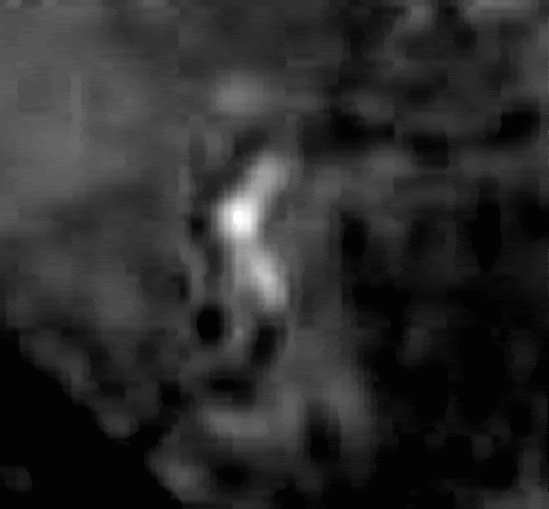
With edges enhanced and noise reduction filter....
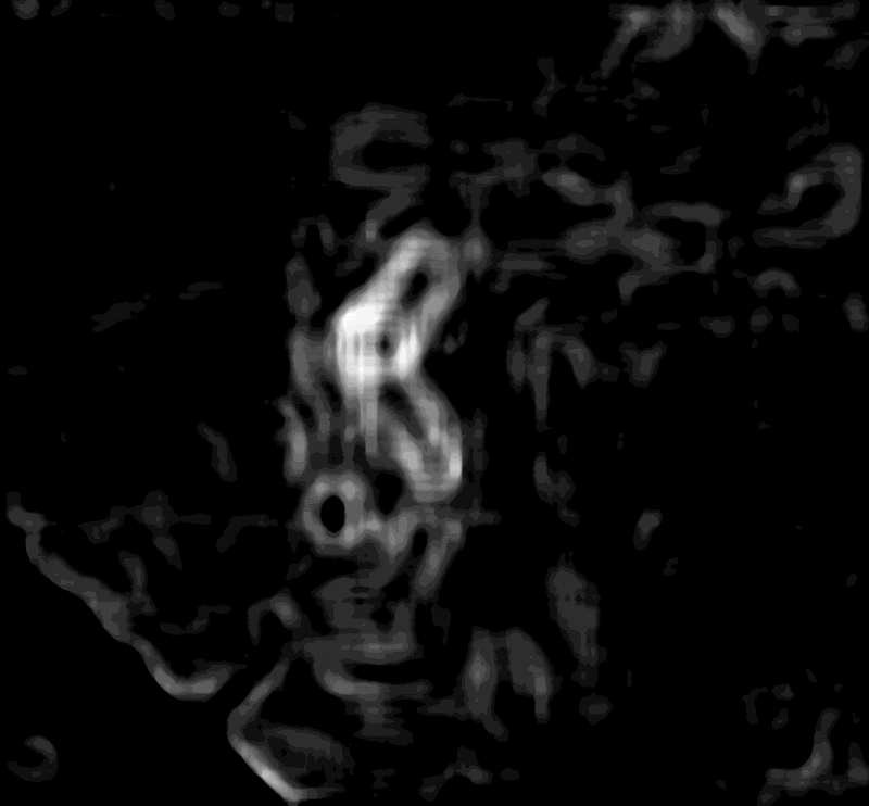
Note the brightness of this object compared to its surroundings.
Another strange structure in your image, which I've enhanced a little. Also check out the shadows in this last pic. What the...?
Cheers!
[edit on 30-6-2008 by mikesingh]
Hi djerwulfe! Those were some real good pics. I've zoomed in and enhanced a couple of them. Check out the image with a strange structure that resembles an arrow head...

With edges enhanced and noise reduction filter....

Note the brightness of this object compared to its surroundings.
Another strange structure in your image, which I've enhanced a little. Also check out the shadows in this last pic. What the...?
Cheers!
[edit on 30-6-2008 by mikesingh]
Found some more interesting facts on Hale crater pic. Dual purple lights, a huge quarry and some strange buildings that I have not see here yet.
Anyone....anyone...anyone!
Makes one wonder even more. I must say that it looks a lot like farm land to me too. Whether new or old, it still looks like that. The one sections
looks like staris alright. Hard to tell whats going on eh?
Originally posted by AgentZ
How do I upload pic's here?
As easy as eating pie! Upload your images on, say, PhotoBucket. Copy on 'direct link' tab and paste the url on your post here like this...
[ ats ] xxxx [ / ats]
Remember, NO spaces!
Cheers!
[edit on 1-7-2008 by mikesingh]
reply to post by mikesingh
Whoa! Cool! The place is Crawling!!
Also, Hale Crater... oh yeah!
Pretty soon I'll put some more out, here.
Thanks!
Whoa! Cool! The place is Crawling!!
Also, Hale Crater... oh yeah!
Pretty soon I'll put some more out, here.
Thanks!
These photos are for reals. U can go to esa.int.com and download the original Hale Crater yourself. Then upload it to photoshop and darken the
images to see the city clearer because the originals have been smuged.
People wake up. It's a massive cover up for years. NVM, talk about bunch of dumb sheeps
People wake up. It's a massive cover up for years. NVM, talk about bunch of dumb sheeps
Wow........Looks like ancient remains buried under ash.
Like Planet Terra
Like Planet Terra
reply to post by andolin
The ESA materials are great.
** It's worth noting that each image in the ESA Mars gallery specifically features a unique and often mysterious aspect of Martian topography. They usually don't jump out at you, but they are there. The images are selected for this purpose: of illustarting weird stuff!
*******
Here's a preview of my next slideshow. And the next, next one will be even cooler. It will be called "The Giant Beefworm and Schoo civilization."
Here's a link to the thread about my first slide show on Sinus Meridiani:
www.abovetopsecret.com...
And these are from the new one...


[edit on 3-7-2008 by djerwulfe]
The ESA materials are great.
** It's worth noting that each image in the ESA Mars gallery specifically features a unique and often mysterious aspect of Martian topography. They usually don't jump out at you, but they are there. The images are selected for this purpose: of illustarting weird stuff!
*******
Here's a preview of my next slideshow. And the next, next one will be even cooler. It will be called "The Giant Beefworm and Schoo civilization."
Here's a link to the thread about my first slide show on Sinus Meridiani:
www.abovetopsecret.com...
And these are from the new one...


[edit on 3-7-2008 by djerwulfe]
reply to post by djerwulfe
Great stuff, dj! Here's a similar image to the one you posted. Looks like the ruins of a long gone town...
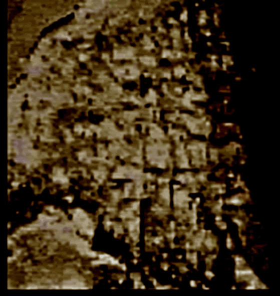
And then we have this...
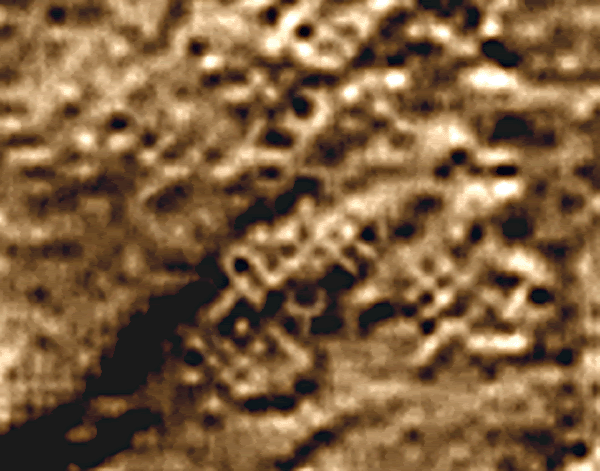
More f the above in my other thread here:
www.abovetopsecret.com...
Cheers!
Great stuff, dj! Here's a similar image to the one you posted. Looks like the ruins of a long gone town...

And then we have this...

More f the above in my other thread here:
www.abovetopsecret.com...
Cheers!
Okay some great images of areas of interest More work for the weary to catch up documenting it all Any volounteers?
Now lets put this in context...
To be able to decide if any of those markings show cities or more likely ancient cities it is good to have a look somewhere where we have examples to compare to...
So lets have a look at Earth... and the Moon
#1
The ancient Khorezmian fortress Koy-Krylgan-kala appeared as an impact crater on the air photo (left); its artificiality is obvious after the excavations in 1956

#2 The air view of the Ancient Assyrian ruins of Assur before they were excavated... (they resemble the lunar lattice below)

#3 The example of a wafer find (image LHD5472Q.287) on the Moon

#4 Simulation of probable HIRES view of ancient settlement on the Moon (left). The erosion wipes off the surface tracks of construction (center), but the SAAM processing could reveal the rectangular anomaly (right).

Now what is IMPORTANT in the above analysis is who is doing the work...
SETI
On Lunar Archeology
Archaeological Reconnaissance of the Moon: Results of SAAM Project
Dr. Alexey V. Arkhipov (rai @ ira.kharkov.ua)
Institute of Radio Astronomy, Nat. Acad. Sci. of Ukraine
spsr.utsi.edu...
Alexey V. Arkhipov is a researcher at the Institute of Radio Astronomy, National Academy of Sciences of the Ukraine, and an Assistant professor at National Kharkov University. He has a Ph.D. in astrophysics and radio astronomy (Main Astronomical Observatory at the National Academy of Sciences of the Ukraine, Kyiv, 1998). The title of his dissertation was "New approaches to the problem of search for extra-terrestrial intelligence." He is a member of the SETI Center (Moscow), the Society for Planetary SETI Research (SPSR), and the SETI section of the Council on Astronomy of the Russian Academy ofSciences.
I have tracked all this on Pegasus' page INCA CITY
But we have another great tool we can use...
Google Earth
One really interesting thing about satellite images is that they can spot things that are buried... You can actually see the "silk road' in the sand from space... thousands of years of camels and people walking on it and leaving droppins etc shows up from space.
I use this fact to snoop around military bases... for signs of old excavation... try it you will easily see the tell tale signs
but more important is the relevance to this thread...
So I will use the site in Iraq... the Ancient City of UR
UR is perfect because they have some sections completely dug out... some partially dug out... some just started and many not touched at all...
But the ones not touched at all SHOW UP ON GOOGLE EARTH
The material of buried walls is denser so moisture and temperature make slight differences in the surface soil... and this can be seen...

Now UR just happens to be right in the middle of Tallil AFB and Saddam's old weapons area... so there are lots of buried missile installations and bunkers to look at too
+30° 57' 38.98", +46° 6' 23.35"
Now lets put this in context...
To be able to decide if any of those markings show cities or more likely ancient cities it is good to have a look somewhere where we have examples to compare to...
So lets have a look at Earth... and the Moon
#1
The ancient Khorezmian fortress Koy-Krylgan-kala appeared as an impact crater on the air photo (left); its artificiality is obvious after the excavations in 1956

#2 The air view of the Ancient Assyrian ruins of Assur before they were excavated... (they resemble the lunar lattice below)

#3 The example of a wafer find (image LHD5472Q.287) on the Moon

#4 Simulation of probable HIRES view of ancient settlement on the Moon (left). The erosion wipes off the surface tracks of construction (center), but the SAAM processing could reveal the rectangular anomaly (right).

Now what is IMPORTANT in the above analysis is who is doing the work...
SETI
On Lunar Archeology
Archaeological Reconnaissance of the Moon: Results of SAAM Project
Dr. Alexey V. Arkhipov (rai @ ira.kharkov.ua)
Institute of Radio Astronomy, Nat. Acad. Sci. of Ukraine
spsr.utsi.edu...
Alexey V. Arkhipov is a researcher at the Institute of Radio Astronomy, National Academy of Sciences of the Ukraine, and an Assistant professor at National Kharkov University. He has a Ph.D. in astrophysics and radio astronomy (Main Astronomical Observatory at the National Academy of Sciences of the Ukraine, Kyiv, 1998). The title of his dissertation was "New approaches to the problem of search for extra-terrestrial intelligence." He is a member of the SETI Center (Moscow), the Society for Planetary SETI Research (SPSR), and the SETI section of the Council on Astronomy of the Russian Academy ofSciences.
I have tracked all this on Pegasus' page INCA CITY
But we have another great tool we can use...
Google Earth
One really interesting thing about satellite images is that they can spot things that are buried... You can actually see the "silk road' in the sand from space... thousands of years of camels and people walking on it and leaving droppins etc shows up from space.
I use this fact to snoop around military bases... for signs of old excavation... try it you will easily see the tell tale signs
but more important is the relevance to this thread...
So I will use the site in Iraq... the Ancient City of UR
UR is perfect because they have some sections completely dug out... some partially dug out... some just started and many not touched at all...
But the ones not touched at all SHOW UP ON GOOGLE EARTH
The material of buried walls is denser so moisture and temperature make slight differences in the surface soil... and this can be seen...

Now UR just happens to be right in the middle of Tallil AFB and Saddam's old weapons area... so there are lots of buried missile installations and bunkers to look at too
+30° 57' 38.98", +46° 6' 23.35"
reply to post by AgentZ
If you want to analyse the area please do not use the 3D computer model, use the other images instead, or you risk analysing software artifacts, even more than with just the photos.
PS: I don't see anything purple on that image, except your own text.
If you want to analyse the area please do not use the 3D computer model, use the other images instead, or you risk analysing software artifacts, even more than with just the photos.
PS: I don't see anything purple on that image, except your own text.
new topics
-
A Merry Christmas.
Other Current Events: 7 minutes ago -
Cold Blooded Killers on Christmas!! GRRRRrrr!!
Pets: 7 hours ago -
Plane Crash Today --Azerbaijanian E190 passenger jet
Mainstream News: 11 hours ago
top topics
-
Orange County Makes Shoplifting a Felony
Other Current Events: 16 hours ago, 17 flags -
Cold Blooded Killers on Christmas!! GRRRRrrr!!
Pets: 7 hours ago, 8 flags -
Plane Crash Today --Azerbaijanian E190 passenger jet
Mainstream News: 11 hours ago, 6 flags -
A Merry Christmas.
Other Current Events: 7 minutes ago, 0 flags
active topics
-
A Merry Christmas.
Other Current Events • 0 • : randomtangentsrme -
Plane Crash Today --Azerbaijanian E190 passenger jet
Mainstream News • 16 • : Flyingclaydisk -
-@TH3WH17ERABB17- -Q- ---TIME TO SHOW THE WORLD--- -Part- --44--
Dissecting Disinformation • 3814 • : brewtiger123 -
Cold Blooded Killers on Christmas!! GRRRRrrr!!
Pets • 10 • : Flyingclaydisk -
London Christmas Market BANS Word ‘Christmas’
Social Issues and Civil Unrest • 50 • : Connector -
The clotting is not going away latest
Medical Issues & Conspiracies • 15 • : NoCorruptionAllowed -
Statements of Intent from Incoming Trump Administration Members - 2025 to 2029.
2024 Elections • 54 • : WeMustCare -
DefCon Teetering on Escalation
World War Three • 51 • : WeMustCare -
1 Billion dollars
General Entertainment • 13 • : ColeYounger2 -
It's Offical Now
US Political Madness • 15 • : Imhere

