It looks like you're using an Ad Blocker.
Please white-list or disable AboveTopSecret.com in your ad-blocking tool.
Thank you.
Some features of ATS will be disabled while you continue to use an ad-blocker.
share:
reply to post by internos
Are sharp-edged pyramid-like features a common geological feature on Mars? The pesky things seem to be everywhere! How come?
Seen that vid before. Naaa, these are nothing but video compression artifacts! Including that 'shadow' on the surface of Mars and that cylindrical object photographed by Phobos II. All photographic glitches! There's nothing there! So I'm heading for the bar!
By the way, Lunica has some nice images coming up. Keep your eyes peeled!
Cheers!
I think mikesingh should be made a Subject Matter Expert on these types of topics.
Anyway I have always enjoyed reading your posts, Mr Mikesingh, and I look forward to many more!
Anyway I have always enjoyed reading your posts, Mr Mikesingh, and I look forward to many more!
Originally posted by mikesingh
reply to post by Skyfloating
Yeah Sky, that's the point! Unless one shows a clear image like one resembling McCarran International Airport, complete with hangers, tool shop, passenger terminals, and runways, few are going to bite!
Anyway, bash on, regardless! The truth is out there!
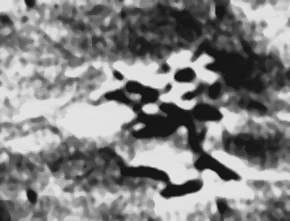
Now have a peek at this. Signs of a long gone civilization?
Mariner 9. Image 4209-75.
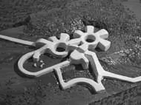
Artists rendering of the
above image.
Courtesy: Ufologie.
Now I'll eat my Mexican hat if someone says it's .jpeg compression or pixelation!
Cheers!
I Have seen this one before, good eaxmple Mike.
Maybe someone knows the coordinates of where this is taken?? It could be there is a MOC-image of the same area!
Somebody???
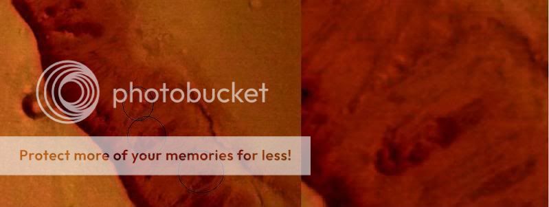
I was wondering if anyone perhaps saw what looks like a might be a monument type object protruding from the side of the hill/cliff? I am not for
certain if this had been discussed and already been deemed as fake. I read the thread all the way thru and I'm pretty sure no one has mentioned it.
There might be a good reason for that, maybe not. I dont know. So, I'll put it out there for opinions sake. The Nadir photo has been discussed, but
as far as I can tell, no has brought up this specific anomaly.
www.esa.int...

www.esa.int...
Originally posted by Lunica
I Have seen this one before, good eaxmple Mike.
Maybe someone knows the coordinates of where this is taken?? It could be there is a MOC-image of the same area!
Somebody???
I've read somewhere that the same formation should be visible here,
despite the mountains aren't visible at all...
(right click-save targes as...)
pdsimg.jpl.nasa.gov...
pdsimg.jpl.nasa.gov...
Download both files to the same directory.
You'll need Nasa View in order to see/save the images:
pds.jpl.nasa.gov...
_______________________________________________________
Originally posted by spikedmilk
The Nadir photo has been discussed, but as far as I can tell, no has brought up this specific anomaly.
I'm looking for the same details in hi-res photos
_______________________________________________________
Odd formation in Mons Olympus # 1?

www.solarviews.com...
Top view..

photojournal.jpl.nasa.gov...
Odd formation in Mons Olympus # 2?

mars.jpl.nasa.gov...
Odd formation in Mons Olympus # 3?

mars.jpl.nasa.gov...
[edit on 12/11/2007 by internos]
Originally posted by mikesingh
Now have a peek at this. Signs of a long gone civilization?
Mariner 9. Image 4209-75.
No. Signs of serious image manipulation to feed the credulous.
I feel kind of dirty participating in MikeSingh's little thread-pumping game he's playing here but what the hay.
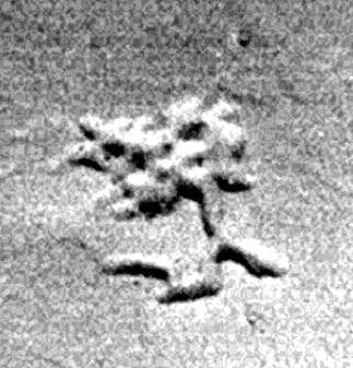
Here's the raw Mariner 9 image data of this feature (full 07938353 IMG and LBL files found here) as internos also found:
Airport? No.
I got my image information here from a guy who already figured this out. It is the first Google Image Search hit for "mars airport".
[edit on 12-11-2007 by IAttackPeople]
Crappy pixelated images?
Originally posted by mikesingh
But why do the scientists want crappy pixelated images?
Are we looking at the same images?
This is a Viking image:
The pics taken by Viking and Mariner seem to be far better than the so called hi res ones being dished out of late!

If I did my calculations right this images has a resolution of around 50 metres/pixels.
This is a MarsExpress image from that area with the "city" from your opening post:

This is a 40 metres/pixels image, but it suffers a little from the JPEG artifacts (ESA uses JPEG compression).
Now, do you see this image with the small yellow rectangle (you have to click the thumbnail)?

That rectangle is the complete image from HiRISE (PSP_003987_1435).

Did you saw the small white rectangle at the bottom of the image? It shows from where I cropped the following image, a very small crop from the original 27975x63201 image.
This is with a 100% zoom, each pixel represents 25 cm, making it a more or less 200x140 metres rectangle.

Is this a crappy pixelated image? I don't think so, but that is just my opinion.
Oh, and they also have false colour images.

This image is not from Hale crater, it's from Tithonium Chasma.
Google Earth (originally Keyhole) is only a program to map images on a sphere, it has nothing to do with the images, they use the same images that you can use (if you pay for them).
How about the simple $79 software used by GoogleEarth? It can be downloaded onto a personal computer and used to "fly over" city streets, landmarks, buildings, the Eiffel Tower, Big Ben and the pyramids with high-resolution. And now you can even read your car number plates, zooming it into focus from outer space!
Yes, and it looks as good as the data used, in some places it is completely useless.
Google Earth also has digital elevation model (DEM) data collected by NASA's Shuttle Radar Topography Mission (SRTM), to see terrain in 3D.
As in any other software, garbage in-garbage out.
We don't get the data from Google, we get the data from the companies who sell it to Google, and if you want something that shows all the planets on the Solar system you can download World Wind for free. It may not have the Earth photos as recent as those used by Google but it has other advantages.
If we can get this kind of stuff from Google for peanuts, why not from from the billion dollar toys of NASA/ESA?
He obviously avoided (I hope he does not ignore it) the fact that the eventual JPEG artifacts would be in the image used to "cover" the 3D model and not on the final image.
I had asked JP Skipper of Mars Anomaly Research for comments about pixelation and compression artefacts on those images. Here’s his reply…
PS: one of the ideas for Mars Express was the mapping of 100% of Mars' surface at a resolution better than 30 m/pixel and 50% of the surface at a better than 15 m/pixel. The real high resolutions, like those from HiRISE, make it impracticable to map the whole planet, even a planet that has only 1/7 of the Earth's surface (if I am not mistaken).
Originally posted by dave420
reply to post by rocksarerocks
Definitely JPEG artefacts. You'd have to see the lossless originals of those photos to look at that depth of magnification, but even then you're still only going to see individual pixels.
These guys try to sound like they know what they are talking about, but they really dont. As you can see in the OP's image vs. what they are presenting as "JPG tiling" examples, there are no new geomeric shapes besides squares (pixels), as with the OPs pics, you can clearly see non-uniform gemotric shapes that were created through ENHANCEMENT, not distortion.
I have a thread on ATS that tries to analyze features on Mars.
www.abovetopsecret.com...
Here are some latest pictures that I came across...
[edit on 13-11-2007 by guyfrom2007]
www.abovetopsecret.com...
Here are some latest pictures that I came across...
[edit on 13-11-2007 by guyfrom2007]
Originally posted by sobolwolf
I think mikesingh should be made a Subject Matter Expert on these types of topics.
Anyway I have always enjoyed reading your posts, Mr Mikesingh, and I look forward to many more!
Thanks sobolwolf. I ain't no expert, but we have many here including Internos, ArMaP, zorgon, Lunica, sherpa, undo and others.
And yeah, it's one heck of a job delving under NASA/ESA's tampered images!! Anyway, keep your eyes peeled. You never know what comes up!!
Cheers!
Dear Administrators,
if you read this, this is another request to make mikesingh a subject matter expert on mars photography anomalies.
if you read this, this is another request to make mikesingh a subject matter expert on mars photography anomalies.
Originally posted by IAttackPeople
No. Signs of serious image manipulation to feed the credulous.
Here's the raw Mariner 9 image data of this feature (full 07938353 IMG and LBL files found here) as internos also found:
Airport? No.
I got my image information here from a guy who already figured this out. It is the first Google Image Search hit for "mars airport".
IAP, why are you pasting pics here that suit your argument? The same author has also included the pic below. Did you miss it out by design? I daresay, you did! So...Nowhere has he said anything about it being a natural formation. He was just trying to debunk the 'airport' theory. And no one here said it was one.
Needless to say, that structure in the middle of nowhere is intriguing, to say the least! An anomaly, if ever there was one! Thanks for that link!
Cheers!
Could it be a purposely pixelated city?
Knowing how dodgy our technology is, they may have camouflaged it, creating what looks like pixelation.
naah.
It is probably actually just compression/colour editing lines.
Knowing how dodgy our technology is, they may have camouflaged it, creating what looks like pixelation.
naah.
It is probably actually just compression/colour editing lines.
reply to post by ArMaP
ArMaP, a star for you, man! That made interesting reading.
But the point still remains - that if I can read my car's number plates through Google, beamed by satellites hundreds of miles up in space, then why not from the multi billion dollar Mars probes?
Here’s something for comparison. This is the blow up of the Mars pic you posted - so called high res.
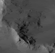
And here’s a satellite image of San Francisco from about the same distance that the Mars orbiters take their images from. Why the horrendous difference in resolution? Why don’t or can’t we use the same technology? Why not the 1.5 or 2-foot-pixel resolution satellite imagery?

Courtesy: DigitalGlobe
Cheers!
ArMaP, a star for you, man! That made interesting reading.
But the point still remains - that if I can read my car's number plates through Google, beamed by satellites hundreds of miles up in space, then why not from the multi billion dollar Mars probes?
Here’s something for comparison. This is the blow up of the Mars pic you posted - so called high res.

And here’s a satellite image of San Francisco from about the same distance that the Mars orbiters take their images from. Why the horrendous difference in resolution? Why don’t or can’t we use the same technology? Why not the 1.5 or 2-foot-pixel resolution satellite imagery?

Courtesy: DigitalGlobe
Cheers!
Originally posted by mikesingh
reply to post by ArMaP
ArMaP, a star for you, man! That made interesting reading.
But the point still remains - that if I can read my car's number plates through Google, beamed by satellites hundreds of miles up in space, then why not from the multi billion dollar Mars probes?
Here’s something for comparison. This is the blow up of the Mars pic you posted - so called high res.

And here’s a satellite image of San Francisco from about the same distance that the Mars orbiters take their images from. Why the horrendous difference in resolution? Why don’t or can’t we use the same technology? Why not the 1.5 or 2-foot-pixel resolution satellite imagery?

Courtesy: DigitalGlobe
Cheers!
I seriously had a good laugh here
Originally posted by tep200377
I hate top brake it to you, but this is just JPEG compression lines. NOTHING else ...
ya ok
how would you
konw
i work as a multimedia for years now
and if you cant see whats right in front of you then maybe you should check your eyes
and if we had to count on you and your intelligence we would all be lost
Originally posted by mikesingh
IAP, why are you pasting pics here that suit your argument?
Why are you posting old and busted "anomaly" pictures like this "terminal" as if they're something new?
Unlike your lazy effort, my post actually had a little research behind it. Anybody can go and repost crap from "Mars anomaly" websites. Put a little effort in and you can present a more complete picture and maybe even learn something!
So, instead of just throwing something up with a one-liner like, "Signs of a long-lost civilization?", I threw up a one-liner with a little meat on it. I included the "terminal" pic and the original Mariner 9 image of surface fissures that was the genesis of this particular anomaly. I also included the links to the original Mariner 9 image so people can take a look for themselves if they care to "deny ignorance". I also included a link that shows how the Mariner 9 image has been manipulated by NASA and others to create this "terminal". Also, just for fun I even created my own "terminal" picture from the Mariner fissure image. Wanna see it?
What else should I post on the matter?
Nowhere has he said anything about it being a natural formation.
This really needs to be stated?
reply to post by IAttackPeople
A few pages ago I pointed out that the original (unaltered) version of the thread-opening-picture displayed straight symmetric lines that cant possibly be of natural origin.
A few posts later you simply responded with something like "nope".
Care to elaborate?
A few pages ago I pointed out that the original (unaltered) version of the thread-opening-picture displayed straight symmetric lines that cant possibly be of natural origin.
A few posts later you simply responded with something like "nope".
Care to elaborate?
reply to post by mikesingh
Why did you create a blow-up of the image I posted and compared it with an image that has a completely different resolution?
An image from that area with the same resolution of the one I posted without being resized (25 cm per pixel), would be something like this.

And yes, we have access to higher resolution technology, but I suppose that there are some limits imposed to what can be sent to Mars, in size, weight and resilience that may reduce the possibilities. Money can also be a limitation, we may know the cost of (some) of the missions to Mars but we do not know the cost of the private satellites that rely on clients like Google to pay the development, launch and operation costs.
[edit on 13/11/2007 by ArMaP]
Why did you create a blow-up of the image I posted and compared it with an image that has a completely different resolution?
An image from that area with the same resolution of the one I posted without being resized (25 cm per pixel), would be something like this.

And yes, we have access to higher resolution technology, but I suppose that there are some limits imposed to what can be sent to Mars, in size, weight and resilience that may reduce the possibilities. Money can also be a limitation, we may know the cost of (some) of the missions to Mars but we do not know the cost of the private satellites that rely on clients like Google to pay the development, launch and operation costs.
[edit on 13/11/2007 by ArMaP]
new topics
-
Liberal Madness and the Constitution of the United States
US Political Madness: 41 minutes ago -
New York Governor signs Climate Law that Fines Fossil Fuel Companies
US Political Madness: 8 hours ago
top topics
-
This is why ALL illegals who live in the US must go
Social Issues and Civil Unrest: 15 hours ago, 18 flags -
New York Governor signs Climate Law that Fines Fossil Fuel Companies
US Political Madness: 8 hours ago, 12 flags -
UK Borders are NOT Secure!
Social Issues and Civil Unrest: 16 hours ago, 6 flags -
Meta Llama local AI system is scary good
Science & Technology: 13 hours ago, 6 flags -
Liberal Madness and the Constitution of the United States
US Political Madness: 41 minutes ago, 1 flags
active topics
-
Liberal Madness and the Constitution of the United States
US Political Madness • 1 • : Flyingclaydisk -
UK Borders are NOT Secure!
Social Issues and Civil Unrest • 7 • : gortex -
Panamanian President-“every square meter” of the Panama Canal belongs to Panama.
New World Order • 47 • : DoubleDNH -
‘Something horrible’: Somerset pit reveals bronze age cannibalism
Ancient & Lost Civilizations • 25 • : BrucellaOrchitis -
The Mystery Drones and Government Lies --- Master Thread
Political Conspiracies • 154 • : Flyingclaydisk -
New York Governor signs Climate Law that Fines Fossil Fuel Companies
US Political Madness • 12 • : Flyingclaydisk -
Elon Musk futurist?
Dreams & Predictions • 14 • : cherokeetroy -
Trump says ownership of Greenland 'is an absolute necessity'
Other Current Events • 53 • : cherokeetroy -
Happy Hanukkah…
General Chit Chat • 23 • : JJproductions -
This is why ALL illegals who live in the US must go
Social Issues and Civil Unrest • 23 • : WeMustCare

