It looks like you're using an Ad Blocker.
Please white-list or disable AboveTopSecret.com in your ad-blocking tool.
Thank you.
Some features of ATS will be disabled while you continue to use an ad-blocker.
share:
a reply to: Chadwickus
I just briefly looked into the start of this thread...
I have read there are no commercial flights allowed to fly over Antarctica.
You'd think it might be the least miles from bottom of South America to Australia, yes?
Anyway the reason I read commercial planes can't fly over Antarctica is because of extreme winds.
As far as I know, the winds over the north pole aren't so extreme and flights can pass over the north pole pretty easy...
a reply to: AgarthaSeed
Ok - don't like WIKIPEDIA as source
How about this ??
www.south-pole.com...
Detailed article listing background and objectives of OPERATION HIGH JUMP
Ok - don't like WIKIPEDIA as source
How about this ??
www.south-pole.com...
Detailed article listing background and objectives of OPERATION HIGH JUMP
a reply to: CainHarmbank
That is because Arctic (North Pole) is flat , no mountains or valleys
It is simply a ice covered frozen ocean
Antarctica is a continental land mass with very high mountains
The continent is bisected by Tran Antarctic mountain range which runs for some 3500 km (2200 miles) and raises to heights of nearly 15,000 ft
There are also numerous volcanic mountains (MT Erebus most well known)
All these mountains affect weather conditions and cause strong katabatic winds as air is forced up and over mountains

Perhaps there is a ceremony taking place at the Mount Erebus Volcano Observatory? I'm sure a few "sacrifices" have to be made for those willing to travel there.
New Zealand's deadliest disaster during peacetime:
On 28 November 1979, the fourteenth flight of TE-901, a McDonnell Douglas DC-10-30, registration ZK-NZP, flew into Mount Erebus on Ross Island, Antarctica, killing all 237 passengers and 20 crew on board.
Air New Zealand Flight 901
257 (dead), is not a nice number in Gematria.
It reduces to 5. CHAOS
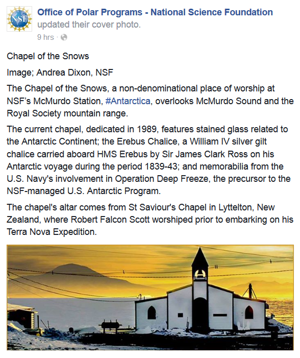
Remember the chalice?
Erebus was one of the primordial deities in Greek mythology, born out of the primeval void, Chaos. It was the personification of the deep darkness and shadows. Erebus was the brother of Gaea (earth), Tartarus (underworld), Eros (love), and Nyx (night). From the union of Erebus and Nyx, various children were produced, including Aether, Hemera (day), Hypnos (sleep), the Moirai (the Fates), Geras (old age) and Thanatos (death). The word Erebus was also used to indicate a region of the Underworld where the dead would go immediately after dying.
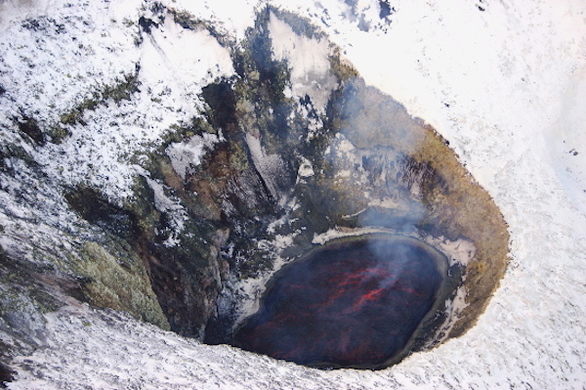
Mount Erebus is currently the most active volcano in Antarctica and is the current eruptive zone of the Erebus hotspot. The summit contains a persistent convecting phonolitic lava lake, one of five long-lasting lava lakes on Earth. Characteristic eruptive activity consists of Strombolian eruptions from the lava lake or from one of several subsidiary vents, all within the volcano's inner crater.
The volcano is scientifically remarkable in that its relatively low-level and unusually persistent eruptive activity enables long-term volcanological study of a Strombolian eruptive system very close (hundreds of metres) to the active vents, a characteristic shared with only a few volcanoes on Earth, such as Stromboli in Italy. Scientific study of the volcano is also facilitated by their proximity to McMurdo Station (U.S.) and Scott Base (New Zealand), both sited on Ross Island approximately thirty-five kilometres away.
The volcano has been active since 1.3 million years ago, and is the world's only presently erupting phonolite volcano.
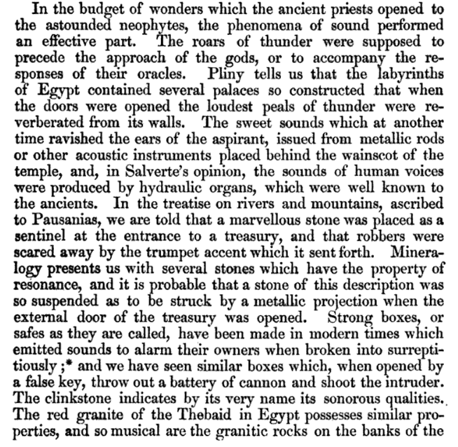
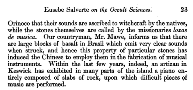
The name phonolite comes from the Ancient Greek meaning "sounding stone" because of the metallic sound it produces if an unfractured plate is hit; hence the English name clinkstone.


I wonder if Scotty two-step brought the chalice?


Notice: "V" Day (day of sacrifice) on 11/11/11
Codex Magica

I love "speculating," lol.
edit on 20-11-2017 by eisegesis because: (no reason given)
originally posted by: firerescue
a reply to: AgarthaSeed
Just one problem ...
Antarctica is separated by hundreds of miles of hostile storm wracked seas from other land masses
How does a primitive society
1) Construct ships of sufficient size and strength to cross the intervening ocean to Antarctica ?
2) How do they transport sufficient supplies to the colony or city to sustain it ?
Remember nothing grows in Antarctica .........
There is no wood to construct dwellings or to build fires for cooking and heat
Yes in modern in times there's no wood or resources to be found there, which is again why I mentioned that this theoretically pre dates antiquity as we know it.
These ruins would be from the era in which Antarctica had a temperate climate. Of course nobody knows the exact time frame, but it's estimated that the climate was actually a "near- tropical rainforest" around 50 million years ago based on seabed sediments among other factors.
In short, there's no appropriate frame of reference to compare a civilization like that to. And it can't be dismissed completely based on the fact that there's no precedent.
newsfeed.time.com...
originally posted by: CainHarmbank
a reply to: Chadwickus
I just briefly looked into the start of this thread...
I have read there are no commercial flights allowed to fly over Antarctica.
You'd think it might be the least miles from bottom of South America to Australia, yes?
Anyway the reason I read commercial planes can't fly over Antarctica is because of extreme winds.
As far as I know, the winds over the north pole aren't so extreme and flights can pass over the north pole pretty easy...
The wind is one reason, but not the main one. Perhaps Zaphod can attest to this. There's an aviation rule that planes flying below 72 degrees latitude need special survival equipment on board, and it's not cost effective for commercial airlines to stock that much equipment to save fuel.
Well, it would be weird if we were the first advanced beings to inhabit this planet in the millions of years that animals have been on it. The
evidence would be long completely deteriorated or buried over thirty thousand years let alone a half million years. Any evidence we find we classify
it as made by man within the last five thousand years, if it was a crystal or inert metals or alloys, it could have been found by the people two
thousand years ago and wind up in their ancient structures and we would think they created it.
nanowaves???
sRGB rendering of the spectrum of visible light
Color Wavelength Frequency Photon energy
Violet 380–450 nm 668–789 THz 2.75–3.26 eV
Blue 450–495 nm 606–668 THz 2.50–2.75 eV
Green 495–570 nm 526–606 THz 2.17–2.50 eV
Yellow 570–590 nm 508–526 THz 2.10–2.17 eV
Orange 590–620 nm 484–508 THz 2.00–2.10 eV
Red 620–750 nm 400–484 THz 1.65–2.00 eV
essentially all visible light is measurable in nanometers, and could therefore be called "nanowaves"
originally posted by: purplemer
a reply to: Chadwickus
So where’s the evidence of the no fly zone? Like, it needs to be known so, you know, no one flies over it. No such no fly zone exists, therefore, the story is bs.
You could try having a little look instead of stomping around threads with your cognitive dissonance.. You cant simply say a story is bs when you dont have any evidence to support it
I cannot speak to continent-wide no-fly zones, but there is specific, interesting no-fly zone at the South Pole station, where a number of scientific experiments rely on the cleanest air on the planet. This particular no-fly zone is meant to shield the “Clean Sector,” one of several protected areas, including the “Dark Sector” and the “"Quiet Sector.” In this Clean Sector, aircraft are forbidden to fly under 2000 meters within an arc of 150km radius.
www.quora.com...
Lol, and you cannot say it is true without evidence to support it. Follow your own example.
originally posted by: rickymouse
Well, it would be weird if we were the first advanced beings to inhabit this planet in the millions of years that animals have been on it. The evidence would be long completely deteriorated or buried over thirty thousand years let alone a half million years. Any evidence we find we classify it as made by man within the last five thousand years, if it was a crystal or inert metals or alloys, it could have been found by the people two thousand years ago and wind up in their ancient structures and we would think they created it.
Mankind or "something" of an advanced kind if you wish has been around alot longer than a meager couple of thousand years...
There is something down there under the ice that has peaked the interest of many a person.
So many visits by people that are not even part of the scientific or political spectrum... Including Royals...
Warmest respects
Lags
a reply to: purplemer
No-fly zones are called NOTAMS, there is a list of NOTAMS on the British Antarctic Survey website:
legacy.bas.ac.uk...
You could try having a little look instead of stomping around threads with your cognitive dissonance.. You cant simply say a story is bs when you dont have any evidence to support it
No-fly zones are called NOTAMS, there is a list of NOTAMS on the British Antarctic Survey website:
legacy.bas.ac.uk...
a reply to: fluff007
You did literally no research on this! No country owns it because of the Antarctic treaty
It's only off limits to you if you cant afford it! you could go right now! What do you mean why is John Kerry there, you do know he was all about climate change and Antarctica is the place to study it?
You do know there is an orthodox church at the Russian base and they actually moved a church there from Russia?
And you seem to think it is 2016 because that all female expedition already happened and you said there are "no updates" yet you can SEE her current projects
ATS used to have the motto "deny ignorance" but...
a reply to: purplemer
Oh FFS!!! the Piri Reis map DOES NOT SHOW ANTARCTICA!!!!!How many more people are going to be that lazy and just quote Hapgood's sketchy research and forced theories over and over and over again?!! Arrgghhhhh!
In reality it's a composite of lots of maps, including maps of of Japan which people confuse as the part of the caribbean and Antarctica is just a continuation of the South American coastline!
This has recently popped up online and explains it a lot better than I ever could without destroying my keyboard into a tiny fragments.
issuu.com...
a reply to: VerveStentor
You are correct it does not show Anartica. It shows a portion of it. Care to comment on the Buache Map too..
Not Hapgood its Hancock.
On 6th July 1960 the U. S. Air Force responded to Prof. Charles H. Hapgood of Keene College, specifically to his request for an evaluation of the ancient Piri Reis Map:
www.ancientdestructions.com...
Oh FFS!!! the Piri Reis map DOES NOT SHOW ANTARCTICA!!!!!How many more people are going to be that lazy and just quote Hapgood's sketchy research and forced theories over and over and over again?!! Arrgghhhhh!
You are correct it does not show Anartica. It shows a portion of it. Care to comment on the Buache Map too..
Not Hapgood its Hancock.
On 6th July 1960 the U. S. Air Force responded to Prof. Charles H. Hapgood of Keene College, specifically to his request for an evaluation of the ancient Piri Reis Map:
TO: Prof Charles H. Hapgood, Keene College
Dear Professor Hapgood,
Your request of evaluation of certain unusual features of the Piri Reis Antarctica map of 1513 by this organization has been reviewed.. The claim that the lower part of the map portrays the Princess Martha Coast of Queen Maud Land, Antarctic, and the Palmer Peninsular, is reasonable. We find that this is the most logical and in all probability the correct interpretation of the map. The geographical detail shown in the lower part of the map agrees very remarkably with the results of the seismic profile made across the top of the ice-cap by the Swedish-British Antarctic Expedition of 1949.This indicates the coastline had been mapped before it was covered by the ice-cap. This part of Antarctica ice free. The ice-cap in this region is now about a mile thick. We have no idea how the data on this map can be reconciled with the supposed state of geographical knowledge in 1513.
Harold Z. Ohlmeyer Lt. Colonel, USAF Commander
www.ancientdestructions.com...
new topics
-
Sorry to disappoint you but...
US Political Madness: 1 hours ago -
Watch as a 12 million years old Crab Emerges from a Rock
Ancient & Lost Civilizations: 5 hours ago
top topics
-
Speaking of Pandemics
General Conspiracies: 14 hours ago, 9 flags -
ILLUMINATION: Dimensions / Degrees – Da Vincis Last Supper And The Philosophers Stone
Secret Societies: 12 hours ago, 9 flags -
Watch as a 12 million years old Crab Emerges from a Rock
Ancient & Lost Civilizations: 5 hours ago, 9 flags -
Just Sick of It! Done! Can't take it anymore!
General Chit Chat: 13 hours ago, 8 flags -
Stuck Farmer And His Queue Jumping Spawn
Rant: 15 hours ago, 4 flags -
Sorry to disappoint you but...
US Political Madness: 1 hours ago, 4 flags
active topics
-
-@TH3WH17ERABB17- -Q- ---TIME TO SHOW THE WORLD--- -Part- --44--
Dissecting Disinformation • 3946 • : WeMustCare -
Musk calls on King Charles III to dissolve Parliament over Oldham sex grooming gangs
Mainstream News • 177 • : fringeofthefringe -
Joe Biden gives the USA's Highest Civilian Honor Award to Hillary Clinton and George Soros.
US Political Madness • 43 • : WeMustCare -
Sorry to disappoint you but...
US Political Madness • 5 • : nugget1 -
Just Sick of It! Done! Can't take it anymore!
General Chit Chat • 14 • : Flyingclaydisk -
What Is 'Quad Demic'? Mask Mandate Returns In These US States
Diseases and Pandemics • 38 • : NorthOS -
Winter Storm
Fragile Earth • 32 • : Irishhaf -
Vehicle Strikes people in New Orleans
Mainstream News • 300 • : Oldcarpy2 -
DONALD J. TRUMP - TIME's Most Extraordinary Person of the Year 2024.
Mainstream News • 61 • : Oldcarpy2 -
Candidate Harris Supporter MARK CUBAN Says Trump Has No Smart-Intelligent Women in His Orbit.
2024 Elections • 88 • : Oldcarpy2
