It looks like you're using an Ad Blocker.
Please white-list or disable AboveTopSecret.com in your ad-blocking tool.
Thank you.
Some features of ATS will be disabled while you continue to use an ad-blocker.
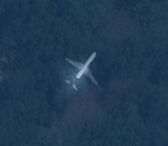
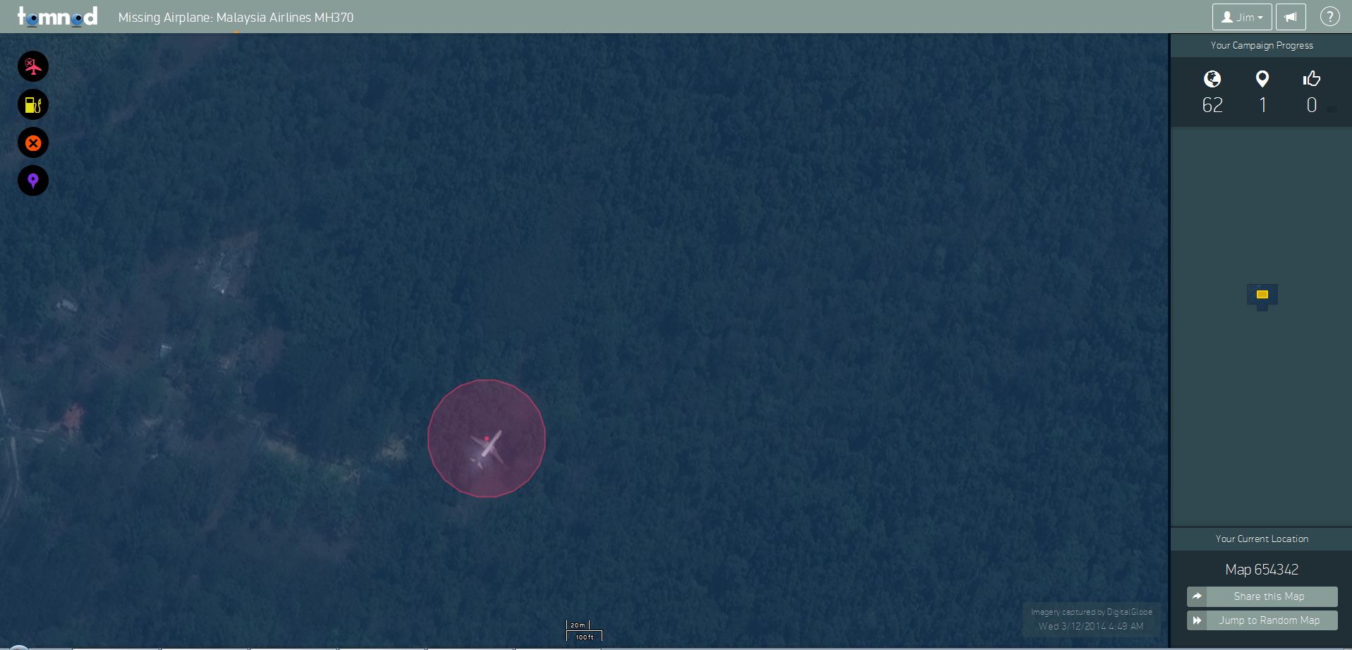
Tomnod.com Sighting .... Wtf is this plane doing here? Could this be Malaysia Airlines Flight 370 ?
page: 4share:

I know it's not even confirmed whether or not it's the right plane, but does it look to anyone else like it's upside down?
minkmouse
Is there a shot of this thing without the red circle? I don't know why the circle is there in the first place unless to hide bad cut and paste. Interesting all the same.
When you use tomnod, you are asked to tag various objects with markers (circles in this case). You get to mark things like "aircraft wreckage", "debris", "liferafts", and "other things" (which i guess is anything from pirate ships to giant kraken).
But that image is definitely way out there.
Have you tried cross-referencing with flightradar and those other flight tracking webpages? Though I think that could be a search plane
edit on
17-3-2014 by stormcell because: (no reason given)
edit on 17-3-2014 by stormcell because: (no reason given)
Similar two engined aircraft however the dark paint colour towards the back of the fuselage and tail fin are not consistent with the missing
aircraft.
Definitely flying above the trees though
PDUK
Definitely flying above the trees though
PDUK
ChefSlug
$20 TMZ gets there first
Harvey at TMZ has the absolute best reporting team. I know ... It's all fluff and gossip.
But man ... that guy knows how to cover things. He's got sources ... better than the mob.
Someone hit TMZ with this ....
They have posted info about the flight on their homepage so they'll check it.
(they check everything I'm sure)
SonoftheSun
andy1972
I reckon the red ring is actually the cloaking thingy that the chinese used to hijack the plane...not seriously..edit on PM1Mon20141972 by andy1972 because: (no reason given)
kx12x
I know it's not even confirmed whether or not it's the right plane, but does it look to anyone else like it's upside down?
It is absolutely above the tree line.
Edit: And highly doubtful that it's flying upside down but who knows.
edit on 2014-03-17T13:55:48-05:002014480355kMonAmerica/ChicagobMon, 17
Mar 2014 13:55:48 -0500 by cosmikDebris because: (no reason given)
reply to post by kx12x
No it doesn't ....!!
If upsides down then engines , one on either wing would be visible..
PDUK
No it doesn't ....!!
If upsides down then engines , one on either wing would be visible..
PDUK
MadHatter364
Yeah right, because since the flight disappeared NO OTHER PLANES HAVE BEEN FLYING...THEREFORE IF I SEE ONE IN A SATELLITE PIC THEN IT MUST BE FLIGHT 370.
People...REALLY?
Am I missing something or has everyone gone full retard?
I'd have to agree, it could be any plane. It's kind of like noticing people with backpacks everywhere after you experienced 9/11. But isn't it more fun this way?
UberL33t
reply to post by cosmikDebris
Here are a few images from Google Images for comparison...couldn't find any top down views...but these do bear a fairly close resemblance...white fuselage and gray-ish wings.
Honestly, the plane on the map is just not engine-y enough. I think it would have been a good catch if it looked similar, but not quite good enough.
Good enough to make a thread about and have people get excited over, though.
kx12x
I know it's not even confirmed whether or not it's the right plane, but does it look to anyone else like it's upside down?
No, because the engines are below the wing.
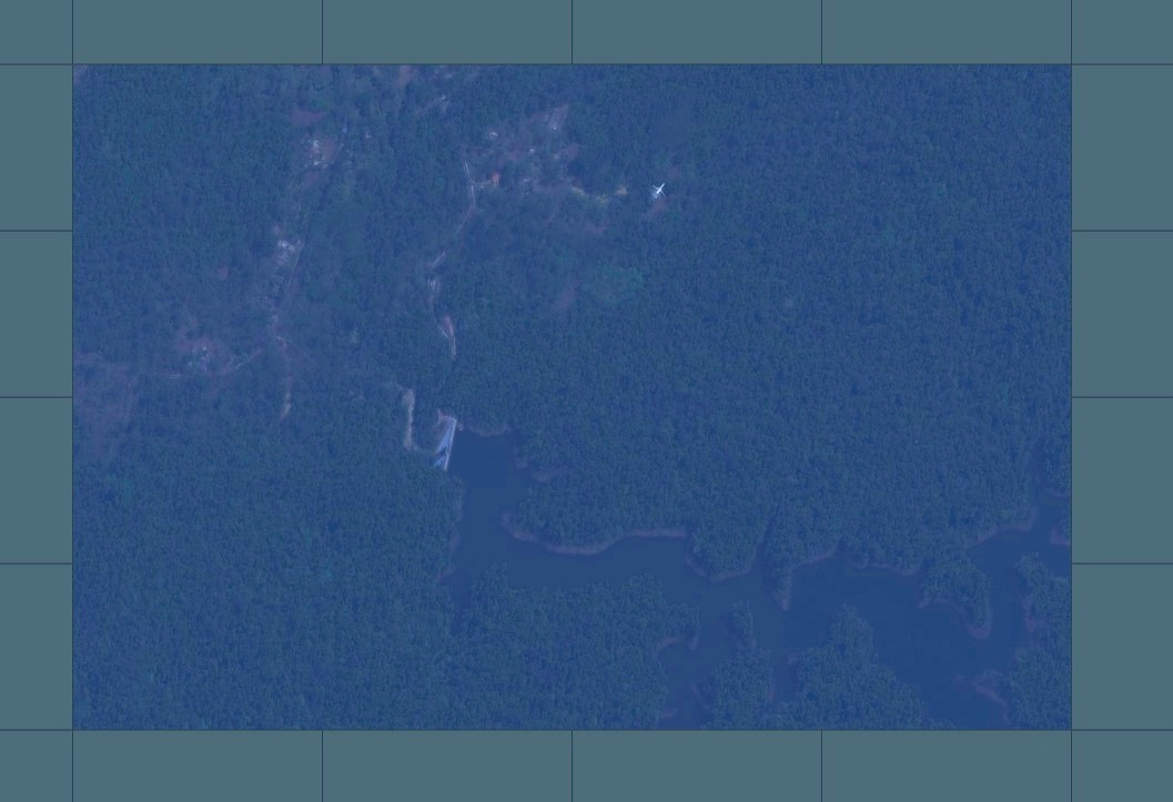
That plane is flying high above the trees. If you open multiple tiles you can see it's NE of a rather large dam. Anyone know where this location is?
I doubt this is the plane as it's in flight. The satellite just happened to catch it.

I doubt this is the plane as it's in flight. The satellite just happened to catch it.

edit on 83157Mondayk22 by Bilk22 because: (no reason given)
parad0x122
Hello Everyone,
Not sure if this exact sighting has been posted but...this was just too weird not to share. I was trolling around on reddit.com and also doing some Tomnod.com spotting of my own when I came across this...
Tomnod Map #655896
For those of you who don't have an account there, I've included a screenshot, because this is just too hard to believe without seeing:
Now, according to their data, that picture was taken at 3/12/14 4:49 AM..time zone not given, but I'm assuming local to me, which is EST. I was able to cross reference tomnod.com to come up with the actual Lat/Long, which came to:
Lat: 11.577303 Long: 92.680922
I've attempted to pull the picture off of GoogleMaps, but was only greeted with cloud cover over the exact location. Given that Lat/Long, it translates to this area:
Nayashahar RV, Andaman and Nicobar Islands, India 744105
Which is located on the southern end of Smith Island, between the Bay of Bengal of the Andaman Sea, India.
I hope some of you have an idea of WTF a plane of that size could be doing there...
It's too small by half to be a 777 - by scale, about 120 foot long vs. the 777-200's 209 ft. Also, the 777 has large wing-mounted engines that should be visible - it looks like a 727, DC-9, or CRJ-class aircraft, with fuselage-mounted engines, on approach to the airport at Port Blair.
reply to post by kx12x
Yep...That's why I said a while back that the tail didn't look right. Could be an illusion but it looks like an upside down aircraft with a high tail fin
Yep...That's why I said a while back that the tail didn't look right. Could be an illusion but it looks like an upside down aircraft with a high tail fin
On the other photos for comparison, the engines look well forward of the wings, yet in the tomnod photo, you can't see the engines from under the
wings..
andy1972
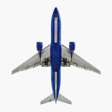
There's Andy's blow up. Now compare it to a top down shot of a 777:

Notice the differences. the angle of the tail and the wings seems to me to be different. The trailing edge of both wings and tail in the original are almost 90 degrees from the fuselage. In the 777 there is a clear angle to both pieces. I don't think the original is a 777 at all.
Edit: I guess it's a bottom-up shot.
edit on 3/17/2014 by schuyler because: (no reason given)
Tontodollydog
reply to post by parad0x122
I have no idea who to call. Someone must know on here. Sorry
Nobody. So many planes are in the air at any given time and this one is just miles from an airport. Highly unlikely that this is the missing plane and it's a matter of hours if not minutes before this is solved/debunked.
SonoftheSun
reply to post by andy1972
And there I was thinking it was aliens or something...
It was aliens...disguised as chinese..to provoke WW3..
new topics
-
Political Warfare & The Resister Special Forces Underground
Political Ideology: 9 minutes ago -
Trump Cancel trip to New Jersey because of drones
Aliens and UFOs: 19 minutes ago -
School shooting in Madison Wi.
Social Issues and Civil Unrest: 5 hours ago -
Prisoner CNN helped free from Syrian prison was actually notorious Assad regime torturer: report
Mainstream News: 7 hours ago -
Labour Plotting to Postpone May's Council Elections ?
Regional Politics: 8 hours ago -
Is this really what is going on?
General Conspiracies: 9 hours ago -
Russias War Against Religion in Ukraine
World War Three: 10 hours ago
top topics
-
iPhone Microphone Being Accessed by Unknown App
The Gray Area: 12 hours ago, 10 flags -
Is this really what is going on?
General Conspiracies: 9 hours ago, 10 flags -
School shooting in Madison Wi.
Social Issues and Civil Unrest: 5 hours ago, 9 flags -
Prisoner CNN helped free from Syrian prison was actually notorious Assad regime torturer: report
Mainstream News: 7 hours ago, 8 flags -
Russias War Against Religion in Ukraine
World War Three: 10 hours ago, 4 flags -
Labour Plotting to Postpone May's Council Elections ?
Regional Politics: 8 hours ago, 4 flags -
Trump Cancel trip to New Jersey because of drones
Aliens and UFOs: 19 minutes ago, 1 flags -
Political Warfare & The Resister Special Forces Underground
Political Ideology: 9 minutes ago, 0 flags
active topics
-
Trump Cancel trip to New Jersey because of drones
Aliens and UFOs • 6 • : AlroyFarms -
School shooting in Madison Wi.
Social Issues and Civil Unrest • 36 • : xuenchen -
Political Warfare & The Resister Special Forces Underground
Political Ideology • 0 • : ADVISOR -
The Acronym Game .. Pt.4
General Chit Chat • 1019 • : JJproductions -
Statements of Intent from Incoming Trump Administration Members - 2025 to 2029.
2024 Elections • 46 • : WeMustCare -
Defending the need for adherence to Old Testament commandments under the new covenant of Christ
Conspiracies in Religions • 34 • : FullHeathen -
iPhone Microphone Being Accessed by Unknown App
The Gray Area • 3 • : whyamIhere -
Labour Plotting to Postpone May's Council Elections ?
Regional Politics • 4 • : NorthOS -
Drones everywhere in New Jersey ---and Elsewhere Master Thread
Aliens and UFOs • 194 • : nugget1 -
ILLUMINATION – Reverse Perception Of Cyclic Probability – CEO ASSASSINATION
Secret Societies • 30 • : Compendium


