It looks like you're using an Ad Blocker.
Please white-list or disable AboveTopSecret.com in your ad-blocking tool.
Thank you.
Some features of ATS will be disabled while you continue to use an ad-blocker.

Google earth strange findings post your finds
page: 4share:
Ah, thank you much, ShadowHawk. I did have some fun following the many random roads to seemingly nowhere. Interesting stuff.
This is interesting - to me at least. I'm sure it's nothing more than the different satellite images being mended together, but:
38°53'44.49"N
77° 2'33.39"W
This is in GE, it's a bit west of the White House. The buildings to the south, you see the southern and eastern faces. To the north, you see the northern and western faces.
Interesting? It's bizarre to look at...
38°53'44.49"N
77° 2'33.39"W
This is in GE, it's a bit west of the White House. The buildings to the south, you see the southern and eastern faces. To the north, you see the northern and western faces.
Interesting? It's bizarre to look at...
All of these are viewable in google earth.
glowing plane
0°08'54.90" s
78°29'20.10" w
Lake of Blood(biblical?)
33 23 45.56N,44 29 11.97E
giant cleets
52.522348,13.370917
giant's car
52.516221,13.377351
giant
43.026079,-88.011507
airplane crash
8.97673,38.804011
have fun! more later.
glowing plane
0°08'54.90" s
78°29'20.10" w
Lake of Blood(biblical?)
33 23 45.56N,44 29 11.97E
giant cleets
52.522348,13.370917
giant's car
52.516221,13.377351
giant
43.026079,-88.011507
airplane crash
8.97673,38.804011
have fun! more later.
ok, if this is not supernatural than i dont think anything on GE is.
weird light
52.521653,5.732932
who flys these things anymore?
WW2 bomber
52 20'13.53" N
0 11'48.82" W
oh yeah, and someone stated that area 51 has the best resolution available on GE. Check out these animal picks in Africa
BUFFALOS:
4°17'21.49" S
31°23'46.46" E
CAMELS:
15°17'40.32" N
20°28'47.42" E
ELEPHANTS:
10°54'13.66" N
19°56'06.15" E
FLAMINGOS:
21°50'36.15" S
35°27'00.60" E
HIPPOS:
6°53'53.00" S
31°11'15.40" E
6°54'00.10" S
31°11'11.67" E
ORYX:
24°57'18.60" S
15°51'30.61" E
SEALS:
18°26'45.45" S
12°00'44.20" E
and last but not least my collection of weird star shapes.
star of david?
37 24' 06.84" N
116 52' 09.12" W
star of david 2?
34 39'27.72N, 108 58'09.13E
pentagram?
23 10'32.87" N, 82 12'52.91"W
very interesting and weird stuff in this topic. by the way, other then actually looking for map coordinates, is there a way to type them in?
The Marree Man
visable on google a huge carved man in the ausie outback
"The Marree Man" lat=-29.5306481624, lon=137.474877084
visable on google a huge carved man in the ausie outback
"The Marree Man" lat=-29.5306481624, lon=137.474877084
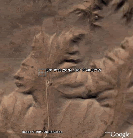
Not sure if anyone has found this one. I found this while surfing the net and had to check it out myself with my google earth. I typed in these
coordinates
50° 0'38.20"N 110° 6'48.32"W
I was surprised to see it was what they said it was.
Here are some images if you do not have google earth. You will see the "Face on Canada" ... which is an Aboriginal. (not native American Indian)
Cropped Image
Zoomed Out Image
I thought this was pretty cool. Now, I've read that some cannot get this image (says streaming 1%) Again, when I typed in the coordinates it did take me directly to the area of interest. I did ask some friends to check it out and they thought it was cool too.
The site where I found this information was this credit site
i found this while looking for nazca lines, there's also something in a circle on the right
any idea what it is?
Google Maps Link - Peru
any idea what it is?
Google Maps Link - Peru
I couldn't find anything on those Peruvian Geoglyphs. I'm now curious to see who, what, and why they were made. I still haven't found anything on
the one I have posted. I would like to know the height of it and if anyone lives in that area ... what do they know about it?
[edit on 24-1-2007 by MicheleLee]
[edit on 24-1-2007 by MicheleLee]
Here is a awsome place to look at tell me what you tink of it?
27degress 39'48.60degrees north
30degrees 54'58.38 degrees east
it is in egypt, just a little west of Tall Bani 'Umran. It looks like a old temple or some thing what is weird is the size of this ruin. Compare to the building in the town. The shapes in the ruins are very strange and I have never seen them in Egyptian buildings before?
The ones the person is talking about acouple of post before this one Looks as if they were photo shoped into the area.
[edit on 26-1-2007 by goddogo1]
[edit on 26-1-2007 by goddogo1]
Originally posted by goddogo1
Here is a awsome place to look at tell me what you tink of it?
27degress 39'48.60degrees north
30degrees 54'58.38 degrees east
it is in egypt, just a little west of Tall Bani 'Umran. It looks like a old temple or some thing what is weird is the size of this ruin. Compare to the building in the town. The shapes in the ruins are very strange and I have never seen them in Egyptian buildings before?
I wanted to bump this up as I am pretty curious about my original posting (image below)
Also I have to say to goddogo1, your coordinates are interesting
27 39'48.60"N, 30 54'58.38"E
I have no clue about that area, but maybe someone here does.
My coordinates of 50° 0'38.20"N 110° 6'48.32"W
I have been checking back to see if anyone has any information on this. I have posted the cropped image with hopes to spark some interest. I would like to know if it is natural, and the estimated height.
Thank you!
Originally posted by rand
While searching 'round Moriarty late one night, I came across this wondrous sight.
Google Maps Link
very interesting.. it almost looks like a hologram... though i can't imagine a hologram having contrails? perhaps it's a badly scanned shadow or something..?
and what's that place they're gunna fly over... looks like it's been hit by a bomb big time~
[edit on 26-1-2007 by x08]
That is weird, I wonder if anyone else know anything about it?
on that one
on that one
I apologize if this has been posted already - but - it's really kinda cool and I would like to know what it is.
coordinates: 70°30'43.72" N, 40°05'04.84" W
[edit on 29-1-2007 by Swats0n]
coordinates: 70°30'43.72" N, 40°05'04.84" W
[edit on 29-1-2007 by Swats0n]
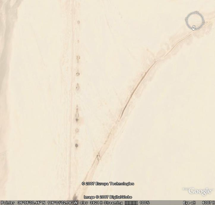
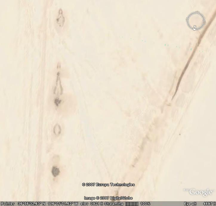
Found these on another thread. Interesting and in relative close proximity to Area 51. They've probably been posted here before although I could
not find them. They look like compasses? Any ideas?
Earth Symbol 1
37°39'39.41"N 116° 1'40.28"W
Earth Symbol 2
37°28'53.03"N 116°13'46.04"W
Earth Symbol 3
37°51'20.77"N 116°49'14.99"W
Earth Symbol 4
37°51'57.05"N 116°49'18.67"W
Earth Symbol 1
37°39'39.41"N 116° 1'40.28"W
Earth Symbol 2
37°28'53.03"N 116°13'46.04"W
Earth Symbol 3
37°51'20.77"N 116°49'14.99"W
Earth Symbol 4
37°51'57.05"N 116°49'18.67"W
Just wondering if i'm right in assuming that "the hook" is a particle accelerator.

Also i found this to be really interesting:
Anybody have an idea what the markings are on the side of the runway? The last two photos are of the Yucca lake bed.
[edit on 11-2-2007 by AlienNation]
Also i found this to be really interesting:
Anybody have an idea what the markings are on the side of the runway? The last two photos are of the Yucca lake bed.
[edit on 11-2-2007 by AlienNation]
Great site of Google Earth strangeness: www.jrgoogleearth.blogspot.com
new topics
-
President BIDEN's FBI Raided Donald Trump's Florida Home for OBAMA-NORTH KOREA Documents.
Political Conspiracies: 3 hours ago -
Maestro Benedetto
Literature: 5 hours ago -
Is AI Better Than the Hollywood Elite?
Movies: 5 hours ago -
Las Vegas UFO Spotting Teen Traumatized by Demon Creature in Backyard
Aliens and UFOs: 8 hours ago -
2024 Pigeon Forge Rod Run - On the Strip (Video made for you)
Automotive Discussion: 9 hours ago -
Gaza Terrorists Attack US Humanitarian Pier During Construction
Middle East Issues: 10 hours ago -
The functionality of boldening and italics is clunky and no post char limit warning?
ATS Freshman's Forum: 11 hours ago -
Meadows, Giuliani Among 11 Indicted in Arizona in Latest 2020 Election Subversion Case
Mainstream News: 11 hours ago
top topics
-
President BIDEN's FBI Raided Donald Trump's Florida Home for OBAMA-NORTH KOREA Documents.
Political Conspiracies: 3 hours ago, 25 flags -
Krystalnacht on today's most elite Universities?
Social Issues and Civil Unrest: 15 hours ago, 9 flags -
University of Texas Instantly Shuts Down Anti Israel Protests
Education and Media: 17 hours ago, 8 flags -
Weinstein's conviction overturned
Mainstream News: 13 hours ago, 8 flags -
Supreme Court Oral Arguments 4.25.2024 - Are PRESIDENTS IMMUNE From Later Being Prosecuted.
Above Politics: 14 hours ago, 8 flags -
Massachusetts Drag Queen Leads Young Kids in Free Palestine Chant
Social Issues and Civil Unrest: 12 hours ago, 7 flags -
Gaza Terrorists Attack US Humanitarian Pier During Construction
Middle East Issues: 10 hours ago, 7 flags -
Las Vegas UFO Spotting Teen Traumatized by Demon Creature in Backyard
Aliens and UFOs: 8 hours ago, 6 flags -
Meadows, Giuliani Among 11 Indicted in Arizona in Latest 2020 Election Subversion Case
Mainstream News: 11 hours ago, 5 flags -
2024 Pigeon Forge Rod Run - On the Strip (Video made for you)
Automotive Discussion: 9 hours ago, 4 flags
active topics
-
Las Vegas UFO Spotting Teen Traumatized by Demon Creature in Backyard
Aliens and UFOs • 11 • : AwakeNotWoke -
President BIDEN's FBI Raided Donald Trump's Florida Home for OBAMA-NORTH KOREA Documents.
Political Conspiracies • 15 • : AwakeNotWoke -
Is AI Better Than the Hollywood Elite?
Movies • 13 • : Justoneman -
Hate makes for strange bedfellows
US Political Madness • 47 • : 19Bones79 -
-@TH3WH17ERABB17- -Q- ---TIME TO SHOW THE WORLD--- -Part- --44--
Dissecting Disinformation • 689 • : daskakik -
University of Texas Instantly Shuts Down Anti Israel Protests
Education and Media • 265 • : Astrocometus -
Gaza Terrorists Attack US Humanitarian Pier During Construction
Middle East Issues • 27 • : ToneD -
Reason of the Existence
The Gray Area • 21 • : BingoMcGoof -
Supreme Court Oral Arguments 4.25.2024 - Are PRESIDENTS IMMUNE From Later Being Prosecuted.
Above Politics • 85 • : Sookiechacha -
Chris Christie Wishes Death Upon Trump and Ramaswamy
Politicians & People • 24 • : nugget1