It looks like you're using an Ad Blocker.
Please white-list or disable AboveTopSecret.com in your ad-blocking tool.
Thank you.
Some features of ATS will be disabled while you continue to use an ad-blocker.
share:
a reply to: Olivine
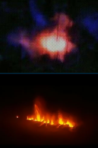
I did find a little more (you just reminded me to post it!). The explanation (below) sounds to me like a complete cover up IF the images being shown ARE from the supposed 'eruption' because it sure looks like a fissure eruption to me.
Source
Yeah right! Now look at the image:

In my experience high voltage systems trip when there is an earth leak abd are switched off. Are they seriously suggesting that sufficient voltage is being leaked to power an electric arc furnace and no one at the lecky company has noticed, even if the system did not trip?
As Victor Meldrew says
I can't find any more info on that "volcano-like" eruption in India--very curious!
I did find a little more (you just reminded me to post it!). The explanation (below) sounds to me like a complete cover up IF the images being shown ARE from the supposed 'eruption' because it sure looks like a fissure eruption to me.
Source
The Times of India reports that further examination by a team from the Geological Survey of India determined that the fiery phenomenon was due to a high-voltage current passing through the ground from an electric pole located on the hill.
They found that the extreme heat caused by the current melted silica stones, which appeared to spew as lava.
Yeah right! Now look at the image:

In my experience high voltage systems trip when there is an earth leak abd are switched off. Are they seriously suggesting that sufficient voltage is being leaked to power an electric arc furnace and no one at the lecky company has noticed, even if the system did not trip?
As Victor Meldrew says
a reply to: PuterMan
"I do not believe its" either.
That would have to be a darn efficient electric arc furnace to melt silicon. A quick wiki exploration shows the melting point of pure silicon to be above 1400°C, and laboratory-grade furnaces can reach 1800°C; but to happen by accident...I don't know....
My guess was that natural gas was oozing from the ground, and was accidentally ignited, but magma would be much more interesting. (not so great for the locals, though)
***************************
The Catania airport has been closed due to ash from Etna. Link WaPo
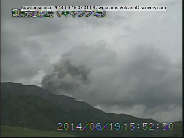
New Eruption & Volcanic Ash warning: Suwanosejima Volcano (Tokara Islands, Japan)

www.volcanodiscovery.com...
ds.data.jma.go.jp...

www.volcanodiscovery.com...
ds.data.jma.go.jp...
edit on 19-6-2014 by SeekingDepth because: Added Ash Warning Link
Rockfalls, steam venting reported at Mayon over past 24 hours
June 30, 2014 11:36am
Two rockfall events and white steam plumes were observed in the last 24 hours at Mayon Volcano in Bicol, the Philippine Institute of Volcanology and Seismology (Phivolcs) said Monday.
....
....
Earlier this month, residents noted wells at the foot of the famous volcano have started drying up, which they believe to be another sign of restiveness from Mayon Volcano.
....
....
Also, they noted many animals such as snakes had been coming down from the volcano's higher areas.
Read more...
Mayon's largest eruption was in 1814 (VEI 4) and the ash from that combined with Tambora in 1815 led to the 'Year with no summer'.
More infor in the inevitable Wikipedia
Someone was faster than me...
Yes, it appears there has been noticeable flooding near Mýrdalsjökull, under which Katla is. This means something is happening under the ice cap.
Too bad both webcams there are useless now.
RUV Webcam (Currently no server found)
Live From Iceland (Only shows grey, dirty cam or just rain/fog)
Yes, it appears there has been noticeable flooding near Mýrdalsjökull, under which Katla is. This means something is happening under the ice cap.
Too bad both webcams there are useless now.
RUV Webcam (Currently no server found)
Live From Iceland (Only shows grey, dirty cam or just rain/fog)
Experts: Katla Not Erupting But Stay Away
Geologists flew over Mýrdalsjökull glacier, which covers the active volcano Katla, yesterday to investigate sudden glacial flooding in Múlakvísl river and Jökulsá river, reports RÚV.
“It is obvious that [the floodwater] is originating from Katla, but there is nothing that points to a major event,” said geophysicist Björn Oddsson.
Although glacial flooding in the area is not expected to be heavy, travellers and tour companies are being told to stay vigilant of sudden rises in water levels and are advised to keep their distance by going no further than Múlakvísl river.
“In large quantities sulphur pollution [rising from the glacial flood] can be dangerous and people can pass out from it if they venture too close,” geologist Gunnar B. Guðmundsson told Vísir.
Grapevine
edit on 9-7-2014 by Thebel because:
(no reason given)
Update in English: Floodwater continues to drain from geothermal sources beneath Mýrdalsjökull into the rivers Múlakvísl and Jökulsá á
Sólheimasandi. Conductivity levels in both rivers remain higher-than-normal, but the latest measurements show a slight decrease. Additionally, the
discharge of both rivers is lower than earlier in the week.
At Sólheimajökull, geothermal gases continue to be released from the floodwater as it emerges from the glacier. Measurements late on 9 July showed that gas levels were dangerously high at edge of Sólheimajökull, close to where floodwater is draining. We urge people not to visit the western side of Sólheimajökull where floodwater is draining from the ice. The mixture of geothermal gases in this area could cause eye irritations and breathing problems. Note that some of the measured gases are odourless and colourless, making it difficult for humans to detect their presence.
Shallow earthquake activity with the Katla caldera continues to occur, but the seismicity rate is not presently increasing. It is likely that the ongoing seismicity is associated with geothermal activity within the Katla caldera. It should be noted that shallow seismicity within the Katla caldera occurs often during the summertime.
things heaten up at Katla... how long before she blows..... knowing she's ready for it
en.vedur.is...
en.vedur.is...
a reply to: Olivine
A lot of people are worried more about the super volcano in Yellowstone, but that's not where it will start. The next big volcano explosion in the U.S. will happen in the NW but I don't think it will be Yellowstone, although it will be close to it.
A lot of people are worried more about the super volcano in Yellowstone, but that's not where it will start. The next big volcano explosion in the U.S. will happen in the NW but I don't think it will be Yellowstone, although it will be close to it.
a reply to: ElectricUniverse
read an report latley somewere that Mnt Rainier was ready for an blow.... lots of eq's magma intrusion related
read an report latley somewere that Mnt Rainier was ready for an blow.... lots of eq's magma intrusion related
edit on 27-7-2014 by ressiv because: (no reason given)
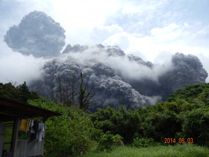
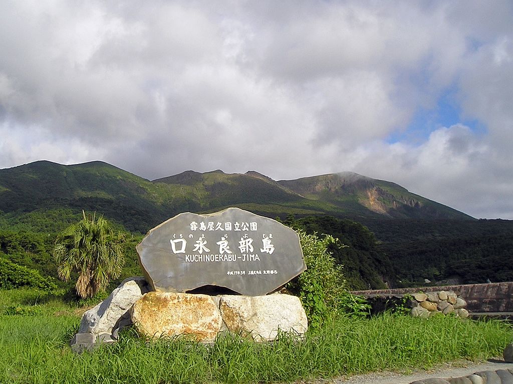
Eruption: Kuchinoerabu Jima Volcano,
Osumi Islands, Japan

thewatchers.adorraeli.com...

tlarremore.wordpress.com...


en.wikipedia.org...
Nicknamed “The Sleeping Gorilla”
Due to its volcanic nature there are plenty of hot springs on the island. It is also a popular fishing destination. Motomura (本村) is the harbor district, and the center of the island. The majority of the island's population is concentrated in Motomura and it's where shops, schools, gas stations, etc. are located.

www.yesyakushima.com...
This is also the place where a college professor from the University of Wyoming Craig Arnold disappeared in 2009 while taking a hike alone on the volcano researching for poetry and essay book about volcanos.
www.cnn.com...
Last eruption was 34 years ago.
Osumi Islands, Japan

thewatchers.adorraeli.com...

tlarremore.wordpress.com...


en.wikipedia.org...
Nicknamed “The Sleeping Gorilla”
Due to its volcanic nature there are plenty of hot springs on the island. It is also a popular fishing destination. Motomura (本村) is the harbor district, and the center of the island. The majority of the island's population is concentrated in Motomura and it's where shops, schools, gas stations, etc. are located.

www.yesyakushima.com...
This is also the place where a college professor from the University of Wyoming Craig Arnold disappeared in 2009 while taking a hike alone on the volcano researching for poetry and essay book about volcanos.
www.cnn.com...
Last eruption was 34 years ago.
edit on 5-8-2014 by SeekingDepth because: added link
Intense swarm in Bárðarbunga volcano in Iceland. Just started few hours ago.

Vatnajökull earthquakes
Its one of those volcanoes that are long overdue, it has erupted every 250-600 years and last significant eruption was in 1477. Its the second-highest volcano in Iceland. It caused largest Holocene lava flow when it erupted 8500 years ago, with volume of more than 21 cubic kilometers, covering the area of nearly 1000 square kilometers. Largest eruption has been VEI-6 in scale. If eruption such as in 1477 would happen in modern times, it would cause major effects in Iceland and on northern hemisphere. The volcano is very remote but dangerous because of its size and eruption history. Eruption could halt all the flight traffic and cause temperatures to cool down. It has shown some earthquake activity in recent years, showing signs that the volcano is still active. The volcano is not very well known because of its remote location and there is not many instruments to monitor its activity.
edit on 16-8-2014 by Thebel because: (no reason given)
they have raised the alert level of Mayon volcano in LEGAZPI CITY, Philippines, from level one to two today.
newsinfo.inquirer.net...
LEGAZPI CITY, Philippines—The Philippine Institute of Volcanology and Seismology (Phivolcs) has raised the alert level over Mayon Volcano from one to two after it showed an evident intrusion of magma that may eventually lead to a larger eruption.
“An intrusion of magma is very evident,” volcanologist Eduardo Laguerta, who is based at Phivolcs’ Lignon Hill Observatory here, told the Inquirer.
A bulletin released by Phivolcs at 2 p.m. on Friday said visual observation showed the growth of a new lava dome, around 30 to 50 meters at the volcano’s summit crater. A lava dome is a pile or mound of lava that grows on the floor of an active crater.
Phivolcs’ instruments also showed a very slight swelling of the middle slopes of the volcano since the May 7, 2013, phreatic or steam-driven explosion of Mayon that caused the death of five climbers, including four foreign tourists and their Filipino guide.
Laguerta noted a sharp increase in the sulfur dioxide
volcanism.wordpress.com...
Alert Level 0: No Alert.
Quiet. No eruption in the foreseeable future.
Alert Level 1: Abnormal.
Low level unrest. No eruption imminent.
Alert Level 2: Increasing Unrest.
Moderate unrest. Unrest probably of magmatic origin, could eventually lead to eruption.
Alert Level 3: Increasing Tendency Towards Eruption.
Relatively high unrest. Magma is close to the crater.
Alert Level 4: Hazardous Eruption Imminent.
Intense unrest. Hazardous eruption is possible within days.
Alert Level 5: Hazardous Eruption.
Hazardous eruption ongoing.
en.wikipedia.org...
Mayon is the most active volcano in the Philippines having erupted over 48 times in the past 400 years.[7] The first record of a major eruption was witnessed in February 1616 by Dutch explorer Joris van Spilbergen who recorded it on his log in his circumnavigation trip around the world.[8] The first eruption of which there is an extended account was the six-day event of July 20, 1766
The most destructive eruption of Mayon occurred on February 1, 1814 (VEI=4).[10] Lava flowed but not as much compared to the 1766 eruption; Instead, the volcano was belching dark ash and eventually bombarded the town of Cagsawa with tephra that buried it. Trees were burned; rivers were certainly damaged. Proximate areas were also devastated by the eruption, with ash accumulating to 9 m (30 ft) in depth. In Albay, a total of 2,200 locals perished in what is considered to be the most lethal eruption in Mayon's history;[6] estimates by PHIVOLCS list the casualties at about 1,200, however. The eruption is believed to have contributed to the accumulation of atmospheric ash,[citation needed] capped by the catastrophic eruption of Mount Tambora in 1815, that led to the Year Without a Summer in 1816.
a reply to: Thebel
Bárðarbunga has likely erupted. The swarm is so intense that 90% change it has erupted. There has been over 300 quakes during this day, strongest ones 3.5 and 3.1 magnitude. I don't currently have access any further info, but seems like we are going to see bigger eruption sooner or later, flooding is expected as glacier above the caldera melts away.


en.vedur.is...
There is about 200-300 meters thick ice cover over to volcano, so the eruption is not visible. Its hard to know what exactly is happening there. There is no webcam monitoring this volcano, and it very remote location. The level of uncertainty has been raised to yellow.
Bárðarbunga has likely erupted. The swarm is so intense that 90% change it has erupted. There has been over 300 quakes during this day, strongest ones 3.5 and 3.1 magnitude. I don't currently have access any further info, but seems like we are going to see bigger eruption sooner or later, flooding is expected as glacier above the caldera melts away.


en.vedur.is...
There is about 200-300 meters thick ice cover over to volcano, so the eruption is not visible. Its hard to know what exactly is happening there. There is no webcam monitoring this volcano, and it very remote location. The level of uncertainty has been raised to yellow.
edit on 16-8-2014 by
Thebel because: (no reason given)
a reply to: Lil Drummerboy
I hope an eruption doesn't melt through the glacier, if it does we're gonna be grounded (again). .
Link to Jón Frímann's Iceland Volcano blog: www.jonfr.com...
I hope an eruption doesn't melt through the glacier, if it does we're gonna be grounded (again). .
Link to Jón Frímann's Iceland Volcano blog: www.jonfr.com...
The charts are skyrocketing ,, we´ll likely see an eruption within the next few hours here in iceland.
hraun.vedur.is...
hraun.vedur.is...
edit on 18-8-2014 by Spacedman13 because: (no reason given)
a reply to: Thebel
The aviation color code has now been raised to Orange.
Seismic activity at Bárðarbunga persists
The aviation color code has now been raised to Orange.
This is the strongest earthquake measured in the region since 1996. As evidence of magma movement shallower than 10 km implies increased potential of a volcanic eruption, the Bárðarbunga aviation color code has been changed to orange. Presently there are no signs of eruption, but it cannot be excluded that the current activity will result in an explosive subglacial eruption, leading to an outburst flood (jökulhlaup) and ash emission. The situation is monitored closely.
Seismic activity at Bárðarbunga persists
edit on 8/18/2014 by Bishop2199 because: I like
change.
new topics
-
Watch as a 12 million years old Crab Emerges from a Rock
Ancient & Lost Civilizations: 1 hours ago -
ILLUMINATION: Dimensions / Degrees – Da Vincis Last Supper And The Philosophers Stone
Secret Societies: 8 hours ago -
Just Sick of It! Done! Can't take it anymore!
General Chit Chat: 9 hours ago -
Speaking of Pandemics
General Conspiracies: 10 hours ago -
Stuck Farmer And His Queue Jumping Spawn
Rant: 10 hours ago
top topics
-
Watch as a 12 million years old Crab Emerges from a Rock
Ancient & Lost Civilizations: 1 hours ago, 9 flags -
Speaking of Pandemics
General Conspiracies: 10 hours ago, 8 flags -
ILLUMINATION: Dimensions / Degrees – Da Vincis Last Supper And The Philosophers Stone
Secret Societies: 8 hours ago, 7 flags -
Just Sick of It! Done! Can't take it anymore!
General Chit Chat: 9 hours ago, 5 flags -
Stuck Farmer And His Queue Jumping Spawn
Rant: 10 hours ago, 4 flags
active topics
-
Watch as a 12 million years old Crab Emerges from a Rock
Ancient & Lost Civilizations • 7 • : CarlLaFong -
Musk calls on King Charles III to dissolve Parliament over Oldham sex grooming gangs
Mainstream News • 172 • : andy06shake -
Nigel Farage's New Year Message.
Politicians & People • 24 • : gortex -
Candidate Harris Supporter MARK CUBAN Says Trump Has No Smart-Intelligent Women in His Orbit.
2024 Elections • 84 • : Oldcarpy2 -
Undiagnosed China Pneumonia Reported
Diseases and Pandemics • 48 • : AdultMaleHumanUK -
-@TH3WH17ERABB17- -Q- ---TIME TO SHOW THE WORLD--- -Part- --44--
Dissecting Disinformation • 3939 • : Thoughtful3 -
DONALD J. TRUMP - TIME's Most Extraordinary Person of the Year 2024.
Mainstream News • 60 • : xuenchen -
Meta Llama local AI system is scary good
Science & Technology • 35 • : Arbitrageur -
Winter Storm
Fragile Earth • 29 • : Flyingclaydisk -
Joe Biden gives the USA's Highest Civilian Honor Award to Hillary Clinton and George Soros.
US Political Madness • 36 • : Flyingclaydisk
