It looks like you're using an Ad Blocker.
Please white-list or disable AboveTopSecret.com in your ad-blocking tool.
Thank you.
Some features of ATS will be disabled while you continue to use an ad-blocker.
share:
reply to post by Tzavros
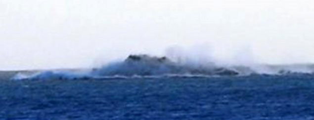
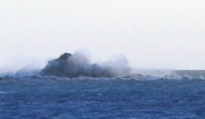
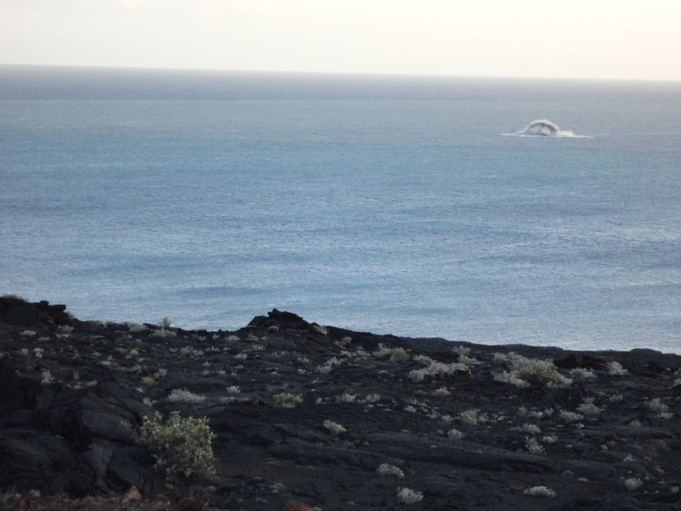
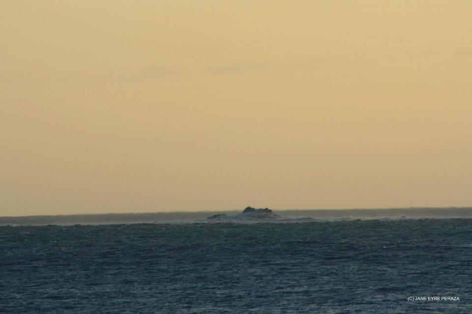
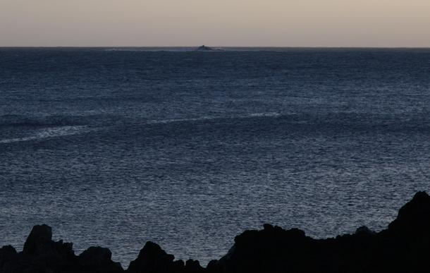
This is something - we are witnessing a new Island being born - Bob is his name. Earth is amazing! Just wish Folks were safe and it did not effect their livelyhood
This is something - we are witnessing a new Island being born - Bob is his name. Earth is amazing! Just wish Folks were safe and it did not effect their livelyhood
Latest...from earthquake report site
"Important Update 05/11 – 23:40 UTC :
Raymond Matabosch reports from his location at El Hierro that, following him, the Surtseyan Eruption phase has started. Burst of ash and water are ejected out of the sea every 30 to 40 minutes.
Update 05/11 – 22:40 UTC :
Our La Restinga human webcam has been evacuated too. She will spend the night with Joke at El Pinar.
Update 05/11 – 21:54 UTC :
What next ?
We expect the next phase to begin soon (a couple of hours) or later (days or even weeks) (a volcano does not show his cards). The present very strong harmonic tremor accompanied by powerful bursts who occur every 30 to 40 minutes, may sustain the process for some time to come.
If the current vents remain open, and if the bursts continue, the gases mixed with ash and steam will have to overcome the water column pressure. They almost did late this afternoon, and will probably continue trying to do so the next couple of hours. In the dark, and unless it is full moon, nobody will notice it (it is not a football stadium).
Once the pressure from below is strong enough to break the water resistance, fountains of steam mixed with ash will blow into the air. At first during the bursts (compare it with geysers) followed bu more continuous fountains.
If all this happens a few km out in the sea, the island will at max. get some ash showers.
These kind of shallow depth eruptions coming above the surface are called Surtseyan eruptions (named after the Icelandic Island formed the same way) or Capelinho’s eruptions (named after a similar eruption in 1957 at Faial, Azores).
At the lower part of this page one will find the explanation of the Capelinho eruption. The article written by Raymond Matabosh explains what will happen next in a very good way.
Please keep in mind that this is an attempt to predict what will happen, not a certainty."
Rainbows
Jane
Update from
earthquake-report
Data Update 06/11 – 10:12 UTC :
Raymond has to leave his viewing point (on the Las Calmas sea) because of the bad and toxic air close to the coastline. He is currently withdrawing to another place on the island. This means that more and more gases are escaping from the jacuzzi vents.
Data Update 06/11 – 10:12 UTC :
Raymond has to leave his viewing point (on the Las Calmas sea) because of the bad and toxic air close to the coastline. He is currently withdrawing to another place on the island. This means that more and more gases are escaping from the jacuzzi vents.
Update from canariesnews
06/11/2011 @ 11:26 – At 09:50 there has been a 3.4 degree earthquake at a depth of 17km. to the north west of El Hierro off the coast of Frontera.
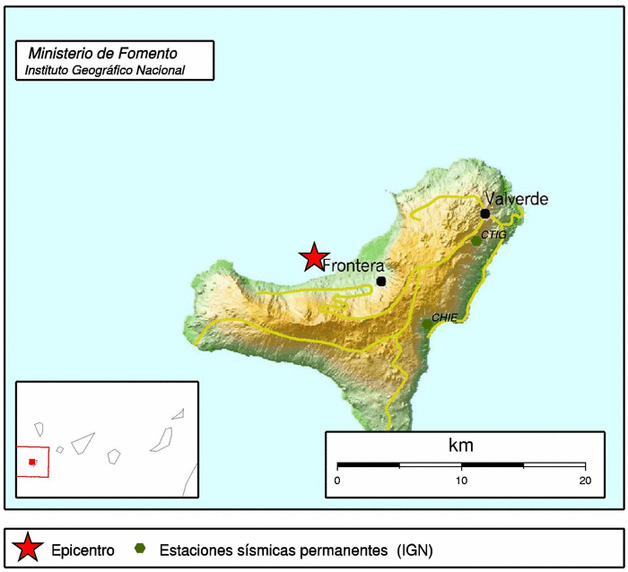
06/11/2011 @ 11:26 – At 09:50 there has been a 3.4 degree earthquake at a depth of 17km. to the north west of El Hierro off the coast of Frontera.

Update from canariesnews
06/11/2011 @ 12:38 – Residents of La Restinga are being allowed to return to their homes during daylight. Residents of Frontera were allowed to visit their homes during 11:00 and 12:00.
So far today there have been 33 earthquakes on El Hierro over 1.5 degrees Richter. The largest one was at 09:50 and registered 3.4 degrees.
edit on 6-11-2011 by Tzavros because: Added info
Can't see this posted anywhere, but I found it very useful to give me a better idea of what I.m looking at!
Rainbows
Jane
Rainbows
Jane
reply to post by Antoniastar
Sorry, still not got the hang of this posting videos bit!
Here's a direct link, maybe somebody can get it up here 'properly'!
www.youtube.com...
Rainbows
Jane
Sorry, still not got the hang of this posting videos bit!
Here's a direct link, maybe somebody can get it up here 'properly'!
www.youtube.com...
Rainbows
Jane
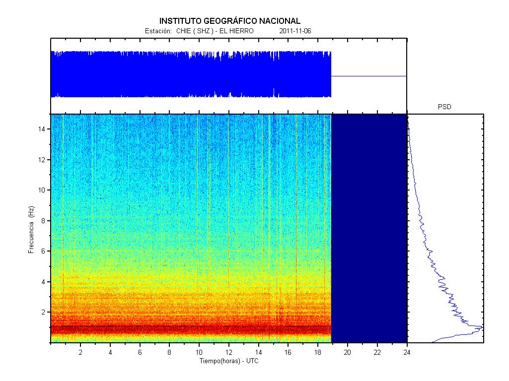
Reports are coming in that the eruptive vent in the Las Calmas Sea is intensifying again. Harmonic tremor graphs indicate from the early afternoon on
that activity is again on the rise.
earthquake-report.com
Video was made this morning ..
www.01.ign.es...
1110652 06/11/2011 18:51:33 27.7980 -18.0619 22 3.1 mbLg NW FRONTERA.IHI [+]
1110645 06/11/2011 18:25:39 27.7838 -18.0482 20 3.9 mbLg NW FRONTERA.IHI [+]
1110644 06/11/2011 17:12:39 27.7854 -18.0535 16 2.4 mbLg NW FRONTERA.IHI [+]
1110641 06/11/2011 16:30:31 27.7736 -18.0437 19 3.4 mbLg NW FRONTERA.IHI [+]
1110637 06/11/2011 14:17:13 27.7813 -18.0463 19 1.8 mbLg NW FRONTERA.IHI [+]
1110638 06/11/2011 14:14:39 27.7918 -18.0511 20 2.7 mbLg NW FRONTERA.IHI [+]
1110639 06/11/2011 14:07:56 27.7905 -18.0501 19 2.4 mbLg NW FRONTERA.IHI [+]
1110634 06/11/2011 13:32:53 27.7768 -18.0455 18 1.8 mbLg NW FRONTERA.IHI [+]
1110635 06/11/2011 13:18:55 27.7934 -18.0609 19 2.0 mbLg NW FRONTERA.IHI [+]
1110636 06/11/2011 13:08:06 27.7806 -18.0448 19 2.7 mbLg NW FRONTERA.IHI [+]
1110629 06/11/2011 12:54:56 27.7957 -18.0539 20 1.7 mbLg NW FRONTERA.IHI [+]
1110628 06/11/2011 12:28:35 27.7709 -18.0349 20 1.9 mbLg NW FRONTERA.IHI [+]
1110625 06/11/2011 11:57:26 27.7517 -18.0319 22 2.6 mbLg W FRONTERA.IHI [+]
1110627 06/11/2011 11:49:53 27.7547 -18.0411 20 1.6 mbLg W FRONTERA.IHI [+]
1110616 06/11/2011 11:12:33 27.8063 -18.0615 18 2.6 mbLg NW FRONTERA.IHI [+]
1110622 06/11/2011 10:41:17 27.7849 -18.0419 20 2.1 mbLg NW FRONTERA.IHI [+]
1110615 06/11/2011 10:33:01 27.7863 -18.0535 20 2.7 mbLg NW FRONTERA.IHI [+]
1110614 06/11/2011 09:50:42 27.7730 -18.0545 17 3.4 mbLg NW FRONTERA.IHI

edit on 6-11-2011 by Dalke07 because: (no reason given)
reply to post by Dalke07
Thanks for those pics.
It's amazing how the new island is forming.
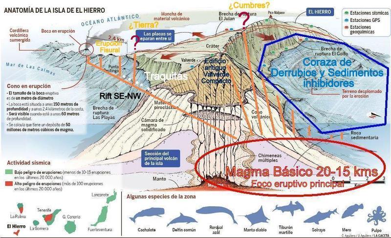
From the drawing you posted, the vent, shaft of the volcano is at 150m deep.
That's a lot of lava just to reach the surface.
I wonder how it will look if this continues for some time...
I don't know much on volcanoes, but could it be that a new shaft is forming through and lava will pour out on the surface?
Or how does it actually works??
Originally posted by angelchemuel
reply to post by Antoniastar
Sorry, still not got the hang of this posting videos bit!
Here's a direct link, maybe somebody can get it up here 'properly'!
www.youtube.com...
Rainbows
Jane
Here you go.
I'll give you a tip that helped me figure out how to add images and videos to posts. Go to a post that has a video embedded, and click quote. It will come up with the code that they entered to achieve their ATS wizadry. In this case, you just copy everything after "/watch?v=" part of the youtube URL.
reply to post by intergalactic fire
If the current vent stays active long enough, then it is possible that it will breach the surface. An example of this occuring is the newly formed volcanic island of Surtsey. It is this island that the current El Hierro eruption style is named after. Surtsey rose from water of about 130 metres depth, and erupted for many years to reach it's final size, although erosion has since diminished the islands size.
I'm not sure if the El Hierro eruption is likely to stay in this eruptive phase at the same vent long enough for an island to form, but I guess we'll just have to wait and see.
edit on 6/11/11 by Curious and Concerned because: rosion does not equal erosion...
Lot's of info just been posted on
earthquake-report. It just
came through on my news feed. Interesting reading.
Volcano-logical Institute confirms an increase in carbon dioxide emissions
Posted before 1 h ..
"The volcanological Institute of the Canaries (non-tip) confirmed the direction of the Civil Protection Plan for Volcanic Risk (Pevolca) a further increase in the diffuse emission of carbon dioxide (CO2) into the atmosphere from the volcano of El Hierro, according to informed the Government of the Canary Islands in a statement."
"The Regional Executive notes that, according to data from non-tip, the measured emission rate has reached the "1218 ± 46 tonnes per day", which is the highest value observed since the beginning of magmatic reactivation takes place on the Island"
"Since last July 21 the non-tip has materialized over 7250 flow measurement of carbon dioxide diffuse through numerous scientific investigations carried out in "the whole island subaerial volcanic edifice" which covers an area of 278 square kilometers, and which have contributed a lot volunteers canaries. The purpose of scientific research is to contribute to the improvement and optimization of monitoring, since the gases are the driving force of volcanic eruptions."
"The registration made more than three months ago the rate stood diffuse emission of carbon dioxide in the "331 ± 16 tons per day," the regional government, adding that the average of the emanation is 345 tons per day. On October 6, prior to the underwater eruption that took place southwest of La Restinga rate reached "990 ± 49", which means it was 2.8 times higher than normal average. Recent results show that this figure is now 3.5 times higher than usual."
"The direction of Pevolca states that the diffuse emission of CO2 is one of the parameters of a volcanic eruption precursors, but it has to be evaluated in conjunction with other deformation, and seismicity depth, among other things. Also remember that "we are in an eruptive process underway in the south of the island, which generates greenhouse gas emissions in the Earth's surface."
Source
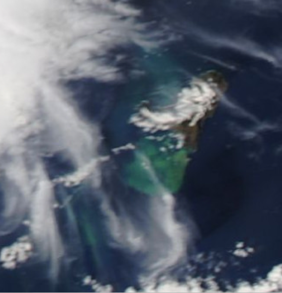
Latest satellite picture ..
Some graphic explanation, hope you find answer here intergalactic fire ..
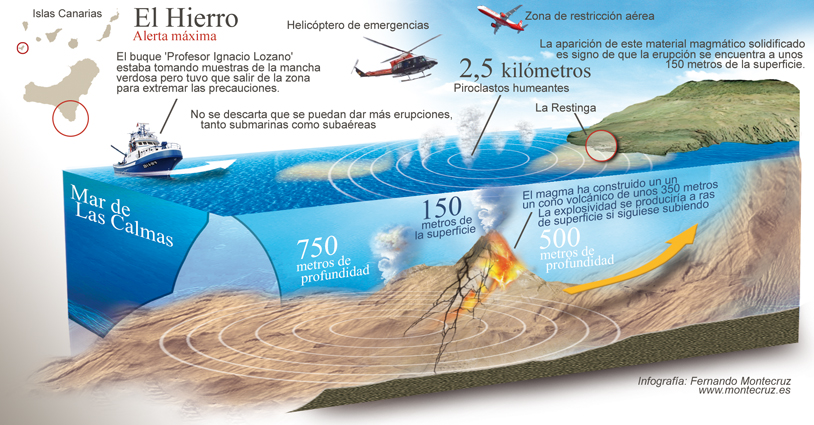
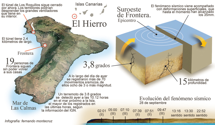
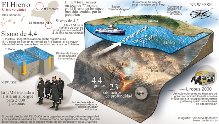
www.montecruz.es...
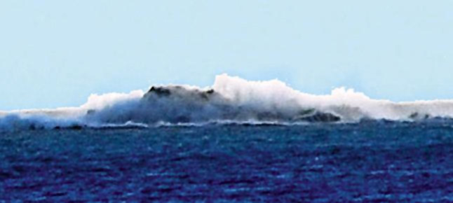
The steam and ash column rose 20 meters above the sea ..
The current eruptive episode, recorded yesterday afternoon at 18:00 and 18:05 hours, had two episodes of subaerial in the header, each lasting approximately one minute ..
The former reached a height of approximately 20 meters above the sea surface and the emission gases consisted of fine particles that drove volcanic material. The second had the same behavior, although with less magnitude ..
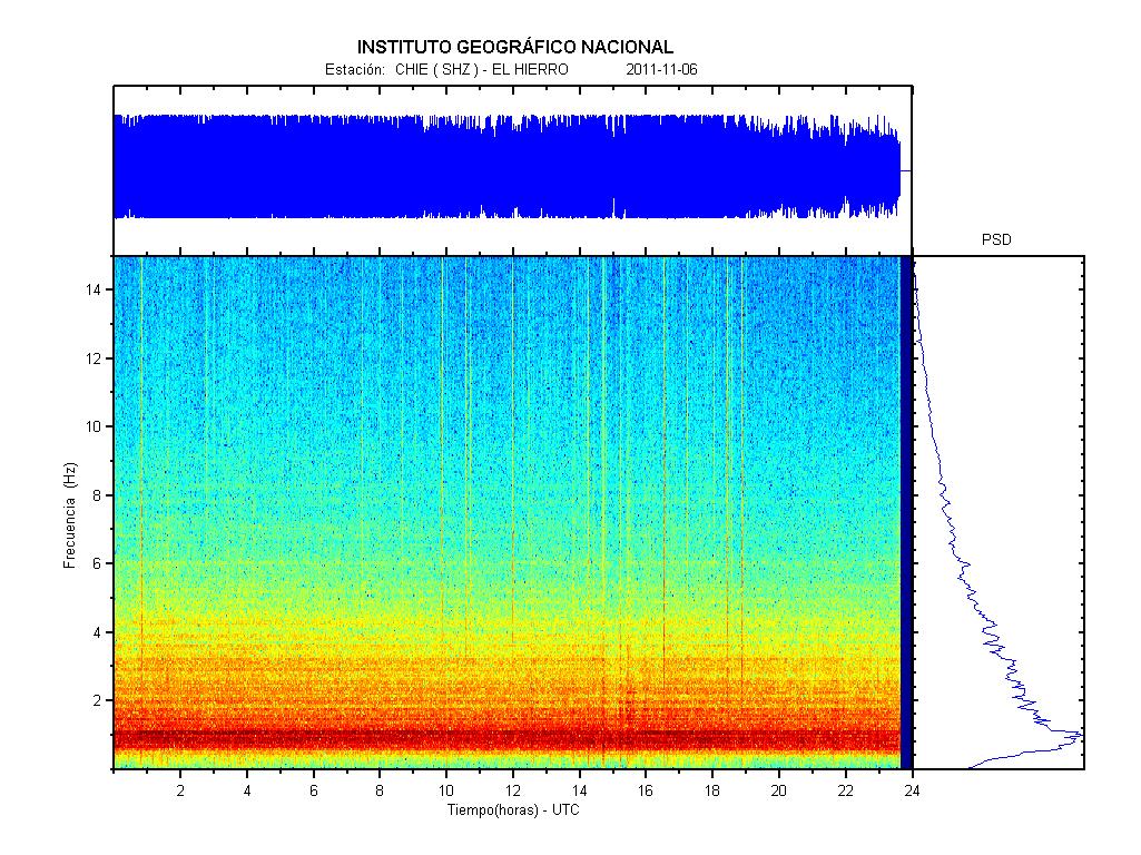
After this M 3.9 at 18:25 magma find way out somewhere, internal pressure was released you can see here on graph ..
1110645 06/11/2011 18:25:39 27.7838 -18.0482 20 3.9 mbLg NW FRONTERA.IHI [+]
Posted before 1 h ..
"The volcanological Institute of the Canaries (non-tip) confirmed the direction of the Civil Protection Plan for Volcanic Risk (Pevolca) a further increase in the diffuse emission of carbon dioxide (CO2) into the atmosphere from the volcano of El Hierro, according to informed the Government of the Canary Islands in a statement."
"The Regional Executive notes that, according to data from non-tip, the measured emission rate has reached the "1218 ± 46 tonnes per day", which is the highest value observed since the beginning of magmatic reactivation takes place on the Island"
"Since last July 21 the non-tip has materialized over 7250 flow measurement of carbon dioxide diffuse through numerous scientific investigations carried out in "the whole island subaerial volcanic edifice" which covers an area of 278 square kilometers, and which have contributed a lot volunteers canaries. The purpose of scientific research is to contribute to the improvement and optimization of monitoring, since the gases are the driving force of volcanic eruptions."
"The registration made more than three months ago the rate stood diffuse emission of carbon dioxide in the "331 ± 16 tons per day," the regional government, adding that the average of the emanation is 345 tons per day. On October 6, prior to the underwater eruption that took place southwest of La Restinga rate reached "990 ± 49", which means it was 2.8 times higher than normal average. Recent results show that this figure is now 3.5 times higher than usual."
"The direction of Pevolca states that the diffuse emission of CO2 is one of the parameters of a volcanic eruption precursors, but it has to be evaluated in conjunction with other deformation, and seismicity depth, among other things. Also remember that "we are in an eruptive process underway in the south of the island, which generates greenhouse gas emissions in the Earth's surface."
Source
Latest satellite picture ..

Some graphic explanation, hope you find answer here intergalactic fire ..


www.montecruz.es...
The steam and ash column rose 20 meters above the sea ..
The current eruptive episode, recorded yesterday afternoon at 18:00 and 18:05 hours, had two episodes of subaerial in the header, each lasting approximately one minute ..
The former reached a height of approximately 20 meters above the sea surface and the emission gases consisted of fine particles that drove volcanic material. The second had the same behavior, although with less magnitude ..
After this M 3.9 at 18:25 magma find way out somewhere, internal pressure was released you can see here on graph ..
1110645 06/11/2011 18:25:39 27.7838 -18.0482 20 3.9 mbLg NW FRONTERA.IHI [+]

edit on 6-11-2011 by Dalke07 because: (no reason given)
reply to post by Curious and Concerned
Interesting to know.
So this could go on for years and eventually form a whole new island.
6 of the 13 Canary Islands has a volcano, so probably they were all created by eruptions like we see today?
Those 6 islands also are the biggest of the Canary region.
Just an informative question.
How many time after the eruptions stopped on Surtsey, did they see fauna and flora on the island?
edit on 6-11-2011 by intergalactic fire
because: (no reason given)
new topics
-
Fire insurance in LA withdrawn months ago
General Conspiracies: 1 hours ago -
Bizarre Labour Party Tic Toc Video Becomes Even More Embarrassing
Regional Politics: 9 hours ago
top topics
-
The elephant in the room (wearing a hoodie)
US Political Madness: 16 hours ago, 14 flags -
Dr. Demento
Music: 16 hours ago, 6 flags -
Fire insurance in LA withdrawn months ago
General Conspiracies: 1 hours ago, 5 flags -
Bizarre Labour Party Tic Toc Video Becomes Even More Embarrassing
Regional Politics: 9 hours ago, 4 flags -
Potter to WHU
World Sports: 15 hours ago, 2 flags
active topics
-
Fire insurance in LA withdrawn months ago
General Conspiracies • 5 • : BeyondKnowledge3 -
-@TH3WH17ERABB17- -Q- ---TIME TO SHOW THE WORLD--- -Part- --44--
Dissecting Disinformation • 3979 • : Guyfriday -
Los Angeles brush fires latest: 2 blazes threaten structures, prompt evacuations
Mainstream News • 285 • : marg6043 -
Judge rules president-elect Donald Trump must be sentenced in 'hush money' trial
US Political Madness • 84 • : Vermilion -
S.C. Jack Smith's Final Report Says Trump Leads a Major Conspiratorial Criminal Organization!.
Political Conspiracies • 47 • : Vermilion -
Statements of Intent from Incoming Trump Administration Members - 2025 to 2029.
2024 Elections • 61 • : cherokeetroy -
Gravitic Propulsion--What IF the US and China Really Have it?
General Conspiracies • 39 • : budbayview -
The elephant in the room (wearing a hoodie)
US Political Madness • 26 • : xuenchen -
Its Looking Like Schiff - Vindman - Ciaramella Conspired to Impeach President Trump.
Political Conspiracies • 188 • : WeMustCare -
Trump's idea to make Canada the 51st US state: 'Potential is massive'
Mainstream News • 155 • : DaydreamerX

