It looks like you're using an Ad Blocker.
Please white-list or disable AboveTopSecret.com in your ad-blocking tool.
Thank you.
Some features of ATS will be disabled while you continue to use an ad-blocker.
share:
OH Boy OH Boy a whole new area for conspiracies to germinate and flourish. Goodie Goodie I can't wait.
Here are some footage about Operation High Jump.
70 minutes color documentarie: Operation High Jum "secret land"
Some others:
70 minutes color documentarie: Operation High Jum "secret land"
Some others:
Sounds good to me, worth 2 cents maybe.
Originally posted by estebadia
maybe they used the submarine to break some ice
more seriously, think about cold war, spies, international waters, and the necessity of having a submarine capable of an underwater surveillance in case of the russian send a sub too .
my idea, worth a penny ?
They did have icebreakers with them though, so I'll go with the Russian sub theory.
reply to post by keyseeker
I'm a firm believer in centripetal force and that the planets are hollow and inside our planet there is many different civilization and life. There is a ton of evidence supporting this, artic flights, satillite paths, Byrd, Verne, Polo, doctored photos from NASA. I've been to Mt. Shasta where there is a believed underground domed city called Telos, I have never been to Telos but as child camping up at Shasta I've seen many of weird things ufos, lights...
Very cool find!
i remember seeing a thread regarding ancient maps that detailed what was under the ice up there,
Its one of the plaes on my to go list .
keep us posted
Its one of the plaes on my to go list .
keep us posted
Seems like the only way of entrance to the holes in Antartica is by means of flying.
reply to post by EarthOccupant
Thanks for that link Been looking for a copy of the whole film for some time. I have seen the clip of the warm area before. What amazes me is that no one has done a follow up on that . It is certainly not on any maps or google Earth. Yet the NAVY film clearly shows a large expanse that is ice free
Thanks for that link Been looking for a copy of the whole film for some time. I have seen the clip of the warm area before. What amazes me is that no one has done a follow up on that . It is certainly not on any maps or google Earth. Yet the NAVY film clearly shows a large expanse that is ice free
Originally posted by MystiqueAgent
Hmm I'm starting to see a lot of correlation with Antarctica and everything that lies south of the equator. It seems we need some investigators of our own to go down and see what's going on there.
Everything south of the equator covers a LOT of territory... can we be more specific on where those investigators should start
Originally posted by marriah3330
Ditto, youd think that if there was a whole TV crew missing, we would be able to find SOMETHING such as news reports, newspaper reports, hell even the enquier magazine, but all i found was this same exact article over and over again,
What part of "it was a story for a book" did you misunderstand?
reply to post by zorgon
I guess the part I missed was where they didnt mention it was in a book, that was the part I missed I guess, a big part.
I guess the part I missed was where they didnt mention it was in a book, that was the part I missed I guess, a big part.
Originally posted by marriah3330
I guess the part I missed was where they didnt mention it was in a book, that was the part I missed I guess, a big part.
Yeah but don't worry about it... It was released as a news story originally. It had me chasing it down too when I saw it originally It was just that I posted the book stuff the post before yours
Originally posted by Lil Drummerboy
After NASA's letdown of the Space object that was just a Black hole.
I am completely deflated..
no energy for excitement.
That comment and this thread as a whole really sums up the mindset of ATSers.
The NASA survey is to study the ice cover and surface features below the ice in order to better ascertain the effects of future ice melt in the region. They are not looking for Hogwarts Castle or Atantis so the likelihood of them announcing they've found something which doesn't exist there is somewhat lower than the likelihood that John Wayne was actually an 19ft tall black martian.
You guys really do set yourselves up for disappointment every time
On the other hand, looking forward from a scientific aspect to seeing the results of this scientific survey.
Originally posted by Essan
You guys really do set yourselves up for disappointment every time
No you are wrong. NASA sets us up every time.. making a big fuss about an upcoming press release then disappointing us every time.
If it's just about ice... been there done that, the Vostok studies are more reliable than good ole NASA
edit on 18-11-2010 by zorgon
because: ArMaP did it!!
I have read somewhere that the ice-free area is explained by the fact that Antarctica is basically a desert and the area with no ice receives almost zero precipitation.
Originally posted by zorgon
reply to post by EarthOccupant
Thanks for that link Been looking for a copy of the whole film for some time. I have seen the clip of the warm area before. What amazes me is that no one has done a follow up on that . It is certainly not on any maps or google Earth. Yet the NAVY film clearly shows a large expanse that is ice free
Originally posted by butcherguyI have read somewhere that the ice-free area is explained by the fact that Antarctica is basically a desert and the area with no ice receives almost zero precipitation.
That would not account for the lakes that are not frozen over when the rest of the continent is under a sheet of ice. I guess I have to do some more digging.
And I have another problem... I just took for granted that the NASA image of Lake Vostok was the real deal
yet how do we see its shore line when it is buried 3700 meters beneath the ice?
As to that warm area with several lakes not frozen... NOWHERE on any images can I find it
The red oval is lake Vostok
Seems I have some work to do. One would thing that open water lakes in Antarctica would command more attention and investigation. Very odd that it is so hard to find any info on this
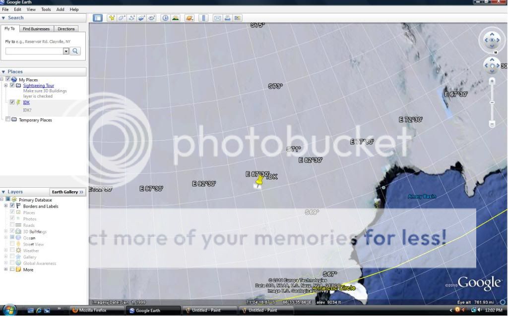
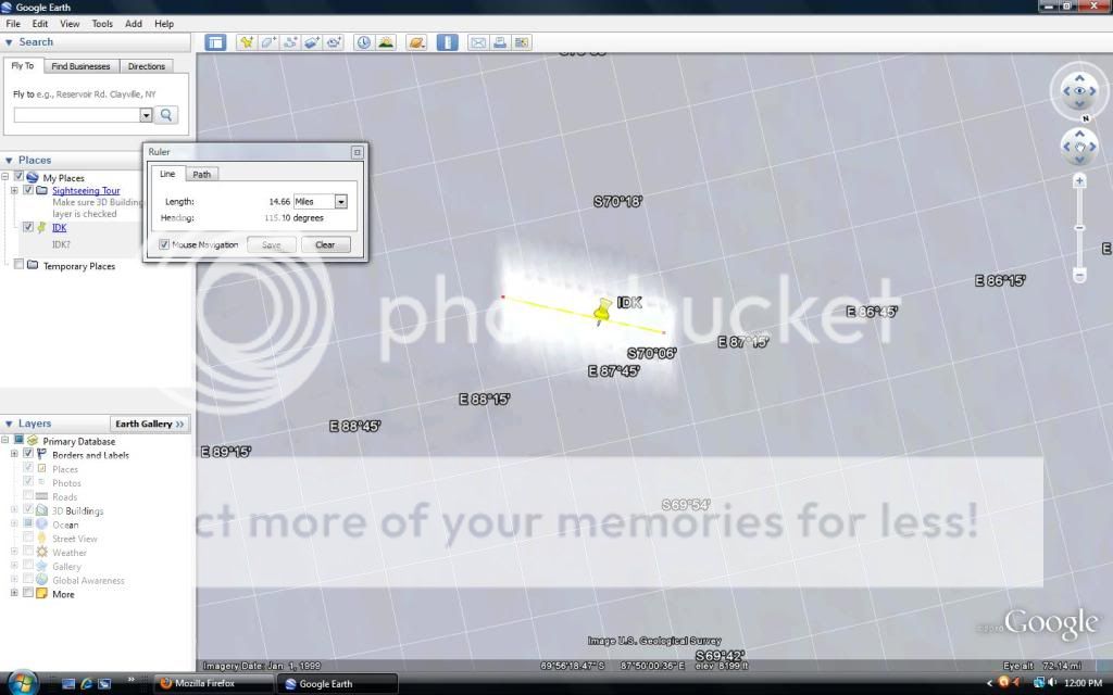
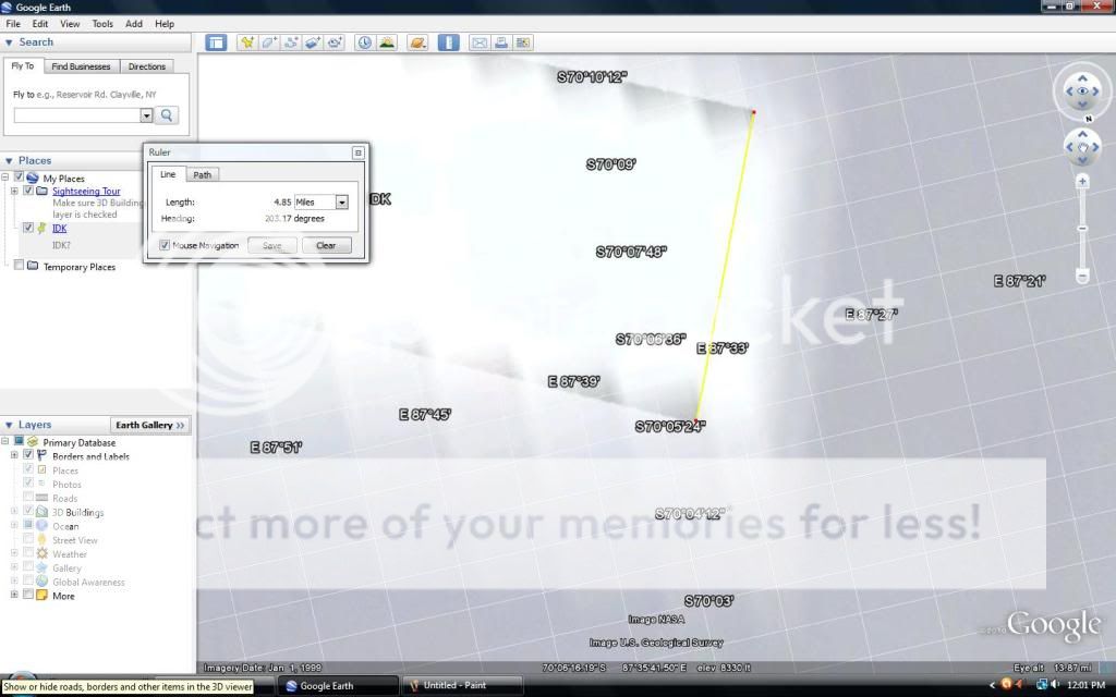
Does anyone know whats at 70° 9'1.00"S, 87°46'22.64"E and why it looks like that on google earth? It's approximately 14 1/2 miles long, and 4
1/2 miles wide. It looks to be partially green underneath but it has a white fog type of covering above it, maybe its nothing, I'm not very familiar
with google earth, but I did find it intriguing none-the-less for the fact of it looking like a piece of land, whether it is or not. But, I just
thought I would add it in anyways.


new topics
-
Judge rules president-elect Donald Trump must be sentenced in 'hush money' trial
US Political Madness: 4 hours ago -
Farmers wife
Music: 5 hours ago -
NJ Drones tied to Tesla explosion at Trump Las vegas
General Conspiracies: 6 hours ago -
New Jersey-Teachers Can Now Be Certified Without Passing Basic Reading Writing Math Testing
Education and Media: 9 hours ago
top topics
-
Matthew Livelsberger said he was being followed by FBI
Political Conspiracies: 12 hours ago, 16 flags -
Here we again... CHINA having mass outbreak of something
Diseases and Pandemics: 16 hours ago, 9 flags -
The 119th Congress has Officially Opened for Business
Mainstream News: 16 hours ago, 7 flags -
New Jersey-Teachers Can Now Be Certified Without Passing Basic Reading Writing Math Testing
Education and Media: 9 hours ago, 7 flags -
Paranoid Liberals Believe U.S. Service Members are More Dangerous than Illegal Aliens.
Social Issues and Civil Unrest: 15 hours ago, 6 flags -
How the Sikhs Deal with Muslim Grooming Gangs – Tommy Robinson
Social Issues and Civil Unrest: 14 hours ago, 6 flags -
NJ Drones tied to Tesla explosion at Trump Las vegas
General Conspiracies: 6 hours ago, 3 flags -
Farmers wife
Music: 5 hours ago, 1 flags -
Judge rules president-elect Donald Trump must be sentenced in 'hush money' trial
US Political Madness: 4 hours ago, 0 flags
active topics
-
Judge rules president-elect Donald Trump must be sentenced in 'hush money' trial
US Political Madness • 4 • : Lazy88 -
Paranoid Liberals Believe U.S. Service Members are More Dangerous than Illegal Aliens.
Social Issues and Civil Unrest • 31 • : Irishhaf -
Candidate TRUMP Now Has Crazy Judge JUAN MERCHAN After Him - The Stormy Daniels Hush-Money Case.
Political Conspiracies • 2173 • : WeMustCare -
Tesla Cybertruck Explodes in Front of Trump Hotel in Las Vegas
Mainstream News • 198 • : Mantiss2021 -
Matthew Livelsberger said he was being followed by FBI
Political Conspiracies • 63 • : BeyondKnowledge3 -
Musk calls on King Charles III to dissolve Parliament over Oldham sex grooming gangs
Mainstream News • 88 • : WeMustCare -
-@TH3WH17ERABB17- -Q- ---TIME TO SHOW THE WORLD--- -Part- --44--
Dissecting Disinformation • 3923 • : RelSciHistItSufi -
Watts home paranormal activity
Paranormal Studies • 6 • : TowmasterLG -
Congress Says the FBI is Covering Up Vital Info on the Jan 5th 2021 D.C. Pipe Bombs at RNC-DNC.
Political Conspiracies • 28 • : GotterDameron23 -
New Jersey-Teachers Can Now Be Certified Without Passing Basic Reading Writing Math Testing
Education and Media • 9 • : rickymouse


