It looks like you're using an Ad Blocker.
Please white-list or disable AboveTopSecret.com in your ad-blocking tool.
Thank you.
Some features of ATS will be disabled while you continue to use an ad-blocker.
share:
originally posted by: turretless
The emblem of the Jewish Autonomous Region (Еврейская автономная область)
Is this the first rainbow flag then? When they decided on it poses an interesting question; why the same flag as something else? Did gay rights movement copy the concept?
Given Tel Aviv's reputation for parades and such.
(not attempting to bring religion in to this)
edit on 2-5-2022 by Asktheanimals because: (no reason given)
edit on 3-5-2022 by
Asktheanimals because: (no reason given)
originally posted by: Asktheanimals
Is this the first rainbow flag then? When they decided on it poses an interesting question; why the same flag as something else? Did gay rights movement copy the concept?
Given Tel Aviv's reputation for parades and such.
(not attempting to bring religion in to this)
The flag was approved on November 27, 1996.
The white color of the main part of the flag symbolizes purity.
The rainbow is a biblical symbol of peace, happiness, goodness. The number of rainbow stripes is equal to the number of candles in the menorah (one of the national and religious Jewish symbols). The menorah speaks of the creation of the world in seven days, and the number of rainbow stripes emphasizes the connection with the ancient Jewish symbol. The rainbow can also symbolize the Seven Laws of the descendants of Noah.
The emblem of the Bryansk region (Брянская область)
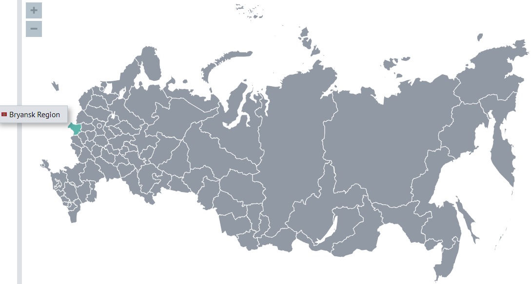
The region borders: in the south with the Sumy and Chernihiv regions of Ukraine, in the west with the Gomel and Mogilev regions of the Republic of Belarus.
It is an area of 34,857 square kilometers (its area is somewhat larger than the area of Belgium).
The population of the region is 1,168,771 (2022).
The region has existed in its modern form since 1944.
The territory of the Bryansk region has been inhabited by Slavic tribes since ancient times. In the 9th-11th centuries, the Severyane lived along the banks of the Desna, the Vyatichi lived on the wooded watershed of the Desna and Oka rivers, and the Radimichi lived in the basin of the Iput and Besed rivers. In the XII-XIII centuries, the Bryansk Territory was part of the Chernigov, and then Novgorod-Seversky principalities. From the 11th century, Vshchizh was the specific center of the Chernihiv Principality. After the ruin of Chernigov by the Mongol-Tatars, the princely capital was moved to Bryansk around 1246. Then the Bryansk principality was formed. Since 1356, the Bryansk lands were under the rule of the Grand Duchy of Lithuania, then the Polish-Lithuanian Commonwealth. At the beginning of the 16th century (according to the treaty of 1503), the region became part of the Muscovite state and became its southwestern outpost in the struggle against Lithuania, Poland and the Crimean Khanate.
In August-October 1941, the region was occupied by German troops. From the first days of the occupation, the struggle against the invaders took on the character of a nationwide movement. About 60 thousand partisans operated in the Bryansk forests. The invaders caused great damage to the region: cities (70% of the housing stock) and villages (111 thousand houses), industrial enterprises were destroyed and burned.
The climate is temperate continental. The average temperature in January is −7…−9 °C, the average temperature in July is +18...+20 °C.
A significant part of the region (about a quarter of the total area) is covered with forests. Forests of various types: coniferous, mixed and broad-leaved, as well as forest-steppe.
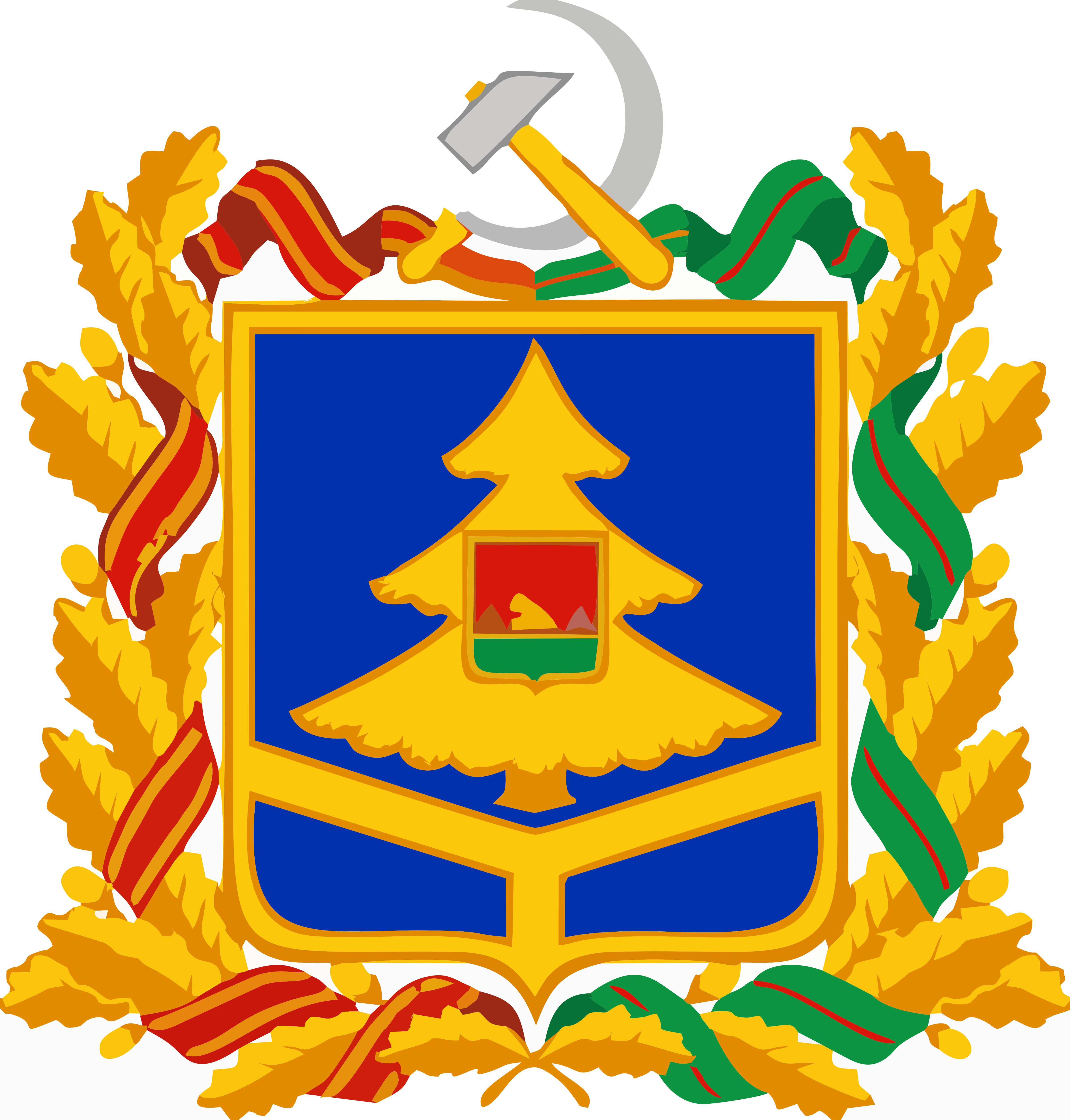
The emblem of the Bryansk region is a blue French shield. Blue is the color of Slavic unity adopted in heraldry. In the lower part of the shield, three golden rays diverge from one point, dividing it into three parts, each of which is a symbol of the unity of Russia, Ukraine and Belarus; the same element indicates the historical geopolitical position of Bryansk at the junction of three Slavic states. The stylized image of a golden spruce with three rows of branches located at the top of the shield is a symbol of the Bryansk forests. In the center of the shield is the coat of arms of the capital city of the Bryansk region. The oak wreath bordering the emblem determines the status of the region as a subject of the Russian Federation. The left side of the wreath is intertwined with the ribbon of the Order of Lenin, which the region was awarded in 1967, the right side of the wreath is intertwined with the ribbon of the medal "The Partisan of the Great Patriotic War". The hammer and sickle above the center of the coat of arms symbolizes not only the unbreakable union of workers and peasants, but also the fact that the region is a territorial entity created under Soviet rule.
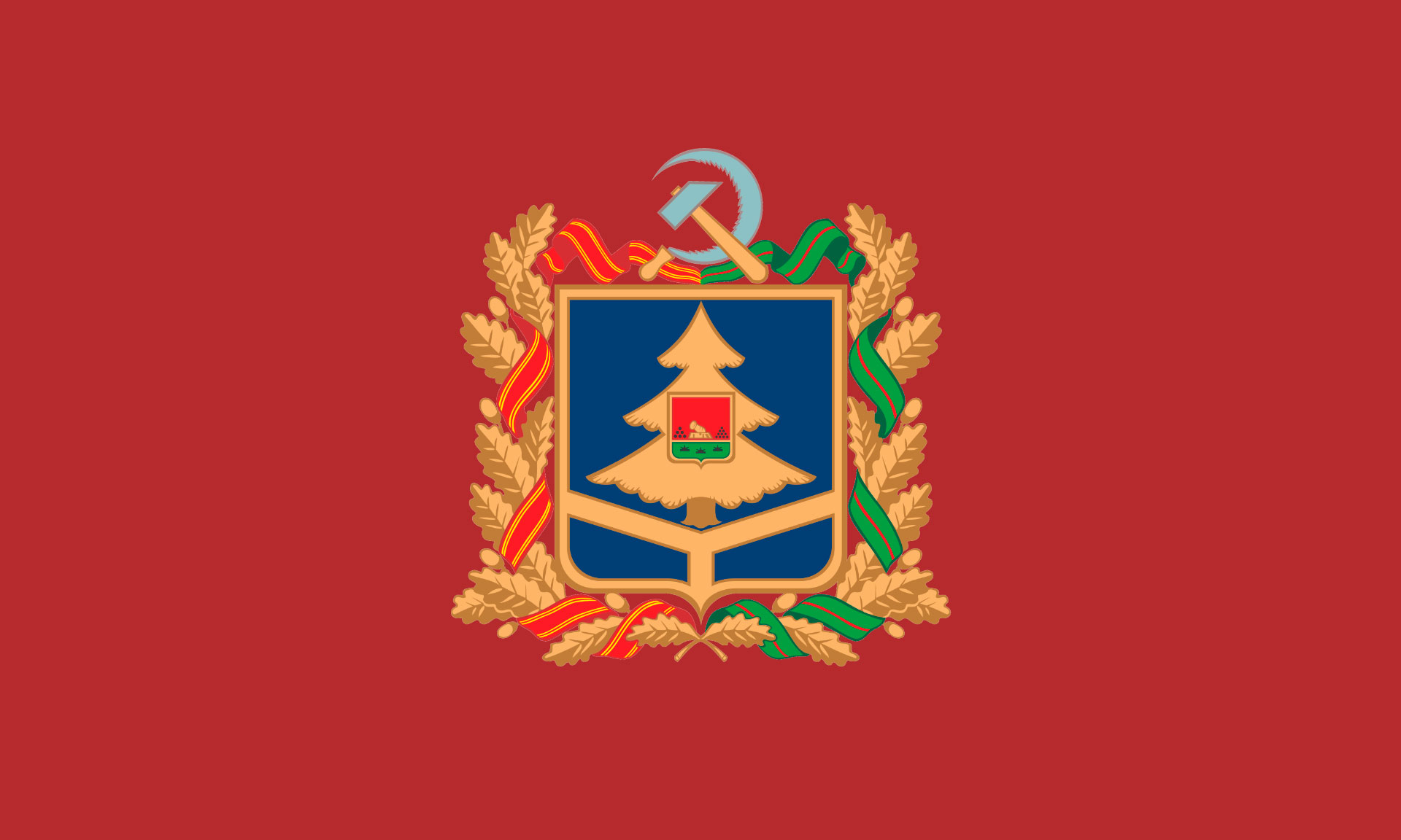
The flag of the Bryansk region
The main city of the Bryansk Region is Bryansk (Брянск)
The city is located on the western outskirts of the Central Russian Upland, on both banks of the Desna River at the confluence of the Bolva and Snezhet rivers.
The exact date of the founding of Bryansk is unknown. Archaeological data obtained during excavations of the old settlement indicate that the city on the territory of present-day Bryansk arose in the last quarter of the 10th century. Based on these data, 985 is considered the conditional year of the foundation of Bryansk. The city was first mentioned in the Ipatiev Chronicle as Debriansk in 1146. The old Russian word "дебрь" means a mountain slope, gorge, ditch, valley or lowland, overgrown with dense forest and shrubs.
Ancient Bryansk was part of the Chernigov Principality. After the destruction by the Mongols in 1239 of Chernigov, Novgorod-Seversky and other cities of the Chernigov principality, the center of the diocese and the capital of the principality in 1246 moved to the surviving Bryansk. Thus the Bryansk principality was formed. His first prince was Roman Mikhailovich, whose heir was to be his son Oleg. However, after he was tonsured a monk, Bryansk, according to the khan's label, was unexpectedly transferred to the Smolensk princes. So in the Golden Horde they prevented the excessive strengthening of the Chernihiv land. In 1310, the city was devastated by the Tatars, brought by Prince Vasily Alexandrovich against his uncle Svyatoslav Glebovich.
In 1356, the Lithuanian prince Olgerd annexed Bryansk to the Grand Duchy of Lithuania. In 1500, the city was taken without a fight by the troops of Ivan III and annexed to the Russian state. At the beginning of the 16th century, a new war broke out with Lithuania, during which Bryansk acted as a stronghold of Russian forces. For many years Bryansk was a bone of contention between the Polish-Lithuanian Commonwealth and the Russian kingdom. The name of the city was present in almost every peace treaty.
In 1709, the city became part of the Kyiv province, since 1727, as part of the Sevsk province, it was transferred to the Belgorod province, and since 1778 it became part of the newly formed Oryol viceroy.
During the Great Patriotic War, on October 6, 1941, the city was occupied by German troops. On September 17, 1943, Bryansk was liberated by Soviet troops, currently this date is celebrated as City Day.
The population of the city is 399,579 (2021).
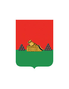
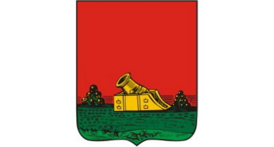
The emblem of the city of Bryansk is depicted as a French shield.
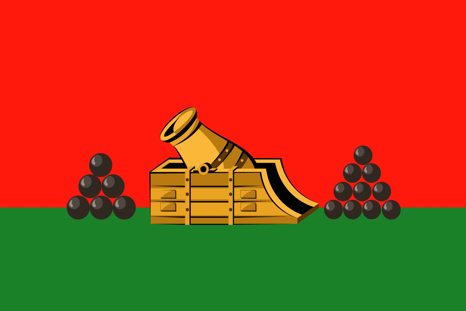
The upper part of the shield is a red background (a symbol of courage, fortitude, fearlessness). The lower part of the shield is a green background (a symbol of hope, joy, abundance), on which there is a golden mortar (a symbol of wealth, justice, generosity) with pyramids of nuclei covered with black (a symbol of sadness, prudence, humility) placed on both sides of it.
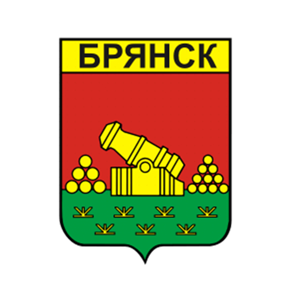
The Soviet emblem of Bryansk
The emblem of Bryansk (1781)
The flag of the Bryansk

The region borders: in the south with the Sumy and Chernihiv regions of Ukraine, in the west with the Gomel and Mogilev regions of the Republic of Belarus.
It is an area of 34,857 square kilometers (its area is somewhat larger than the area of Belgium).
The population of the region is 1,168,771 (2022).
The region has existed in its modern form since 1944.
The territory of the Bryansk region has been inhabited by Slavic tribes since ancient times. In the 9th-11th centuries, the Severyane lived along the banks of the Desna, the Vyatichi lived on the wooded watershed of the Desna and Oka rivers, and the Radimichi lived in the basin of the Iput and Besed rivers. In the XII-XIII centuries, the Bryansk Territory was part of the Chernigov, and then Novgorod-Seversky principalities. From the 11th century, Vshchizh was the specific center of the Chernihiv Principality. After the ruin of Chernigov by the Mongol-Tatars, the princely capital was moved to Bryansk around 1246. Then the Bryansk principality was formed. Since 1356, the Bryansk lands were under the rule of the Grand Duchy of Lithuania, then the Polish-Lithuanian Commonwealth. At the beginning of the 16th century (according to the treaty of 1503), the region became part of the Muscovite state and became its southwestern outpost in the struggle against Lithuania, Poland and the Crimean Khanate.
In August-October 1941, the region was occupied by German troops. From the first days of the occupation, the struggle against the invaders took on the character of a nationwide movement. About 60 thousand partisans operated in the Bryansk forests. The invaders caused great damage to the region: cities (70% of the housing stock) and villages (111 thousand houses), industrial enterprises were destroyed and burned.
The climate is temperate continental. The average temperature in January is −7…−9 °C, the average temperature in July is +18...+20 °C.
A significant part of the region (about a quarter of the total area) is covered with forests. Forests of various types: coniferous, mixed and broad-leaved, as well as forest-steppe.

The emblem of the Bryansk region is a blue French shield. Blue is the color of Slavic unity adopted in heraldry. In the lower part of the shield, three golden rays diverge from one point, dividing it into three parts, each of which is a symbol of the unity of Russia, Ukraine and Belarus; the same element indicates the historical geopolitical position of Bryansk at the junction of three Slavic states. The stylized image of a golden spruce with three rows of branches located at the top of the shield is a symbol of the Bryansk forests. In the center of the shield is the coat of arms of the capital city of the Bryansk region. The oak wreath bordering the emblem determines the status of the region as a subject of the Russian Federation. The left side of the wreath is intertwined with the ribbon of the Order of Lenin, which the region was awarded in 1967, the right side of the wreath is intertwined with the ribbon of the medal "The Partisan of the Great Patriotic War". The hammer and sickle above the center of the coat of arms symbolizes not only the unbreakable union of workers and peasants, but also the fact that the region is a territorial entity created under Soviet rule.
The flag of the Bryansk region

The main city of the Bryansk Region is Bryansk (Брянск)
The city is located on the western outskirts of the Central Russian Upland, on both banks of the Desna River at the confluence of the Bolva and Snezhet rivers.
The exact date of the founding of Bryansk is unknown. Archaeological data obtained during excavations of the old settlement indicate that the city on the territory of present-day Bryansk arose in the last quarter of the 10th century. Based on these data, 985 is considered the conditional year of the foundation of Bryansk. The city was first mentioned in the Ipatiev Chronicle as Debriansk in 1146. The old Russian word "дебрь" means a mountain slope, gorge, ditch, valley or lowland, overgrown with dense forest and shrubs.
Ancient Bryansk was part of the Chernigov Principality. After the destruction by the Mongols in 1239 of Chernigov, Novgorod-Seversky and other cities of the Chernigov principality, the center of the diocese and the capital of the principality in 1246 moved to the surviving Bryansk. Thus the Bryansk principality was formed. His first prince was Roman Mikhailovich, whose heir was to be his son Oleg. However, after he was tonsured a monk, Bryansk, according to the khan's label, was unexpectedly transferred to the Smolensk princes. So in the Golden Horde they prevented the excessive strengthening of the Chernihiv land. In 1310, the city was devastated by the Tatars, brought by Prince Vasily Alexandrovich against his uncle Svyatoslav Glebovich.
In 1356, the Lithuanian prince Olgerd annexed Bryansk to the Grand Duchy of Lithuania. In 1500, the city was taken without a fight by the troops of Ivan III and annexed to the Russian state. At the beginning of the 16th century, a new war broke out with Lithuania, during which Bryansk acted as a stronghold of Russian forces. For many years Bryansk was a bone of contention between the Polish-Lithuanian Commonwealth and the Russian kingdom. The name of the city was present in almost every peace treaty.
In 1709, the city became part of the Kyiv province, since 1727, as part of the Sevsk province, it was transferred to the Belgorod province, and since 1778 it became part of the newly formed Oryol viceroy.
During the Great Patriotic War, on October 6, 1941, the city was occupied by German troops. On September 17, 1943, Bryansk was liberated by Soviet troops, currently this date is celebrated as City Day.
The population of the city is 399,579 (2021).

The emblem of the city of Bryansk is depicted as a French shield.
The upper part of the shield is a red background (a symbol of courage, fortitude, fearlessness). The lower part of the shield is a green background (a symbol of hope, joy, abundance), on which there is a golden mortar (a symbol of wealth, justice, generosity) with pyramids of nuclei covered with black (a symbol of sadness, prudence, humility) placed on both sides of it.
The Soviet emblem of Bryansk

The emblem of Bryansk (1781)

The flag of the Bryansk

The emblem of the Vladimir region (Владимирская область)
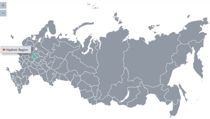
The region borders on the Moscow region.
It is an area of 29,084 square kilometers (its area is somewhat larger than the area of Albania and somewhat smaller than the area of Belgium).
The population of the region is 1,323,659 (2022).
The region has existed in its modern form since 1944.
From the 10th century, the Slavic colonization of the region began, the cities of Murom and Suzdal arose. The territory of the modern Vladimir region became part of Kievan Rus. In the XI century, the territory became part of the Rostov-Suzdal principality, in the XII century it became part of the Vladimir-Suzdal principality.
The Grand Duchy of Vladimir (1157-1362) was formed in connection with the transfer of the capital of the Rostov-Suzdal principality to Vladimir by the Prince Andrei Bogolyubsky.
There are several points of view on the date of foundation of the city. According to one version, it was founded by Prince Vladimir Svyatoslavich in 990, according to another, it was founded in 1108 by Prince Vladimir Monomakh. Under Prince Andrei Bogolyubsky (around 1111-1174) and his successors, the city flourished.
In the second half of the 12th - early 13th centuries, the Grand Vladimir Principality was the largest economic, political and cultural center of Russia. The transfer of the political center of Russia to Vladimir played a big role in the formation of the Russian nation. At the beginning of the XIII century, the Tatar-Mongol invasion dealt an irreparable blow to the economic and political power of the principality. In 1238, the cities of Vladimir, Pereslavl-Zalessky, Suzdal, Yuryev-Polsky were devastated.
From the time of Ivan Kalita (1284-1340) [he was the Duke of Moscow and the Grand Duke of Vladimir], the role of Vladimir as a capital city ceased. However, the political and cultural traditions of the Grand Vladimir Principality were adopted by the Grand Duchy of Moscow during the formation of the Russian centralized state. The process of joining the Vladimir lands to Moscow actually ended in the 16th century under Ivan the Terrible (1530-1584).
The Vladimir province was one of the most industrially developed provinces in the European part of Russia. Since the 17th century, textile production has been developing in it. Ironworks were built there. Glass factories were founded in the second half of the 18th century.
During the Great Patriotic War, the Vladimir region was located next to the active front, but the bloody battles and occupation did not touch the region.
The climate of the region is temperate continental, with warm summers, moderately cold winters and pronounced transitional seasons. The duration of the period with an average daily temperature below 0 °C is 137 days, the average annual temperature is 5 °C, the average temperature in January is −12 °C, and in July about +18 °C. The average annual rainfall is 550-600 mm, with maximum precipitation in summer. In winter, a stable snow cover is formed, up to 55 cm thick by the end of March.
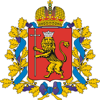
The emblem of the Vladimir region is an image of a golden lion leopard [as written in the original], in an iron crown decorated with gold and colored stones, holding in its right paw a long silver cross on a red background. There is a crown above the shield and it is surrounded by golden oak leaves connected by St. Andrew's ribbon.
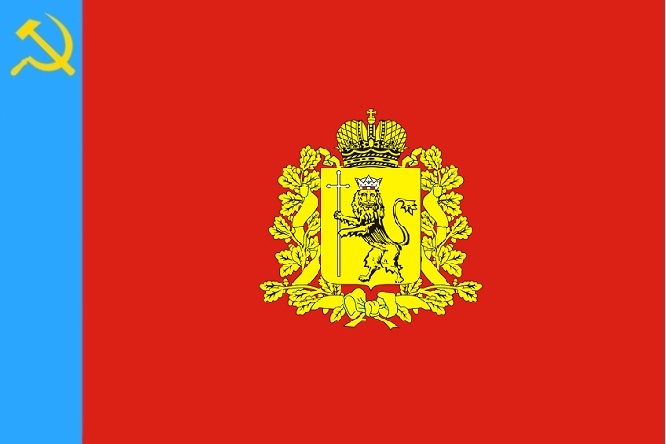
The flag of the Vladimir region

The region borders on the Moscow region.
It is an area of 29,084 square kilometers (its area is somewhat larger than the area of Albania and somewhat smaller than the area of Belgium).
The population of the region is 1,323,659 (2022).
The region has existed in its modern form since 1944.
From the 10th century, the Slavic colonization of the region began, the cities of Murom and Suzdal arose. The territory of the modern Vladimir region became part of Kievan Rus. In the XI century, the territory became part of the Rostov-Suzdal principality, in the XII century it became part of the Vladimir-Suzdal principality.
The Grand Duchy of Vladimir (1157-1362) was formed in connection with the transfer of the capital of the Rostov-Suzdal principality to Vladimir by the Prince Andrei Bogolyubsky.
There are several points of view on the date of foundation of the city. According to one version, it was founded by Prince Vladimir Svyatoslavich in 990, according to another, it was founded in 1108 by Prince Vladimir Monomakh. Under Prince Andrei Bogolyubsky (around 1111-1174) and his successors, the city flourished.
In the second half of the 12th - early 13th centuries, the Grand Vladimir Principality was the largest economic, political and cultural center of Russia. The transfer of the political center of Russia to Vladimir played a big role in the formation of the Russian nation. At the beginning of the XIII century, the Tatar-Mongol invasion dealt an irreparable blow to the economic and political power of the principality. In 1238, the cities of Vladimir, Pereslavl-Zalessky, Suzdal, Yuryev-Polsky were devastated.
From the time of Ivan Kalita (1284-1340) [he was the Duke of Moscow and the Grand Duke of Vladimir], the role of Vladimir as a capital city ceased. However, the political and cultural traditions of the Grand Vladimir Principality were adopted by the Grand Duchy of Moscow during the formation of the Russian centralized state. The process of joining the Vladimir lands to Moscow actually ended in the 16th century under Ivan the Terrible (1530-1584).
The Vladimir province was one of the most industrially developed provinces in the European part of Russia. Since the 17th century, textile production has been developing in it. Ironworks were built there. Glass factories were founded in the second half of the 18th century.
During the Great Patriotic War, the Vladimir region was located next to the active front, but the bloody battles and occupation did not touch the region.
The climate of the region is temperate continental, with warm summers, moderately cold winters and pronounced transitional seasons. The duration of the period with an average daily temperature below 0 °C is 137 days, the average annual temperature is 5 °C, the average temperature in January is −12 °C, and in July about +18 °C. The average annual rainfall is 550-600 mm, with maximum precipitation in summer. In winter, a stable snow cover is formed, up to 55 cm thick by the end of March.

The emblem of the Vladimir region is an image of a golden lion leopard [as written in the original], in an iron crown decorated with gold and colored stones, holding in its right paw a long silver cross on a red background. There is a crown above the shield and it is surrounded by golden oak leaves connected by St. Andrew's ribbon.
The flag of the Vladimir region

The main city of the Vladimir Region is Vladimir (Владимир)
In the past, the variants Vladimir-on-Klyazma and Vladimir-Zalessky were also used, which was associated with the existence of a city of the same name in Southwestern Russia - Vladimir in Volyn (now the Volyn region, Ukraine).
Vladimir begins to grow and intensify thanks to the care of Vladimir Monomakh and Yuri Dolgoruky, who strengthened it as a stronghold for the protection of the Rostov-Suzdal principality. Yuri Dolgoruky, who lived then in Suzdal, had a residence here.
The city owes its flourishing to Prince Andrei Bogolyubsky, who in 1157 moved the capital of the principality here. In Vladimir, as the new capital of North-Eastern Russia, the Assumption Cathedral (1158-1160) was erected. The Golden Gate (built around 1164) became the central point of defense of the city and at the same time a symbol of the capital's status. For the construction of these architectural masterpieces, Prince Andrei invited an architect who worked for the Holy Roman Emperor Frederick I Barbarossa.
Under the successors of Prince Andrei Bogolyubsky, the city expanded greatly. Along the perimeter of the city from the east, south and north, the Silver, Copper and Irina gates were built. In Vladimir and neighboring Suzdal, the Vladimir-Suzdal icon-painting school of painting developed. The city kept its own chronicle. The principality of Vladimir reached its highest power during the reign of Vsevolod the Big Nest (1176-1212), when the Demetrius Cathedral was built (1191). The title of “great” is finally assigned to the Vladimir princes.
In 1238, Vladimir was struck by the invasion of the Mongol-Tatars. Later, the city was several times subjected to Tatar raids, the heaviest of which was the ruin of the Dudeneva army in 1293.
Starting with Vasily Yaroslavich, in the conditions of increased fragmentation in North-Eastern Russia, Vladimir ceased to be the residence of the Grand Dukes, who now only performed the rite of enthronement in it, remaining to live in their hereditary lands. Nevertheless, it was the princes of Vladimir who were recognized in the Golden Horde by status as the main and oldest in all of Russia, thanks to which Vladimir remained the capital of the Russian lands. The Khan of the Horde issued a label for the great reign of Vladimir. The status of the city increased even more in 1299, when it became the residence of Russian metropolitans after the Kyiv Metropolitan Maxim moved to Vladimir.
An important milestone was the move in 1325 from Vladimir to Moscow under Ivan Kalita, Metropolitan Peter. Subsequently, Dmitry Donskoy managed to achieve recognition of hereditary rights to Vladimir from all neighboring princes and the Horde, which meant recognition of him as the Grand Duke of Vladimir and Moscow. At the same time, this also meant the annexation of the Vladimir lands to the Moscow principality.
In 1382, Vladimir, like other cities of North-Eastern Russia, suffered from the invasion of Khan Tokhtamysh. In 1410, Vladimir was raided and plundered by the Tatar prince Talych.
In 1861, traffic was opened along the Moscow-Vladimir line of the Moscow-Nizhny Novgorod railway. In December 1858, a telegraph began to operate in the city, in 1866 the construction of a water supply system was completed, in 1887 a telephone connection appeared.
During the Great Patriotic War, Vladimir was one of the largest evacuation centers in the European part of the country; in 1941-1945, a total of 18 evacuation hospitals were located in the city. Residents of the city donated about 40,000 liters of blood. In the autumn of 1941, Vladimir received many refugees from Moscow and the Moscow region, who were fleeing east from the German offensive. In 1944, the Gorky Vladimir Regional Library was opened and a concert and variety bureau was organized.
The population of the city is 352,347 (2021).
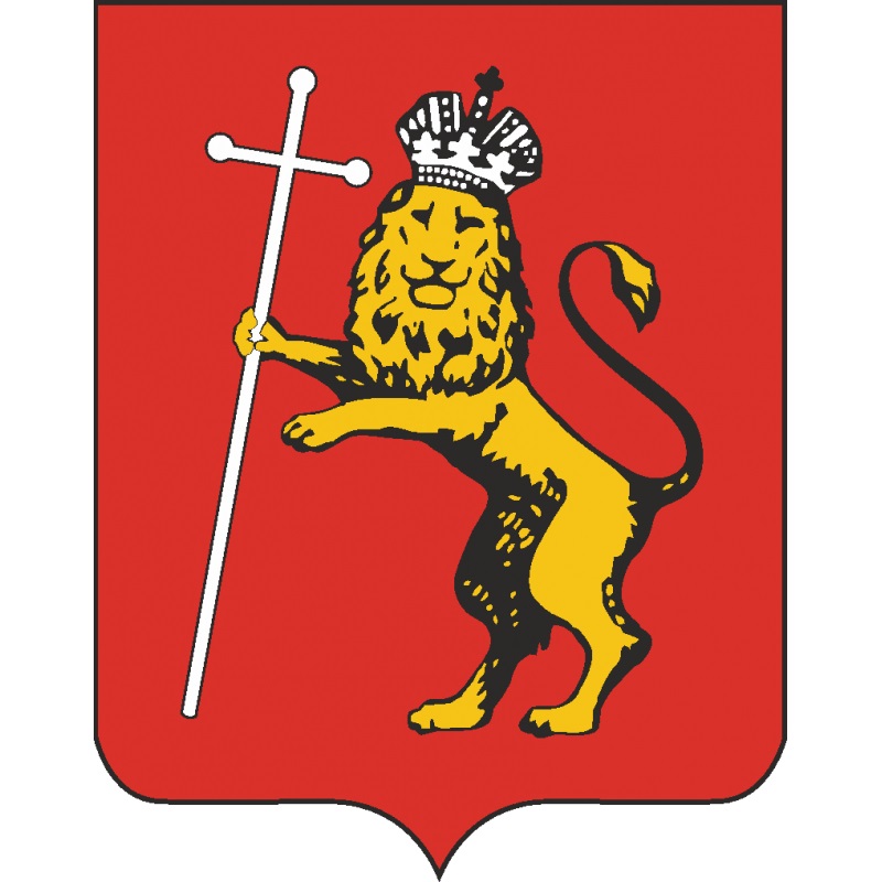
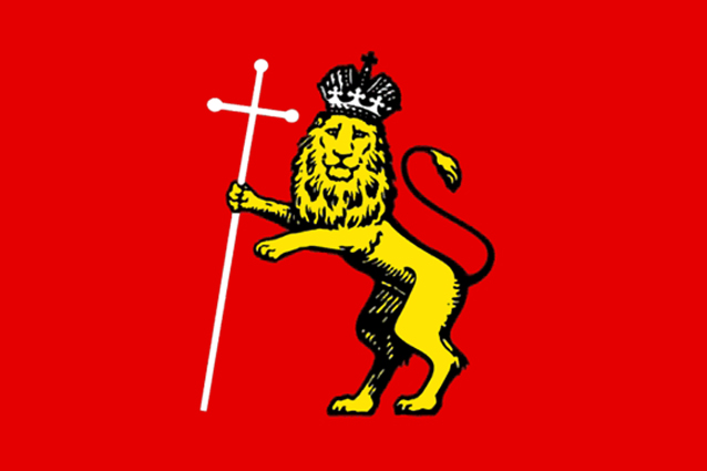
Against a red background, a lion standing on its hind legs, having an iron crown on its head, holds a long silver cross in its front right paw.
The emblem of the city of Vladimir is a lion. By its origin, it is one of the most ancient in Russian heraldry, it is over seven hundred years old. It originated in the 12th century as a family sign of the Vladimir-Suzdal princes. The image of a lion is one of the most common subjects in the decoration of churches built on Vladimir land in the 12th-14th centuries.
The figure of a lion in heraldry, as a rule, symbolizes strength, courage, power, which does not contradict the main political idea of the Vladimir-Suzdal princes in the XII-XIII centuries - the creation of princely power capable of overcoming the feudal fragmentation of Russia.
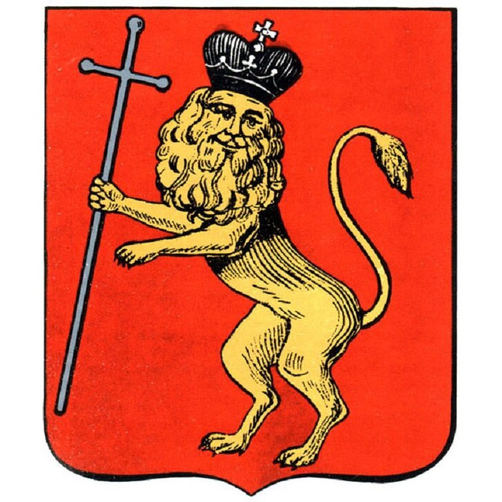
The emblem of Vladimir (1781)
The flag of the Vladimir
In the past, the variants Vladimir-on-Klyazma and Vladimir-Zalessky were also used, which was associated with the existence of a city of the same name in Southwestern Russia - Vladimir in Volyn (now the Volyn region, Ukraine).
Vladimir begins to grow and intensify thanks to the care of Vladimir Monomakh and Yuri Dolgoruky, who strengthened it as a stronghold for the protection of the Rostov-Suzdal principality. Yuri Dolgoruky, who lived then in Suzdal, had a residence here.
The city owes its flourishing to Prince Andrei Bogolyubsky, who in 1157 moved the capital of the principality here. In Vladimir, as the new capital of North-Eastern Russia, the Assumption Cathedral (1158-1160) was erected. The Golden Gate (built around 1164) became the central point of defense of the city and at the same time a symbol of the capital's status. For the construction of these architectural masterpieces, Prince Andrei invited an architect who worked for the Holy Roman Emperor Frederick I Barbarossa.
Under the successors of Prince Andrei Bogolyubsky, the city expanded greatly. Along the perimeter of the city from the east, south and north, the Silver, Copper and Irina gates were built. In Vladimir and neighboring Suzdal, the Vladimir-Suzdal icon-painting school of painting developed. The city kept its own chronicle. The principality of Vladimir reached its highest power during the reign of Vsevolod the Big Nest (1176-1212), when the Demetrius Cathedral was built (1191). The title of “great” is finally assigned to the Vladimir princes.
In 1238, Vladimir was struck by the invasion of the Mongol-Tatars. Later, the city was several times subjected to Tatar raids, the heaviest of which was the ruin of the Dudeneva army in 1293.
Starting with Vasily Yaroslavich, in the conditions of increased fragmentation in North-Eastern Russia, Vladimir ceased to be the residence of the Grand Dukes, who now only performed the rite of enthronement in it, remaining to live in their hereditary lands. Nevertheless, it was the princes of Vladimir who were recognized in the Golden Horde by status as the main and oldest in all of Russia, thanks to which Vladimir remained the capital of the Russian lands. The Khan of the Horde issued a label for the great reign of Vladimir. The status of the city increased even more in 1299, when it became the residence of Russian metropolitans after the Kyiv Metropolitan Maxim moved to Vladimir.
An important milestone was the move in 1325 from Vladimir to Moscow under Ivan Kalita, Metropolitan Peter. Subsequently, Dmitry Donskoy managed to achieve recognition of hereditary rights to Vladimir from all neighboring princes and the Horde, which meant recognition of him as the Grand Duke of Vladimir and Moscow. At the same time, this also meant the annexation of the Vladimir lands to the Moscow principality.
In 1382, Vladimir, like other cities of North-Eastern Russia, suffered from the invasion of Khan Tokhtamysh. In 1410, Vladimir was raided and plundered by the Tatar prince Talych.
In 1861, traffic was opened along the Moscow-Vladimir line of the Moscow-Nizhny Novgorod railway. In December 1858, a telegraph began to operate in the city, in 1866 the construction of a water supply system was completed, in 1887 a telephone connection appeared.
During the Great Patriotic War, Vladimir was one of the largest evacuation centers in the European part of the country; in 1941-1945, a total of 18 evacuation hospitals were located in the city. Residents of the city donated about 40,000 liters of blood. In the autumn of 1941, Vladimir received many refugees from Moscow and the Moscow region, who were fleeing east from the German offensive. In 1944, the Gorky Vladimir Regional Library was opened and a concert and variety bureau was organized.
The population of the city is 352,347 (2021).

Against a red background, a lion standing on its hind legs, having an iron crown on its head, holds a long silver cross in its front right paw.
The emblem of the city of Vladimir is a lion. By its origin, it is one of the most ancient in Russian heraldry, it is over seven hundred years old. It originated in the 12th century as a family sign of the Vladimir-Suzdal princes. The image of a lion is one of the most common subjects in the decoration of churches built on Vladimir land in the 12th-14th centuries.
The figure of a lion in heraldry, as a rule, symbolizes strength, courage, power, which does not contradict the main political idea of the Vladimir-Suzdal princes in the XII-XIII centuries - the creation of princely power capable of overcoming the feudal fragmentation of Russia.
The emblem of Vladimir (1781)

The flag of the Vladimir

Thanks for additional material you have added. A very long history and vast territory means you certainly have your work cut out for you.
The emblem of the Volgograd region (Волгоградская область)
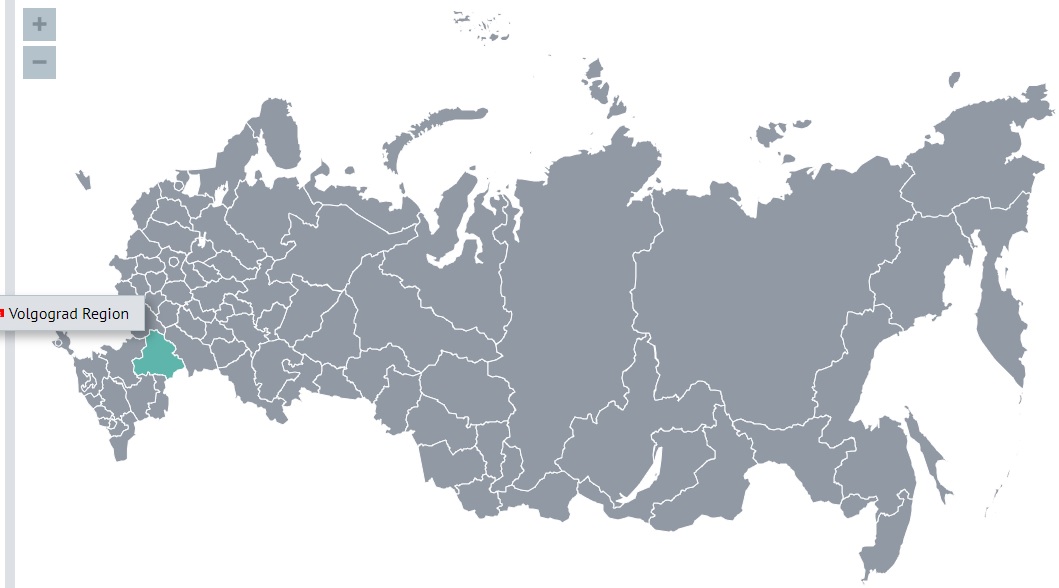
Volgograd region borders Kazakhstan in the east.
It is an area of 112,877 square kilometers (this area is somewhat larger than the area of Bulgaria or the area of Cuba).
The population of the region is 2,449,781 (2022).
The region has existed in its modern form since 1961.
In the Middle Ages, the lands of the present Volgograd region were part of such large state formations as the Turkic and Khazar Khaganates, the Golden Horde, the Astrakhan Khanate, the Nogai Horde and the Moscow kingdom. Since the 1st millennium AD, on the territory of the region on the Volgodonsk isthmus, there was the Volgodonsk perevoloka (a land route along which ships were moved from one river to another river). The ancient trade and military route existed until 1952, when the VolgoDon canal began to provide transport links between the rivers.
In the 19th century, most of the right-bank part of the modern Volgograd region of Russia was part of the Don Cossack Region (an administrative-territorial unit of the Russian Empire inhabited by Don Cossacks and governed by a special position). From 1786 it was officially called the land of the Don Army, in 1870-1918 - the Region of the Don Army.
In Soviet times, this territory repeatedly changed its size and name until December 16, 1961 was renamed the Volgograd region.
The climate of the region is arid, with a pronounced continentality. The northwestern part is located in the meadow steppe zone, the eastern part is in the semi-desert zone, approaching real deserts with a dry, sharply continental climate. The average temperature in January is from -7 to -12°С, in July from +28 to +35°С.
The main form of the emblem of the Volgograd region
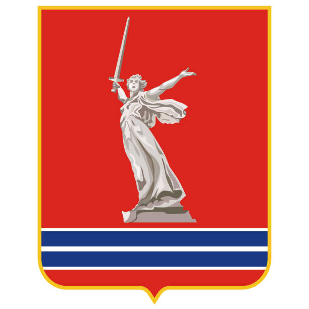
The emblem of the region is a traditional for Russian heraldry rectangular heraldic shield with a height to width ratio of 4:3. In the red background of the shield, the figure of the statue of the Motherland, installed on the Mamaev Kurgan, is depicted in natural white. At the level of the lower third, the shield is crossed horizontally by two blue stripes, framed at the edges and separated by white borders. The width of each blue stripe is equal to one twentieth of the height of the shield, the width of the white borders is one sixtieth of the height of the shield.
The red color of the emblem and the cloth of the Flag of the region recalls the color of the historical emblems of the Tsaritsyn regiments, the emblem of the county town of Tsaritsyn, the State Emblem of the RSFSR and the modern State Emblem of the Russian Federation, the banners of ancient Russia and the flags of the Soviet period and symbolizes the continuity of the symbols of the Volgograd region, its glorious traditions and history .
The red color is also a symbol of the courage and steadfastness of the inhabitants of the Volgograd region during all periods of its being part of Russia, their activity, determination, solidarity and ability to sacrifice. This color is considered a symbol of pride and freedom and reminds that the sacred Volgograd land is abundantly watered with the blood of the defenders of the Fatherland.
The statue of the Motherland, long and firmly associated throughout the world with the Volgograd region, personifies the boundless patriotism of the inhabitants of the region, the military and labor heroism of the people over the centuries and reminds that it was on the territory of the Volgograd region that the grandiose Battle of Stalingrad took place, which largely determined further historical destinies our country and all mankind.
The blue stripes on the Emblem and the Flag of the region remind of the natural and geographical originality of the Volgograd region, which is the only region of the European part of the Russian Federation, through which two largest rivers of European Russia, the Volga and the Don, flow at once, and symbolize these rivers, crossing the territory of the Volgograd region, playing great importance in its life and development throughout history. Blue color is a symbol of eternal youth and harmony, wisdom and spiritual perfection.
The white color of the statue and the borders on the emblem of the region means peace, nobility, justice and bright ideals.
The Ceremonial (Big) emblem of the Volgograd region
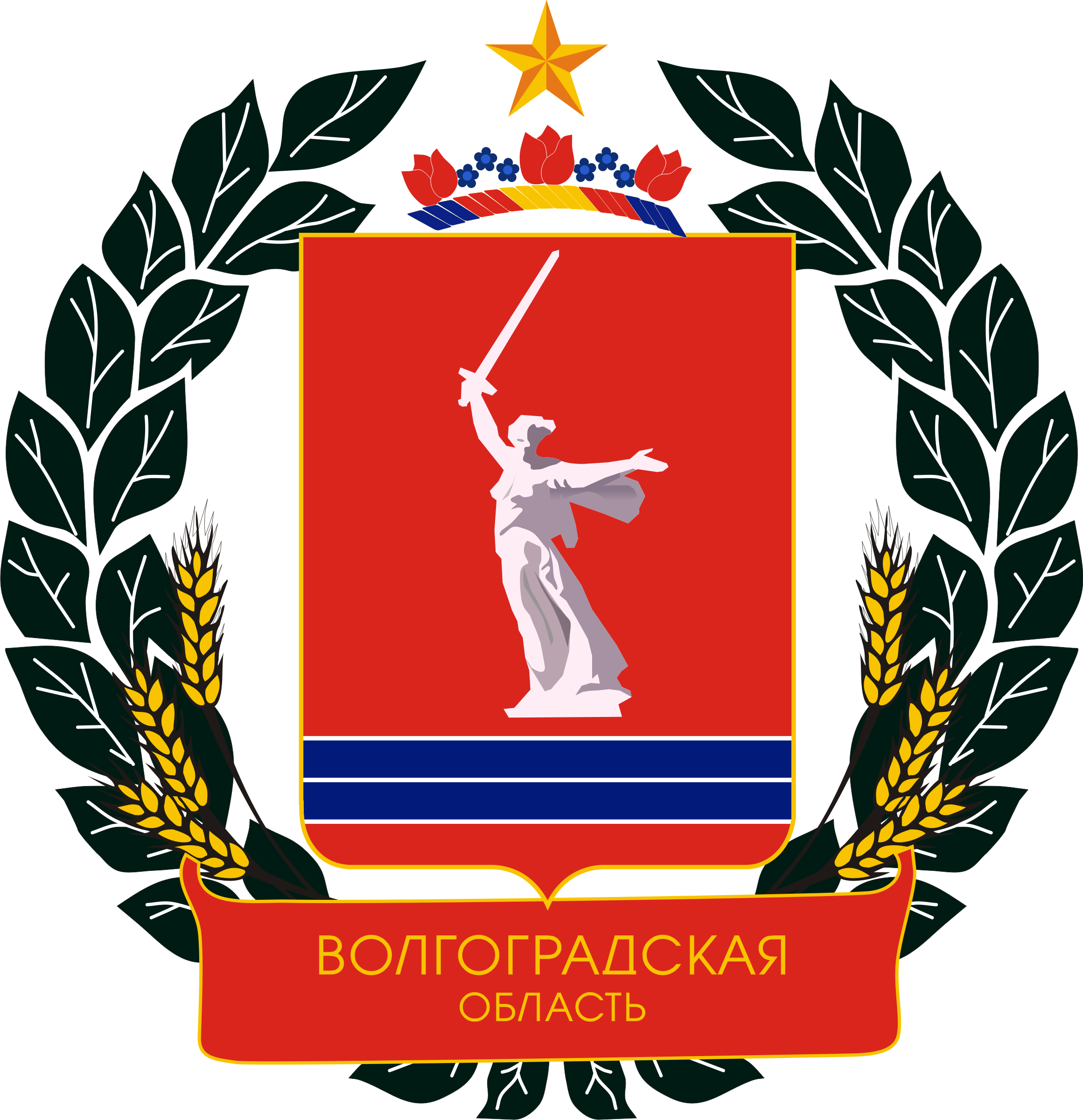
The shield is framed by a wreath of two green laurel branches and six yellow wheat ears. Over the lower part of the wreath is a red ribbon, on which the inscription "VOLGOGRAD REGION" is made in yellow capital letters. Between the upper ends of the wreath is a yellow five-pointed star. Above the emblem there is a heraldic crown (a burelet) of blue, red and white colors alternately, crowned with three red flowers of the steppe tulip and six blue cornflower flowers.
The burelet placed above the emblem has the same colors as the shield, and the flowers of the field tulip and cornflower crowning it symbolize the originality of the nature of the Volgograd region and personify its future prosperity.
A wreath of laurel branches and ears of wheat is a symbol of the military and labor glory of the Volgograd region, its natural resources, the cohesion of its inhabitants, and the green and yellow colors of the wreath denote vitality and prosperity, respectively. The yellow five-pointed star is a symbol of heroism and a brighter future. The inscription on the ribbon is the name of the region, and the combination of yellow and red colors of the inscription and the ribbon is a color symbol of the glory and heroism of the Volgograd region.
The combination in the emblem and the flag of the region of white, blue and red colors of the modern State Flag of the Russian Federation, and in the emblem the combination of yellow and red colors of the modern State Emblem of the Russian Federation symbolizes the fact that the Volgograd Region is part of Russia as a subject of the Federation and its inseparable unity with Russia.
The flag of the Volgograd region


Volgograd region borders Kazakhstan in the east.
It is an area of 112,877 square kilometers (this area is somewhat larger than the area of Bulgaria or the area of Cuba).
The population of the region is 2,449,781 (2022).
The region has existed in its modern form since 1961.
In the Middle Ages, the lands of the present Volgograd region were part of such large state formations as the Turkic and Khazar Khaganates, the Golden Horde, the Astrakhan Khanate, the Nogai Horde and the Moscow kingdom. Since the 1st millennium AD, on the territory of the region on the Volgodonsk isthmus, there was the Volgodonsk perevoloka (a land route along which ships were moved from one river to another river). The ancient trade and military route existed until 1952, when the VolgoDon canal began to provide transport links between the rivers.
In the 19th century, most of the right-bank part of the modern Volgograd region of Russia was part of the Don Cossack Region (an administrative-territorial unit of the Russian Empire inhabited by Don Cossacks and governed by a special position). From 1786 it was officially called the land of the Don Army, in 1870-1918 - the Region of the Don Army.
In Soviet times, this territory repeatedly changed its size and name until December 16, 1961 was renamed the Volgograd region.
The climate of the region is arid, with a pronounced continentality. The northwestern part is located in the meadow steppe zone, the eastern part is in the semi-desert zone, approaching real deserts with a dry, sharply continental climate. The average temperature in January is from -7 to -12°С, in July from +28 to +35°С.
The main form of the emblem of the Volgograd region

The emblem of the region is a traditional for Russian heraldry rectangular heraldic shield with a height to width ratio of 4:3. In the red background of the shield, the figure of the statue of the Motherland, installed on the Mamaev Kurgan, is depicted in natural white. At the level of the lower third, the shield is crossed horizontally by two blue stripes, framed at the edges and separated by white borders. The width of each blue stripe is equal to one twentieth of the height of the shield, the width of the white borders is one sixtieth of the height of the shield.
The red color of the emblem and the cloth of the Flag of the region recalls the color of the historical emblems of the Tsaritsyn regiments, the emblem of the county town of Tsaritsyn, the State Emblem of the RSFSR and the modern State Emblem of the Russian Federation, the banners of ancient Russia and the flags of the Soviet period and symbolizes the continuity of the symbols of the Volgograd region, its glorious traditions and history .
The red color is also a symbol of the courage and steadfastness of the inhabitants of the Volgograd region during all periods of its being part of Russia, their activity, determination, solidarity and ability to sacrifice. This color is considered a symbol of pride and freedom and reminds that the sacred Volgograd land is abundantly watered with the blood of the defenders of the Fatherland.
The statue of the Motherland, long and firmly associated throughout the world with the Volgograd region, personifies the boundless patriotism of the inhabitants of the region, the military and labor heroism of the people over the centuries and reminds that it was on the territory of the Volgograd region that the grandiose Battle of Stalingrad took place, which largely determined further historical destinies our country and all mankind.
The blue stripes on the Emblem and the Flag of the region remind of the natural and geographical originality of the Volgograd region, which is the only region of the European part of the Russian Federation, through which two largest rivers of European Russia, the Volga and the Don, flow at once, and symbolize these rivers, crossing the territory of the Volgograd region, playing great importance in its life and development throughout history. Blue color is a symbol of eternal youth and harmony, wisdom and spiritual perfection.
The white color of the statue and the borders on the emblem of the region means peace, nobility, justice and bright ideals.
The Ceremonial (Big) emblem of the Volgograd region

The shield is framed by a wreath of two green laurel branches and six yellow wheat ears. Over the lower part of the wreath is a red ribbon, on which the inscription "VOLGOGRAD REGION" is made in yellow capital letters. Between the upper ends of the wreath is a yellow five-pointed star. Above the emblem there is a heraldic crown (a burelet) of blue, red and white colors alternately, crowned with three red flowers of the steppe tulip and six blue cornflower flowers.
The burelet placed above the emblem has the same colors as the shield, and the flowers of the field tulip and cornflower crowning it symbolize the originality of the nature of the Volgograd region and personify its future prosperity.
A wreath of laurel branches and ears of wheat is a symbol of the military and labor glory of the Volgograd region, its natural resources, the cohesion of its inhabitants, and the green and yellow colors of the wreath denote vitality and prosperity, respectively. The yellow five-pointed star is a symbol of heroism and a brighter future. The inscription on the ribbon is the name of the region, and the combination of yellow and red colors of the inscription and the ribbon is a color symbol of the glory and heroism of the Volgograd region.
The combination in the emblem and the flag of the region of white, blue and red colors of the modern State Flag of the Russian Federation, and in the emblem the combination of yellow and red colors of the modern State Emblem of the Russian Federation symbolizes the fact that the Volgograd Region is part of Russia as a subject of the Federation and its inseparable unity with Russia.
The flag of the Volgograd region

The main city of the Volgograd Region is Volgograd (Волгоград)
The name of the city consists of two words Volga (Волга) river and a town (град).
Until 1925 the city was called Tsaritsyn (Царицын). From 1925 until 1961 the city was called Stalingrad (Сталинград).
The settlement on the territory of modern Volgograd was founded presumably in 1555. It was first mentioned in historical materials as Tsaritsyn in 1589.
The city got its name from the river Tsaritsa, which flows into the Volga. The name is based on the Tatar words "sari-su" (yellow river) or "sari-chin" (yellow island). A Russian settlement with a wooden fortress originally arose on the island of Tsaritsyn and served to defend the Volga route at the junction of the Volga and the Don from the steppe nomads and robber gangs roaming the Volga.
At the beginning of the 17th century, the city of Tsaritsyn burned down and was rebuilt in 1615 on the right bank of the Volga.
In 1667-1672, the Tsaritsyno garrison took the side of the rebel Stepan Razin. In 1691, a customs office was established in Tsaritsyn, and there was a lively trade in salt and fish. In 1707, the Don Cossacks, led by the rebel Vasily Bulavin, took the city, but were soon expelled by government troops arriving from Astrakhan. In 1722 and 1723 Peter I visited the city and presented it to his wife Catherine I. In 1727 Tsaritsyn was destroyed by fire again. In 1731 Tsaritsyn was rebuilt and fortified. The city became the center of the military line from the Volga to the Don. In 1774, the city was besieged twice by the rebel Pugachev, but without success.
In 1708, Tsaritsyn was assigned to the Kazan province, from 1719 it was assigned to the Astrakhan province, from 1773 it was assigned to the Saratov governorate. At the beginning of the XIX century, small industry began to appear in the city (3 brick, 2 candle factories, mustard and beer factories). 5 postal roads ran through Tsaritsyn: Moscow, Astrakhan, Saratov, Cherkasy and Tsarevskaya. In 1862, the Volga-Don railway was put into operation, in 1879 a railway to Moscow appeared, in 1897 a railway to the North Caucasus appeared, in 1900 a railway to the Donbass appeared. In Tsaritsyn there were agencies of many shipping companies. In 1880, the oil refining complex of the Nobel company was put into operation, the largest oil storage facilities in Russia were built. Shipbuilding and woodworking industries developed in the city. At the beginning of the 20th century, more than 230 factories and factories, banks, banking offices were operating in the city.
During the Civil War (1918-1920) fierce battles took place in Tsaritsyn. Joseph Stalin participated in this as a member of the Military Council of the North Caucasian Military District.
During the Great Patriotic War (1941-1945), on the outskirts of the city and in the city itself from July 17, 1942 to February 2, 1943, one of the most important battles of the Second World War took place - the Battle of Stalingrad, which became its turning point. Initially, the offensive in the Stalingrad direction was carried out by the 6th German Army, and from July 31, 1942, by the 4th Panzer Army. In a defensive operation, Soviet troops bled the main enemy grouping near Stalingrad and created the conditions for a counter offensive. Having concentrated additional forces, the Soviet command carried out an offensive operation, as a result of which the Nazi 6th and 4th tank armies, the Romanian 3rd and 4th armies, and the Italian 8th army were surrounded and defeated.
The Battle of Stalingrad lasted 200 days. The fascist bloc lost in it killed, wounded, captured and missing about 1.5 million people (a quarter of all its forces operating on the Soviet-German front).
The city was completely destroyed during the Second World War.
For outstanding services to the Motherland, on May 1, 1945, Stalingrad was awarded the honorary title of Hero City, and on May 8, 1965, it was awarded the Order of Lenin and the Gold Star medal.
The population of the city is 1,001,183 (2022).
The emblem of Volgograd
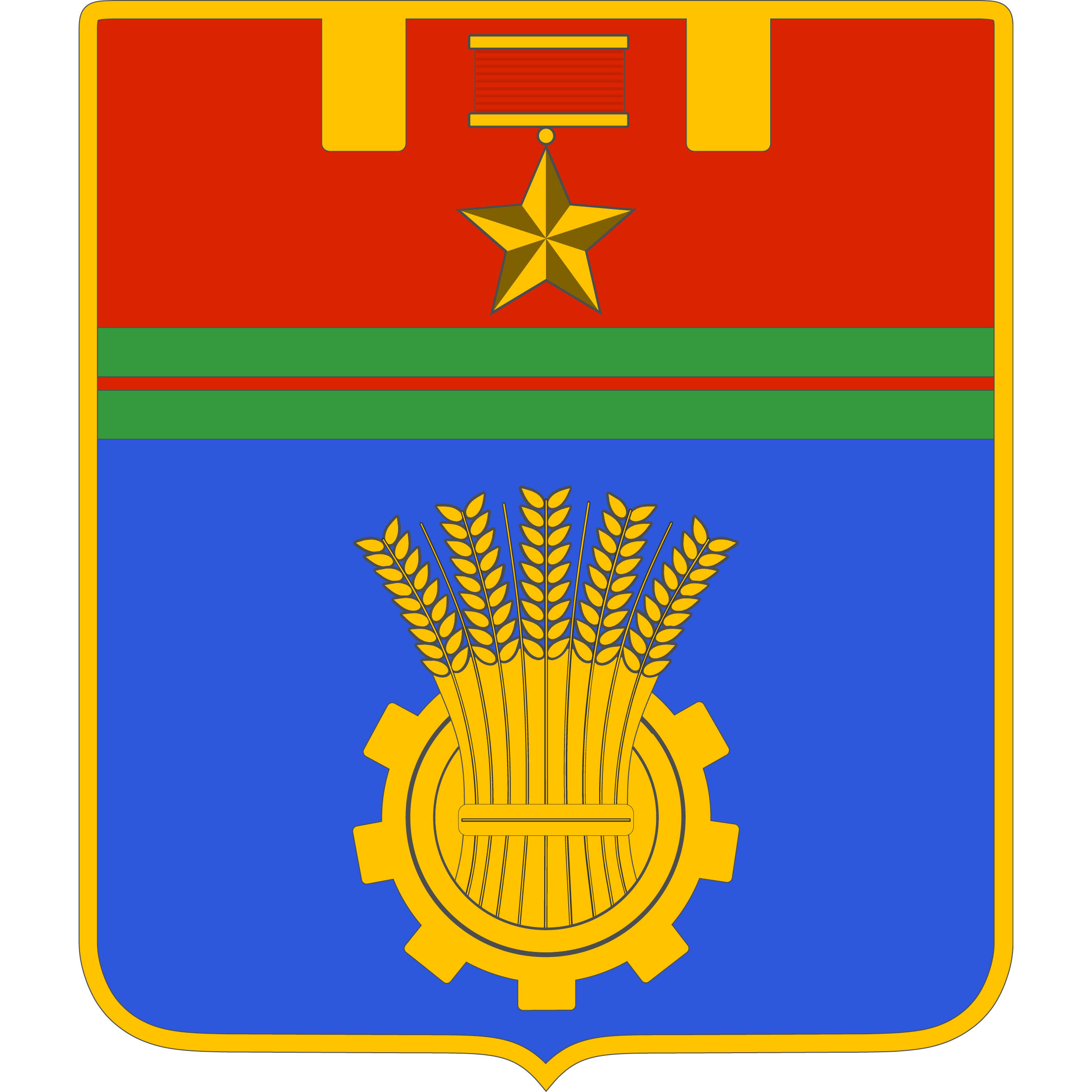
The general form of the emblem of the hero city of Volgograd is traditional. It is based on a shield of golden color, divided into two halves by a ribbon of the medal "For the Defense of Stalingrad". The upper half of the emblem is a symbolic image of an impregnable fortress on the Volga. It is presented in the form of battlements of the fortress wall, painted in red. Red symbolizes courage, sovereignty, blood shed for the fatherland, strength, energy. Complements this medal "Gold Star", which was awarded to the city, depicted in golden color on a common red background. In the lower half of the emblem there is a golden gear symbolizing the developed industry of the city, and a golden sheaf of wheat, which is a symbol of the abundance of the Volgograd land. The blue color throughout the field in this part of the coat of arms symbolizes the Volga. The width to height ratio should be 8:9.
The emblem of Tsaritsyn (1854)
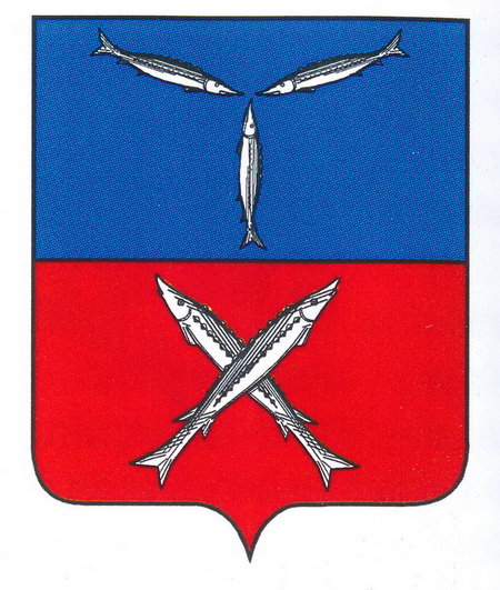
In the upper half is the emblem of the Saratov province, in the lower half on a red background are two silver cross-shaped sterlets, in commemoration of the sterlet fishing that takes place in this city.
The flag of Volgograd

The name of the city consists of two words Volga (Волга) river and a town (град).
Until 1925 the city was called Tsaritsyn (Царицын). From 1925 until 1961 the city was called Stalingrad (Сталинград).
The settlement on the territory of modern Volgograd was founded presumably in 1555. It was first mentioned in historical materials as Tsaritsyn in 1589.
The city got its name from the river Tsaritsa, which flows into the Volga. The name is based on the Tatar words "sari-su" (yellow river) or "sari-chin" (yellow island). A Russian settlement with a wooden fortress originally arose on the island of Tsaritsyn and served to defend the Volga route at the junction of the Volga and the Don from the steppe nomads and robber gangs roaming the Volga.
At the beginning of the 17th century, the city of Tsaritsyn burned down and was rebuilt in 1615 on the right bank of the Volga.
In 1667-1672, the Tsaritsyno garrison took the side of the rebel Stepan Razin. In 1691, a customs office was established in Tsaritsyn, and there was a lively trade in salt and fish. In 1707, the Don Cossacks, led by the rebel Vasily Bulavin, took the city, but were soon expelled by government troops arriving from Astrakhan. In 1722 and 1723 Peter I visited the city and presented it to his wife Catherine I. In 1727 Tsaritsyn was destroyed by fire again. In 1731 Tsaritsyn was rebuilt and fortified. The city became the center of the military line from the Volga to the Don. In 1774, the city was besieged twice by the rebel Pugachev, but without success.
In 1708, Tsaritsyn was assigned to the Kazan province, from 1719 it was assigned to the Astrakhan province, from 1773 it was assigned to the Saratov governorate. At the beginning of the XIX century, small industry began to appear in the city (3 brick, 2 candle factories, mustard and beer factories). 5 postal roads ran through Tsaritsyn: Moscow, Astrakhan, Saratov, Cherkasy and Tsarevskaya. In 1862, the Volga-Don railway was put into operation, in 1879 a railway to Moscow appeared, in 1897 a railway to the North Caucasus appeared, in 1900 a railway to the Donbass appeared. In Tsaritsyn there were agencies of many shipping companies. In 1880, the oil refining complex of the Nobel company was put into operation, the largest oil storage facilities in Russia were built. Shipbuilding and woodworking industries developed in the city. At the beginning of the 20th century, more than 230 factories and factories, banks, banking offices were operating in the city.
During the Civil War (1918-1920) fierce battles took place in Tsaritsyn. Joseph Stalin participated in this as a member of the Military Council of the North Caucasian Military District.
During the Great Patriotic War (1941-1945), on the outskirts of the city and in the city itself from July 17, 1942 to February 2, 1943, one of the most important battles of the Second World War took place - the Battle of Stalingrad, which became its turning point. Initially, the offensive in the Stalingrad direction was carried out by the 6th German Army, and from July 31, 1942, by the 4th Panzer Army. In a defensive operation, Soviet troops bled the main enemy grouping near Stalingrad and created the conditions for a counter offensive. Having concentrated additional forces, the Soviet command carried out an offensive operation, as a result of which the Nazi 6th and 4th tank armies, the Romanian 3rd and 4th armies, and the Italian 8th army were surrounded and defeated.
The Battle of Stalingrad lasted 200 days. The fascist bloc lost in it killed, wounded, captured and missing about 1.5 million people (a quarter of all its forces operating on the Soviet-German front).
The city was completely destroyed during the Second World War.
For outstanding services to the Motherland, on May 1, 1945, Stalingrad was awarded the honorary title of Hero City, and on May 8, 1965, it was awarded the Order of Lenin and the Gold Star medal.
The population of the city is 1,001,183 (2022).
The emblem of Volgograd

The general form of the emblem of the hero city of Volgograd is traditional. It is based on a shield of golden color, divided into two halves by a ribbon of the medal "For the Defense of Stalingrad". The upper half of the emblem is a symbolic image of an impregnable fortress on the Volga. It is presented in the form of battlements of the fortress wall, painted in red. Red symbolizes courage, sovereignty, blood shed for the fatherland, strength, energy. Complements this medal "Gold Star", which was awarded to the city, depicted in golden color on a common red background. In the lower half of the emblem there is a golden gear symbolizing the developed industry of the city, and a golden sheaf of wheat, which is a symbol of the abundance of the Volgograd land. The blue color throughout the field in this part of the coat of arms symbolizes the Volga. The width to height ratio should be 8:9.
The emblem of Tsaritsyn (1854)

In the upper half is the emblem of the Saratov province, in the lower half on a red background are two silver cross-shaped sterlets, in commemoration of the sterlet fishing that takes place in this city.
The flag of Volgograd

The emblem of the Vologda region (Вологодская область)
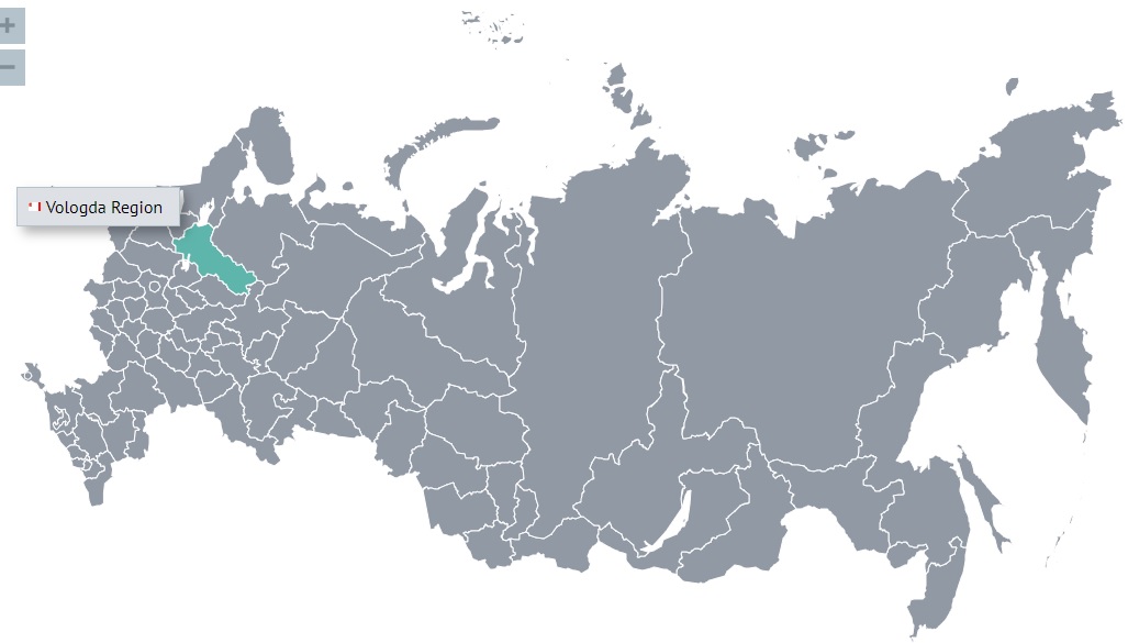
The Vologda region is located in the northeast of the East European Plain, in the continental part of the taiga zone.
It is an area of 144,527 square kilometers (this area is larger than the area of Greece).
The population of the region is 1,139,499 (2022).
The region has existed in its modern form since 1944.
In the V-VII centuries A.D. e. the development of the region by the Slavic population begins, which led to the assimilation of the Finno-Ugric tribes. The colonization of the Russian North took place both from the west (Slovenes) and from the south (Krivichi tribes). Representatives of the princely administration followed in the footsteps of the colonists: they collected tribute on the newly developed lands, began building cities. This is how Beloozero, Veliky Ustyug, Vologda arose.
The first mention of the most ancient city of Beloozero dates back to 862. Until the XV century, the western regions of the present Vologda region were part of the Novgorod land, and the central and eastern lands were first part of the Rostov principality. In 1238, the region separated from the Rostov Principality into an independent Belozersky Principality. In the XIV century, it falls under the rule of Moscow and becomes a district of the unified Russian state.
The natural features of the region determined the traditional economic activity of the inhabitants of the region. From ancient times, the population of the European North was engaged in hunting, fishing, extracting salt from salt springs, sublimation of resin, tar and wax. Significant deposits of iron ore in the swampy forests of the Ustyuzhna land determined the importance of Ustyuzhna Zhelezopolskaya as one of the significant processing centers for blacksmithing and weapons making. Until the beginning of the 20th century, the Totma salt mines were famous. At the salt works of the Stroganovs, salt was boiled in significant quantities, supplying the entire European North and even Moscow with it. Favorable soil and climatic conditions of the Vologda province contributed to the cultivation of high quality flax, cultivated in the North since the 12th century.
Forests cover more than half of the territory of the region, so it is not by chance that the most common activities were related to the harvesting and processing of wood.
The wood was rafted along the main rivers, sold at forest fairs, from there it got to consumers: large timber merchants and timber merchants of Vologda, Arkhangelsk, St. Petersburg, the southern provinces of Russia, and also abroad.
A person who has never been in our region connects the word Vologda with the words “Vologda butter” and “Vologda lace”. The forbs of flood meadows of the Prisukhonskaya and Mologo-Sheksna lowlands contributed to the production of butter with a unique delicate nutty taste.
A special technology of weaving, the use of a variety of ornaments, creatively meaningful traditions have formed a unique style of Vologda lace.
The development of the all-Russian market has led to great interest in the development of the natural resources of Siberia, the Far East, and the Pacific coast.
Semyon Dezhnev, a resident of the Vologda region, in 1648, with his comrades on small ships, went on an expedition with the aim of sailing by sea from Kolyma to Anadyr, bypassed the Chukotka Peninsula and was the first in the world to prove the existence of a strait between Asia and America. The name of this brave explorer is the extreme north-eastern point of Asia - Cape Dezhnev.
One of the largest cities in the Russian Far East, Khabarovsk is named after a resident of the Vologda region Yerofei Khabarov, who in 1648 equipped and led an expedition at his own expense, with which he traveled the shortest route from Yakutsk to the Amur, sailed along this great river to the sea and was the first to draw up a map Amur, a detailed description of the region, its population.
Vladimir Atlasov, a resident of the Vologda region, is honored as the discoverer of Kamchatka, he passed it in 1697-1699, made a description of this remote land, thus opening a period of intensive exploration of the coasts and islands of the Pacific Ocean.
The name of a resident of the Vologda region Ivan Kuskov is widely known. In 1789, at the head of a party of fishermen, he went in search of new lands, swam across the Pacific Ocean and reached the shores of America. Ivan Kuskov devoted more than thirty years to the study and development of the then little-explored Alaska and Northern California. Under his leadership, a Russian settlement was founded near the modern city of San Francisco and the Ross Fortress, which was quite significant for that time, was built.
The Vologda region ranks first among all other regions of Russia in terms of the share of the Russian population in the region (96.56% of Russians among the total population of the region).
The climate of the region is temperate continental with long moderately cold winters and relatively short warm summers. The severity of the climate increases from west to east. The average temperature in January is from -11 °C in the west of the region to -14 °C in the east, the average temperature in July, respectively, is from +16 °C to +18 °C. There is quite a lot of precipitation - 500-650 mm per year (maximum in the summer months); evaporation is much less, so the area is rich in rivers, lakes and swamps. Snow cover lies for 165-170 days.

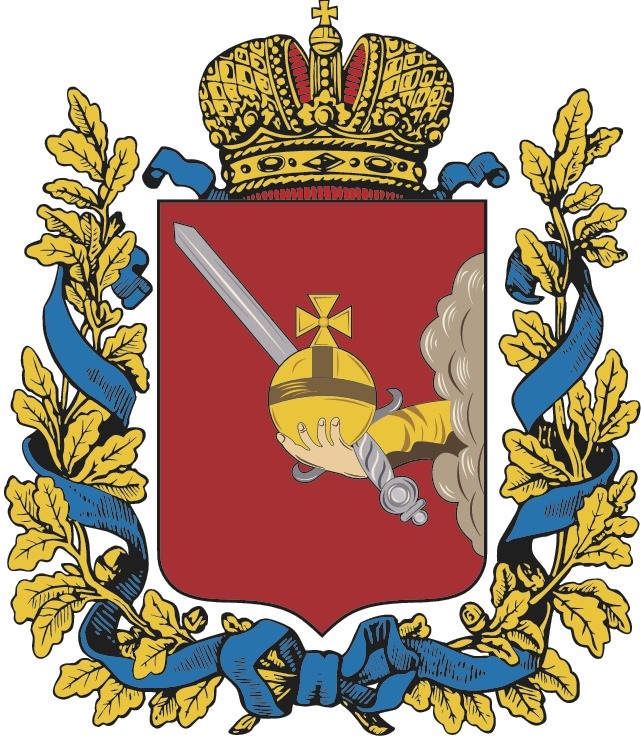
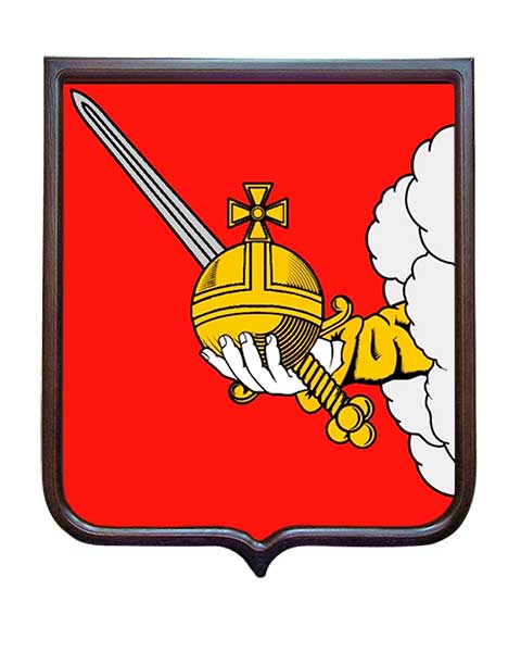
The emblem of the Vologda region is a quadrangular, with rounded lower corners, a red heraldic shield pointed at the tip, with a right hand in a golden robe emerging from silver clouds, holding a golden orb adorned with precious stones, and behind it a silver sword with a golden hilt, put in a baldric. Above the shield is the golden Russian Imperial crown, with blue ribbons fluttering.
The main elements of the coat of arms symbolize:
right hand with a sword - justice, legal court, defense of the Fatherland;
golden orb - power, statehood, rights of the Vologda region as a subject of the Russian Federation;
the imperial crown, a traditional heraldic sign of high dignity and power, the historical state territorial status of the Vologda region;
red color - power and courage,
gold - abundance and might,
silver - nobility, light and purity.
The emblem of the Vologda region (1878)
The flag of the Vologda region


The Vologda region is located in the northeast of the East European Plain, in the continental part of the taiga zone.
It is an area of 144,527 square kilometers (this area is larger than the area of Greece).
The population of the region is 1,139,499 (2022).
The region has existed in its modern form since 1944.
In the V-VII centuries A.D. e. the development of the region by the Slavic population begins, which led to the assimilation of the Finno-Ugric tribes. The colonization of the Russian North took place both from the west (Slovenes) and from the south (Krivichi tribes). Representatives of the princely administration followed in the footsteps of the colonists: they collected tribute on the newly developed lands, began building cities. This is how Beloozero, Veliky Ustyug, Vologda arose.
The first mention of the most ancient city of Beloozero dates back to 862. Until the XV century, the western regions of the present Vologda region were part of the Novgorod land, and the central and eastern lands were first part of the Rostov principality. In 1238, the region separated from the Rostov Principality into an independent Belozersky Principality. In the XIV century, it falls under the rule of Moscow and becomes a district of the unified Russian state.
The natural features of the region determined the traditional economic activity of the inhabitants of the region. From ancient times, the population of the European North was engaged in hunting, fishing, extracting salt from salt springs, sublimation of resin, tar and wax. Significant deposits of iron ore in the swampy forests of the Ustyuzhna land determined the importance of Ustyuzhna Zhelezopolskaya as one of the significant processing centers for blacksmithing and weapons making. Until the beginning of the 20th century, the Totma salt mines were famous. At the salt works of the Stroganovs, salt was boiled in significant quantities, supplying the entire European North and even Moscow with it. Favorable soil and climatic conditions of the Vologda province contributed to the cultivation of high quality flax, cultivated in the North since the 12th century.
Forests cover more than half of the territory of the region, so it is not by chance that the most common activities were related to the harvesting and processing of wood.
The wood was rafted along the main rivers, sold at forest fairs, from there it got to consumers: large timber merchants and timber merchants of Vologda, Arkhangelsk, St. Petersburg, the southern provinces of Russia, and also abroad.
A person who has never been in our region connects the word Vologda with the words “Vologda butter” and “Vologda lace”. The forbs of flood meadows of the Prisukhonskaya and Mologo-Sheksna lowlands contributed to the production of butter with a unique delicate nutty taste.
A special technology of weaving, the use of a variety of ornaments, creatively meaningful traditions have formed a unique style of Vologda lace.
The development of the all-Russian market has led to great interest in the development of the natural resources of Siberia, the Far East, and the Pacific coast.
Semyon Dezhnev, a resident of the Vologda region, in 1648, with his comrades on small ships, went on an expedition with the aim of sailing by sea from Kolyma to Anadyr, bypassed the Chukotka Peninsula and was the first in the world to prove the existence of a strait between Asia and America. The name of this brave explorer is the extreme north-eastern point of Asia - Cape Dezhnev.
One of the largest cities in the Russian Far East, Khabarovsk is named after a resident of the Vologda region Yerofei Khabarov, who in 1648 equipped and led an expedition at his own expense, with which he traveled the shortest route from Yakutsk to the Amur, sailed along this great river to the sea and was the first to draw up a map Amur, a detailed description of the region, its population.
Vladimir Atlasov, a resident of the Vologda region, is honored as the discoverer of Kamchatka, he passed it in 1697-1699, made a description of this remote land, thus opening a period of intensive exploration of the coasts and islands of the Pacific Ocean.
The name of a resident of the Vologda region Ivan Kuskov is widely known. In 1789, at the head of a party of fishermen, he went in search of new lands, swam across the Pacific Ocean and reached the shores of America. Ivan Kuskov devoted more than thirty years to the study and development of the then little-explored Alaska and Northern California. Under his leadership, a Russian settlement was founded near the modern city of San Francisco and the Ross Fortress, which was quite significant for that time, was built.
The Vologda region ranks first among all other regions of Russia in terms of the share of the Russian population in the region (96.56% of Russians among the total population of the region).
The climate of the region is temperate continental with long moderately cold winters and relatively short warm summers. The severity of the climate increases from west to east. The average temperature in January is from -11 °C in the west of the region to -14 °C in the east, the average temperature in July, respectively, is from +16 °C to +18 °C. There is quite a lot of precipitation - 500-650 mm per year (maximum in the summer months); evaporation is much less, so the area is rich in rivers, lakes and swamps. Snow cover lies for 165-170 days.

The emblem of the Vologda region is a quadrangular, with rounded lower corners, a red heraldic shield pointed at the tip, with a right hand in a golden robe emerging from silver clouds, holding a golden orb adorned with precious stones, and behind it a silver sword with a golden hilt, put in a baldric. Above the shield is the golden Russian Imperial crown, with blue ribbons fluttering.
The main elements of the coat of arms symbolize:
right hand with a sword - justice, legal court, defense of the Fatherland;
golden orb - power, statehood, rights of the Vologda region as a subject of the Russian Federation;
the imperial crown, a traditional heraldic sign of high dignity and power, the historical state territorial status of the Vologda region;
red color - power and courage,
gold - abundance and might,
silver - nobility, light and purity.
The emblem of the Vologda region (1878)

The flag of the Vologda region

The main city of the Vologda Region is Vologda (Вологда)
The city is located on both banks of the Vologda River. In addition to this river, several dozen other rivers flow in the city, flowing into the Vologda River.
The date of foundation of the city is unknown, the first mention in the annals falls on 1147. (Founding of the Trinity-Gerasimov Monastery by St. Gerasim.)
Until the end of the XIV century, Vologda was subordinate to the Novgorod Republic. However, since the end of the XIII century, due to its favorable geographical position at the crossroads of waterways, the city has repeatedly become the object of internecine wars between Novgorod Republic, Tver and Moscow grand duchies. Since then, the city's belonging to Novgorod was not stable and was constantly being negotiated with the Grand Dukes, although Vologda appeared in the Novgorod charters until 1456. So in 1304-1305, Grand Duke Mikhail Yaroslavich even managed to appoint his governor in the city for a short time. In 1368, Vologda was captured by the Moscow Grand Duke Dmitry Donskoy, after which a duumvirate of Novgorod and Moscow governors was apparently established in the city.
In 1397, the Moscow Grand Duke Vasily I, by military means, actually annexed Vologda to his possessions. However, even after that, the city was repeatedly attacked by Novgorodians, and was one of the objects of struggle during the Internecine War of 1425-1453.
A few months after the defeat by the Moscow Grand Duke Dmitry Shemyaka, the Moscow Grand Duke Vasily II the Dark with his wife and children was released "out of capture." On September 15, 1446, Shemyaka granted Vasily II the inheritance of Vologda. Thus, Vasily II became the first Duke of Vologda. In 1450, Vologda was besieged by the troops of Dmitry Shemyaka, who, according to legend, could not take the city thanks to the miraculous intercession of St. Dmitry Prilutsky and two young men in white robes, who killed the besiegers.
After the death of Vasily II, Vologda in 1462 passes into the inheritance of his son Andrei and again becomes the center of the Vologda Principality.
In 1481, after the death of Duke Andrei, who left no heirs, Vologda passes to the Grand Duke Ivan III, is transformed into the Vologda district and is finally assigned to the Moscow principality.
During the reign of Tsar Ivan IV, Vologda became one of the most important transit centers in Russia's foreign trade with England, Holland and other Western countries along the Severodvinsk route and in trade with Siberia along the Sukhona and Vychegda rivers. In 1555, the British opened their trading office in Vologda, and the first Russian ambassador sent to England for negotiations was Osip Nepeya from Vologda.
During the Time of Troubles, Vologda became an important center of the struggle against the invaders. In the summer of 1612, the Vologda detachments under the command of P. Mansurov set out to liberate Moscow from the Polish-Lithuanian garrison, but there were not enough troops left in Vologda itself to defend the city. As a result, on September 22, 1612, one of the Polish-Lithuanian predatory detachments easily captured Vologda, after which the city was burned, and many residents were killed or taken prisoner.
After the end of the Time of Troubles, Vologda is experiencing a new heyday. At the end of the XVII century, Vologda was third only to Moscow and Yaroslavl in terms of the number of households.
During the reign of Peter I, Vologda, in addition to its trade and craft significance, became a major military base of the country and a shipbuilding center. However, with the founding of St. Petersburg, which opened the sea route to Europe through the Baltic Sea, the importance of Vologda as the center of Russia's foreign trade fell sharply. In addition, Vologda ceased to be an administrative center: in 1708 the city was assigned to the Arkhangelsk province. And by Peter's decree of 1722 on the restriction of trade through Arkhangelsk, Vologda was completely aloof from trade routes, deserted and turned into an ordinary provincial city.
The new economic upsurge of the city is associated with the launch of the Mariinsky and Severo-Dvinskaya water systems, steamship traffic along the Sukhona River and the construction of a railway line connecting Vologda with Yaroslavl and Moscow (1872), with Arkhangelsk (1898), with St. Petersburg and Vyatka (1905).
In the 1930s, industrialization took place in Vologda: a flax mill, a plant for the manufacture of sawmill equipment "Northern Kommunar", the Clara Zetkin garment factory, ship repair, wood chemical and car repair plants.
During the Great Patriotic War, martial law was introduced in Vologda, and industrial enterprises switched to military production. In addition, the city has become one of the largest evacuation points (mainly for residents of besieged Leningrad) and a hospital center.
Beginning in the 1960s, tangible changes took place in the region and in the city in all spheres of life and economy: a bearing and optical-mechanical plants, a machine-tool plant, a poultry farm were founded; a polytechnic institute was opened; large-scale construction of housing and the first high-rise buildings is being launched, which resulted in the emergence of new microdistricts. In 1982 the city was awarded the Order of the October Revolution.
The population of the city is 308,530 (2021).
The emblem of the Vologda
The Ceremonial (Big) emblem of the Vologda
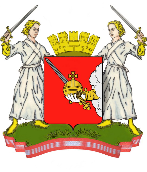
The ceremonial version of the emblem of the city of Vologda is the emblem of the city of Vologda, supplemented with ceremonial elements:
- a golden tower crown located above the heraldic shield with five visible prongs, each of which ends with three small prongs;
- the shield holders are young men standing on a green hill with golden hair in silver robes, shod with gold and with golden sleeves visible from under the robes, the right young man holds an upraised silver sword with a golden hilt in his left hand, the left young man holds an upraised silver sword with a golden hilt in the right hand;
- the ribbon of the Order of the October Revolution, encircling the bottom of a green hill.
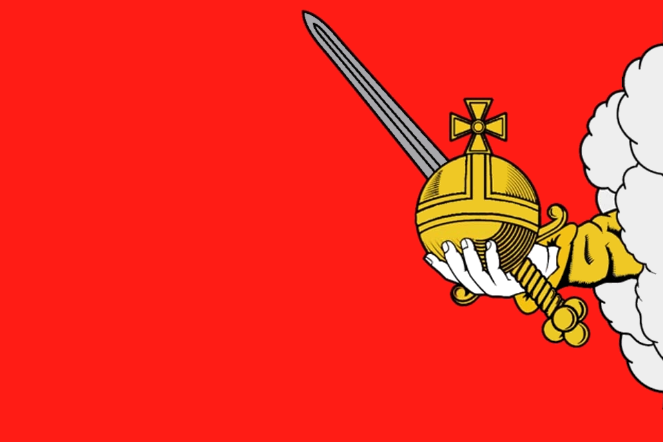
The right hand with a sword is a symbol of justice, a fair trial, as well as the defense of the Fatherland, and also reminds of the "Legend of the young men in white robes." The orb - a symbol of power, statehood of the rights of the administrative center of the subject of the Russian Federation, recalls the legend about the desire of Ivan IV the Terrible to make Vologda the capital. The red color of the emblem background symbolizes bravery and courage, gold serves as a symbol of wealth and power, silver - nobility, light and purity. A gold tower crown with five prongs indicates that the city of Vologda is the administrative center of the Vologda region. Two young men in white robes symbolize the legendary "young men in white robes" who saved Vologda from enemies at the cost of their own lives.
The flag of the Vologda
The city is located on both banks of the Vologda River. In addition to this river, several dozen other rivers flow in the city, flowing into the Vologda River.
The date of foundation of the city is unknown, the first mention in the annals falls on 1147. (Founding of the Trinity-Gerasimov Monastery by St. Gerasim.)
Until the end of the XIV century, Vologda was subordinate to the Novgorod Republic. However, since the end of the XIII century, due to its favorable geographical position at the crossroads of waterways, the city has repeatedly become the object of internecine wars between Novgorod Republic, Tver and Moscow grand duchies. Since then, the city's belonging to Novgorod was not stable and was constantly being negotiated with the Grand Dukes, although Vologda appeared in the Novgorod charters until 1456. So in 1304-1305, Grand Duke Mikhail Yaroslavich even managed to appoint his governor in the city for a short time. In 1368, Vologda was captured by the Moscow Grand Duke Dmitry Donskoy, after which a duumvirate of Novgorod and Moscow governors was apparently established in the city.
In 1397, the Moscow Grand Duke Vasily I, by military means, actually annexed Vologda to his possessions. However, even after that, the city was repeatedly attacked by Novgorodians, and was one of the objects of struggle during the Internecine War of 1425-1453.
A few months after the defeat by the Moscow Grand Duke Dmitry Shemyaka, the Moscow Grand Duke Vasily II the Dark with his wife and children was released "out of capture." On September 15, 1446, Shemyaka granted Vasily II the inheritance of Vologda. Thus, Vasily II became the first Duke of Vologda. In 1450, Vologda was besieged by the troops of Dmitry Shemyaka, who, according to legend, could not take the city thanks to the miraculous intercession of St. Dmitry Prilutsky and two young men in white robes, who killed the besiegers.
After the death of Vasily II, Vologda in 1462 passes into the inheritance of his son Andrei and again becomes the center of the Vologda Principality.
In 1481, after the death of Duke Andrei, who left no heirs, Vologda passes to the Grand Duke Ivan III, is transformed into the Vologda district and is finally assigned to the Moscow principality.
During the reign of Tsar Ivan IV, Vologda became one of the most important transit centers in Russia's foreign trade with England, Holland and other Western countries along the Severodvinsk route and in trade with Siberia along the Sukhona and Vychegda rivers. In 1555, the British opened their trading office in Vologda, and the first Russian ambassador sent to England for negotiations was Osip Nepeya from Vologda.
During the Time of Troubles, Vologda became an important center of the struggle against the invaders. In the summer of 1612, the Vologda detachments under the command of P. Mansurov set out to liberate Moscow from the Polish-Lithuanian garrison, but there were not enough troops left in Vologda itself to defend the city. As a result, on September 22, 1612, one of the Polish-Lithuanian predatory detachments easily captured Vologda, after which the city was burned, and many residents were killed or taken prisoner.
After the end of the Time of Troubles, Vologda is experiencing a new heyday. At the end of the XVII century, Vologda was third only to Moscow and Yaroslavl in terms of the number of households.
During the reign of Peter I, Vologda, in addition to its trade and craft significance, became a major military base of the country and a shipbuilding center. However, with the founding of St. Petersburg, which opened the sea route to Europe through the Baltic Sea, the importance of Vologda as the center of Russia's foreign trade fell sharply. In addition, Vologda ceased to be an administrative center: in 1708 the city was assigned to the Arkhangelsk province. And by Peter's decree of 1722 on the restriction of trade through Arkhangelsk, Vologda was completely aloof from trade routes, deserted and turned into an ordinary provincial city.
The new economic upsurge of the city is associated with the launch of the Mariinsky and Severo-Dvinskaya water systems, steamship traffic along the Sukhona River and the construction of a railway line connecting Vologda with Yaroslavl and Moscow (1872), with Arkhangelsk (1898), with St. Petersburg and Vyatka (1905).
In the 1930s, industrialization took place in Vologda: a flax mill, a plant for the manufacture of sawmill equipment "Northern Kommunar", the Clara Zetkin garment factory, ship repair, wood chemical and car repair plants.
During the Great Patriotic War, martial law was introduced in Vologda, and industrial enterprises switched to military production. In addition, the city has become one of the largest evacuation points (mainly for residents of besieged Leningrad) and a hospital center.
Beginning in the 1960s, tangible changes took place in the region and in the city in all spheres of life and economy: a bearing and optical-mechanical plants, a machine-tool plant, a poultry farm were founded; a polytechnic institute was opened; large-scale construction of housing and the first high-rise buildings is being launched, which resulted in the emergence of new microdistricts. In 1982 the city was awarded the Order of the October Revolution.
The population of the city is 308,530 (2021).
The emblem of the Vologda

The Ceremonial (Big) emblem of the Vologda

The ceremonial version of the emblem of the city of Vologda is the emblem of the city of Vologda, supplemented with ceremonial elements:
- a golden tower crown located above the heraldic shield with five visible prongs, each of which ends with three small prongs;
- the shield holders are young men standing on a green hill with golden hair in silver robes, shod with gold and with golden sleeves visible from under the robes, the right young man holds an upraised silver sword with a golden hilt in his left hand, the left young man holds an upraised silver sword with a golden hilt in the right hand;
- the ribbon of the Order of the October Revolution, encircling the bottom of a green hill.
The right hand with a sword is a symbol of justice, a fair trial, as well as the defense of the Fatherland, and also reminds of the "Legend of the young men in white robes." The orb - a symbol of power, statehood of the rights of the administrative center of the subject of the Russian Federation, recalls the legend about the desire of Ivan IV the Terrible to make Vologda the capital. The red color of the emblem background symbolizes bravery and courage, gold serves as a symbol of wealth and power, silver - nobility, light and purity. A gold tower crown with five prongs indicates that the city of Vologda is the administrative center of the Vologda region. Two young men in white robes symbolize the legendary "young men in white robes" who saved Vologda from enemies at the cost of their own lives.
The flag of the Vologda

Excellent Thread
Thankyou for your effort
Very informative , and a welcomed change
Would love to see St Petersburg one day
Stay Safe
Riouz
Thankyou for your effort
Very informative , and a welcomed change
Would love to see St Petersburg one day
Stay Safe
Riouz
I read about Stenka Razin's rebellion in the book "The Cossacks" by Philip Longworth. A most fascinating read and the book that really spurred my
interest in learning more about Russia. The idea of freedom has a long history with those living along the frontier regions no matter what
continent.
edit on 15-5-2022 by Asktheanimals because: (no reason given)
a reply to: Asktheanimals
Someone sees in this the idea of freedom, and someone sees in this the idea of anarchy.
Someone sees in this the idea of freedom, and someone sees in this the idea of anarchy.
The emblem of the Voronezh region (Воронежская область)
The region borders on the territory of Ukraine (Lugansk region). That is, with the Luhansk People's Republic.
It is an area of 52,216 square kilometers (this area is larger than the area of Costa Rica).
The population of the region is 2,287,678 (2022).
The region has existed in its modern form since 1957.
In the Voronezh region, there are burial mounds of the Scythians and Sarmatians who once lived on these lands a long time ago. In the 4th century, the Huns passed through the Don steppes from east to west. In the VII century, the steppe part of the territory of the Voronezh region became part of the Khazar Khaganate. In the VIII century, a Slavic population appears in Voronezh and the middle Don River.
During the period of feudal fragmentation, the territory of the region was part of the Ryazan and Chernigov principalities.
In the 16th century after the annexation of the Grand Duchy of Ryazan to the Russian state (about 1521), as well as a temporary weakening of the threat of raids by the Crimean khans (especially after the Battle of Molodin in 1572), the city of Voronezh was founded here (1585), which contributed to the mass settlement of the northern part of the region.
In 1696, by decision and with the personal participation of Peter the Great, a shipyard was created for the construction of the Russian fleet as a springboard for the development of the Black Sea lands. From here, the Azov campaigns of Peter the Great begin. An admiralty, a storehouse and a citadel are established in Voronezh.
During the Great Patriotic War, Voronezh was the center of fierce battles with the Nazis. The capture of Voronezh by the 4th Panzer Army of Hoth was an integral part of the summer offensive of the troops of the German Army Group "South" to Stalingrad and the Caucasus according to the plan of Operation "Blau". From June 28 to July 3, 1942, having broken through the defenses at the junction of the 13th and 40th armies of the Bryansk Front, parts of the 24th Panzer Division and the mechanized division "Grossdeutschland" reached the Don River and on July 4-5, 1942 created bridgeheads to the west and southwest of Voronezh. On July 6, tanks and motorized infantry of the 4th German Panzer Army broke into the city and by the end of July 9, captured its right-bank part. During the defense of Voronezh in July 1942, its defenders (soldiers of the garrison, the 3rd Air Defense Division, the 232nd Infantry Division, the 18th Tank Corps, individual artillery regiments and units of the 2nd Air Army) stopped the enemy, defended the left bank and for 5 days delayed the breakthrough of the German army group to Stalingrad, frustrating the plan to encircle the Southwestern Front in the Middle Don River. Near Voronezh, up to 10 divisions of the 2nd German Army were tied down by battles. On January 25, 1943, during the Voronezh-Kastornenskaya operation, the troops of the 60th Army of General I. Chernyakhovsky completely liberated Voronezh.
The city was destroyed by more than 90%.
The climate in the region is temperate continental with an average January temperature of −9°C, July +20.5°C and an average annual temperature of +4.5°C in the north-east of the region to +7.5°C in the extreme south. Precipitation falls from 600 mm in the northwest to 450 mm in the southeast.
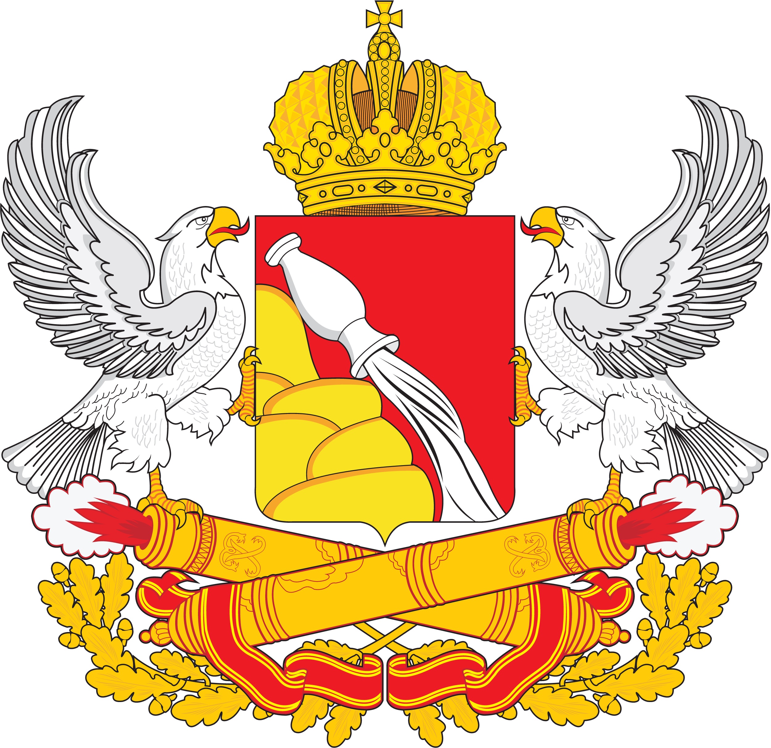
Against a red background, a mountain composed of large golden stones emerging from the left, on the slope of which there is an overturned silver jug pouring out silver water. The shield is topped with a gold imperial crown. Shield holders are eagles with silver wings stretched out to the sides of the shield and with red tongues, golden paws and beaks. The basis for the shield are two golden cannon barrels laid crosswise, from the muzzles of which a red flame surrounded by silver smoke emanates. From below and on the sides, the cannon barrels are surrounded by two golden oak branches, connected by cuttings crosswise under the center of the shield and diverging down and to the sides, and entwined with two ribbons of the Order of Lenin.
The meaning of the elements of the emblem:
Eagles come from the banner of the Petrovsky regiment of 1730;
The mountain expresses the hilly topography of the region;
The silver jug is the wealth and fertility of our land;
The crown is sovereignty and unity of the subjects of the Russian Federation;
Gold is harvest, light and spirituality;
Silver is generosity;
The cannons should remind of the labor and military exploits of the inhabitants of the Voronezh region, of the contribution of the region's enterprises to strengthening the country's defense power;
Oak branches are a symbol of courage, strength and resilience shown by residents during the Great Patriotic War;
Two ribbons of the Order of Lenin emphasize the outstanding achievements of the region, for which in 1935 and 1966 it was awarded the highest award of the USSR, the Order of Lenin;
Water is the Voronezh River;
The red color symbolizes work.
The emblem of the Voronezh region (1878)
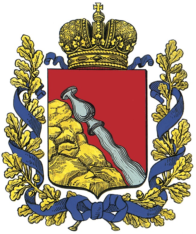
The emblem of the Voronezh region (1997-2005)
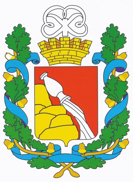
The flag of the Voronezh region


The region borders on the territory of Ukraine (Lugansk region). That is, with the Luhansk People's Republic.
It is an area of 52,216 square kilometers (this area is larger than the area of Costa Rica).
The population of the region is 2,287,678 (2022).
The region has existed in its modern form since 1957.
In the Voronezh region, there are burial mounds of the Scythians and Sarmatians who once lived on these lands a long time ago. In the 4th century, the Huns passed through the Don steppes from east to west. In the VII century, the steppe part of the territory of the Voronezh region became part of the Khazar Khaganate. In the VIII century, a Slavic population appears in Voronezh and the middle Don River.
During the period of feudal fragmentation, the territory of the region was part of the Ryazan and Chernigov principalities.
In the 16th century after the annexation of the Grand Duchy of Ryazan to the Russian state (about 1521), as well as a temporary weakening of the threat of raids by the Crimean khans (especially after the Battle of Molodin in 1572), the city of Voronezh was founded here (1585), which contributed to the mass settlement of the northern part of the region.
In 1696, by decision and with the personal participation of Peter the Great, a shipyard was created for the construction of the Russian fleet as a springboard for the development of the Black Sea lands. From here, the Azov campaigns of Peter the Great begin. An admiralty, a storehouse and a citadel are established in Voronezh.
During the Great Patriotic War, Voronezh was the center of fierce battles with the Nazis. The capture of Voronezh by the 4th Panzer Army of Hoth was an integral part of the summer offensive of the troops of the German Army Group "South" to Stalingrad and the Caucasus according to the plan of Operation "Blau". From June 28 to July 3, 1942, having broken through the defenses at the junction of the 13th and 40th armies of the Bryansk Front, parts of the 24th Panzer Division and the mechanized division "Grossdeutschland" reached the Don River and on July 4-5, 1942 created bridgeheads to the west and southwest of Voronezh. On July 6, tanks and motorized infantry of the 4th German Panzer Army broke into the city and by the end of July 9, captured its right-bank part. During the defense of Voronezh in July 1942, its defenders (soldiers of the garrison, the 3rd Air Defense Division, the 232nd Infantry Division, the 18th Tank Corps, individual artillery regiments and units of the 2nd Air Army) stopped the enemy, defended the left bank and for 5 days delayed the breakthrough of the German army group to Stalingrad, frustrating the plan to encircle the Southwestern Front in the Middle Don River. Near Voronezh, up to 10 divisions of the 2nd German Army were tied down by battles. On January 25, 1943, during the Voronezh-Kastornenskaya operation, the troops of the 60th Army of General I. Chernyakhovsky completely liberated Voronezh.
The city was destroyed by more than 90%.
The climate in the region is temperate continental with an average January temperature of −9°C, July +20.5°C and an average annual temperature of +4.5°C in the north-east of the region to +7.5°C in the extreme south. Precipitation falls from 600 mm in the northwest to 450 mm in the southeast.

Against a red background, a mountain composed of large golden stones emerging from the left, on the slope of which there is an overturned silver jug pouring out silver water. The shield is topped with a gold imperial crown. Shield holders are eagles with silver wings stretched out to the sides of the shield and with red tongues, golden paws and beaks. The basis for the shield are two golden cannon barrels laid crosswise, from the muzzles of which a red flame surrounded by silver smoke emanates. From below and on the sides, the cannon barrels are surrounded by two golden oak branches, connected by cuttings crosswise under the center of the shield and diverging down and to the sides, and entwined with two ribbons of the Order of Lenin.
The meaning of the elements of the emblem:
Eagles come from the banner of the Petrovsky regiment of 1730;
The mountain expresses the hilly topography of the region;
The silver jug is the wealth and fertility of our land;
The crown is sovereignty and unity of the subjects of the Russian Federation;
Gold is harvest, light and spirituality;
Silver is generosity;
The cannons should remind of the labor and military exploits of the inhabitants of the Voronezh region, of the contribution of the region's enterprises to strengthening the country's defense power;
Oak branches are a symbol of courage, strength and resilience shown by residents during the Great Patriotic War;
Two ribbons of the Order of Lenin emphasize the outstanding achievements of the region, for which in 1935 and 1966 it was awarded the highest award of the USSR, the Order of Lenin;
Water is the Voronezh River;
The red color symbolizes work.
The emblem of the Voronezh region (1878)

The emblem of the Voronezh region (1997-2005)

The flag of the Voronezh region

The main city of the Voronezh Region is Voronezh (Воронеж)
The city is located on the banks of the Voronezh River, 12 kilometers from its confluence with the Don River.
Officially, the year of foundation of Voronezh is 1586.
From July 7, 1942 to January 25, 1943, Voronezh, partly under German occupation, suffered significant damage. According to the State Control Commission, 18,000 houses (92% of all residential buildings) were destroyed in Voronezh. During the occupation, German military personnel carried out massacres of civilians in Voronezh (including women and children).
The population of the city is 1,050,602 (2021).
The Big emblem of Voronezh
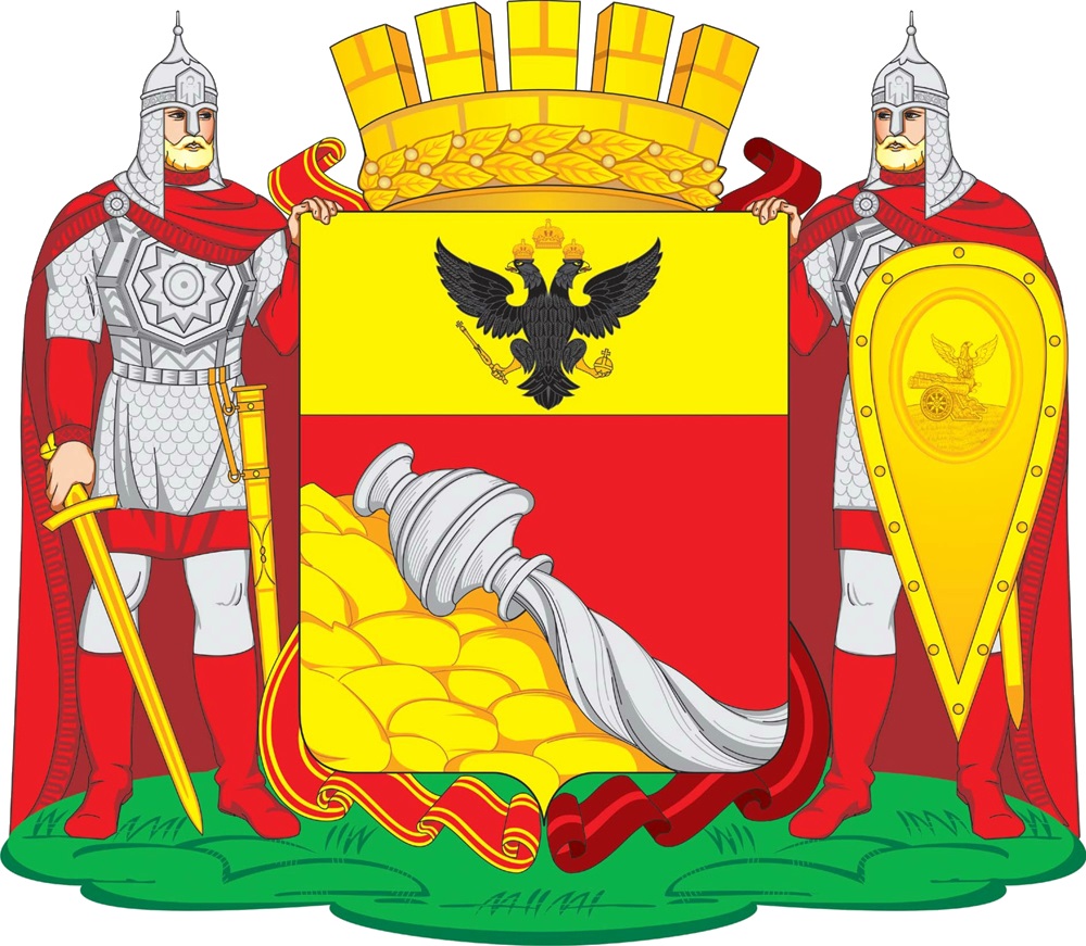
On a red background with a golden top is a black double-headed eagle with golden beaks, paws and eyes, with red tongues, crowned with three golden imperial crowns and holding a golden scepter in its right paw, and holding a golden orb in its left paw. A golden mountain made of boulders appears on the left, on the slope of which there is an overturned silver jug pouring out silver water.
The shield is crowned with a gold tower crown with five visible prongs, surrounded by a gold laurel wreath along the hoop. The shield holders are knights standing on the green earth in silver chain mail, mirror armor, helmets, in red cloaks fastened on the right shoulder with silver, in shirts and boots of the same color and trousers of the same metal; the left knight holds in his right hand a golden sword pointing down, and on his belt a golden scabbard; the right knight holds in his left hand in front of him an old gold (almond-shaped) shield, and on his belt is a sword in a sheath of the same metal. The shield is framed with order ribbons: on the right - the Order of Lenin, and on the left - the Order of the Patriotic War, I degree.
The figures of the emblem symbolize the city and its inhabitants as workers, whose huge contribution to the economic, cultural, spiritual development of the Voronezh region and the country is of great importance.
The basis of the composition of the emblem of the city of Voronezh is the historical emblem of the city, approved by the imperial authorities on September 21, 1781. The double-headed eagle on a golden background was granted to the city of Voronezh as a sign of special merits in the formation and development of the Russian state. There are only a few cities in Russia that have been awarded this honor.
The eagle in heraldry symbolizes power, might, fearlessness, as well as renewal and care for the younger generation. Raised wings mean striving for the future.
A jug with water pouring out of it is a unique historical symbol of Voronezh, it expresses the wealth and fertility of the local lands. An overturned jug of pouring water serves as a traditional sign of a source, a beginning, endless fertility and inexhaustible natural power. At the same time, water pouring from a jug is traditionally an allegorical symbol of the source, spring and river, in this case the Voronezh River. The appearance of a jug in the coat of arms of Voronezh is not accidental and has a deep meaning. A jug with water flowing out of it symbolically indicated that Voronezh had become for Russia "the gate to all the seas", since it was in Voronezh that the real beginning of the Russian fleet was laid. It was from here that Russia's journey along the waters began, which eventually led from the modest Voronezh River to the most distant seas and oceans, a journey that continues today. Thus, the symbolism of the Voronezh emblem is deeply positive in its basis and is a well-deserved centuries-old pride of the city's residents.
At the same time, the silver jug, as a creation of skillful human hands, allegorically shows the industriousness of the inhabitants of the city.
Silver in heraldry is a symbol of nobility, purity, justice, generosity, as well as peace.
Gold is a symbol of greatness, respect, strength, intelligence, as well as light and spirituality. At the same time, gold symbolizes the harvest, abundance and fertility - it allegorically shows the developed agricultural sector of the city's economy.
The red color in heraldry symbolizes life-affirming strength, courage, celebration, beauty and labor, which complements the content of the emblem of the city of Voronezh, as an industrial center.
Green color is a symbol of nature, health, life growth, rebirth.
The mountain in the emblem is consonant with the steep right bank of the city of Voronezh.
The gold tower crown with five visible prongs, complemented by a gold laurel wreath, shows the status of the city of Voronezh as the administrative center of a subject of the Russian Federation.
The city of Voronezh was awarded the following orders: May 6, 1975 - Order of the Patriotic War, 1st degree, for courage and heroism during the Great Patriotic War and success in work; March 10, 1986 - the Order of Lenin in connection with the 400th anniversary. Order ribbons framing the shield emphasize the great merits of the city to the state.
Shield holders (Russian knights) symbolize the valor, courage and heroism shown by the inhabitants of the city over the centuries in the defense of Russian lands. For courage, steadfastness and mass heroism shown by the defenders of the city in the struggle for the freedom and independence of the Fatherland, the city of Voronezh was awarded the honorary title "City of Military Glory". The symbolism of the shield holders is polysemantic. They also symbolize the fact that the city was founded as a fortress, designed to protect Russian lands from the raids of nomadic tribes. The knights also symbolize the governors first builders of the city of Voronezh: S. Saburov and his followers V. Birkin and I. Sudakov.
On the shield of the warrior there is an emblem depicted all in gold, from the regimental banner of the Voronezh infantry regiment, approved on March 8, 1730.
The Medium emblem of Voronezh (There is also a Small emblem of Voronezh. It is the same as the Medium emblem only it lacks a crown.)
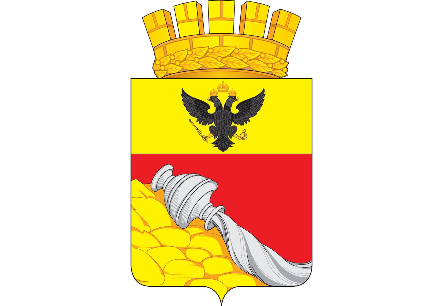
The emblem of Voronezh (1781)
The emblem of Voronezh (1881)
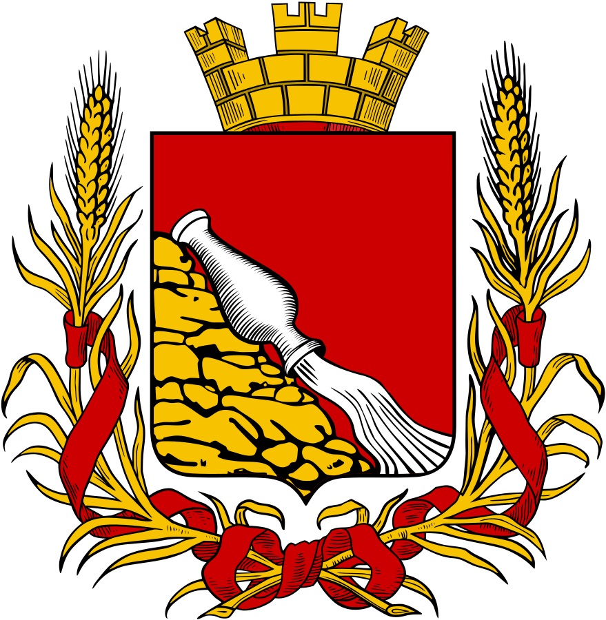
The emblem of Voronezh (1969)
At the top of the shield is the image of the State Flag of the RSFSR. The main background is gold. In the center is a wreath, the lower part of which represents a gear, and the upper part represents converging ears of wheat. Inside the wreath on a white background is the sign of the transistor. In the lower part of the shield there is a red fortress wall, under which there is a blue background with wavy lines, symbolizing the reservoir and the Voronezh River. In the center of the lower part of the shield is a red background, which contains a white three-masted sailing ship. The heraldic figures of the emblem of Voronezh symbolize its history as a fortress and the center of the construction of the Russian navy at the end of the 17th century, and also characterize the industrial potential of the city and the agricultural significance of the region in Soviet times.
The flag of Voronezh
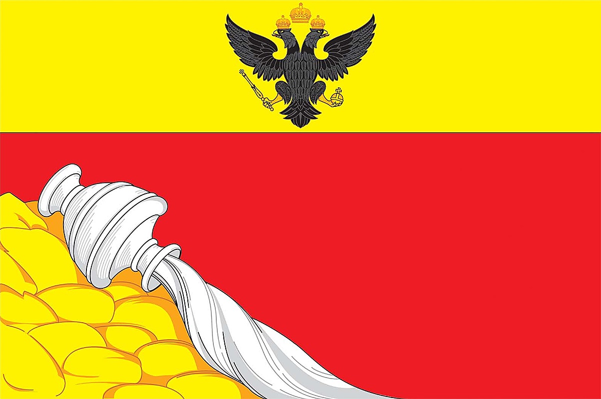
The city is located on the banks of the Voronezh River, 12 kilometers from its confluence with the Don River.
Officially, the year of foundation of Voronezh is 1586.
From July 7, 1942 to January 25, 1943, Voronezh, partly under German occupation, suffered significant damage. According to the State Control Commission, 18,000 houses (92% of all residential buildings) were destroyed in Voronezh. During the occupation, German military personnel carried out massacres of civilians in Voronezh (including women and children).
The population of the city is 1,050,602 (2021).
The Big emblem of Voronezh

On a red background with a golden top is a black double-headed eagle with golden beaks, paws and eyes, with red tongues, crowned with three golden imperial crowns and holding a golden scepter in its right paw, and holding a golden orb in its left paw. A golden mountain made of boulders appears on the left, on the slope of which there is an overturned silver jug pouring out silver water.
The shield is crowned with a gold tower crown with five visible prongs, surrounded by a gold laurel wreath along the hoop. The shield holders are knights standing on the green earth in silver chain mail, mirror armor, helmets, in red cloaks fastened on the right shoulder with silver, in shirts and boots of the same color and trousers of the same metal; the left knight holds in his right hand a golden sword pointing down, and on his belt a golden scabbard; the right knight holds in his left hand in front of him an old gold (almond-shaped) shield, and on his belt is a sword in a sheath of the same metal. The shield is framed with order ribbons: on the right - the Order of Lenin, and on the left - the Order of the Patriotic War, I degree.
The figures of the emblem symbolize the city and its inhabitants as workers, whose huge contribution to the economic, cultural, spiritual development of the Voronezh region and the country is of great importance.
The basis of the composition of the emblem of the city of Voronezh is the historical emblem of the city, approved by the imperial authorities on September 21, 1781. The double-headed eagle on a golden background was granted to the city of Voronezh as a sign of special merits in the formation and development of the Russian state. There are only a few cities in Russia that have been awarded this honor.
The eagle in heraldry symbolizes power, might, fearlessness, as well as renewal and care for the younger generation. Raised wings mean striving for the future.
A jug with water pouring out of it is a unique historical symbol of Voronezh, it expresses the wealth and fertility of the local lands. An overturned jug of pouring water serves as a traditional sign of a source, a beginning, endless fertility and inexhaustible natural power. At the same time, water pouring from a jug is traditionally an allegorical symbol of the source, spring and river, in this case the Voronezh River. The appearance of a jug in the coat of arms of Voronezh is not accidental and has a deep meaning. A jug with water flowing out of it symbolically indicated that Voronezh had become for Russia "the gate to all the seas", since it was in Voronezh that the real beginning of the Russian fleet was laid. It was from here that Russia's journey along the waters began, which eventually led from the modest Voronezh River to the most distant seas and oceans, a journey that continues today. Thus, the symbolism of the Voronezh emblem is deeply positive in its basis and is a well-deserved centuries-old pride of the city's residents.
At the same time, the silver jug, as a creation of skillful human hands, allegorically shows the industriousness of the inhabitants of the city.
Silver in heraldry is a symbol of nobility, purity, justice, generosity, as well as peace.
Gold is a symbol of greatness, respect, strength, intelligence, as well as light and spirituality. At the same time, gold symbolizes the harvest, abundance and fertility - it allegorically shows the developed agricultural sector of the city's economy.
The red color in heraldry symbolizes life-affirming strength, courage, celebration, beauty and labor, which complements the content of the emblem of the city of Voronezh, as an industrial center.
Green color is a symbol of nature, health, life growth, rebirth.
The mountain in the emblem is consonant with the steep right bank of the city of Voronezh.
The gold tower crown with five visible prongs, complemented by a gold laurel wreath, shows the status of the city of Voronezh as the administrative center of a subject of the Russian Federation.
The city of Voronezh was awarded the following orders: May 6, 1975 - Order of the Patriotic War, 1st degree, for courage and heroism during the Great Patriotic War and success in work; March 10, 1986 - the Order of Lenin in connection with the 400th anniversary. Order ribbons framing the shield emphasize the great merits of the city to the state.
Shield holders (Russian knights) symbolize the valor, courage and heroism shown by the inhabitants of the city over the centuries in the defense of Russian lands. For courage, steadfastness and mass heroism shown by the defenders of the city in the struggle for the freedom and independence of the Fatherland, the city of Voronezh was awarded the honorary title "City of Military Glory". The symbolism of the shield holders is polysemantic. They also symbolize the fact that the city was founded as a fortress, designed to protect Russian lands from the raids of nomadic tribes. The knights also symbolize the governors first builders of the city of Voronezh: S. Saburov and his followers V. Birkin and I. Sudakov.
On the shield of the warrior there is an emblem depicted all in gold, from the regimental banner of the Voronezh infantry regiment, approved on March 8, 1730.
The Medium emblem of Voronezh (There is also a Small emblem of Voronezh. It is the same as the Medium emblem only it lacks a crown.)

The emblem of Voronezh (1781)

The emblem of Voronezh (1881)

The emblem of Voronezh (1969)

At the top of the shield is the image of the State Flag of the RSFSR. The main background is gold. In the center is a wreath, the lower part of which represents a gear, and the upper part represents converging ears of wheat. Inside the wreath on a white background is the sign of the transistor. In the lower part of the shield there is a red fortress wall, under which there is a blue background with wavy lines, symbolizing the reservoir and the Voronezh River. In the center of the lower part of the shield is a red background, which contains a white three-masted sailing ship. The heraldic figures of the emblem of Voronezh symbolize its history as a fortress and the center of the construction of the Russian navy at the end of the 17th century, and also characterize the industrial potential of the city and the agricultural significance of the region in Soviet times.
The flag of Voronezh

The emblem of the Ivanovo region (Ивановская область)
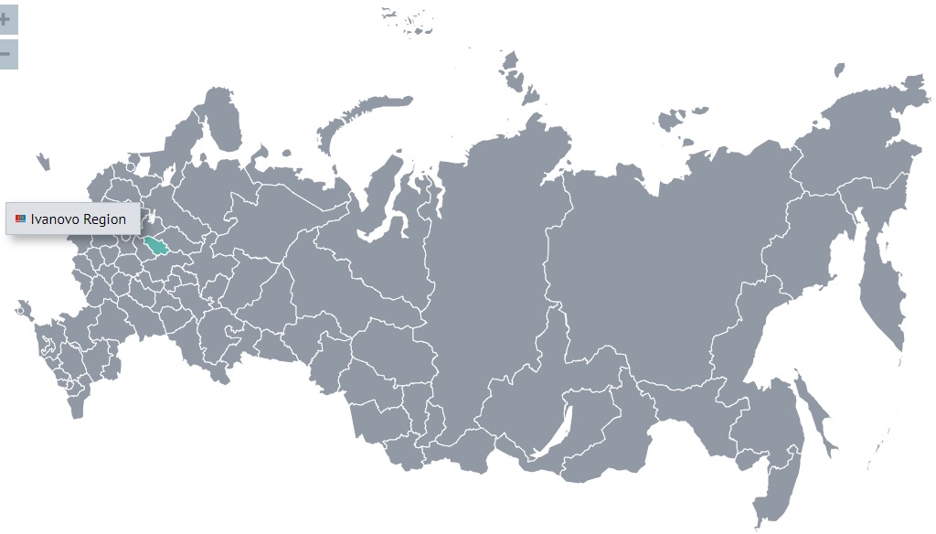
It is an area of 21,436 square kilometers (this is somewhat smaller than the area of Israel and somewhat larger than the area of El Salvador).
The population of the region is 976,918 (2022).
The region has existed in its modern form since 1994.
Since the middle of the X century, the Slavs appeared on the territory of the region.
According to the chronicles, the most ancient city of the Ivanovo region is Yuryevets (1225), and according to the results of archaeological excavations, the cities of Shuya, Kineshma, Plyos, Gavrilov Posad and Kokhma already existed in the pre-Mongolian period.
Ivanovo region was devastated after the Mongol Horde invasion in early 1238. Most towns and villages perished.
The first administrative-territorial formations on the territory of the region were the Shuisky, Paletsky and Ryapolovsky principalities. There was an influential Lukh specific principality, which for a long time belonged to the duke of Belsky. In the XIV-XV centuries, the lands of the region gradually became part of the Muscovite state. In 1364, the Starodub and Kostroma principalities came under the rule of Moscow, in 1393-1435 - the Suzdal-Nizhny Novgorod principality, and in 1451 - the lands of the Suzdal duke.
From the end of the XIV - beginning of the XV centuries, the fortress of Soldog on the Volga, the fortress of Shuya, which was an important strategic point on the way from Vladimir to the Volga River, and the Lukhskaya fortress, which guarded the northeastern border of the Moscow state, were known. In 1410, in Plyos, by decree of Vasily I, the Grand Duke of Moscow and Vladimir, a new one was founded on the site of the old fortress. Thus, the Plyos customs defense line was created, which allowed the Moscow princes to take control of the main waterway of Russia, the Volga River. The region during this period constantly suffered from enemy invasions. Cheremis attacked Yuryevets. In 1429, during the campaign of the Kazan prince Mahmud, Plyos and Lukh were devastated. In 1445, many settlements suffered from the invasion of the Kazan Khan Mamutek. In 1440, the Russian regiments defeated the Kazan army in the battle of Plyos.
During the Time of Troubles, battles took place on the territory of the region between the Russian troops and the Polish invaders. In 1609, Kineshma and several other fortresses were captured and destroyed by the Polish detachment of the Lithuanian nobleman Alexander Lisovsky.
The commercial nature of the region was determined by its natural geographical reasons: the harsh climate and poverty of soils made agriculture risky, but there were convenient river routes and cheap technical raw materials (hemp, flax, wool, leather, etc.) Plyos, Kineshma and Yuryevets became all-Russian centers for the production of linen fabrics, followed by Ivanovo, Kokhma, Shuya and other settlements. In Shuya, sheep breeding, dressing of hides and skins, and soap making also achieved significant development.
During the Great Patriotic War, thousands of residents of the Ivanovo region participated in the defense of our Motherland. Their contribution to the cause of the Victory was appreciated - 156 people were awarded the high title of Hero of the Soviet Union, 20 were awarded Orders of Glory of three degrees.
The climate of the region is temperate continental. It is characterized by relatively warm summers and moderately frosty winters with stable snow cover. The coldest month of the year is traditionally January with an average monthly temperature of −12°C, and the warmest month in summer is July with an average monthly temperature of +18°C. Precipitation is about 550-600 mm per year.
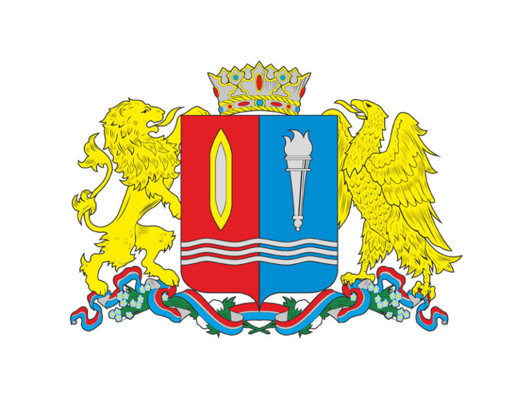
The emblem of the Ivanovo region is an image of a shield, dissected in red and blue, at the end there are three narrow wavy silver belts. On the right red background is a golden shuttle with a silver core, on the left azure background is a silver torch. Above the shield is an iron crown. Supporters: on the right - a golden lion, on the left - a golden eagle. The pedestal is a wreath of green stems and leaves with blue flax flowers and cotton bolls intertwined with a red-blue ribbon with a silver stripe.
The colors of the shield, red and blue, convey the colors of the emblem of the Vladimir and Kostroma provinces, from parts of which the Ivanovo-Voznesensk province was formed in 1918. The ancient emblem of the Vladimir province was a golden crowned lion on a red background. And the official emblem of the Kostroma province was a golden ship with an eagle on the bow on a blue background. So the red color of Vladimir and the blue color of Kostroma converged on the Ivanovo shield. The shuttle accurately and succinctly symbolizes the main branch of the economy - textile production, which has been developing from the 17th century to the present. The silver torch is an emblem generally accepted in heraldry, symbolizing knowledge, education, and the desire for progress.
Three narrow wavy silver belts crossing the shield symbolize the great Volga River, which flows through the territory of the Ivanovo region. At the same time, these emblems denote fabrics created at a large number of textile factories in the region. The main shield is crowned with an old Vladimir iron crown. Its presence, on the one hand, indicates that our region was once part of the Grand Vladimir Principality, and on the other hand, speaks of the rights of the Ivanovo Region as a subject of the Russian Federation.
The flag of the Ivanovo region
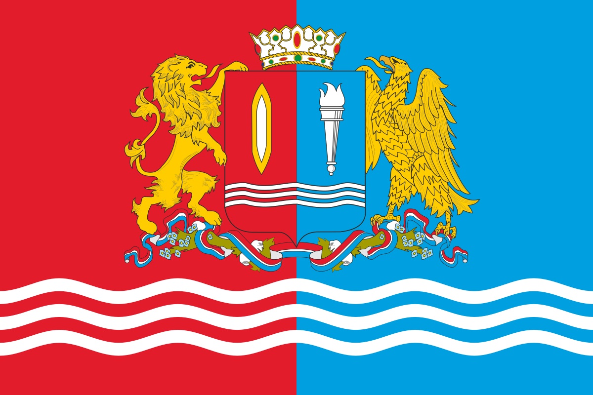
The main city of the Ivanovo Region is Ivanovo (Иваново)
Most likely the name of the city comes from the name Ivan. Ivanovo has been a city since 1871. In 1871-1932 it was called Ivanovo-Voznesensk (Иваново-Вознесенск).
It was first mentioned in sources in February 1609, when during the Polish intervention it was captured by a detachment of Alexander Lisovsky.
By the end of the XVII century, the village became a major craft center, where the main occupations of the population were textile crafts, dressing of linen canvases, and dyeing them.
The population of the city is 401,505 (2021).

Against a blue background is a young woman in a silver shirt with a golden collar and a red sundress, decorated with gold at the top, with a red kokoshnik (headdress) decorated with gold, and a silver scarf on her head, sitting and facing left, from behind her knees a standing behind her is a golden comb of a spinning wheel with a silver tow, which she holds with her right hand, in front of her stands a spinning wheel, the wheel of which she rotates with her left hand.
The emblem of Ivanovo (1970)
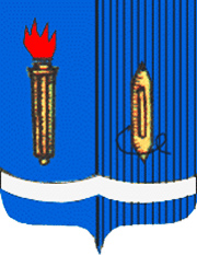
On a blue background, a torch is depicted on the left; it is a symbol of the struggle of the Ivanovo-Voznesensk workers during the years of the first Russian revolution (1905), a symbol of the city - the Motherland of the First Soviet [in Ivanovo-Voznesensk in 1905, during the strikes, the first council of workers' deputies was created]; on the right, on the black lines representing the warp threads, a weaving shuttle characterizing Ivanovo as a cultural center of the textile industry; at the bottom is a white winding line, a symbolic image of the Talka River.
The flag of Ivanovo
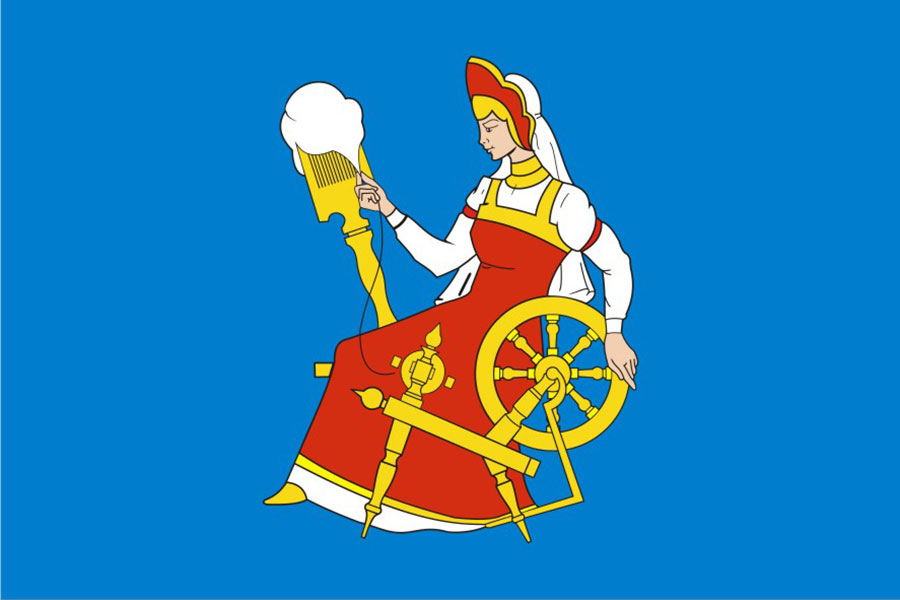

It is an area of 21,436 square kilometers (this is somewhat smaller than the area of Israel and somewhat larger than the area of El Salvador).
The population of the region is 976,918 (2022).
The region has existed in its modern form since 1994.
Since the middle of the X century, the Slavs appeared on the territory of the region.
According to the chronicles, the most ancient city of the Ivanovo region is Yuryevets (1225), and according to the results of archaeological excavations, the cities of Shuya, Kineshma, Plyos, Gavrilov Posad and Kokhma already existed in the pre-Mongolian period.
Ivanovo region was devastated after the Mongol Horde invasion in early 1238. Most towns and villages perished.
The first administrative-territorial formations on the territory of the region were the Shuisky, Paletsky and Ryapolovsky principalities. There was an influential Lukh specific principality, which for a long time belonged to the duke of Belsky. In the XIV-XV centuries, the lands of the region gradually became part of the Muscovite state. In 1364, the Starodub and Kostroma principalities came under the rule of Moscow, in 1393-1435 - the Suzdal-Nizhny Novgorod principality, and in 1451 - the lands of the Suzdal duke.
From the end of the XIV - beginning of the XV centuries, the fortress of Soldog on the Volga, the fortress of Shuya, which was an important strategic point on the way from Vladimir to the Volga River, and the Lukhskaya fortress, which guarded the northeastern border of the Moscow state, were known. In 1410, in Plyos, by decree of Vasily I, the Grand Duke of Moscow and Vladimir, a new one was founded on the site of the old fortress. Thus, the Plyos customs defense line was created, which allowed the Moscow princes to take control of the main waterway of Russia, the Volga River. The region during this period constantly suffered from enemy invasions. Cheremis attacked Yuryevets. In 1429, during the campaign of the Kazan prince Mahmud, Plyos and Lukh were devastated. In 1445, many settlements suffered from the invasion of the Kazan Khan Mamutek. In 1440, the Russian regiments defeated the Kazan army in the battle of Plyos.
During the Time of Troubles, battles took place on the territory of the region between the Russian troops and the Polish invaders. In 1609, Kineshma and several other fortresses were captured and destroyed by the Polish detachment of the Lithuanian nobleman Alexander Lisovsky.
The commercial nature of the region was determined by its natural geographical reasons: the harsh climate and poverty of soils made agriculture risky, but there were convenient river routes and cheap technical raw materials (hemp, flax, wool, leather, etc.) Plyos, Kineshma and Yuryevets became all-Russian centers for the production of linen fabrics, followed by Ivanovo, Kokhma, Shuya and other settlements. In Shuya, sheep breeding, dressing of hides and skins, and soap making also achieved significant development.
During the Great Patriotic War, thousands of residents of the Ivanovo region participated in the defense of our Motherland. Their contribution to the cause of the Victory was appreciated - 156 people were awarded the high title of Hero of the Soviet Union, 20 were awarded Orders of Glory of three degrees.
The climate of the region is temperate continental. It is characterized by relatively warm summers and moderately frosty winters with stable snow cover. The coldest month of the year is traditionally January with an average monthly temperature of −12°C, and the warmest month in summer is July with an average monthly temperature of +18°C. Precipitation is about 550-600 mm per year.

The emblem of the Ivanovo region is an image of a shield, dissected in red and blue, at the end there are three narrow wavy silver belts. On the right red background is a golden shuttle with a silver core, on the left azure background is a silver torch. Above the shield is an iron crown. Supporters: on the right - a golden lion, on the left - a golden eagle. The pedestal is a wreath of green stems and leaves with blue flax flowers and cotton bolls intertwined with a red-blue ribbon with a silver stripe.
The colors of the shield, red and blue, convey the colors of the emblem of the Vladimir and Kostroma provinces, from parts of which the Ivanovo-Voznesensk province was formed in 1918. The ancient emblem of the Vladimir province was a golden crowned lion on a red background. And the official emblem of the Kostroma province was a golden ship with an eagle on the bow on a blue background. So the red color of Vladimir and the blue color of Kostroma converged on the Ivanovo shield. The shuttle accurately and succinctly symbolizes the main branch of the economy - textile production, which has been developing from the 17th century to the present. The silver torch is an emblem generally accepted in heraldry, symbolizing knowledge, education, and the desire for progress.
Three narrow wavy silver belts crossing the shield symbolize the great Volga River, which flows through the territory of the Ivanovo region. At the same time, these emblems denote fabrics created at a large number of textile factories in the region. The main shield is crowned with an old Vladimir iron crown. Its presence, on the one hand, indicates that our region was once part of the Grand Vladimir Principality, and on the other hand, speaks of the rights of the Ivanovo Region as a subject of the Russian Federation.
The flag of the Ivanovo region

The main city of the Ivanovo Region is Ivanovo (Иваново)
Most likely the name of the city comes from the name Ivan. Ivanovo has been a city since 1871. In 1871-1932 it was called Ivanovo-Voznesensk (Иваново-Вознесенск).
It was first mentioned in sources in February 1609, when during the Polish intervention it was captured by a detachment of Alexander Lisovsky.
By the end of the XVII century, the village became a major craft center, where the main occupations of the population were textile crafts, dressing of linen canvases, and dyeing them.
The population of the city is 401,505 (2021).

Against a blue background is a young woman in a silver shirt with a golden collar and a red sundress, decorated with gold at the top, with a red kokoshnik (headdress) decorated with gold, and a silver scarf on her head, sitting and facing left, from behind her knees a standing behind her is a golden comb of a spinning wheel with a silver tow, which she holds with her right hand, in front of her stands a spinning wheel, the wheel of which she rotates with her left hand.
The emblem of Ivanovo (1970)

On a blue background, a torch is depicted on the left; it is a symbol of the struggle of the Ivanovo-Voznesensk workers during the years of the first Russian revolution (1905), a symbol of the city - the Motherland of the First Soviet [in Ivanovo-Voznesensk in 1905, during the strikes, the first council of workers' deputies was created]; on the right, on the black lines representing the warp threads, a weaving shuttle characterizing Ivanovo as a cultural center of the textile industry; at the bottom is a white winding line, a symbolic image of the Talka River.
The flag of Ivanovo

a reply to: turretless
Excellent addition to your work. Having so much information in one place about the physical aspects of Russia is a valuable asset.
Excellent addition to your work. Having so much information in one place about the physical aspects of Russia is a valuable asset.
new topics
-
The Carpet Coating that Attacked the Environment
Medical Issues & Conspiracies: 54 minutes ago -
Microplastics in your drinks
Medical Issues & Conspiracies: 2 hours ago -
Happy Rush Day 2024 - 2112
Music: 7 hours ago -
China Working on 'Drone Mothership' Plane
Military Projects: 7 hours ago -
12-21-24 Usyk-Fury II
World Sports: 10 hours ago
top topics
-
My Retirement
General Chit Chat: 15 hours ago, 18 flags -
China Working on 'Drone Mothership' Plane
Military Projects: 7 hours ago, 9 flags -
Driving home for Christmas… fast!
General Entertainment: 14 hours ago, 8 flags -
‘Something horrible’: Somerset pit reveals bronze age cannibalism
Ancient & Lost Civilizations: 16 hours ago, 6 flags -
Happy Rush Day 2024 - 2112
Music: 7 hours ago, 4 flags -
Microplastics in your drinks
Medical Issues & Conspiracies: 2 hours ago, 3 flags -
12-21-24 Usyk-Fury II
World Sports: 10 hours ago, 1 flags -
The Carpet Coating that Attacked the Environment
Medical Issues & Conspiracies: 54 minutes ago, 1 flags
active topics
-
Microplastics in your drinks
Medical Issues & Conspiracies • 7 • : BeyondKnowledge3 -
'Mass Casualty event' - Attack at Christmas market in Germany
Mainstream News • 133 • : Freeborn -
The Carpet Coating that Attacked the Environment
Medical Issues & Conspiracies • 3 • : BeyondKnowledge3 -
My Retirement
General Chit Chat • 18 • : Flyingclaydisk -
Post A Funny (T&C Friendly) Pic Part IV: The LOL awakens!
General Chit Chat • 7941 • : KrustyKrab -
Spiritual Solstice
Short Stories • 10 • : Naftalin -
US Federal Funding set to Expire December 20th. Massive CR on the way.
Mainstream News • 76 • : IndieA -
12-21-24 Usyk-Fury II
World Sports • 3 • : Blueracer -
Happy Rush Day 2024 - 2112
Music • 3 • : NorthOS -
China Working on 'Drone Mothership' Plane
Military Projects • 5 • : BeyondKnowledge3

