It looks like you're using an Ad Blocker.
Please white-list or disable AboveTopSecret.com in your ad-blocking tool.
Thank you.
Some features of ATS will be disabled while you continue to use an ad-blocker.
share:
Hi all, this has been building up considerably for the last month, but there were indications of this starting last year. Since the midlle of February
we've been getting daily shakes, averaging around 1200 a day (mostly less than Mag 3) in the southwest of Iceland.
I stay in Reykjavik and I can attest to the 4s and 5s that we've felt. GPS data has indicated for over a year now that the Reykjanes peninsula was filling up and tonight the pimple burst.
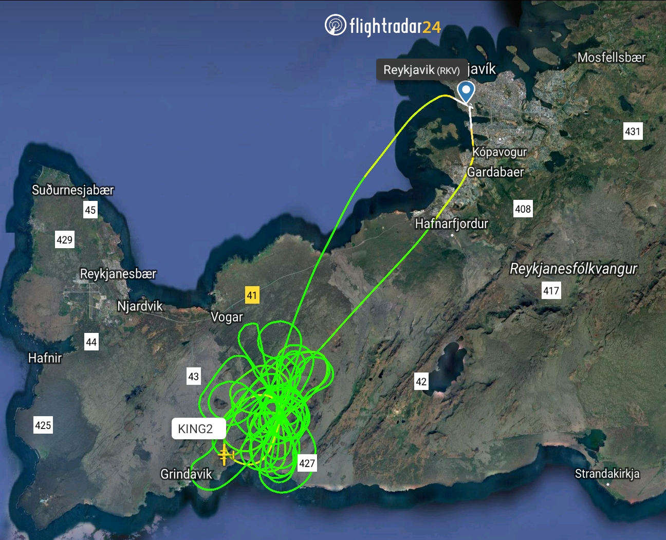
The area is called Fagradalsfjall, google that and you'll get up to date. This is close to the International Airport, so.. I'll be here.
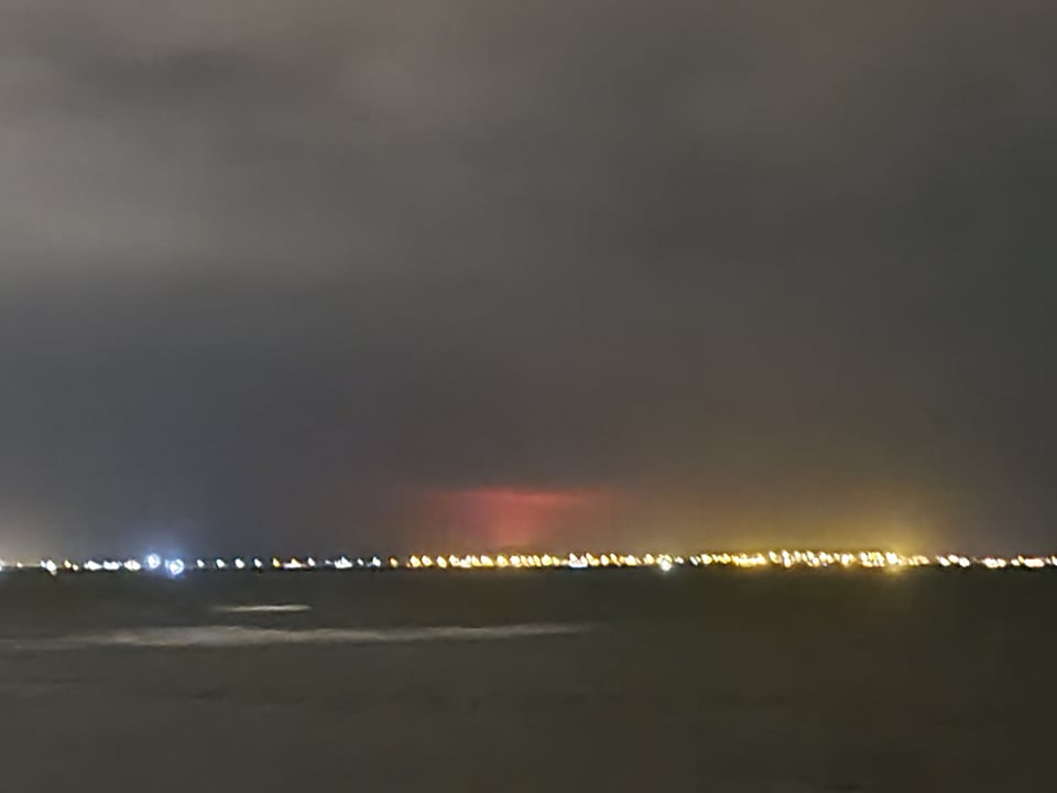
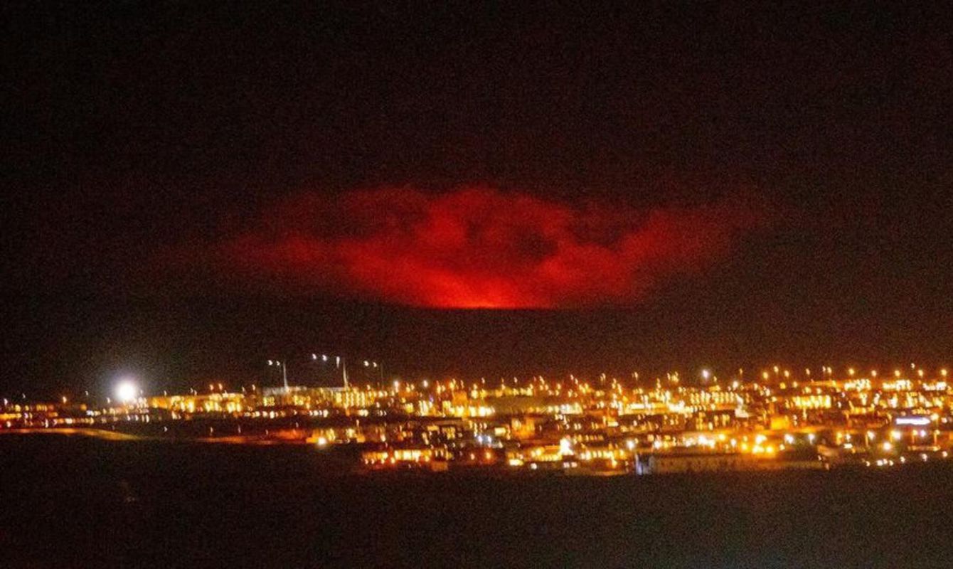
I went to the coast closest to me, which happens to look right over the bay to where this is happening. It was a pretty dense north-atlantic evening, but my camera picked it out better than my eyes could, behind the town Gardabær:
imgur.com...
Here's a bbc article on it:
www.bbc.com...
Cheers!
edit on 19-3-2021 by Revolvacron because: Seemed #ed?
a reply to: rickymouse
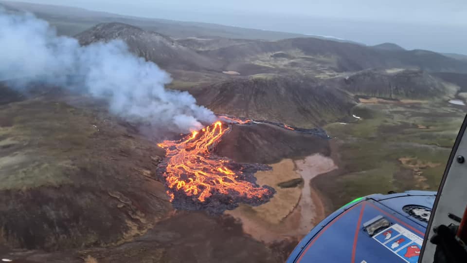
I was here for an eruption that was on the other side of the country, that didn't affect anyone. It looks like this is going to be an effusive eruption, there's no central cone this is erupting from.
By expert's estimates, it couldn't have happened in a better place - it'll likely bowl up in this valley. That said, they have put out word for bulldozers and water pumps. They've done this before..
en.wikipedia.org...
a reply to: rickymouse
It's bad when one of the glacial-capped volcanoes go off, like in 2010/2011. This isn't one of those.
It's bad when one of the glacial-capped volcanoes go off, like in 2010/2011. This isn't one of those.
Wow!!!! ...That’s kind of pretty combined with kind of scary ! Is it on land or in the ocean ? Ans How will this affect the animal , wildlife ,
or any people living in its path ?
edit on 20-3-2021 by Meldionne1 because: (no reason given)
a reply to: Revolvacron
Well i just read the area is uninhabited and they dont expect it to pose any danger to people. So thats a good thing looks like you get to enjoy natures light show. Though i will say be careful and stay safe and thank you for posting i find this interesting. I know i would want to get a closer look so im one of those stupid people that gets hurt. Did the same thing in a hurricane i had to see it
Well i just read the area is uninhabited and they dont expect it to pose any danger to people. So thats a good thing looks like you get to enjoy natures light show. Though i will say be careful and stay safe and thank you for posting i find this interesting. I know i would want to get a closer look so im one of those stupid people that gets hurt. Did the same thing in a hurricane i had to see it
edit on 3/20/21 by dragonridr because:
(no reason given)
a reply to: Meldionne1
It's on land so far. Whether it flows into the sea nobody can say for sure. Depends on how big this burp is
It's on land so far. Whether it flows into the sea nobody can say for sure. Depends on how big this burp is
a reply to: dragonridr
You have the right of it, I think. Pretty to see with one's own eyes, probably not so pretty with one's breath.
You have the right of it, I think. Pretty to see with one's own eyes, probably not so pretty with one's breath.
My understanding is this particular volcano has been quiet for thousands of years. Is that correct?
Pretty cool that you get to witness it's waking.
Pretty cool that you get to witness it's waking.
a reply to: MrRCflying
Yeah, you're mostly correct. I believe that the freshest lava in the area is around 800 years old, but prior to that it's in the region of 10,000 years. The whole area is just a layering of effusive eruptions, if you ever get the chance to fly to Iceland, the drive between the Intl Airport and Reykjavik takes you through these same fields.
Yeah, you're mostly correct. I believe that the freshest lava in the area is around 800 years old, but prior to that it's in the region of 10,000 years. The whole area is just a layering of effusive eruptions, if you ever get the chance to fly to Iceland, the drive between the Intl Airport and Reykjavik takes you through these same fields.
This type of eruption is only really bad if it either happens to ooze into your backyard or if it lasts long enough starts deep enough to tap into
gas.
There was one fissure eruption that killed off a lot of livestock on the island and caused a lot of air quality problems on the continent of Europe. The Laki eruption I think.
Obviously, the odds that this is anything like that are very low.
There was one fissure eruption that killed off a lot of livestock on the island and caused a lot of air quality problems on the continent of Europe. The Laki eruption I think.
The system erupted violently over an eight-month period between June 1783 and February 1784 from the Laki fissure and the adjoining volcano Grímsvötn, pouring out an estimated 42 billion tons or 14 km3 (3.4 cu mi) of basalt lava and clouds of poisonous hydrofluoric acid and sulfur dioxide compounds that contaminated the soil, leading to the death of over 50% of Iceland's livestock population, and the destruction of the vast majority of all crops. This led to a famine which then killed approximately 25% of the island's human population.[4] The lava flows also destroyed 20 villages.
The Laki eruption and its aftermath caused a drop in global temperatures, as 120 million tons of sulfur dioxide was spewed into the Northern Hemisphere. This caused crop failures in Europe and may have caused droughts in North Africa and India.
Obviously, the odds that this is anything like that are very low.
a reply to: ketsuko
Unlike those in the Puna district of Hawaii, Icelanders seem to have some sense.
www.sfgate.com...
Didn't work out so well for many.
Unlike those in the Puna district of Hawaii, Icelanders seem to have some sense.
www.sfgate.com...
Didn't work out so well for many.
edit on 3/20/2021 by Phage because: (no reason given)
An update from the Icelandic Meteorological society on this quite interesting eruption. Basically there are no signs of a magma chamber beneath the
peninsula and analyses of the lavas that have been produced indicate that they come from primitive magma (directly from the mantle, as opposed to
coming from a chamber in the crust):
Vedur.is (Icelandic)
How long can the eruption last? On the Reykjanes peninsula, wave refraction measurements show that the earth's crust is usually about 15 km thick, and below the earth's crust the mantle takes over. Geophysical measurements can detect signs of magma or magma chambers in the earth's crust, but on the Reykjanes peninsula there are no signs of this, neither magma nor magma chambers. Therefore, magma that arises in eruptions on the Reykjanes peninsula can be expected to come directly from below the crust, straight from the mantle.
Chemical analyzes by the University of Iceland's Institute of Earth Sciences on the new lava field in Geldingadalur have now confirmed that this is the case, i.e. that the magma that arises is primitive and comes directly from a mantle from a depth of 15-17 km. It is estimated that the magma flow in Geldingadalur is around 5-6 m3/s and the flow has changed little since the eruption began. A tremor graph from the FAF seismometer, east of Fagradalsfjall about 2.5 km from the eruption fissure, shows the strength of the eruption well in the frequency range 2-4 Hz (blue line). According to the unrest, the intensity of the eruption has not diminished but rather the opposite, been steadily increasing in recent days, especially at night. These observations of turbulence compare well with other observations, e.g. images from satellites. But how long can the eruption last?
A direct connection has now been formed from magma at the top of the mantle to the surface in Geldingadalur. First and foremost, it is the amount of magma at the top of the mantle that determines how much material reaches the surface. There are examples of shield volcano eruptions on the Reykjanes peninsula that undoubtedly lasted for years and produced a lot of lava, e.g. Þráinsskjöldur, Sandfellshæð and Heiðin há which are the largest shield volcanoes in the area.
It can be assumed that a direct connection was also formed from magma in the mantle to the surface based on chemical analysis. There are other examples of eruptions where magma chambers in the crust were not known and lasted for a long time, such as e.g. the Surtsey eruption from 1963 to 1967 [that rose straight from the sea]. It is unknown at this time how long the eruption will last but based on the steady lava flow and other indicators, the eruption could last much longer than initially was expected based only on the [small] size of the eruption.
Vedur.is (Icelandic)
new topics
-
Federal law trumps state and local law every time
Social Issues and Civil Unrest: 4 hours ago
top topics
-
Federal law trumps state and local law every time
Social Issues and Civil Unrest: 4 hours ago, 10 flags
active topics
-
The Acronym Game .. Pt.4
General Chit Chat • 992 • : Moon68 -
The Reactionary Conspiracy 13. The plot’s theology.
General Conspiracies • 310 • : andy06shake -
Federal law trumps state and local law every time
Social Issues and Civil Unrest • 14 • : BeyondKnowledge3 -
Interesting Video-UFO?
Aliens and UFOs • 14 • : BeyondKnowledge3 -
Ed Dowd some good news
Medical Issues & Conspiracies • 39 • : chr0naut -
Post A Funny (T&C Friendly) Pic Part IV: The LOL awakens!
General Chit Chat • 7829 • : KrustyKrab -
I thought Trump was the existential threat?
World War Three • 74 • : PorkChop96 -
DOJ Special Counsel Robert HUR Says JOE BIDEN Can Be ARRESTED After Jan 20th 2025.
Above Politics • 20 • : Flyingclaydisk -
Well, here we go red lines crossed Biden gives the go ahead to use long range missiles
World War Three • 373 • : bastion -
Petition Calling for General Election at 564,016 and rising Fast
Political Issues • 90 • : gortex


