It looks like you're using an Ad Blocker.
Please white-list or disable AboveTopSecret.com in your ad-blocking tool.
Thank you.
Some features of ATS will be disabled while you continue to use an ad-blocker.
share:
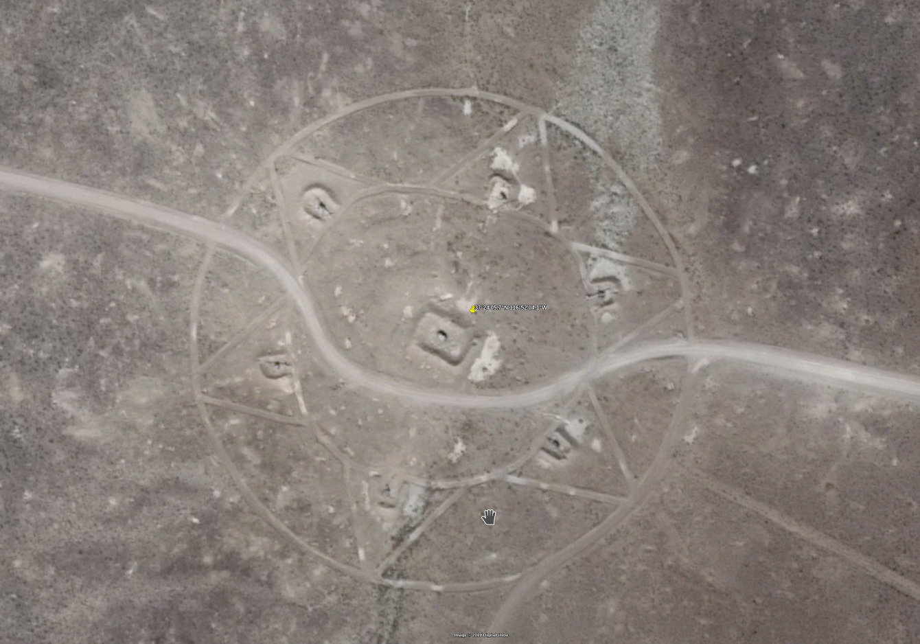
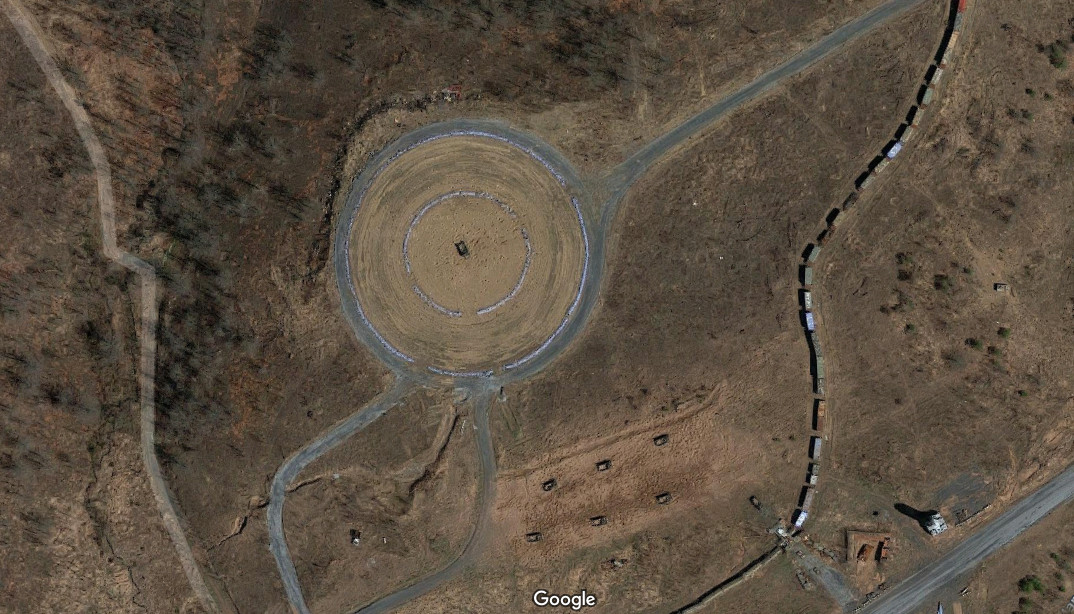
An internet post had these coordinates in it with no explanation about what or why. So I went and took a look. It looks like it is in Nevada so I am
guessing some kind of military range. Any ideas? There are many other interesting sights for miles and miles around this site.
Nuclear waste site? Bombing site? Rocket test site?


Nuclear waste site? Bombing site? Rocket test site?
That's my house.
The first photo reminds me of gun emplacements around a central bunker. Even the shadows.
The first photo reminds me of gun emplacements around a central bunker. Even the shadows.
edit on 28-5-2019 by CharlesT because: (no reason
given)
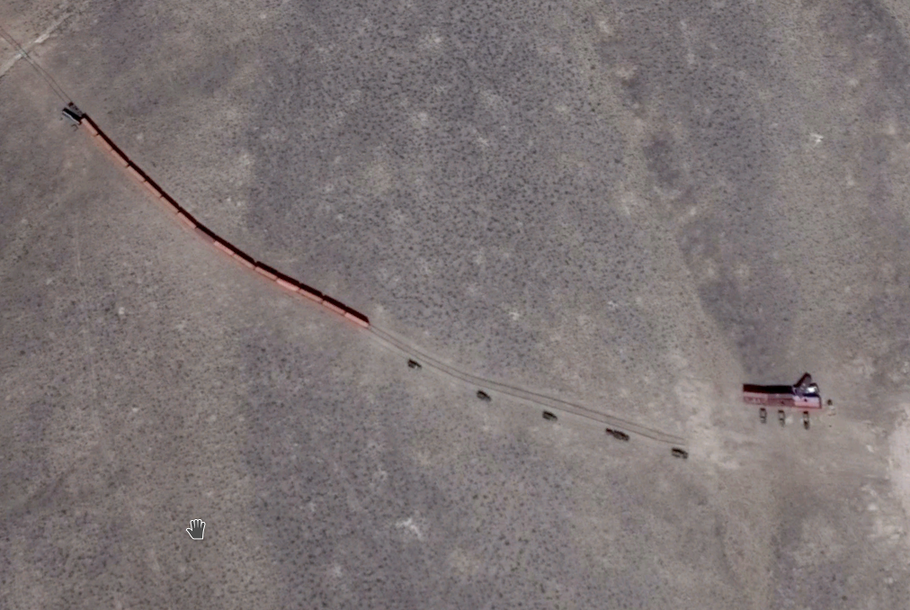
I see tracks from a loading area but no destination.
originally posted by: LookingAtMars
a reply to: CharlesT
2d pic seems to be a train or mock train?
Lot of other cool stuff all around that area.
Isn't the first laid out like the jewish star of david?
Might be ben shapiro's bunker.
Might be ben shapiro's bunker.
a reply to: LookingAtMars
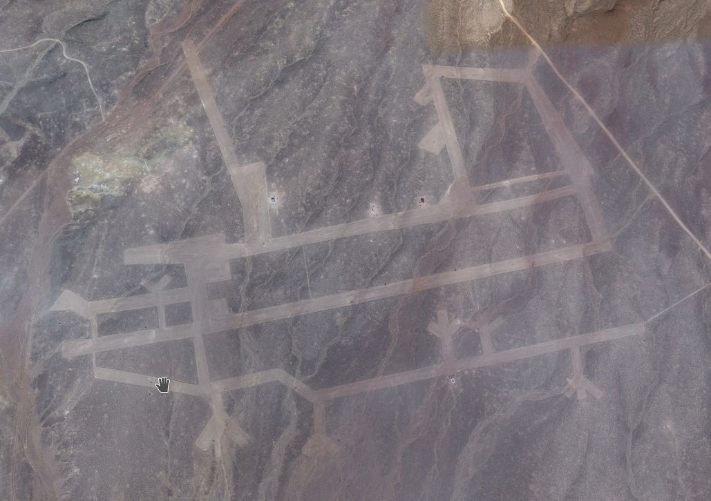
They're training areas. First is a SAM site, looks like a train, the bottom is an airfield.
They're training areas. First is a SAM site, looks like a train, the bottom is an airfield.
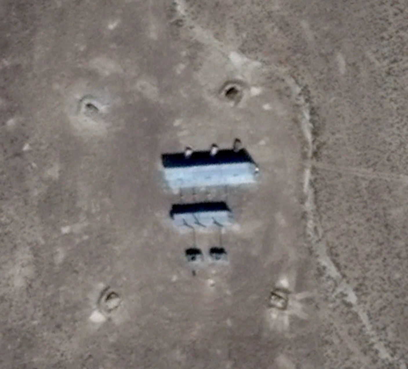
Third photo appears to be 4 tanks around the buildings. You have me interested.
Where you shoot them or where they go boom?
originally posted by: Zaphod58
a reply to: LookingAtMars
They're training areas. First is a SAM site, looks like a train, the bottom is an airfield.
I see so many white areas that look like shelling but nothing large.
edit on 28-5-2019 by CharlesT because: (no reason given)
originally posted by: LookingAtMars
a reply to: MisterSpock
I was worried at first it was a 5 pointed star.
At first glance, I assumed it to be as well, but then I counted(I can count to 15, my parents are super proud).
I assumed then that it was a jewish thing and that meant nothing other than a secret production base for the nefarious alt right neo nazi ben shapiro. It no doubt has a secret medical facility where his wife, she's a doctor BTW(well kept secret) carries on the work of the 3rd reichts nefarious medical experiments.
There is a gentleman on here that is the area51 rider. He drives around Nevada and flies his drone as close to Area51 as he can, gets buzzed by
choppers sometimes. Are these coordinates somewhere that could be seen within the range of a drone, or are they all the way inside the exclusion zone
for range by a civilian drone?
40.434977, -76.668099
Google Maps Link
this is a typical air to ground range ( this is Bollen range at Ft. Indiantown gap, PA). I did some work on a home nearby, and was lucky enough to hear the beautiful brrrrt of A-10s doing practice runs.

Google Maps Link
this is a typical air to ground range ( this is Bollen range at Ft. Indiantown gap, PA). I did some work on a home nearby, and was lucky enough to hear the beautiful brrrrt of A-10s doing practice runs.
edit on 28-5-2019 by dubiousatworst because: working on linky
edit on
28-5-2019 by dubiousatworst because: pic added
edit on 28-5-2019 by dubiousatworst because: finally a link
edit on
28-5-2019 by dubiousatworst because: what a pain
originally posted by: Zaphod58
a reply to: LookingAtMars
They're training areas. First is a SAM site, looks like a train, the bottom is an airfield.
Seems like there was also a mock city similar to the strangeness of this posted a ways back. It was also used for training if I remember right.
edit on 29-5-2019 by mtnshredder because: (no reason given)
new topics
-
Watch as a 12 million years old Crab Emerges from a Rock
Ancient & Lost Civilizations: 3 hours ago -
ILLUMINATION: Dimensions / Degrees – Da Vincis Last Supper And The Philosophers Stone
Secret Societies: 9 hours ago -
Just Sick of It! Done! Can't take it anymore!
General Chit Chat: 10 hours ago
top topics
-
Speaking of Pandemics
General Conspiracies: 12 hours ago, 9 flags -
Watch as a 12 million years old Crab Emerges from a Rock
Ancient & Lost Civilizations: 3 hours ago, 9 flags -
ILLUMINATION: Dimensions / Degrees – Da Vincis Last Supper And The Philosophers Stone
Secret Societies: 9 hours ago, 8 flags -
Just Sick of It! Done! Can't take it anymore!
General Chit Chat: 10 hours ago, 5 flags -
Stuck Farmer And His Queue Jumping Spawn
Rant: 12 hours ago, 4 flags
active topics
-
Musk calls on King Charles III to dissolve Parliament over Oldham sex grooming gangs
Mainstream News • 174 • : NoCorruptionAllowed -
Joe Biden gives the USA's Highest Civilian Honor Award to Hillary Clinton and George Soros.
US Political Madness • 40 • : marg6043 -
What Is 'Quad Demic'? Mask Mandate Returns In These US States
Diseases and Pandemics • 35 • : nugget1 -
Vehicle Strikes people in New Orleans
Mainstream News • 300 • : Oldcarpy2 -
DONALD J. TRUMP - TIME's Most Extraordinary Person of the Year 2024.
Mainstream News • 61 • : Oldcarpy2 -
Candidate Harris Supporter MARK CUBAN Says Trump Has No Smart-Intelligent Women in His Orbit.
2024 Elections • 88 • : Oldcarpy2 -
Matthew Livelsberger said he was being followed by FBI
Political Conspiracies • 72 • : WeMustCare -
Winter Storm
Fragile Earth • 30 • : RickinVa -
Watch as a 12 million years old Crab Emerges from a Rock
Ancient & Lost Civilizations • 9 • : FullHeathen -
-@TH3WH17ERABB17- -Q- ---TIME TO SHOW THE WORLD--- -Part- --44--
Dissecting Disinformation • 3941 • : WeMustCare
