It looks like you're using an Ad Blocker.
Please white-list or disable AboveTopSecret.com in your ad-blocking tool.
Thank you.
Some features of ATS will be disabled while you continue to use an ad-blocker.
3
share:
Debunking one of the most used talking points (disinformation points) against the facility at S-4 Papoose Lake
Many go to the used "But there are no roads, tracks, etc. near the S-4 location"
However, that is untrue.
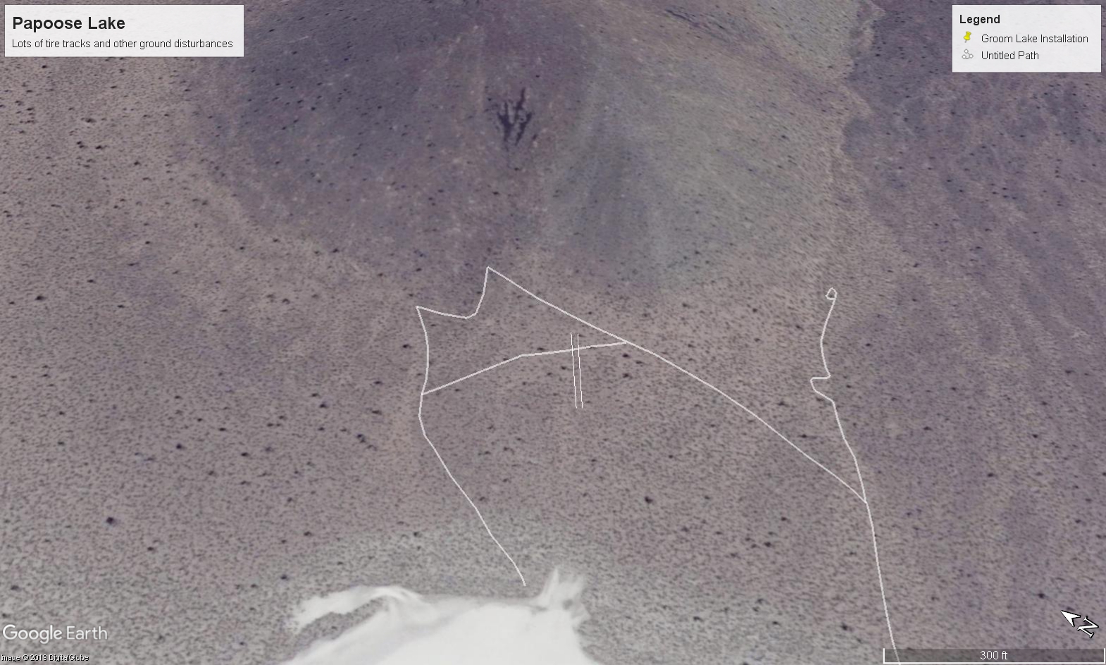

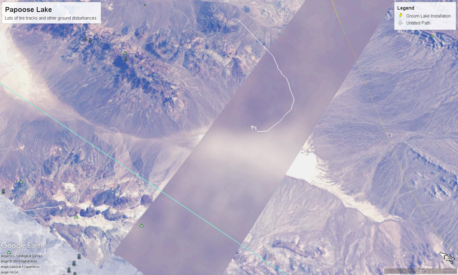
There are numerous roads leading to S-4 directly from Groom Lake, North and South... and even one that goes over a lower part of the Papoose Mountain range. Additionally, there is a turnaround area as described by Bob Lazar...and many old tracks present running by the outcroppings as Lazar described.
I suggest using Google Earth and using historical imagery to check the locations as outlined by my image.
This does it for me, Bob Lazar's revelation was factual. Always did think that, especially when he passed the polygraph exams and as more information he presented was verified/revealed true as he stated. As far as I am concerned, everything about S-4 that came out of his mouth should be taken as gospel.
Also of interest is the myriad of straight lines and angles present on the outcropping where S-4 sits (sat? It probably was abandoned in place). According to a NASA document on analyzing satellite imagery, straight lines and geometric shapes do not occur in nature.
Standard policy government denials hold no weight. In fact, the government has never presented a shred of evidence refuting Lazar's revelations. It would have been a very simple matter to clear up - merely inviting some reporters out to Papoose lake for a look would have proved he was lying/telling the truth.
Another key point is during a span of approximately 3 years, the area around Papoose (including S-4) is suspiciously blotted out by Google.
This road splits off toward S-4 from the North Access Road running from Groom Lake -> Papoose Lake
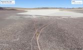
Another set of tracks
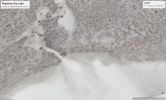
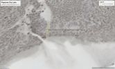
^Measurements show a width consistent with tracks a Bluebird school bus from the 1980's would leave (along with other makes and models of vehicles)
More activity at the "turnaround" which is directly near the S-4 location
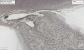
So much for no tire tracks....
Lets also not forget the Russian spy satelite photo obtained by John Andrews of Testors model corporation which clearly shows an object consistent with Lazar's description.
i.redd.it...
Many go to the used "But there are no roads, tracks, etc. near the S-4 location"
However, that is untrue.


There are numerous roads leading to S-4 directly from Groom Lake, North and South... and even one that goes over a lower part of the Papoose Mountain range. Additionally, there is a turnaround area as described by Bob Lazar...and many old tracks present running by the outcroppings as Lazar described.
I suggest using Google Earth and using historical imagery to check the locations as outlined by my image.
This does it for me, Bob Lazar's revelation was factual. Always did think that, especially when he passed the polygraph exams and as more information he presented was verified/revealed true as he stated. As far as I am concerned, everything about S-4 that came out of his mouth should be taken as gospel.
Also of interest is the myriad of straight lines and angles present on the outcropping where S-4 sits (sat? It probably was abandoned in place). According to a NASA document on analyzing satellite imagery, straight lines and geometric shapes do not occur in nature.
Standard policy government denials hold no weight. In fact, the government has never presented a shred of evidence refuting Lazar's revelations. It would have been a very simple matter to clear up - merely inviting some reporters out to Papoose lake for a look would have proved he was lying/telling the truth.
Another key point is during a span of approximately 3 years, the area around Papoose (including S-4) is suspiciously blotted out by Google.

This road splits off toward S-4 from the North Access Road running from Groom Lake -> Papoose Lake

Another set of tracks


^Measurements show a width consistent with tracks a Bluebird school bus from the 1980's would leave (along with other makes and models of vehicles)
More activity at the "turnaround" which is directly near the S-4 location

So much for no tire tracks....
Lets also not forget the Russian spy satelite photo obtained by John Andrews of Testors model corporation which clearly shows an object consistent with Lazar's description.
i.redd.it...
edit on 3/19/2019 by JBurns because: (no reason given)
a reply to: JBurns
Do people really use “no roads” as an argument?
Even if there were no surface roads there would still be the vast underground tunnels across that whole area. At this point they could have a whole city under that desert with little to no evidence on the surface.
Do people really use “no roads” as an argument?
Even if there were no surface roads there would still be the vast underground tunnels across that whole area. At this point they could have a whole city under that desert with little to no evidence on the surface.
a reply to: Quantumgamer1776
Sadly, yes. Although admittedly this was long before imagery had a high enough resolution to spot them. Given the fact many of them are seemingly no longer in use it would have been near darn impossible to spot back then
But they sure are there, none the less
And as you said, given the vast network of mines/caves along with the PLOWSHARE excavating nuclear tests and the large amount of earth moving equipment on site.... there could easily be massive networks of tunnels running under the mountain/under the ground
In fact there are a few sites along the North and South access road that could drop into a mine/tunnel and lead God only knows where
Sadly, yes. Although admittedly this was long before imagery had a high enough resolution to spot them. Given the fact many of them are seemingly no longer in use it would have been near darn impossible to spot back then

But they sure are there, none the less
And as you said, given the vast network of mines/caves along with the PLOWSHARE excavating nuclear tests and the large amount of earth moving equipment on site.... there could easily be massive networks of tunnels running under the mountain/under the ground
In fact there are a few sites along the North and South access road that could drop into a mine/tunnel and lead God only knows where
We are making ufos but we need roads.....
Anyone who has seen back to the future, knows that, ‘we don’t need roads”
Plus the underground tunnels
Anyone who has seen back to the future, knows that, ‘we don’t need roads”
Plus the underground tunnels
originally posted by: JBurns
Debunking one of the most used talking points (disinformation points) against the facility at S-4 Papoose Lake
Many go to the used "But there are no roads, tracks, etc. near the S-4 location"
However, that is untrue.
Those aren't roads. Those are jeep trails aka GOAT trails. I have ridden similar trails around the perimeter of Area 51 for 16 years. Typically on a 4 wheeler, sometimes in my Dodge 4WD truck. No way in HELL a "bus with blacked out windows" is gonna make it on those trails. My truck gets beat up on those trails.
And there aren't "numerous" trails leading to Papoose Dry Lake. There is a trail in from the north, and one that comes in from east to west, south of the dry lake. Again, both goat trails. Leading to the dry lake. Which in the winter ain't so dry.
Neither of which end up anywhere near where Lazar claimed "S4" is/was.
And what straight lines and angles are you referring to? The ones created by the faux topography on Google Earth, generated from a flat image?
ETA: a friend of mine, knows this area far better than I do, has said a number of times "the desert takes forever to heal". Point being, some of those trails you see on Google Earth date back to the time of settlers and covered wagons.
edit on 19-3-2019 by FosterVS because: (no reason
given)
a reply to: FosterVS
thearea51rider, a real pleasure to meet you
I am a big fan of your YouTube videos riding around the GL area. I have never seen those roads personally, so I believe you how you describe them
I am curious to note however that in one of your (I believe it was yours) video that showed the Groom Lake shuttle/bus it appeared it may have been tuned up or otherwise upgraded which of course isn't that unusual considering where it is operating I suppose
If you don't mind my asking, Since you have spent so much time in the area, do you believe it is possible there is a location within Area 51 (or even the surrounding areas) for holding recovered ETV? If so, where do you believe it would most likely be?
Admittedly I am unfamiliar with that neck of the woods.. but this is a logical explanation
Are you familiar with the Papoose area (on Google Earth)? If so, take a look at what I think is called the "Kelly mine" and it seems there are two roads (one from Papoose one by the Kelly Mine) that nearly meet. It meets in the same way the power lines running from the NTS go up the mountain on the Papoose side up to the mountain top installation and then down to the other side into Groom. To me it seemed as though another set of lines was heading from the Kelly Mine area to Papoose but I may have been seeing things on there since as you said it does tend to warp and pixelate things. Anyhow I would be real interested/appreciative to get your take on that, always real good when someone with knowledge of the area and especially its topography can jump in
-Jack
thearea51rider, a real pleasure to meet you
I am a big fan of your YouTube videos riding around the GL area. I have never seen those roads personally, so I believe you how you describe them
I am curious to note however that in one of your (I believe it was yours) video that showed the Groom Lake shuttle/bus it appeared it may have been tuned up or otherwise upgraded which of course isn't that unusual considering where it is operating I suppose
If you don't mind my asking, Since you have spent so much time in the area, do you believe it is possible there is a location within Area 51 (or even the surrounding areas) for holding recovered ETV? If so, where do you believe it would most likely be?
Point being, some of those trails you see on Google Earth date back to the time of settlers and covered wagons.
Admittedly I am unfamiliar with that neck of the woods.. but this is a logical explanation
Are you familiar with the Papoose area (on Google Earth)? If so, take a look at what I think is called the "Kelly mine" and it seems there are two roads (one from Papoose one by the Kelly Mine) that nearly meet. It meets in the same way the power lines running from the NTS go up the mountain on the Papoose side up to the mountain top installation and then down to the other side into Groom. To me it seemed as though another set of lines was heading from the Kelly Mine area to Papoose but I may have been seeing things on there since as you said it does tend to warp and pixelate things. Anyhow I would be real interested/appreciative to get your take on that, always real good when someone with knowledge of the area and especially its topography can jump in
-Jack
a reply to: JBurns
Those so-called "roads" are nothing to write home about.
Lazar also claimed that there were hangars built into the side of a mountain adjacent to Papoose Lake, but there is no mountain or hillside abutting the lakebed. The landscape surrounding the playa consists of alluvial fans of sediment washed down from the nearby mountains. It's the worst type of material for excavating an underground facility, and you couldn't do to without leaving an awful scar. I have seen much smaller excavations leave enduring scars on the desert even in the wake of multimillion dollar projects that were supposed to restore the landscape to its original condition.
originally posted by: JBurns
a reply to: FosterVS
thearea51rider, a real pleasure to meet you
I am a big fan of your YouTube videos riding around the GL area. I have never seen those roads personally, so I believe you how you describe them. I am curious to note however that in one of your (I believe it was yours) video that showed the Groom Lake shuttle/bus it appeared it may have been tuned up or otherwise upgraded which of course isn't that unusual considering where it is operating I suppose
Thanks for the kind words! The "Area 51 Worker Bus" appears to me to be a standard ol' Bluebird bus. I wouldn't doubt it probably has nicer seats and AC over stock. I have taken numerous pics of the bus, and I see nothing much out of the ordinary. There is a stubby antenna near the roof where the driver is. That bus hauls ass too, I had trouble keeping up to it, and I was doing 80 mph. The story I have been told is that bus parks at the Groom Lake Road guard shack, and another bus takes the workers the rest of the way in to the base. Just a story I heard.
If you don't mind my asking, Since you have spent so much time in the area, do you believe it is possible there is a location within Area 51 (or even the surrounding areas) for holding recovered ETV? If so, where do you believe it would most likely be?
I spend one month a year doing my exploring in the area, my bucket list is usually only half done at the end.
There's all kinds of places at Area 51 or Tonopah Test Range to "hold recovered ETV", assuming you believe in such things. I don't. Existing hangars, roll it out at night.
Admittedly I am unfamiliar with that neck of the woods.. but this is a logical explanation
Are you familiar with the Papoose area (on Google Earth)? If so, take a look at what I think is called the "Kelly mine" and it seems there are two roads (one from Papoose one by the Kelly Mine) that nearly meet. It meets in the same way the power lines running from the NTS go up the mountain on the Papoose side up to the mountain top installation and then down to the other side into Groom. To me it seemed as though another set of lines was heading from the Kelly Mine area to Papoose but I may have been seeing things on there since as you said it does tend to warp and pixelate things. Anyhow I would be real interested/appreciative to get your take on that, always real good when someone with knowledge of the area and especially its topography can jump in
-Jack
I have peered at Google Earth as much as anybody probably. That's the extent of my "knowledge of the area", other than poking around the perimeter once a year. Or info I have been told by other people who know more about this stuff than I do.
I recently did a viewshed analysis to prove something I was pretty sure of anyways. There are a few places you can see S4 from outside the restricted area. Mind you, it's over 50 miles away. The same spot(s) will give you a view of that UAV test facility in Area 6, again from a hell of a distance. Someone who likes to imitate me, is claiming he is gonna give "views of S4". Unless he has done some research, he is talking out his behind (yet again).
Lazar picked a perfect spot for his S4, right in the bloody middle of the NTTR, surrounded by hills.
I have not heard of "Kelly Mine" but I will peer at Google Earth again and see if I can spot what you are referring to.
A word to the wise - pay attention to Shadowhawk. He's knows much more than almost all of us on these matters.
originally posted by: JBurns
a reply to: FosterVS
Are you familiar with the Papoose area (on Google Earth)? If so, take a look at what I think is called the "Kelly mine" and it seems there are two roads (one from Papoose one by the Kelly Mine) that nearly meet. It meets in the same way the power lines running from the NTS go up the mountain on the Papoose side up to the mountain top installation and then down to the other side into Groom. To me it seemed as though another set of lines was heading from the Kelly Mine area to Papoose but I may have been seeing things on there since as you said it does tend to warp and pixelate things. Anyhow I would be real interested/appreciative to get your take on that, always real good when someone with knowledge of the area and especially its topography can jump in
-Jack
This is what shows as "Kelly Mine" on Google Earth:
37.157117°, -115.784770°
Frankly, I don't see what you are seeing. Nevada has over 200,000 abandoned mines, including within the NTTR.
What I see, with the trails, diggings, etc. it looks like many other abandoned mines.
new topics
-
Just spotted an unusual aircraft Melbourne Australia
Aliens and UFOs: 5 hours ago -
The truth lets admit it
Aliens and UFOs: 10 hours ago
top topics
-
Mass Shooting Towson, Maryland - 7 shot, 1 possibly dead
Social Issues and Civil Unrest: 13 hours ago, 6 flags -
The truth lets admit it
Aliens and UFOs: 10 hours ago, 6 flags -
Just spotted an unusual aircraft Melbourne Australia
Aliens and UFOs: 5 hours ago, 5 flags
active topics
-
The truth lets admit it
Aliens and UFOs • 30 • : Xtrozero -
Defending the need for adherence to Old Testament commandments under the new covenant of Christ
Conspiracies in Religions • 40 • : lilzazz -
Mass Shooting Towson, Maryland - 7 shot, 1 possibly dead
Social Issues and Civil Unrest • 13 • : xuenchen -
Just spotted an unusual aircraft Melbourne Australia
Aliens and UFOs • 3 • : xuenchen -
Statements of Intent from Incoming Trump Administration Members - 2025 to 2029.
2024 Elections • 48 • : WeMustCare -
New job to help stop school shootings
Social Issues and Civil Unrest • 23 • : Xtrozero -
Trump Cancel trip to New Jersey because of drones
Aliens and UFOs • 62 • : Xtrozero -
School shooting in Madison Wi.
Social Issues and Civil Unrest • 69 • : Xtrozero -
Was Biden's Mass clemency and pardons one last cash grab?
US Political Madness • 5 • : mysterioustranger -
Post A Funny (T&C Friendly) Pic Part IV: The LOL awakens!
General Chit Chat • 7921 • : underpass61
3
