It looks like you're using an Ad Blocker.
Please white-list or disable AboveTopSecret.com in your ad-blocking tool.
Thank you.
Some features of ATS will be disabled while you continue to use an ad-blocker.
15
share:
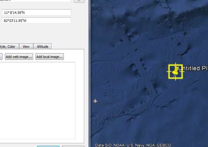
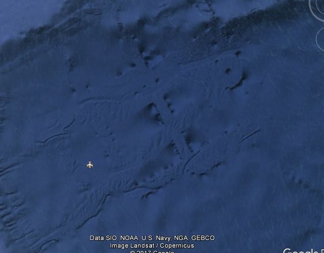
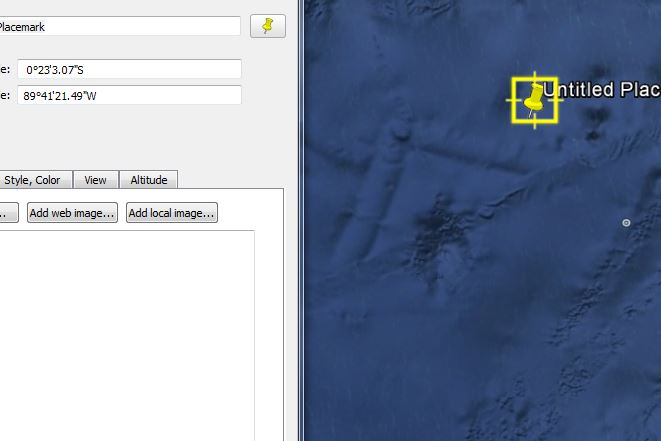
Found these searching the Ocean can anyone shed some light on what they could be?


Looks interesting for sure!
Anyone know the depth of these anomalies?
Anyone know the depth of these anomalies?
a reply to: Gargoyle91
All i can think of now is how it looks like a sideways pencil compass embedded in the ocean.
Hmm interesting.
-Alee
All i can think of now is how it looks like a sideways pencil compass embedded in the ocean.
Hmm interesting.
-Alee
a reply to: Gargoyle91
It's nothing, the Google version of the ocean floor is very very VERY weak representation, you will not be able to see any details, most likely they are sonar tracks from various science ships, you can see those sonar tracks all over Google, the ocean bottom is a little more detailed in those sonar tracks.
It's nothing, the Google version of the ocean floor is very very VERY weak representation, you will not be able to see any details, most likely they are sonar tracks from various science ships, you can see those sonar tracks all over Google, the ocean bottom is a little more detailed in those sonar tracks.
Cool looking stuff huh!! Love it too!! Hope this helps!
Great video explaining how sonar tracks can look like high intelligence made structures or are they just sonar tracks. Good Info if you watch the video.
This is the site he was using in the above video
MGDS Marine Geoscience Data Center www.marine-geo.org...
On the other hand here is another video “with the exact place you are looking at in your posted pics” Some others thought it was unique also. Maybe use the MGDS to closer check this area out & see what you can find out.
The specific area you are looking at doesn’t to me (no expert) look like the sonar tracks in the first video???
Here is another very educational & interesting & hopefully helpful link.
Exploring our Fluid Earth
manoa.hawaii.edu...
Keep your curiosity
a reply to: SeekingDepth
Reminds of Richard Sauder, author of the book Hidden in Plain Sight, no disrespect to Philip Schneider.
Saunder is a trailblazer in underground bases research. He started with solid documents research- plans, budgets and infos on engineers' conventions specializing in underground bases. Here's a video of his interview where he mentioned underwater bases for submarines:
new topics
-
What Comes After January 20th
Mainstream News: 24 minutes ago -
Canada as a state .. how would it work?
General Chit Chat: 33 minutes ago -
Those stupid GRAVITE commercials
Rant: 1 hours ago -
Let's Buy Greenland
General Chit Chat: 2 hours ago -
Planned Civil War In Britain May Be Triggered Soon
Social Issues and Civil Unrest: 5 hours ago -
Claim: General Mark Milley Approved Heat and Sound Directed Energy Weapons During 2020 Riots
Whistle Blowers and Leaked Documents: 6 hours ago
top topics
-
Claim: General Mark Milley Approved Heat and Sound Directed Energy Weapons During 2020 Riots
Whistle Blowers and Leaked Documents: 6 hours ago, 10 flags -
Planned Civil War In Britain May Be Triggered Soon
Social Issues and Civil Unrest: 5 hours ago, 5 flags -
What Comes After January 20th
Mainstream News: 24 minutes ago, 4 flags -
Let's Buy Greenland
General Chit Chat: 2 hours ago, 3 flags -
Those stupid GRAVITE commercials
Rant: 1 hours ago, 2 flags -
Canada as a state .. how would it work?
General Chit Chat: 33 minutes ago, 0 flags
active topics
-
Let's Buy Greenland
General Chit Chat • 9 • : CarlLaFong -
What Comes After January 20th
Mainstream News • 3 • : UpIsNowDown2 -
Gravitic Propulsion--What IF the US and China Really Have it?
General Conspiracies • 30 • : Lazy88 -
Remember These Attacks When President Trump 2.0 Retribution-Justice Commences.
2024 Elections • 133 • : Oldcarpy2 -
Canada as a state .. how would it work?
General Chit Chat • 4 • : enament -
Sorry to disappoint you but...
US Political Madness • 40 • : cherokeetroy -
Those stupid GRAVITE commercials
Rant • 2 • : BeyondKnowledge3 -
January 6th report shows disturbing trend (nobody is shocked)
US Political Madness • 72 • : JadedGhost -
-@TH3WH17ERABB17- -Q- ---TIME TO SHOW THE WORLD--- -Part- --44--
Dissecting Disinformation • 3954 • : Thoughtful3 -
Claim: General Mark Milley Approved Heat and Sound Directed Energy Weapons During 2020 Riots
Whistle Blowers and Leaked Documents • 20 • : NoCorruptionAllowed
15
