It looks like you're using an Ad Blocker.
Please white-list or disable AboveTopSecret.com in your ad-blocking tool.
Thank you.
Some features of ATS will be disabled while you continue to use an ad-blocker.
share:
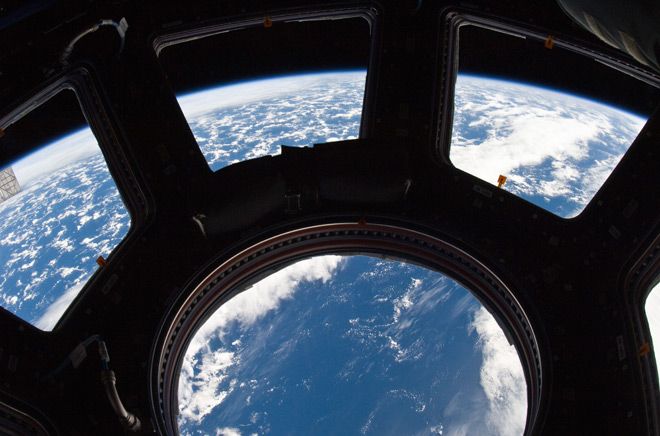
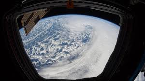
I recently came across these pics,
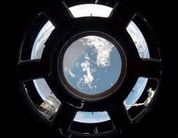
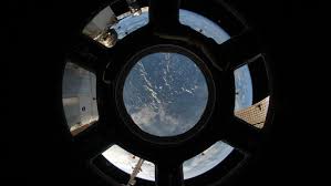
There are more like them. I was like WTF!
I thought it was not possible to capture the entire Earth in one shot from lower Earth orbit. NASA said this themselves, it was the reason why almost all of their Earth pics are not real, but photoshopped composite images. This is by their own admission.
www.nasa.gov...
This alone should be enough to prove that these cupola pics showing the entire Earth are fake as hell. The funny thing is that if I were to make a thread just showing these pics and would talk about how cool they are and how pretty the Earth looks from ISS there would be all sorts of space buffs, astrophotographers and space exploration "experts" agreeing on this, and not one would even notice the blatant impossibility of such a shot.
Just goes to show they will believe anything that is produced by official sources without any form of critical and independant thought......
Even after all the proof I will have provided by the end of this thread they will still be in denial of the facts and will probably resort to insults and ridicule.
Well the joke's on you.
So, although enough proof has already been offered, let me show you some visual proof. Here is a quick scale model of the Earth, showing the max altitude of the ISS above Earth and the max field of view of the Earth, from that altitude.
en.wikipedia.org...
The altitude in my drawing actually represents 450 km.
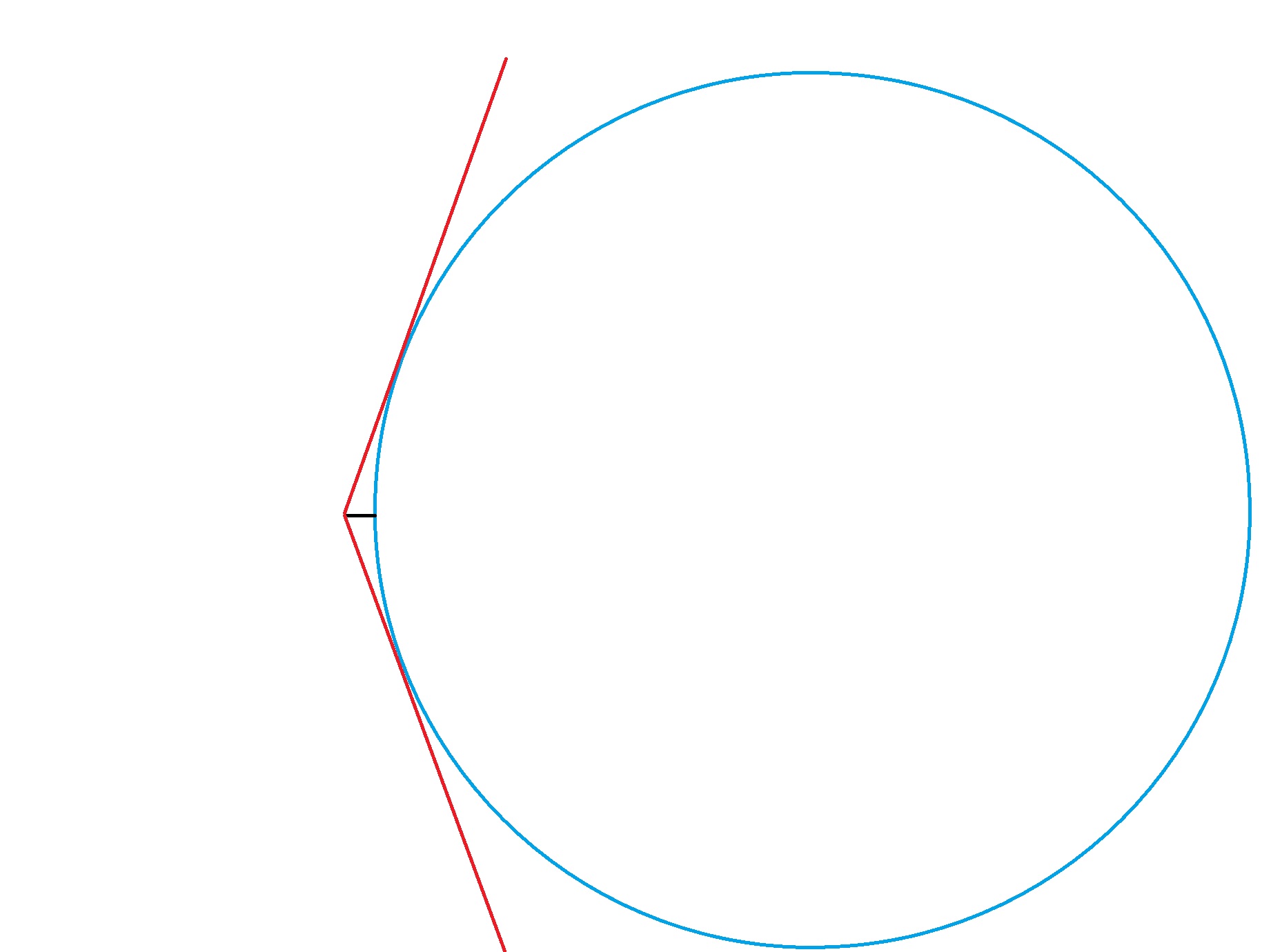
We can clearly see that it is simply physically impossible to view the entire Earth from this altitude........
We can also do some calculations.
The diameter of the cupola windows together is 2 meter.
The middle window is 80 cm across. Going by these dimensions we can determine that the camera is about 2m from the windows in these pics.
Using Pythagoras we can calculate the angle of the max field of view. This would be an angle of about 53 degrees.
According to Metabunk's Earth Curve Calculator, the distance to the horizon from 450 km is 2625271 meter.
www.metabunk.org...
So using Pythagoras again we can calculate the amount of the Earth that would be visible from 450 km with that field of view.
This would be 4698890 meter, or 4699 km.
In order to get the entire Earth this would have to be 12,742 km........
So there you have it.
100% fake pic of Earth from ISS, produced by NASA.
If anyone has a problem with the values I used for my calculations go ahead and do your own calculation, it will never add up with this view, but I already proved that without the calculations.


There are more like them. I was like WTF!
I thought it was not possible to capture the entire Earth in one shot from lower Earth orbit. NASA said this themselves, it was the reason why almost all of their Earth pics are not real, but photoshopped composite images. This is by their own admission.
My role is to make imagery from Earth sciences data. I turn data into pictures.
The last time anyone took a photograph from above low Earth orbit that showed an entire hemisphere (one side of a globe) was in 1972 during Apollo 17. NASA’s Earth Observing System (EOS) satellites were designed to give a check-up of Earth’s health. By 2002, we finally had enough data to make a snap shot of the entire Earth. So we did. The hard part was creating a flat map of the Earth’s surface with four months’ of satellite data. Reto Stockli, now at the Swiss Federal Office of Meteorology and Climatology, did much of this work. Then we wrapped the flat map around a ball. My part was integrating the surface, clouds, and oceans to match people’s expectations of how Earth looks from space. That ball became the famous Blue Marble.
www.nasa.gov...
Images of the earth may seem commonplace, but there are actually very few pictures of the entire planet. The problem, Simmon said, is all the NASA earth-observing satellites are in low-earth or geostationary orbit, meaning none of them are far enough away to see a full hemisphere. The most familiar pictures of the entire Earth are from the 1960s and 1970s Apollo missions to the moon.
This alone should be enough to prove that these cupola pics showing the entire Earth are fake as hell. The funny thing is that if I were to make a thread just showing these pics and would talk about how cool they are and how pretty the Earth looks from ISS there would be all sorts of space buffs, astrophotographers and space exploration "experts" agreeing on this, and not one would even notice the blatant impossibility of such a shot.
Just goes to show they will believe anything that is produced by official sources without any form of critical and independant thought......
Even after all the proof I will have provided by the end of this thread they will still be in denial of the facts and will probably resort to insults and ridicule.
Well the joke's on you.
So, although enough proof has already been offered, let me show you some visual proof. Here is a quick scale model of the Earth, showing the max altitude of the ISS above Earth and the max field of view of the Earth, from that altitude.
The ISS maintains an orbit with an altitude of between 330 and 435 km
en.wikipedia.org...
The altitude in my drawing actually represents 450 km.

We can clearly see that it is simply physically impossible to view the entire Earth from this altitude........
We can also do some calculations.
The diameter of the cupola windows together is 2 meter.
The middle window is 80 cm across. Going by these dimensions we can determine that the camera is about 2m from the windows in these pics.
Using Pythagoras we can calculate the angle of the max field of view. This would be an angle of about 53 degrees.
According to Metabunk's Earth Curve Calculator, the distance to the horizon from 450 km is 2625271 meter.
www.metabunk.org...
So using Pythagoras again we can calculate the amount of the Earth that would be visible from 450 km with that field of view.
This would be 4698890 meter, or 4699 km.
In order to get the entire Earth this would have to be 12,742 km........
So there you have it.
100% fake pic of Earth from ISS, produced by NASA.
If anyone has a problem with the values I used for my calculations go ahead and do your own calculation, it will never add up with this view, but I already proved that without the calculations.
edit on 25-3-2017 by WaxingGibbons because: (no reason given)
a reply to: WaxingGibbons
But... Those pictures don't show a full view of the Earth. What is represented in the pictures actually seems to match the altitude drawing you made.
But... Those pictures don't show a full view of the Earth. What is represented in the pictures actually seems to match the altitude drawing you made.
a reply to: WaxingGibbons
You don't. You see the framing of the cupola and the interior of the station. The camera is mounted inside the cupola, not on the exterior.
You don't. You see the framing of the cupola and the interior of the station. The camera is mounted inside the cupola, not on the exterior.
originally posted by: WaxingGibbons
a reply to: DrWily
They don't? Then why do we space all around the Earth. Come on now.
You got me, I didn't look super closely at the picture. But in really looking at it, I noticed a few anomalies.
First off, where did you get those pictures? Links please. I've never seen NASA post such a low resolution pic on their site. Second... You are right, there is a abnormally large view of the Earth. It almost looks like it would have been taken from geostationary orbit...
Another possibility is image distortion. I'm sure the windows on the Cupola module are pretty thick. What could be happening is the coke bottle effect you see on people with thick glasses.
a reply to: DrWily
Don't know if this is official enough, let me look for the original NASA sources,
www.issphotolibrary.com...
I did notice on this page that it shows views of only part of the Earth, so why is it rounded off looking like a sphere.
Don't know if this is official enough, let me look for the original NASA sources,
www.issphotolibrary.com...
I did notice on this page that it shows views of only part of the Earth, so why is it rounded off looking like a sphere.
edit on 25-3-2017 by
WaxingGibbons because: (no reason given)
a reply to: WaxingGibbons
That's all inside the station, except the very small area just above the curvature of the earth in that picture. The astronauts use a DSLR to shoot out the windows of the cupola. In the original post, the "space" around the earth is inside the station.
That's all inside the station, except the very small area just above the curvature of the earth in that picture. The astronauts use a DSLR to shoot out the windows of the cupola. In the original post, the "space" around the earth is inside the station.
originally posted by: WaxingGibbons
a reply to: DrWily
I already showed you that it is simply impossible to get a view of the entire Earth from that altitude. It has nothing to do with lenses and such.
It's not impossible. A negative lens, one with a concave surface, has the ability to make objects seem smaller than they really are. Haven't you ever read the little message on the side mirrors of your car? There is a amusing scene in Jurassic Park about this very subject.
Never mind.
edit on 3/25/2017 by Zaphod58 because: (no reason given)
a reply to: WaxingGibbons
Also, perhaps you aren't considering the shape of the Capola. What you are saying is absolutely true for the central round window. But the trapezoid shaped windows have a wider field of view than the drawing you made. Mystery solved.
Also, perhaps you aren't considering the shape of the Capola. What you are saying is absolutely true for the central round window. But the trapezoid shaped windows have a wider field of view than the drawing you made. Mystery solved.
So on this site you can see a pic from the cupola that shows lake Malawi. The lake is 580 km long. It is about one third of the shot. This means we
are looking at 1700/1800 kms.
We should be seeing like I calculated earlier about 4700 km of the surface. The pic is obviously not zoomed in either.
www.issphotolibrary.com...
No matter how you look at these pics, they are fake, fake, fake.......
We should be seeing like I calculated earlier about 4700 km of the surface. The pic is obviously not zoomed in either.
www.issphotolibrary.com...
No matter how you look at these pics, they are fake, fake, fake.......
edit on 25-3-2017 by WaxingGibbons because: (no reason given)
a reply to: DrWily
BS, the max diameter that you can view through is still 2m, regardless of the angle of the windows. And again, such a shot is simply not possible from that altitude, NASA claims this themselves for god sakes.
You didn't solve anything. You are in straight denial.
BS, the max diameter that you can view through is still 2m, regardless of the angle of the windows. And again, such a shot is simply not possible from that altitude, NASA claims this themselves for god sakes.
You didn't solve anything. You are in straight denial.
edit on 25-3-2017 by WaxingGibbons because: (no reason given)
It doesn't even look like full earth pictures. The first picture there's only part of one land mass. Can you link to the pictures you're using?
a reply to: WaxingGibbons
Not fake, just a fisheye lens. In that picture the middle window and the surrounding windows look flat, while in reality they are side windows
Not fake, just a fisheye lens. In that picture the middle window and the surrounding windows look flat, while in reality they are side windows
edit on 25/3/2017 by chrismir because: typo
new topics
-
Potter to WHU
World Sports: 3 hours ago -
Dr. Demento
Music: 5 hours ago -
The elephant in the room (wearing a hoodie)
US Political Madness: 5 hours ago
top topics
-
The elephant in the room (wearing a hoodie)
US Political Madness: 5 hours ago, 9 flags -
Green Grapes
General Chit Chat: 16 hours ago, 7 flags -
To become president, Zelensky had to learn Ukrainian
Political Conspiracies: 12 hours ago, 6 flags -
Dr. Demento
Music: 5 hours ago, 4 flags -
Potter to WHU
World Sports: 3 hours ago, 1 flags
active topics
-
Los Angeles brush fires latest: 2 blazes threaten structures, prompt evacuations
Mainstream News • 139 • : xuenchen -
To become president, Zelensky had to learn Ukrainian
Political Conspiracies • 26 • : Dalamax -
-@TH3WH17ERABB17- -Q- ---TIME TO SHOW THE WORLD--- -Part- --44--
Dissecting Disinformation • 3975 • : Thoughtful3 -
The elephant in the room (wearing a hoodie)
US Political Madness • 14 • : Edumakated -
Trump says ownership of Greenland 'is an absolute necessity'
Other Current Events • 70 • : BedevereTheWise -
The Truth about Migrant Crime in Britain.
Social Issues and Civil Unrest • 37 • : BedevereTheWise -
Dr. Demento
Music • 9 • : DAVID64 -
The Fight for Election Integrity Continues -- Audits, Criminal Investigations, Legislative Reform
2024 Elections • 4370 • : fringeofthefringe -
What Is 'Quad Demic'? Mask Mandate Returns In These US States
Diseases and Pandemics • 42 • : Owlwatcher -
Steering the Titantic from the Drydock.
Rant • 46 • : Owlwatcher

