It looks like you're using an Ad Blocker.
Please white-list or disable AboveTopSecret.com in your ad-blocking tool.
Thank you.
Some features of ATS will be disabled while you continue to use an ad-blocker.
share:
originally posted by: jeep3r
originally posted by: ArMaP
a reply to: jeep3r
Can we get a video?
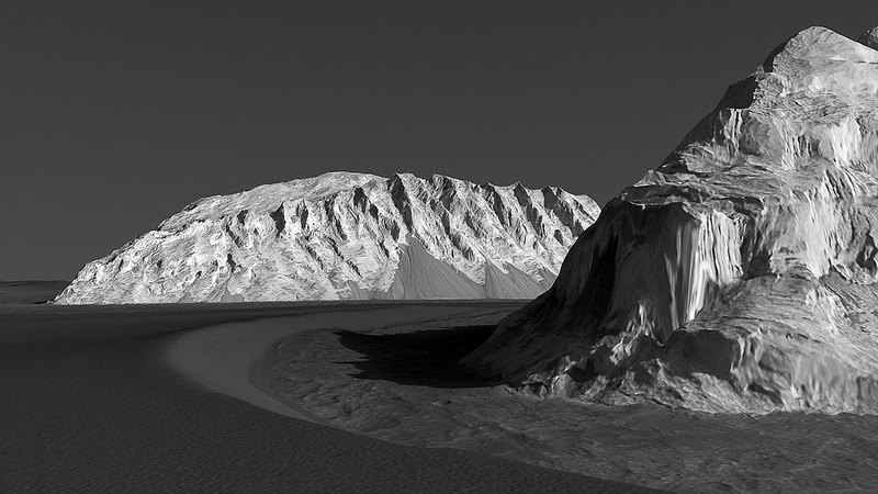
I created a short flyover clip (40 seconds, format: h.264/1920 x 1080) but currently can't access my old youtube account that I previously used for ATS stuff. I uploaded the file (27 mb) here instead, as a temporary download.
Wow!
I need to look into how to do this stuff!
e2a: Do people think it's worth doing a tutorial thread on this stuff? tTere are lots of images and data out there from a variety of space agencies that anyone can get hold of but it's sometimes difficult to work out how to get the images into a more standard format. I have some experience with Chinese, Indian and Japanese images I could contribute.
edit on 14/1/2017 by OneBigMonkeyToo because: (no reason given)
originally posted by: OneBigMonkeyToo
e2a: Do people think it's worth doing a tutorial thread on this stuff? tTere are lots of images and data out there from a variety of space agencies that anyone can get hold of but it's sometimes difficult to work out how to get the images into a more standard format. I have some experience with Chinese, Indian and Japanese images I could contribute.
I think that's a great idea.
originally posted by: ArMaP
originally posted by: OneBigMonkeyToo
e2a: Do people think it's worth doing a tutorial thread on this stuff? tTere are lots of images and data out there from a variety of space agencies that anyone can get hold of but it's sometimes difficult to work out how to get the images into a more standard format. I have some experience with Chinese, Indian and Japanese images I could contribute.
I think that's a great idea.
I've added a JAXA tutorial to this thread:
www.abovetopsecret.com...
Obviously it's for moon data, not mars, but a lot of the techniques are portable once you get your head around them.
Thanks to this thread I now know about QGIS, so the bit at the end covering that is what I'v learned since last night
Virtual 3D flyovers, or just images themselves, are an amazing way to explore and study the Solar System. Some of these images and animations use
photos taken through a telescope, which is even more amazing.
Regarding Mars data, I think it should be possible to use RGB images for these 3D projections and animations. I'd very much like to see some.
Example: DTM, RGB image.
Regarding Mars data, I think it should be possible to use RGB images for these 3D projections and animations. I'd very much like to see some.
Example: DTM, RGB image.
originally posted by: wildespace
Regarding Mars data, I think it should be possible to use RGB images for these 3D projections and animations. I'd very much like to see some.
Example: DTM, RGB image.
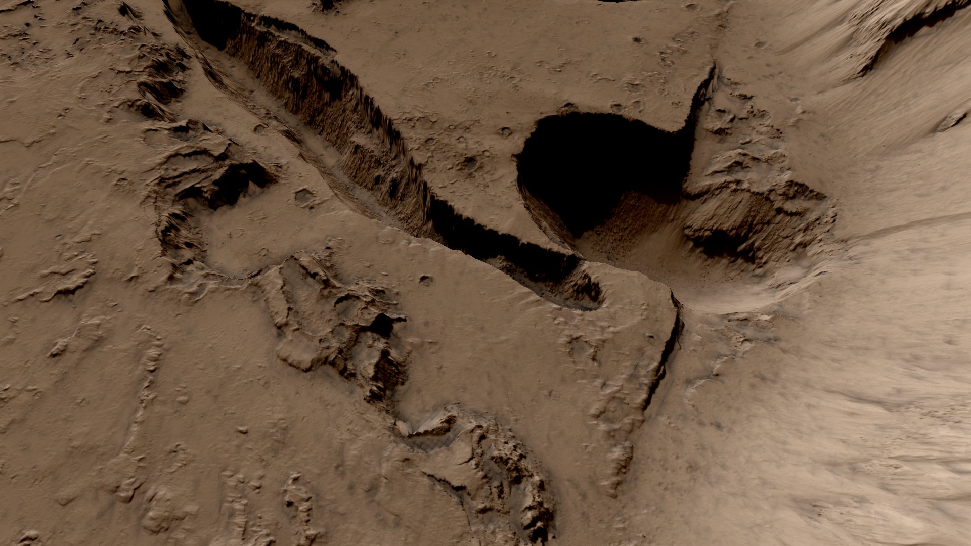
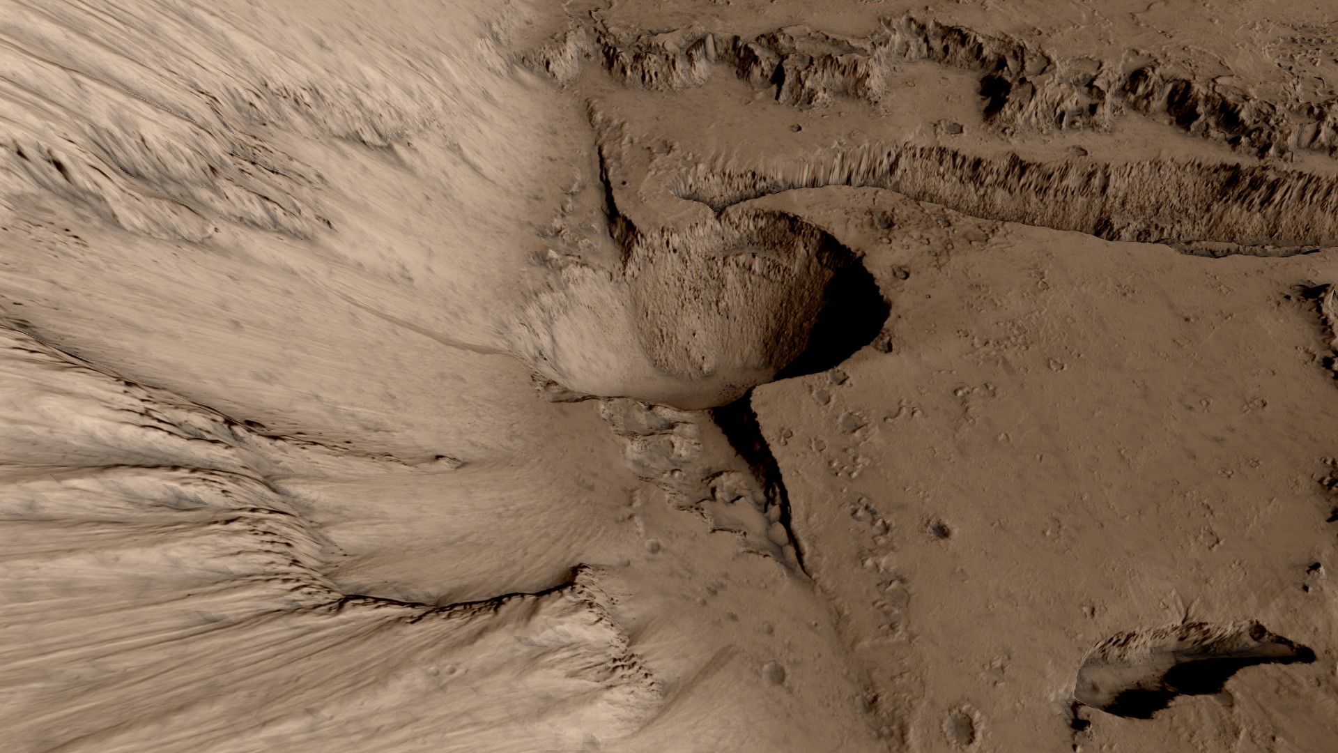
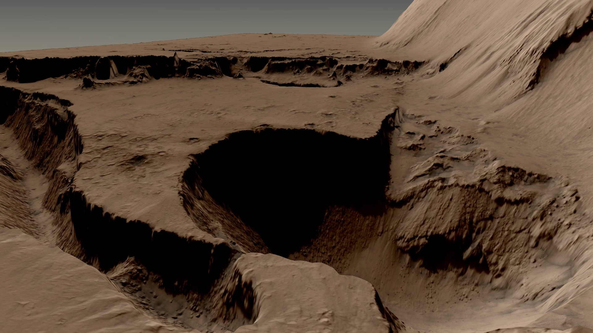
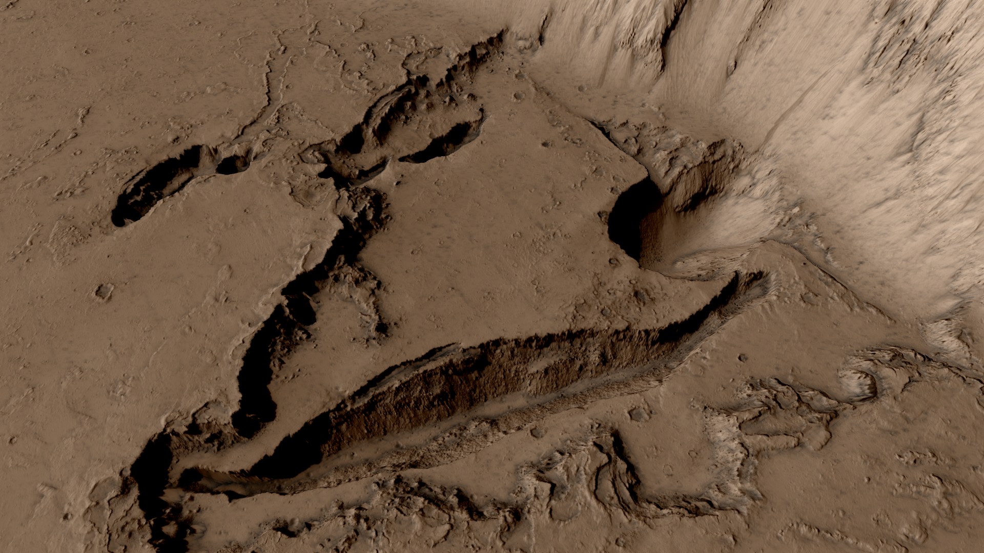
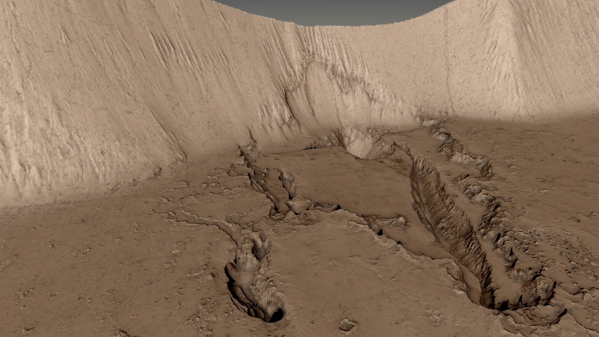
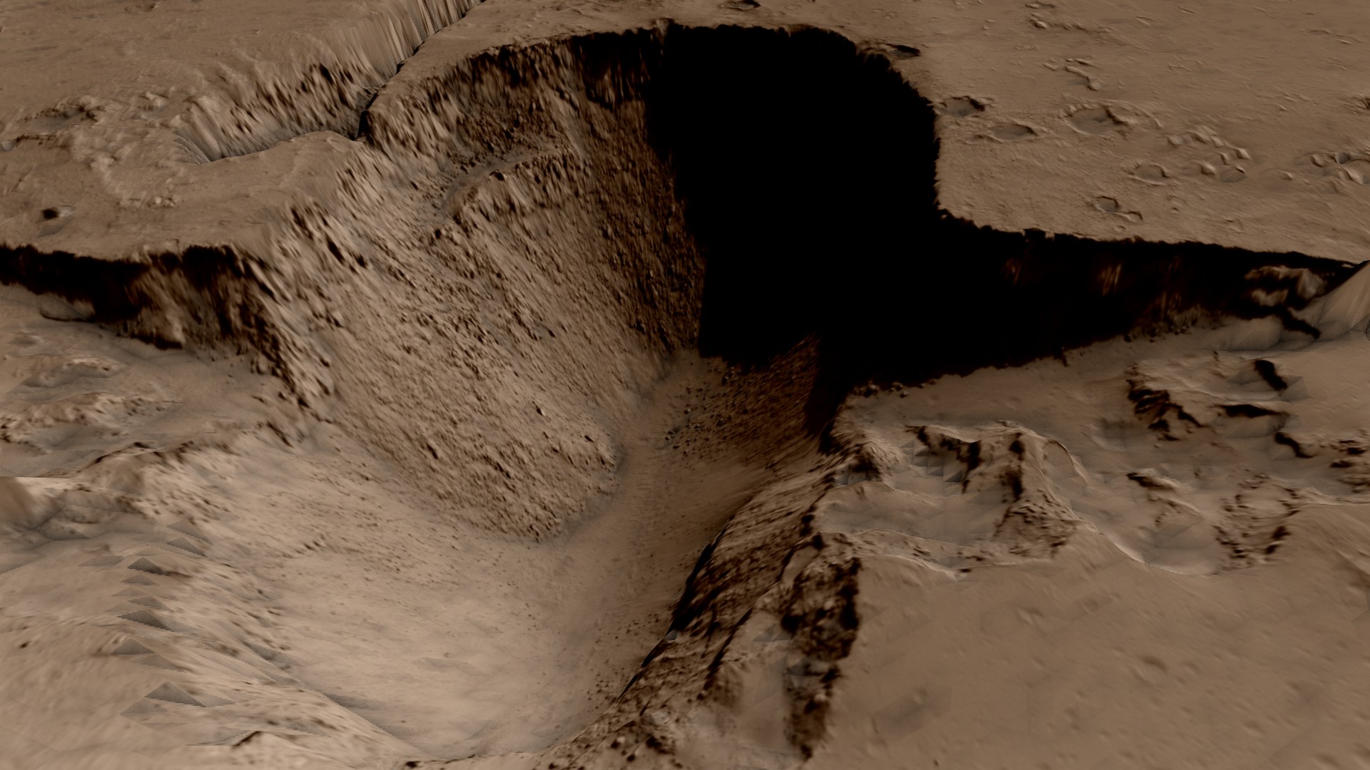
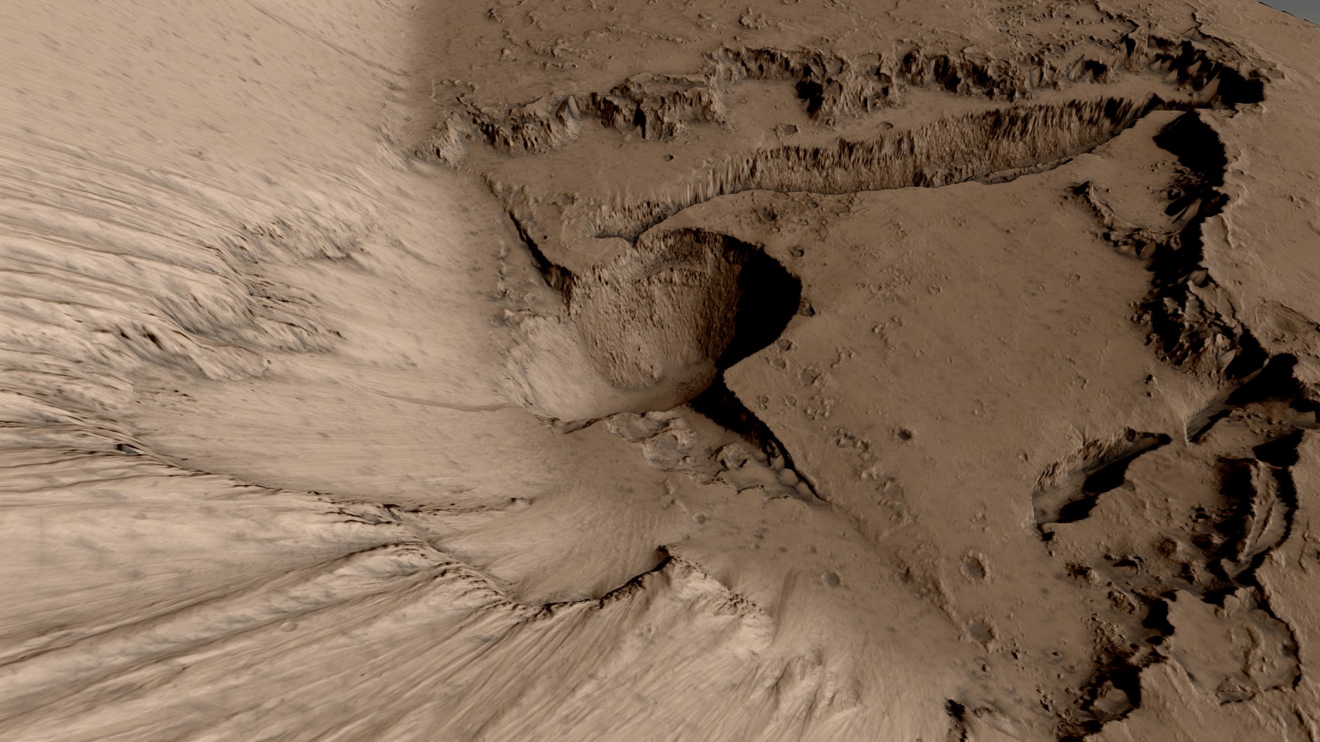
That DTM indeed has some interesting features in it. I did a version with the entire terrain colorized according to the reddish hue taken from the RGB image strip. So here goes Hibes Monte in the typical mars colors:
edit on 15-1-2017 by jeep3r because: text
originally posted by: OneBigMonkeyToo
I've added a JAXA tutorial to this thread:
www.abovetopsecret.com...
Obviously it's for moon data, not mars, but a lot of the techniques are portable once you get your head around them.
This result is simply overwhelming (ETA: image on the right is from Apollo 17). It's amazing to see the simulated terrain corresponding to the real surface with such precision.
edit on 15-1-2017 by jeep3r because: text
a reply to: jeep3r
Great images, both in your post & in the OP.
To my untrained eye, it seems to me that Mars has been absolutely covered with very fine grade debris - as though it was totally immersed in a sea of dust which aggregated over all of its original surface geology, and was then weathered by natural atmospheric processes.
It strikes me that the state of the surface of Mars provides a rather compelling possibility of a confirmation of the 'exploded planet hypothesis' originally raised by Van Flandern, and further developed by many authors. My favourite book so far, regarding the state of our solar system & the anomalies/ mythos which apparently surround it, is 'The Cosmic War' by author & researcher Dr Joseph P Farrell. Seriously good stuff, a great jumping-off point for the ancient 'War in Heaven' type of research.
edit on JanuarySunday1701CST09America/Chicago-060055 by FlyInTheOintment because: spelling
MRO's DTMs have been used for this rather psychedelic video exploring the idea of aliens on Mars: vimeo.com...
Utopia Planitia is a CG short about space exploration and the quest of finding traces of extraterrestrial forms of life. Flying over spectacular desert planet, seeing strangely familiar ancient civilizations remains and experiencing a first contact with the existence of unknown living things.
new topics
-
Tariffs all around, Except for ...
Predictions & Prophecies: 1 hours ago -
Gen Flynn's Sister and her cohort blow the whistle on DHS/CBP involvement in child trafficking.
Whistle Blowers and Leaked Documents: 5 hours ago -
Anybody else using Pomodoro time management technique?
General Chit Chat: 8 hours ago -
Bucks County commissioners vote to count illegal ballots in Pennsylvania recount
2024 Elections: 10 hours ago -
Trump sues media outlets -- 10 Billion Dollar lawsuit
US Political Madness: 11 hours ago
top topics
-
Trump sues media outlets -- 10 Billion Dollar lawsuit
US Political Madness: 11 hours ago, 24 flags -
Bucks County commissioners vote to count illegal ballots in Pennsylvania recount
2024 Elections: 10 hours ago, 21 flags -
How long till it starts
US Political Madness: 13 hours ago, 17 flags -
USSS Agent Fired for Having Sex In Michelle Obama's Bathroom
Politicians & People: 15 hours ago, 10 flags -
Fired fema employee speaks.
US Political Madness: 12 hours ago, 10 flags -
Watching TV
Jokes, Puns, & Pranks: 17 hours ago, 9 flags -
Gen Flynn's Sister and her cohort blow the whistle on DHS/CBP involvement in child trafficking.
Whistle Blowers and Leaked Documents: 5 hours ago, 7 flags -
Anybody else using Pomodoro time management technique?
General Chit Chat: 8 hours ago, 3 flags -
Tariffs all around, Except for ...
Predictions & Prophecies: 1 hours ago, 1 flags
active topics
-
Mike Tyson returns 11-15-24
World Sports • 51 • : Hypntick -
Tariffs all around, Except for ...
Predictions & Prophecies • 6 • : gort69 -
60s-70s Psychedelia
Music • 54 • : gort69 -
The Trump effect 6 days after 2024 election
2024 Elections • 142 • : WakeUpBeer -
The art of being offended
Social Issues and Civil Unrest • 49 • : gort69 -
Bucks County commissioners vote to count illegal ballots in Pennsylvania recount
2024 Elections • 20 • : gort69 -
Gen Flynn's Sister and her cohort blow the whistle on DHS/CBP involvement in child trafficking.
Whistle Blowers and Leaked Documents • 6 • : gort69 -
President-Elect DONALD TRUMP's 2nd-Term Administration Takes Shape.
Political Ideology • 204 • : WeMustCare -
How long till it starts
US Political Madness • 17 • : WeMustCare -
USSS Agent Fired for Having Sex In Michelle Obama's Bathroom
Politicians & People • 24 • : rickymouse


