It looks like you're using an Ad Blocker.
Please white-list or disable AboveTopSecret.com in your ad-blocking tool.
Thank you.
Some features of ATS will be disabled while you continue to use an ad-blocker.
13
share:
Hi guys,
I was at the flee market this morning and stumbled on a stack of mixed photos. In the vast majority, black and white photos of random people from the past... family pictures, lost for eternity.
I always like to dig in there. Sometimes you stumble on little photographic masterpieces.
Annnnyway... I was looking at all these oldies and found this picture.
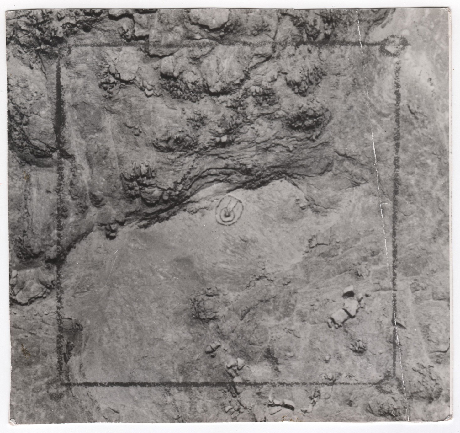
I have no idea what it is and thought it was intriguing so I took it. I thought maybe it could distract a few of you guys here.
No date, just a few handwritten inscriptions on the back:
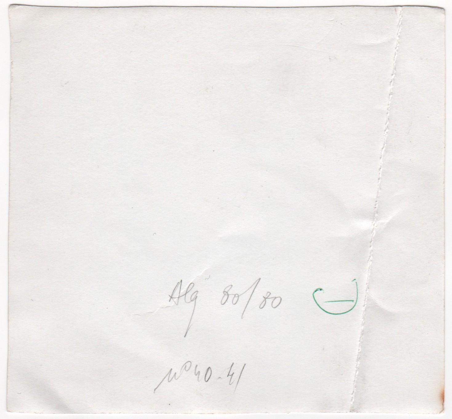
Alg 80 x 80
n°40/41
As I live in Paris, France, it might reffer to a pic from Alg(eria)? given our hsitorical colonial past?
Is it an aerial pic? of what???
"Mystère et boulles de gommes" as we might say here.
I was at the flee market this morning and stumbled on a stack of mixed photos. In the vast majority, black and white photos of random people from the past... family pictures, lost for eternity.
I always like to dig in there. Sometimes you stumble on little photographic masterpieces.
Annnnyway... I was looking at all these oldies and found this picture.

I have no idea what it is and thought it was intriguing so I took it. I thought maybe it could distract a few of you guys here.
No date, just a few handwritten inscriptions on the back:

Alg 80 x 80
n°40/41
As I live in Paris, France, it might reffer to a pic from Alg(eria)? given our hsitorical colonial past?
Is it an aerial pic? of what???
"Mystère et boulles de gommes" as we might say here.
edit on 10-1-2016 by Logiciel because: missing L to aerial
edit on
10-1-2016 by Logiciel because: (no reason given)
Better viewing here with magnifier,
imagizer.imageshack.us...
It could be an old picture of this place, Hassi Messaoud well in Algeria before the oilmen moved in, or something similar there.
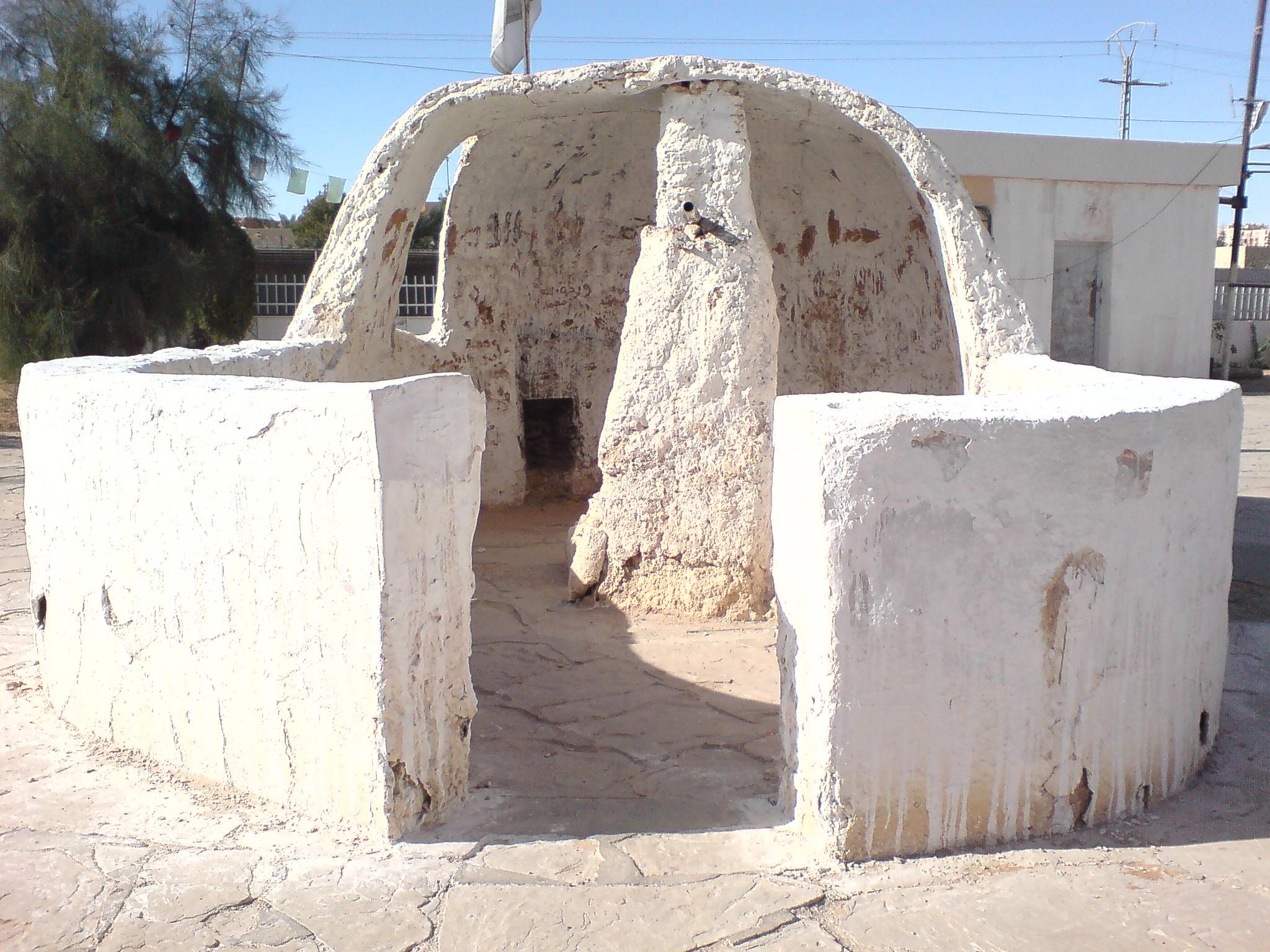
files.abovetopsecret.com...
imagizer.imageshack.us...
It could be an old picture of this place, Hassi Messaoud well in Algeria before the oilmen moved in, or something similar there.

files.abovetopsecret.com...
edit on 10-1-2016 by smurfy because: Text.
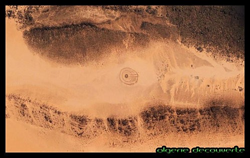
If it's an aerial shot, the terrain certainly does look like Algeria.
The "artwork" in center looks like a geoglyph.
The box lines look like they were made to frame the "artwork".
Did you google Algerian geoglyphs?
The box lines look like they were made to frame the "artwork".
Did you google Algerian geoglyphs?
ok guys after a quick search,
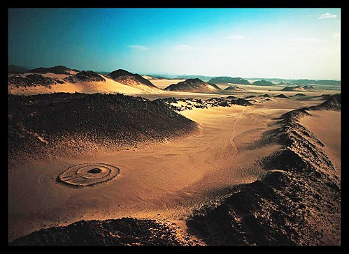
looks like a "tumulus" or cairn from neolitic age probably shot over Algeria...
link to a french page on the subject
sorry guys, to my great regret this is no ALIEN OUTHOUSE
be back soon tho
looks like a "tumulus" or cairn from neolitic age probably shot over Algeria...


link to a french page on the subject
sorry guys, to my great regret this is no ALIEN OUTHOUSE
be back soon tho
Ahhhhhhh, tumulus. "Keyhole tombs".
In English.
philica.com...
In English.
philica.com...
edit on 10-1-2016 by Annee because: (no reason given)
If a tomb, someone already found it. Probably been plundered.
But I get the old photos thing. I have found so many, when peoples stuff gets thrown out at storage units it winds up in the dumpster. Their whole life is in their pictures, sometimes letters, too. I enjoy looking through that, its forensics on the human race.
You learn so much from peoples garbage.
a reply to: Logiciel
According to this, that latitude and longitude would be in Turkey - link
So, the "Alg" can't be Algeria, if the numbers are correct, and refer to the coordinates. I wonder if the "80x80" is a reference to the scale, as in 80 miles by 80 miles, or something of that sort. Or feet, or whatever. Hard to say, without knowing the scale of anything in the picture.
The border almost looks like it was drawn on, to show an area of interest. Why they have the circles at the corners, I can't say, unless they were connecting four points of interest, and showing that all four formed a square. I am not sure what to make of the whatever-it-is in the center, the circles and wedge. With more circles, I'd say it looked like Minas Tirith. Only two, though, so I don't know. Hard to tell, looking online, if that is drawn on or some actual structure in the picture itself. Can you tell looking at the original? From what I can see, it looks like they drew a circle around an actual object - the center bit - and then another around that, with the wedge-shaped "arrow" for emphasis. So, overall, it looks like four points of interest somehow form the corners of a square with some unknown object in the middle. Or, maybe, there are four points from which to attack said center location.
I see, upon reading, that some think it looks like a tomb. Could be. Those coordinates aren't Algeria, though, so does anyone know of that sort of tomb is found in Turkey as well?
new topics
-
Turns out, they planned to go after P-nut.
US Political Madness: 28 minutes ago -
Sick sick sick
Social Issues and Civil Unrest: 6 hours ago -
Comcast dumping MSNBC
Mainstream News: 9 hours ago
top topics
-
Comcast dumping MSNBC
Mainstream News: 9 hours ago, 14 flags -
President-elect TRUMP Picks MATT GAETZ for his ATTORNEY GENERAL - High Level PANIC Ensues.
2024 Elections: 12 hours ago, 13 flags -
Mike Tyson returns 11-15-24
World Sports: 17 hours ago, 5 flags -
Sick sick sick
Social Issues and Civil Unrest: 6 hours ago, 4 flags -
Turns out, they planned to go after P-nut.
US Political Madness: 28 minutes ago, 4 flags
active topics
-
Sick sick sick
Social Issues and Civil Unrest • 23 • : Irishhaf -
President-Elect Donald Trump will Meet with Coup-Victim JOE BIDEN on Wed 11.13.2024.
2024 Elections • 34 • : Irishhaf -
The Acronym Game .. Pt.4
General Chit Chat • 944 • : tinkerbell99 -
Turns out, they planned to go after P-nut.
US Political Madness • 3 • : nugget1 -
WATCH LIVE: US Congress hearing on UFOs, unidentified anomalous phenomena
Aliens and UFOs • 37 • : putnam6 -
Alex Jones Reinstated on X
Education and Media • 80 • : starvosan -
How can you defend yourself when the police will not tell you what you did?
Posse Comitatus • 74 • : network dude -
President-elect TRUMP Picks MATT GAETZ for his ATTORNEY GENERAL - High Level PANIC Ensues.
2024 Elections • 43 • : network dude -
HHS Spent Hundreds of Millions of Dollars on DEI Initiatives Under Biden, Watchdog Finds
US Political Madness • 6 • : marg6043 -
My aunt kidnapped my father.
Rant • 17 • : BrotherKinsMan
13

