It looks like you're using an Ad Blocker.
Please white-list or disable AboveTopSecret.com in your ad-blocking tool.
Thank you.
Some features of ATS will be disabled while you continue to use an ad-blocker.
share:
It would appear that thousands of square-shaped formations dot the landscape of Australia, and possibly Indonesia/Southeast Asia as well.
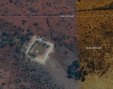
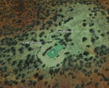
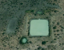
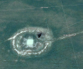
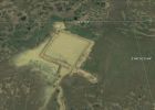
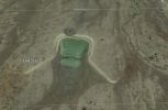
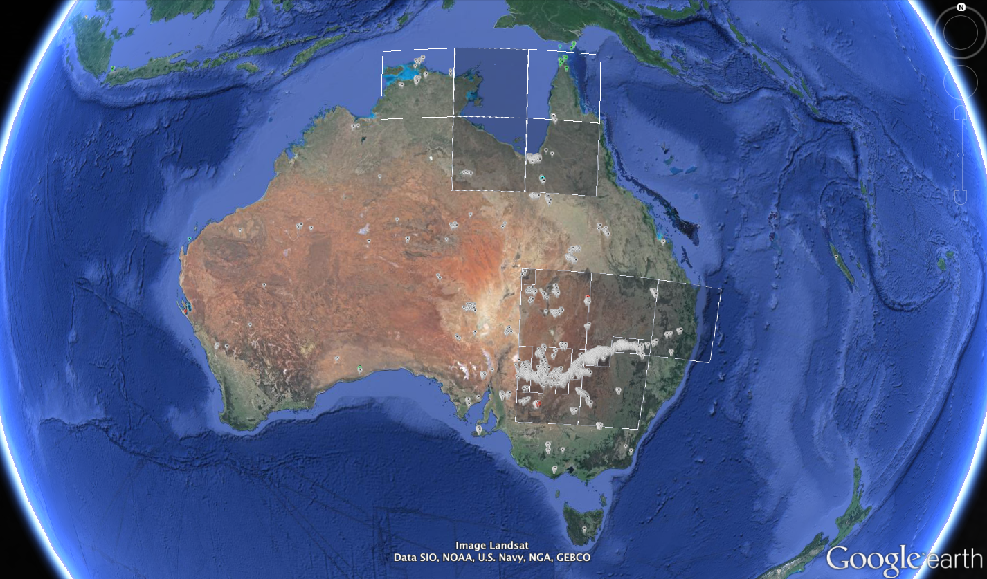
Observations by 19th century explorers mention sites matching the description of what I have begun to survey in Google Earth as "square water-holes." Additionally, it is noted in one of these accounts (p.19 of linked text) that the basins have been attracting settlers to live near them due to their ability to retain remarkably clean water even through times of severe drought.

So while many of these basins are clearly being exploited as retention ponds by modern people, it is my belief that no industrial activity in modern history can reasonably account for all of them. Furthermore, their layout appears to be strategic with respect to the course of rivers, but without regards to present-day climates or even shorelines, implying that they were built when global sea levels were considerably lower.
For weeks I have been obsessing over these sites, racking my brain trying to figure out what they are. Aside from their relationship to rivers, I was clueless, at least until I saw this thread about a discovery in Teotihuacan:
Liquid mercury found under Mexican pyramid could lead to king's tomb
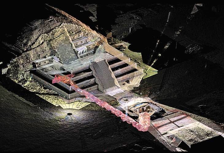

Look at the tunnel entrance to the subterranean chamber: Roughly square-shaped and approximately the same size as the ones in Australia. Even complete with a secondary "vent" chamber. I'm not an archaeologist but I have a talent for noticing patterns and relationships that often go overlooked. To be fair, I'm also not the first person to take notice of individual sites such as these in Australia. Another thread by ATS user EA006 speculates about possible uses for one of them. I'm writing this thread to attempt bring awareness of the vastness of this culture to light, and perhaps start a collaborative online group to survey them, as there are far too many for me to do alone. (Is there a way to host non-image resources on ATS like KML files?)
My personal opinion, for what it's worth, is that the Mayan people, for all of their ingenious methods of keeping time (and playing a hell of a soccer game,) didn't build the pyramids at Teotihuacan. Instead, I believe they discovered pyramids that had been buried for millenia, dug some of them out, and built their capital city around them. The pyramids were originally built build to function as a kind of reactor, catalyzing liquid mercury with river water for an unknown result. If the electric universe theory is correct, the pyramid shape could have functioned as an antenna or dish to focus and exploit this energy. Just speculation, but for all I know that I don't know, I can't explain away these sites. Any constructive input would be invaluable.


Observations by 19th century explorers mention sites matching the description of what I have begun to survey in Google Earth as "square water-holes." Additionally, it is noted in one of these accounts (p.19 of linked text) that the basins have been attracting settlers to live near them due to their ability to retain remarkably clean water even through times of severe drought.

So while many of these basins are clearly being exploited as retention ponds by modern people, it is my belief that no industrial activity in modern history can reasonably account for all of them. Furthermore, their layout appears to be strategic with respect to the course of rivers, but without regards to present-day climates or even shorelines, implying that they were built when global sea levels were considerably lower.

For weeks I have been obsessing over these sites, racking my brain trying to figure out what they are. Aside from their relationship to rivers, I was clueless, at least until I saw this thread about a discovery in Teotihuacan:
Liquid mercury found under Mexican pyramid could lead to king's tomb


Look at the tunnel entrance to the subterranean chamber: Roughly square-shaped and approximately the same size as the ones in Australia. Even complete with a secondary "vent" chamber. I'm not an archaeologist but I have a talent for noticing patterns and relationships that often go overlooked. To be fair, I'm also not the first person to take notice of individual sites such as these in Australia. Another thread by ATS user EA006 speculates about possible uses for one of them. I'm writing this thread to attempt bring awareness of the vastness of this culture to light, and perhaps start a collaborative online group to survey them, as there are far too many for me to do alone. (Is there a way to host non-image resources on ATS like KML files?)
My personal opinion, for what it's worth, is that the Mayan people, for all of their ingenious methods of keeping time (and playing a hell of a soccer game,) didn't build the pyramids at Teotihuacan. Instead, I believe they discovered pyramids that had been buried for millenia, dug some of them out, and built their capital city around them. The pyramids were originally built build to function as a kind of reactor, catalyzing liquid mercury with river water for an unknown result. If the electric universe theory is correct, the pyramid shape could have functioned as an antenna or dish to focus and exploit this energy. Just speculation, but for all I know that I don't know, I can't explain away these sites. Any constructive input would be invaluable.
edit on 29-4-2015 by johnsequitur1221 because: fixed link
a reply to: johnsequitur1221
G,day mate
the waterholes in your pics are all man made dug with dozers/graders/scrapers most homesteads have them
you will also find these dams along creek lines passing out of shallow valleys and at the bottom of end of gullys
its a bloody dry place. the others in the article are natural deep holes in the murray river some up to 60 feet deep at the bottom of a 25 foot deep river. the depths do vary ok.
cocky's er farmers/station owners er you call em ranches also place yabbies and fish in their dams
in some places the stock come into the dams to drink but most of the time water is piped to watering points thus keeping the stock from damaging the built up earth mounds surrounding the dams.
as a kid i have watched the old man and the dozer driver deciding just where along the creek/gully line to place dams
and i have also watched the construction of a bloody great square one (as seen in your pics) out in a paddock to store water pumped up from the great artesian basin by windmill.
bugga me i used to go swimming in it and i had been told not to.
why. frigging really cold to the point of muscle cramps a lot of people drown in the damn dams down here
i will look up some info on the ancients in aussie for you and get back to you.
should i hope leave you gob smacked
The sun is relatively quiet in modern times. Outside of that event in the late 1800's.
But what if that event in the late 1800's was a frequent event in more ancient times, during a period of vastly increased activity? The air, electrified by CME....
I have always wondered about that (more like daydreamed on it), and in particular the heavy quartz content of the mesoamerican pyramids. What if it was a detector meant to alert you to the incoming plasma charge from a CME, to give you time to get into a protected environment? The increasing electric charge causes some kind of electrical outburst that alerts you to the presence of high levels of charge. Sounds kind of like an element in an interesting fiction book.
But more on topic....the purpose of the mercury...who knows. But the existence of intercontinental travel in ancient times? All but guaranteed. The Mesoamericans even have stories of folks coming to see them from the other side of the ocean. Visitors that sound just like Mediterranean people.
a reply to: johnsequitur1221
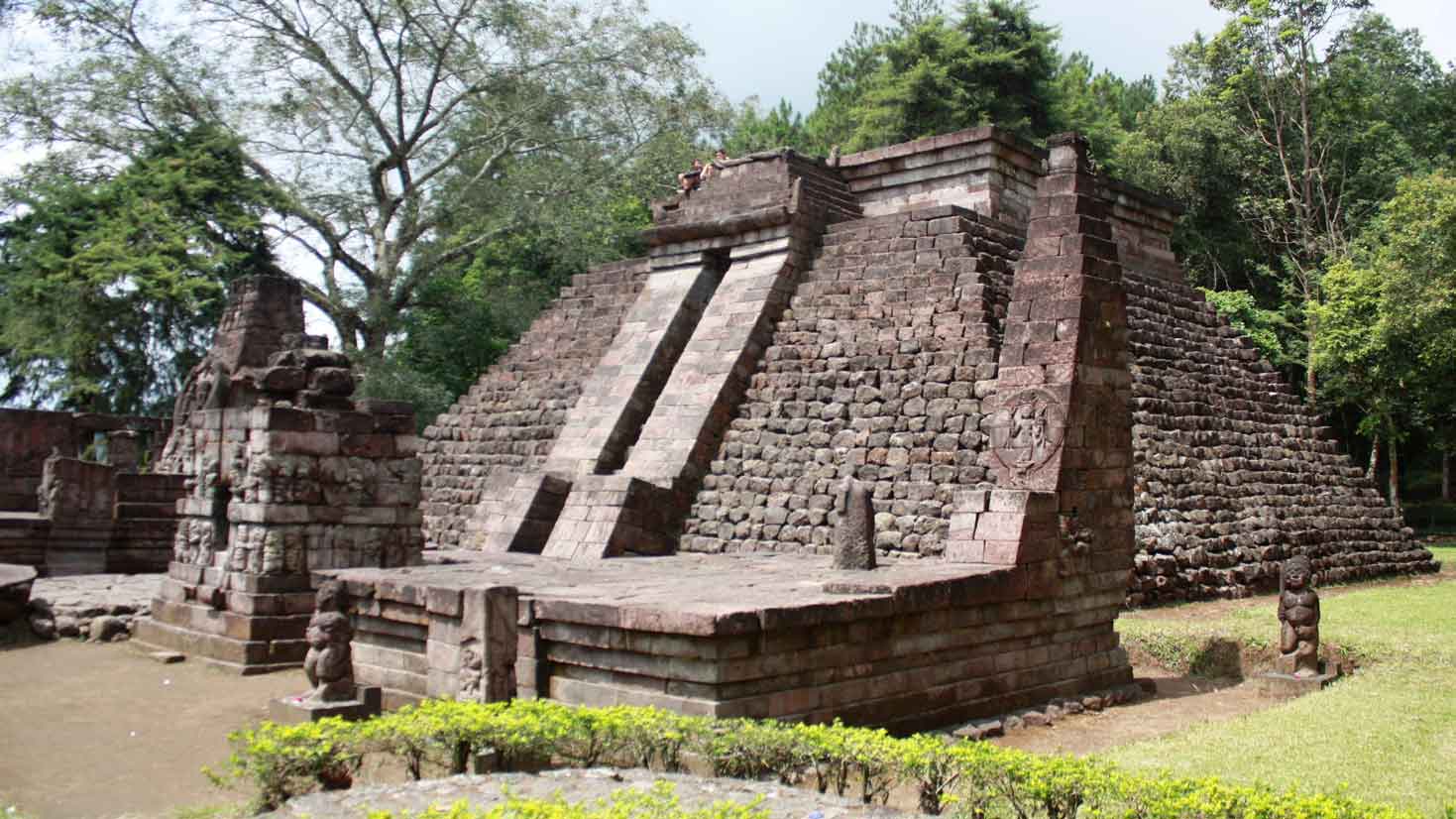
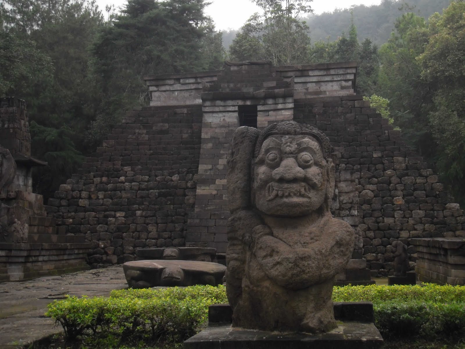
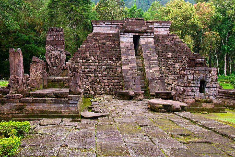

I believe you


I believe you
edit on 3America/Chicago33Wed, 29 Apr 2015 18:33:05 -0500296u15 by weirdguy because: (no reason given)
originally posted by: pronto
a reply to: johnsequitur1221
G,day mate
the waterholes in your pics are all man made dug with dozers/graders/scrapers most homesteads have them
you will also find these dams along creek lines passing out of shallow valleys and at the bottom of end of gullys
You can see in some of the posted photos the angled 'ramps' that are constructed to get the water in without any other instruments.
I've been to Chitzen Itza and climbed the big pyramid. The casing stones are very interesting, they look almost like they were carved to resemble
metal plating.
There's some kind of "buzz" there too, a kind of "vibe" that ruins in other places of the world didn't have for me. The Colosseum in Rome felt dead and cold. That pyramid though, there was an almost "electric" vibe in the air. I can't quite describe it, but I know it was absent from all the other ruins in Europe I've visited.
There's some kind of "buzz" there too, a kind of "vibe" that ruins in other places of the world didn't have for me. The Colosseum in Rome felt dead and cold. That pyramid though, there was an almost "electric" vibe in the air. I can't quite describe it, but I know it was absent from all the other ruins in Europe I've visited.
a reply to: johnsequitur1221
I'm disappointed. I didn't agree with the premise, but while reading the OP, I was thinking that it was rather refreshing to see a well thought out, well presented thread in this forum (god knows they're few and far between)....Then just as I was beginning to enjoy the read, you got completely ridiculous. "Catalyzing mercury with river water"? Seriously? Do you honestly believe any of what you've put forth here? *sigh*
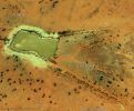
Anyway.....The pictures you posted are just regular retention ponds. Here's several more, out in the middle of nothing in the desert, kind of near where I live, for comparison:
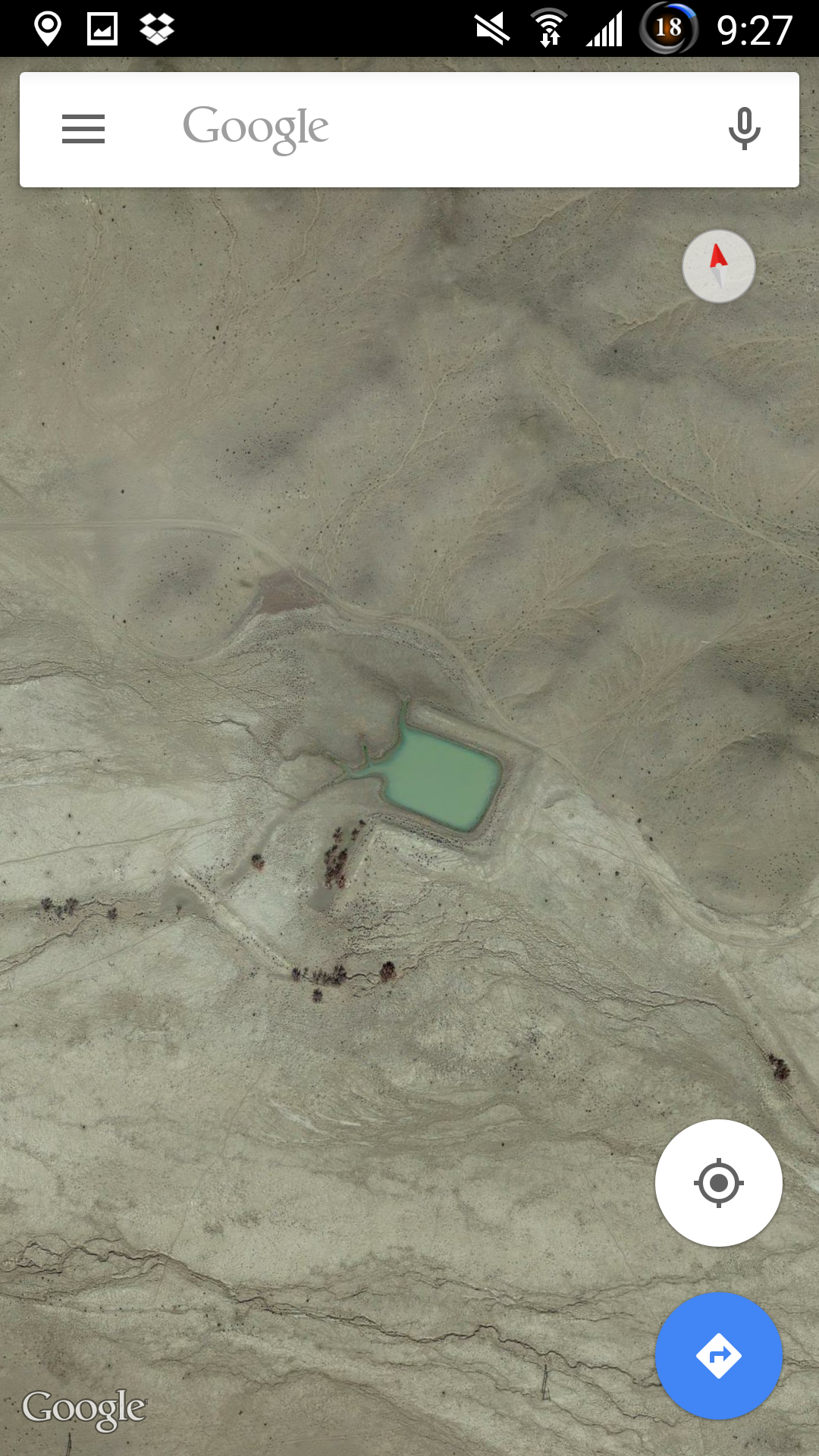
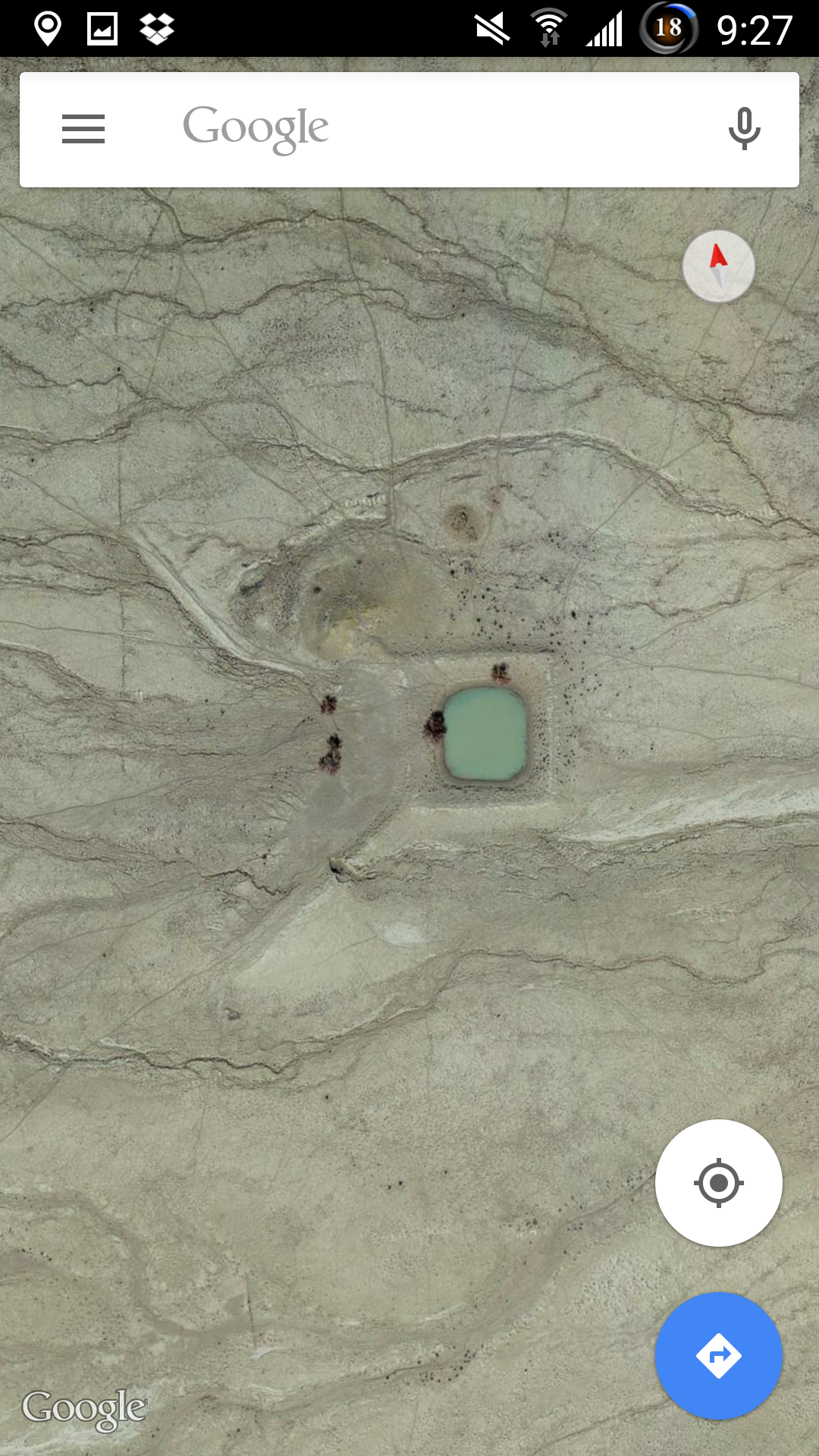
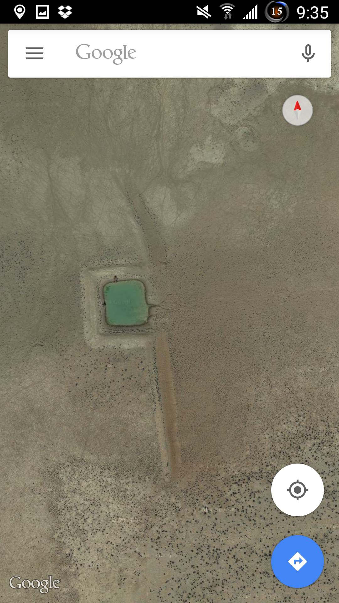
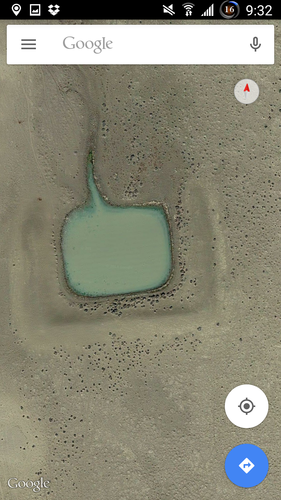
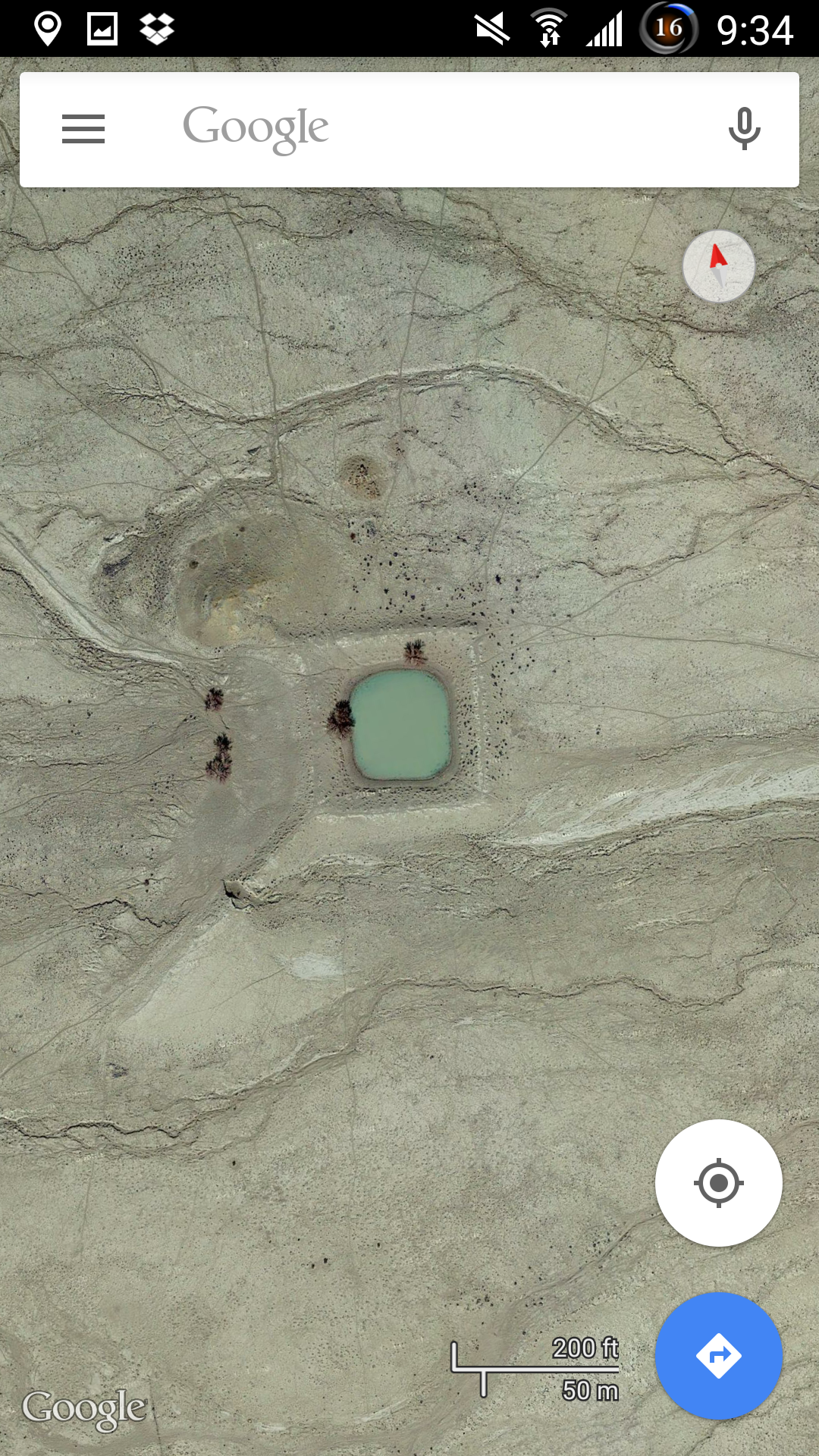


a reply to: johnsequitur1221
They're modern man made dams.
I haven't read any replies yet, but I HOPE someone has already pointed this out..
SMH
ETA: what evidence do you have that early explorers found square shaped water holes?
They're modern man made dams.
I haven't read any replies yet, but I HOPE someone has already pointed this out..
SMH
ETA: what evidence do you have that early explorers found square shaped water holes?
edit on 29/4/15 by Chadwickus because: (no reason
given)
a reply to: AdmireTheDistance and Chadwickus
I agree that these are man made and being used as dams/reservoirs today.
Here is a screenshot of the page I linked from the Google Free Library. (Page 19 of this text)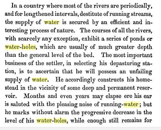
Here is a sketch from C.W. Babbage's sketchbook, made from an expedition in 1858 (source) mentioning proximity to square water holes.
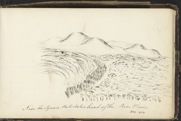
While I don't know the history of modern industrial Australia as well as some, It would seem that many of the were already there and being exploited (and quite possibly imitated) by modern people. I doubt that there was enough modern activity to account for all of them (at least as of the early 19th century.) I also agree that people will always have a need to exploit and retain water resources in a dry climate no matter what time period. But that explanation, while simple, fails to account for a few important things:
Why such a uniform shape and scale? There seem to be several varieties, but the larger ones are on par with the WTC reflecting pools in NYC (about 75 meters or so on each side.) Retention ponds, while generally rectangular, don't have to be so similar over an entire continent; they only have to be built to meet the needs of their specific location. Their uniform shape (despite many sites being severely eroded and barely recognizable) suggests to me a more rigid and precise standard for construction with a modern adaptation to save time building your own.
As I stated in my opening post, these basins clearly correspond to rivers, not just where they flow today, but rivers which appear to have long since dried up (though I admit I don't know how long that is.)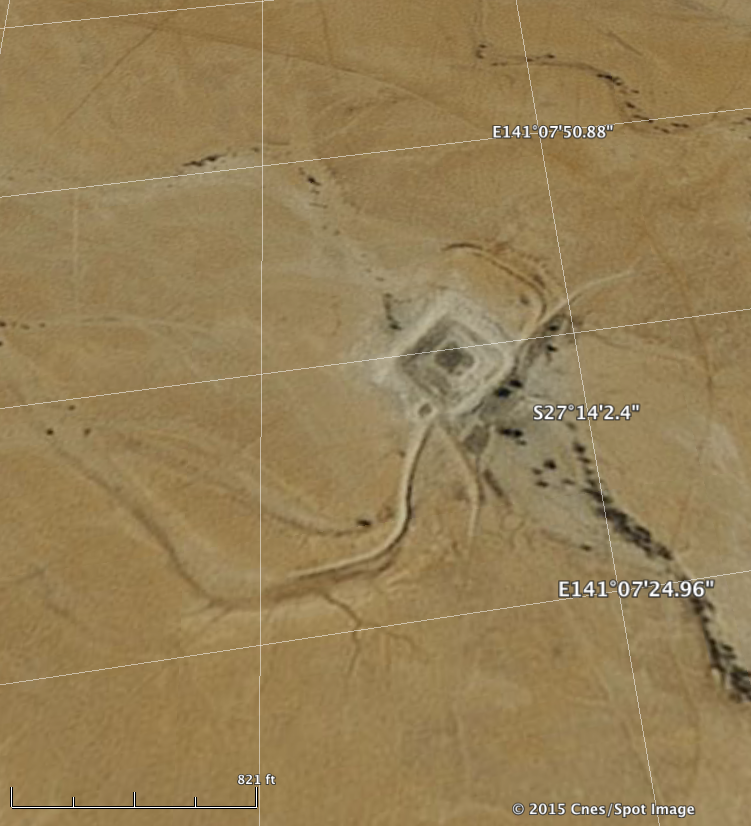
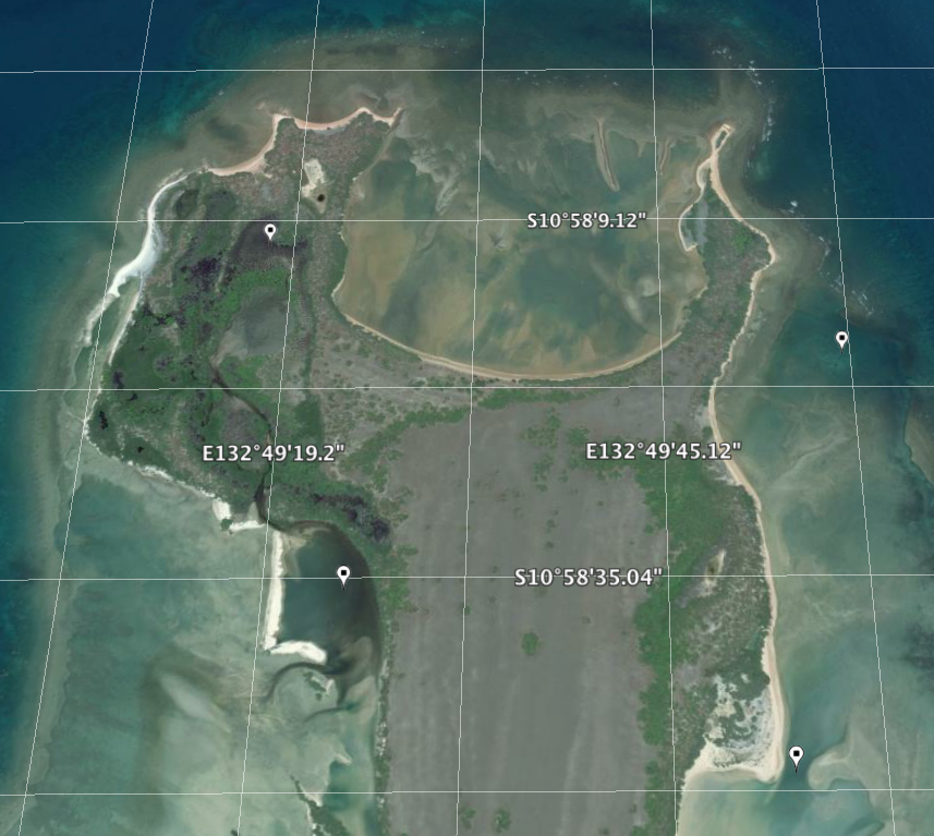
However, I would argue that the damning evidence for their age is, aside from their advanced erosion, the fact that their layout extends beyond current shorelines and into the shallow seas north of Australia proper. This is the best example I could find (with coordinates) but there are many others.

The last part was my opinion. Just a feeling, which I can't prove. I'm speculating, which is all I can do after a point. For now I'm just trying to point out the similarities between clearly artificial formations in different places. If you have Google Earth, study their relationships to rivers in the desert (where they're the most clearly visible) and you'll be able to infer traces of them elsewhere. Just try not to let pareidolia get the best of you. I'd suggest using one type of placemark for possible sites vs. ones you're more certain about, as these run the full gamut, especially outside of Australia. Apparently traces of the element mercury have also been found under pyramids in China. Until recently the accepted theory was that pyramid-building was just a natural phase for separate cultures to go through.
But why is it ridiculous to think that an ancient people could have been scientifically advanced, but in a different way than us? Not every rise to the stars will be marked on an Apple Watch. But if there was an advanced culture here that we can't trace our modern progress back to, it suggests something catastrophic occurred and we had to start over. Oral traditions from indigenous people all over the world speak of fire in the sky, then a flood, then having to flee their drowned homeland and begin again.

It's almost easier to stomach the "aliens" argument than to think of nature being that cruel.
I agree that these are man made and being used as dams/reservoirs today.
Here is a screenshot of the page I linked from the Google Free Library. (Page 19 of this text)

Here is a sketch from C.W. Babbage's sketchbook, made from an expedition in 1858 (source) mentioning proximity to square water holes.

While I don't know the history of modern industrial Australia as well as some, It would seem that many of the were already there and being exploited (and quite possibly imitated) by modern people. I doubt that there was enough modern activity to account for all of them (at least as of the early 19th century.) I also agree that people will always have a need to exploit and retain water resources in a dry climate no matter what time period. But that explanation, while simple, fails to account for a few important things:
Why such a uniform shape and scale? There seem to be several varieties, but the larger ones are on par with the WTC reflecting pools in NYC (about 75 meters or so on each side.) Retention ponds, while generally rectangular, don't have to be so similar over an entire continent; they only have to be built to meet the needs of their specific location. Their uniform shape (despite many sites being severely eroded and barely recognizable) suggests to me a more rigid and precise standard for construction with a modern adaptation to save time building your own.
As I stated in my opening post, these basins clearly correspond to rivers, not just where they flow today, but rivers which appear to have long since dried up (though I admit I don't know how long that is.)

However, I would argue that the damning evidence for their age is, aside from their advanced erosion, the fact that their layout extends beyond current shorelines and into the shallow seas north of Australia proper. This is the best example I could find (with coordinates) but there are many others.

The last part was my opinion. Just a feeling, which I can't prove. I'm speculating, which is all I can do after a point. For now I'm just trying to point out the similarities between clearly artificial formations in different places. If you have Google Earth, study their relationships to rivers in the desert (where they're the most clearly visible) and you'll be able to infer traces of them elsewhere. Just try not to let pareidolia get the best of you. I'd suggest using one type of placemark for possible sites vs. ones you're more certain about, as these run the full gamut, especially outside of Australia. Apparently traces of the element mercury have also been found under pyramids in China. Until recently the accepted theory was that pyramid-building was just a natural phase for separate cultures to go through.
But why is it ridiculous to think that an ancient people could have been scientifically advanced, but in a different way than us? Not every rise to the stars will be marked on an Apple Watch. But if there was an advanced culture here that we can't trace our modern progress back to, it suggests something catastrophic occurred and we had to start over. Oral traditions from indigenous people all over the world speak of fire in the sky, then a flood, then having to flee their drowned homeland and begin again.

It's almost easier to stomach the "aliens" argument than to think of nature being that cruel.

edit on 30-4-2015 by
johnsequitur1221 because: Morgan Freeman
edit on 30-4-2015 by johnsequitur1221 because: grammar and reply tag
a reply to: pronto
Thank you so much for your response. I was hoping someone more local would have some input. While I'm sure people are building dams and reservoirs today, one of my 19th century sources has a large number of them already existing before 1848.

Full Source Text (Screenshot is from p.19)
I respectfully envy you, my friend. I would love to go swimming in one of those, especially if they are as ancient as I believe they are.
Thank you so much for your response. I was hoping someone more local would have some input. While I'm sure people are building dams and reservoirs today, one of my 19th century sources has a large number of them already existing before 1848.

Full Source Text (Screenshot is from p.19)
I respectfully envy you, my friend. I would love to go swimming in one of those, especially if they are as ancient as I believe they are.
a reply to: bigfatfurrytexan
I'd like to see an experiment conducted to investigate the properties of mercury and the pyramid shape. Build one on a smaller scale, but otherwise to the proper proportions, with the same kind of stone, and introduce mercury beneath it. Ideally you'd want to use a liner to prevent the toxic liquid from seeping into the earth. The technology exists to detect any anomalies in energy, magnetism, or gravity, should any occur. It's just not cheap to get ahold of. I know I presented it as speculation, BFFT, as is your response. But sometimes that's where you have to start. I can tell you, like me, aren't going to settle for the notion that "modern science hasn't discovered it yet, so it's invalid." The Universe appears to be filled with energy all around us. Far more than we could ever have a need for. But instead of harnessing this energy (as I believe our ancestors did successfully, and Tesla was attempting to do), we're supposed to accept that fossil fuels will just have to do for the foreseeable future.
At any rate, our speculation about the possible uses for mercury shouldn't invalidate the relationship between building techniques and oral traditions of people spread across the world today.
edit on 30-4-2015 by johnsequitur1221 because: beercheers
Not for nothing, but I feel this is important to point out. The Maya didn't build Teotihuacan. Some evidence suggests Toltecs or Totonoc, however
nobody is really sure. But Teotihuacan influences Maya culture, not the other way around. So, really, I'd build at least part of my argument off the
fact that we actually don't know who built Teotihuacan, only that as some point the Nahua peoples found it, gave it a Nahuatl name, and started doing
Aztecy things there. Like you do.
a reply to: MystikMushroom and bigfatfurrytexan
Hardy Pyramid Double Helix - 11/01/97
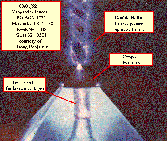
I see someone's attempted to re-create the energy fields you may have experienced, MystikMushroom. While it seems awfully new-agey and speculative, even for me, it shows an attempt to validate a theory with a controlled experiment, so I won't write it off as meaningless. Instead I want to know more. I'll keep digging (ba dump tss) but I have other things to attend to in the meantime.
Hardy Pyramid Double Helix - 11/01/97

I see someone's attempted to re-create the energy fields you may have experienced, MystikMushroom. While it seems awfully new-agey and speculative, even for me, it shows an attempt to validate a theory with a controlled experiment, so I won't write it off as meaningless. Instead I want to know more. I'll keep digging (ba dump tss) but I have other things to attend to in the meantime.
edit on 30-4-2015 by johnsequitur1221 because:
phrasing... or are we not doing that anymore?
originally posted by: johnsequitur1221
a reply to: weirdguy
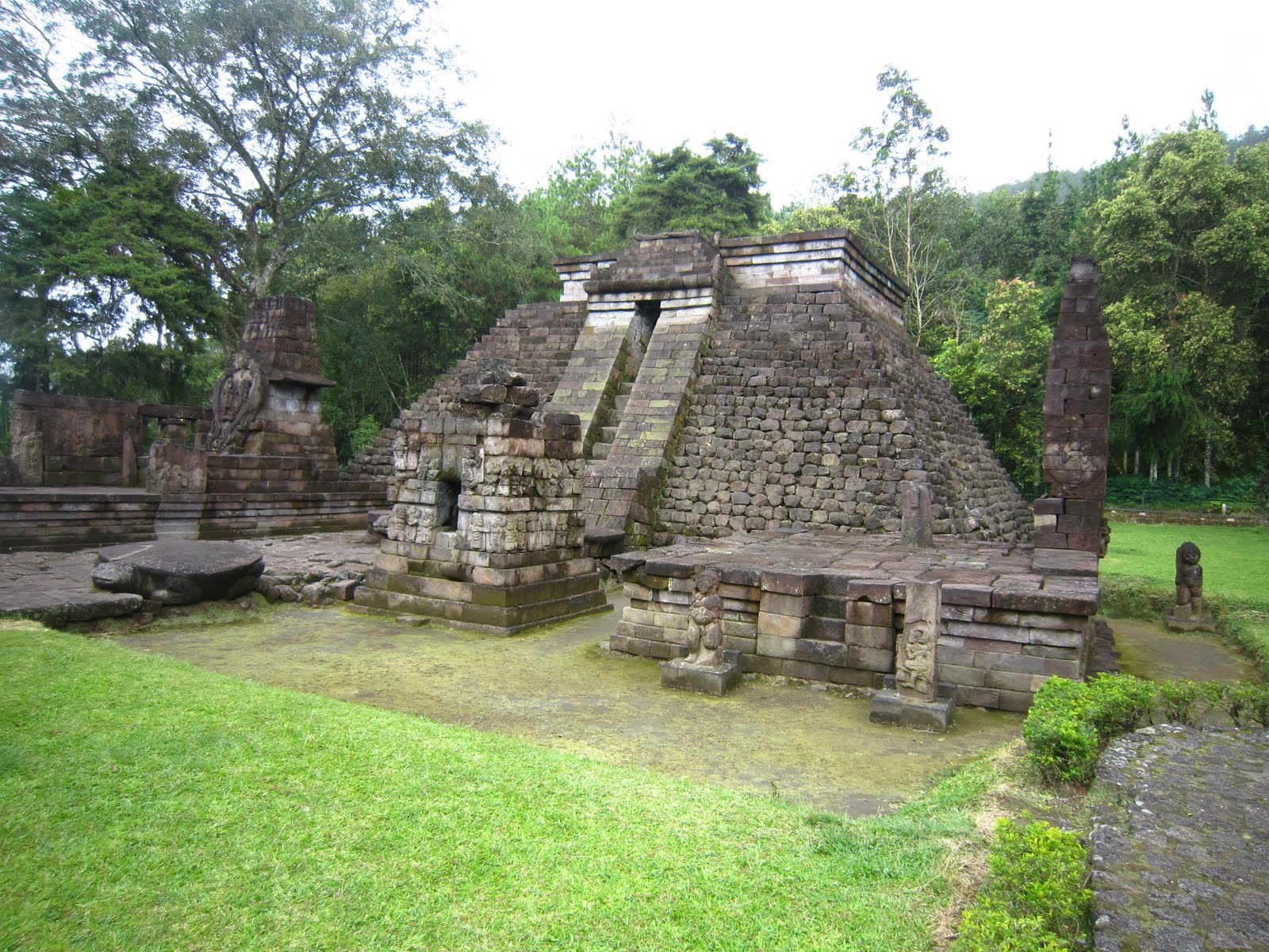
Where are these photos taken? I don't recognize that text, but I'm definitely intrigued.
I have to find it again but it is in Indonesia, maybe Java.
Natural occurring pools at the end of a creek are called billabongs here in Auss..The rectangular ones are man made for stock,cattle and
sheep.Australia is 85% semi arid desert with only water coming from the great artesian basin or rain.
a reply to: johnsequitur1221
The places all always seem to have a coordinate relationship with some other major ancient site in the world
In the first picture the
the longitude is S30 37 arc minutes arc 44 seconds
which works out to 30.628888 degrees
and latitude 145 20 arc minutes and 8.16 arc seconds
which works out to 145.3356 degrees
Great Pyramid of Giza, Coordinates
Giza 29.9792° N, 31.1344° E
The displacement in latitude degrees GP and the square water hole 29.9792 + 30.628888 = 60.608 degrees
and
The displacement in longitude degrees GP and the square water hole 145.3356 - 31.1344 = 114.2012 degrees
work out Tan angle 60.608/114.2012 = 27.9554 degrees
Add the angles in the three corner of a right hand side triangle = 180 degrees
so 180 - 90 - 27.9554 = 62.0445 degrees
very close to a 30/60 degree right hand triangle. The variation might be represented by a offset values in jumps of 0.44 or 0.044 degrees to the triangle angle, so it would be an interesting exercise applying these offsets to the triangle angle to work out lattitide longitude coordinates coordinates. Use an excel spread sheet with formula calcuating latitude and longitude coordinates between angle 60 degrees and 62.0445 degrees and see if what turns up.
edit on 30-4-2015 by AthlonSavage because: (no reason given)
a reply to: johnsequitur1221
The book is talking about natural water holes, and they're not square.
Straight edges can obviously be found in nature, and spotted easily from the air, but it's not a surefire way of determining if they're man made or not.
In one of The Bush Tucker Man's episodes he spotter a straight edge on a waterhole and thought it may have been constructed by early explorers looking for gold. It wasn't until he got down at ground level that it became clear it was natural.
edit on 30/4/15 by Chadwickus because: (no reason given)
edit on 30/4/15 by Chadwickus because: (no reason given)
a reply to: AthlonSavage
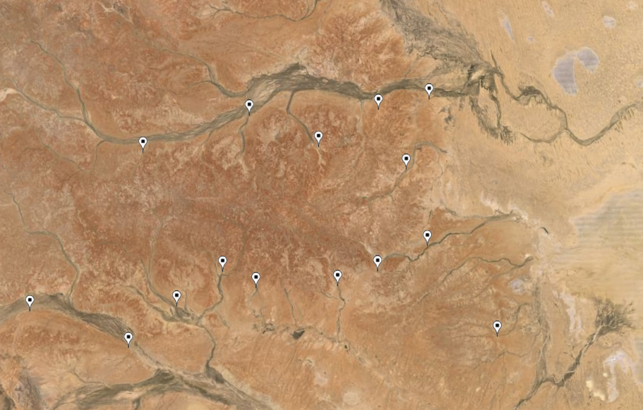
Although I've heard of ancient sacred sites being aligned in various ways (allegedly to exploit some sort of super/natural/cosmic/planetary energy), these sites are spread out all over Australia, and possibly Indonesia, Vietnam and India, with no apparent center like Giza. The large pins represent clusters (green), best examples on land (white) and in shallow water (blue.) The rest are the tiny white dots in the lower right.
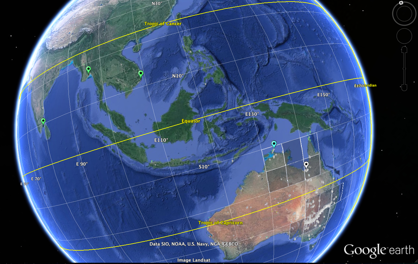
Although I've heard of ancient sacred sites being aligned in various ways (allegedly to exploit some sort of super/natural/cosmic/planetary energy), these sites are spread out all over Australia, and possibly Indonesia, Vietnam and India, with no apparent center like Giza. The large pins represent clusters (green), best examples on land (white) and in shallow water (blue.) The rest are the tiny white dots in the lower right.

a reply to: johnsequitur1221
My previous post suggested an idea, using Giza and the coordinates of the first square water hole as a reference, I have worked out a triangle. Then I modify the triangles angle in increments of 0.044 degrees until I reach a right angle 60/30 degree triangle, generating a sequence of lattitude and longitude coordinates at each increment. The below I post 6 different coordinate positions based on the angle increment at a time. I generated a much larger list but theres too many positions for me to check, so i have gone and checked the first 6 positions on the generated listed. In each instance i went on to Google map and checked the nearest square on the map, which i indicate the direction from the coordinate. Each increment moves the coordinate in a equal displacement in a west and north direction of about 5km. Interesting in the locations i have check so far a square anomaly appears in a north west direction from the coordinate indicating some connecting pattern to where the squares are being located. Still need to do more research but interesting findings so far.
Long, Latt, Distance to a square
145.3355832 -30.9101 1.84km North direction from coordinate
145.2890059 -30.8661 2.51km West direction from coordinate
145.2423612 -30.8221 1.87km North West direction from coordinate
145.1956492 -30.7781 1.8km North west direction from coordinate
145.14887 -30.7341 4.99KM North direction from coordinate
145.1020235 -30.6901 4.14kmWest direction from coordinate
edit on 30-4-2015 by AthlonSavage because: (no reason given)
new topics
-
Trump-appointed judge blocks Biden administration overtime rule
Social Issues and Civil Unrest: 59 minutes ago -
Don't cry do Cryo instead
General Chit Chat: 6 hours ago -
Tariffs all around, Except for ...
Dreams & Predictions: 8 hours ago
top topics
-
Bucks County commissioners vote to count illegal ballots in Pennsylvania recount
2024 Elections: 17 hours ago, 23 flags -
Gen Flynn's Sister and her cohort blow the whistle on DHS/CBP involvement in child trafficking.
Whistle Blowers and Leaked Documents: 12 hours ago, 8 flags -
Don't cry do Cryo instead
General Chit Chat: 6 hours ago, 5 flags -
Anybody else using Pomodoro time management technique?
General Chit Chat: 15 hours ago, 3 flags -
Tariffs all around, Except for ...
Dreams & Predictions: 8 hours ago, 3 flags -
Trump-appointed judge blocks Biden administration overtime rule
Social Issues and Civil Unrest: 59 minutes ago, 2 flags
active topics
-
The Acronym Game .. Pt.4
General Chit Chat • 963 • : JJproductions -
Trump picks Gov. Kristi Noem to serve as homeland security secretary
2024 Elections • 45 • : Solvedit -
Trump-appointed judge blocks Biden administration overtime rule
Social Issues and Civil Unrest • 0 • : Cabin -
How can you defend yourself when the police will not tell you what you did?
Posse Comitatus • 85 • : alldaylong -
Don't cry do Cryo instead
General Chit Chat • 2 • : network dude -
Tariffs all around, Except for ...
Dreams & Predictions • 13 • : network dude -
Anybody else using Pomodoro time management technique?
General Chit Chat • 9 • : Cabin -
Oligarchy It Is Then
Short Stories • 14 • : UKTruth -
Mike Tyson returns 11-15-24
World Sports • 54 • : angelchemuel -
President-Elect DONALD TRUMP's 2nd-Term Administration Takes Shape.
Political Ideology • 205 • : WeMustCare
