It looks like you're using an Ad Blocker.
Please white-list or disable AboveTopSecret.com in your ad-blocking tool.
Thank you.
Some features of ATS will be disabled while you continue to use an ad-blocker.
share:
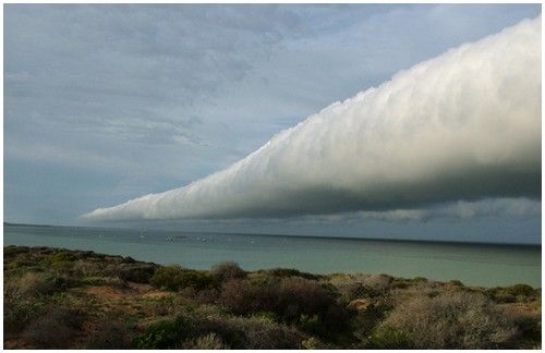
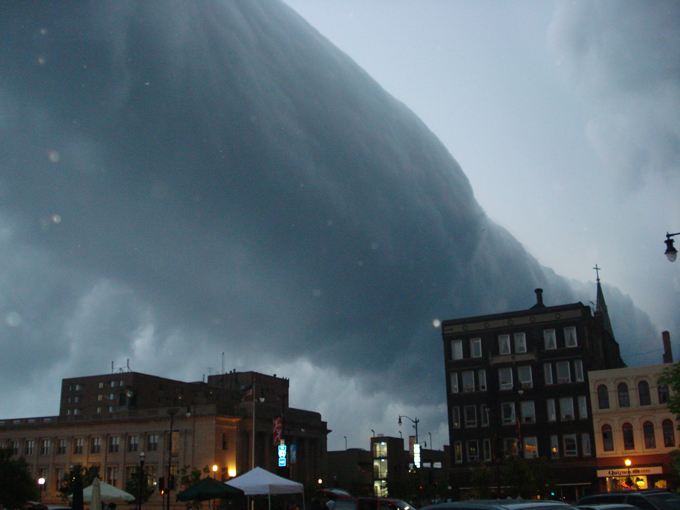
Roll Clouds, or Arcus clouds are another amazing bit of nature:
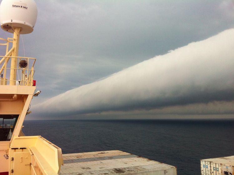
NASA link
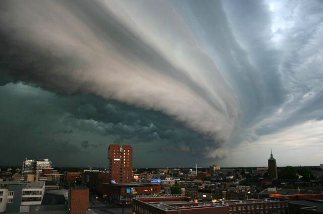
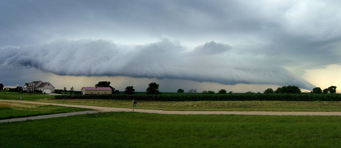
There are two types of arcus clouds, roll clouds and shelf clouds:
nasa
I've always though clouds were amazing, I'm working on a stop motion video of them amongst many other things... here is someone else's that shows them literally rolling like a wave:
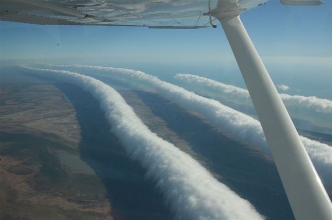
Some they don't even understand:
wired
Some more roll cloud/arcus clous pics and videos:

nasa
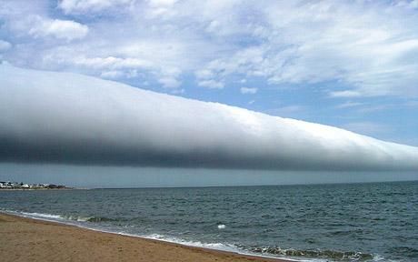
telegraph.co.uk


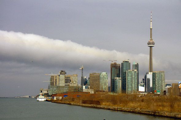

blogto.com

Russel White
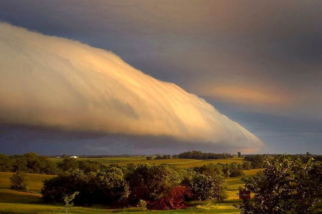
Dan Bush
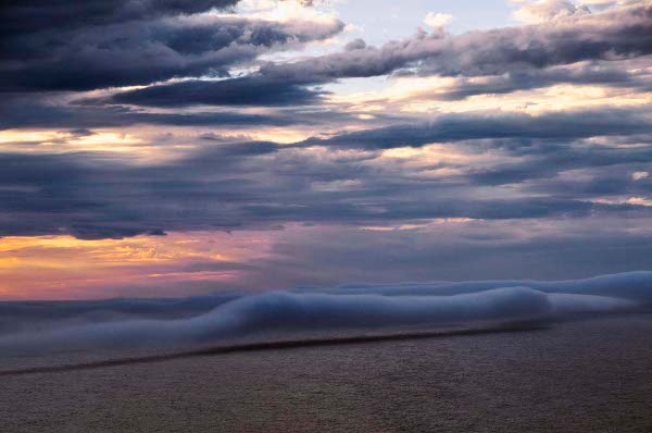
Susan Mace

wikipedia

The photo above showing a sinister looking roll cloud was taken aboard ship while en route from Paranagua, Brazil to Montevideo, Uruguay. A cloud feature like this isn't something you would want to run into on the open sea or on a crowded highway, but roll clouds (arcus cloud) aren't necessarily a presage of severe weather. They most often form along the leading edge of a mature thunderstorm in the relatively cool air associated with the storm's downdraft; however, they're detached from the storm itself and may be seen to roll or tumble along their horizontal axis. Photo taken on February 6, 2012.
NASA link
There are two types of arcus clouds, roll clouds and shelf clouds:


The main difference between roll clouds and shelf clouds (both are called arcus clouds) is that a roll cloud is detached from the parent thunderstorm, whereas a shelf cloud is affixed to the base of a cumulonimbus cloud.
nasa
I've always though clouds were amazing, I'm working on a stop motion video of them amongst many other things... here is someone else's that shows them literally rolling like a wave:
Some they don't even understand:

wired
Some more roll cloud/arcus clous pics and videos:

nasa

telegraph.co.uk


blogto.com

Russel White

Dan Bush

Susan Mace


wikipedia
edit on 5-3-2012 by pianopraze because: adding images
edit on 5-3-2012 by pianopraze because: ...
Very cool post. Love the pics and videos. This kind of weather phenomenon is really interesting to learn about.
Wow, look at the size of those chemtrails.
...kidding.
S&F
...kidding.
S&F
Just beautiful!
Thanks for bringing such beauty to light. I have never seen a roll cloud myself but I look for them in the sky!
I didn't even know they existed until a few weeks ago.
Thanks for bringing such beauty to light. I have never seen a roll cloud myself but I look for them in the sky!
I didn't even know they existed until a few weeks ago.
reply to post by boncho
aahahaha
But nice thread OP. I love watching thunderstorm fronts roll in, they're so pretty
aahahaha
But nice thread OP. I love watching thunderstorm fronts roll in, they're so pretty
reply to post by pianopraze
These clouds are so ominous looking...
This is the best collection I have ever seen!
Good work!
I have one to add:
www.dailymail.co.uk
These clouds are so ominous looking...
This is the best collection I have ever seen!
Good work!
I have one to add:
www.dailymail.co.uk
Rob Sharrock snapped up his Nikon D300 and dashed out to capture this monstrous
roll cloud which seems to go on forever.
Mr Sharrock , from Warrnambool, Victoria, Australia, lives in the house
with the awning to the left of the frame.
[atsimg]http://files.abovetopsecret.com/images/member/21b2f5ff3437.jpg[/atsimg]
UFO flying in the blogto picture. The one with all the cranes.
No really silver disk in front of the cloud.
No really silver disk in front of the cloud.
edit on 5-3-2012 by Shadowalker because: (no reason given)
Originally posted by Shadowalker
UFO flying in the blogto picture. The one with all the cranes.
No really silver disk in front of the cloud.edit on 5-3-2012 by Shadowalker because: (no reason given)
cool beans
feel free to go post it over in the UFO forum, you'll probably get lots of stars, let's keep this thread on topic, thanks!
Here's another roll cloud for those following the thread:
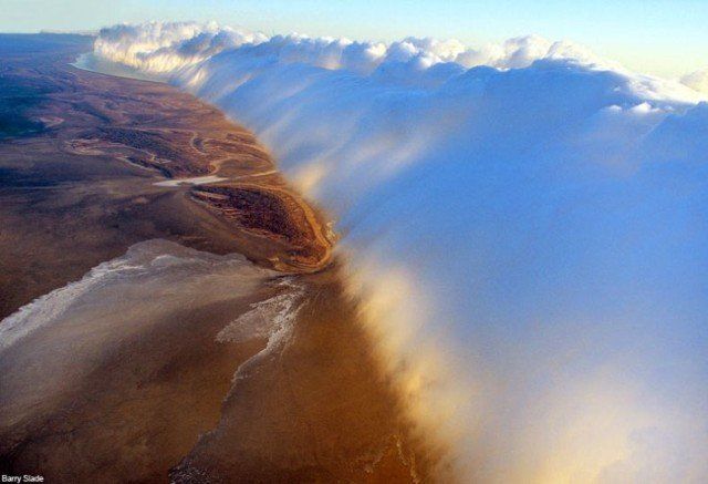
Barry Slade
reply to post by Shadowalker
i had to scroll up and double check but i see what your talking about, interesting, to say the least it looks like an old school UFO. lol. any one have the ability to zoom and and check it out i imagine its just an "image artifact"
i had to scroll up and double check but i see what your talking about, interesting, to say the least it looks like an old school UFO. lol. any one have the ability to zoom and and check it out i imagine its just an "image artifact"
reply to post by burntheships
Beautiful!
It seems quite a lot of these happen in Australia.
Here in the USA I've seen lots of shelf clouds but no roll clouds:
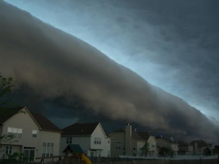
zmescience.com
Beautiful!
It seems quite a lot of these happen in Australia.
Here in the USA I've seen lots of shelf clouds but no roll clouds:

zmescience.com
edit on 5-3-2012 by pianopraze because: ...
Have these types of clouds always been around or are they becoming more common I wonder. I have never seen one. they seem so unnatural. I bet they are
scary when seen in person.
Originally posted by boncho
Wow, look at the size of those chemtrails.
...kidding.
S&F
I've seen these clouds called chemtrails, this video in particular...
Originally posted by crimsongod21
reply to post by Shadowalker
i had to scroll up and double check but i see what your talking about, interesting, to say the least it looks like an old school UFO. lol. any one have the ability to zoom and and check it out i imagine its just an "image artifact"
Sometimes photo artifacts are just aftifacts... I have a thread on this topic: my lens flare thread
Please stay on topic of arcus roll and shelf clouds... thank you!
Here's an on topic video with lots of pictures:
They're amazing! My first thought would be "how big was the plane that made those trails!?!" Haha.
I'm from Australia and I've seen quite a few... None that looked as spectacular as the above though. I love natures random beauty. Next time I might
snap a few shots, if their good enough I might upload
Thanks for sharing these OP.
Thanks for sharing these OP.
Originally posted by WishForWings
I'm from Australia and I've seen quite a few...
Australia also has a H.A.A.R.P. base there...wouldn't surprise me you see those roll clouds either.
reply to post by pianopraze
Absolutely stunning!!
I just hope I'll be lucky enough to one day see formations such as these. Here in the UK it tends to just be the usual miserable clouds.
Absolutely stunning!!
I just hope I'll be lucky enough to one day see formations such as these. Here in the UK it tends to just be the usual miserable clouds.
reply to post by pianopraze
Very beautiful natural phenomenon. I have not been lucky enough to see one in person, but I sure hope to.
Thanks!
Very beautiful natural phenomenon. I have not been lucky enough to see one in person, but I sure hope to.
Thanks!
new topics
-
FLORIDA Sues Biden-Harris FEMA for Denying Disaster Assistance to Homeowners with TRUMP Signs.
US Political Madness: 38 minutes ago -
Turns out, they planned to go after P-nut.
US Political Madness: 4 hours ago -
Sick sick sick
Social Issues and Civil Unrest: 10 hours ago
top topics
-
Comcast dumping MSNBC
Mainstream News: 13 hours ago, 20 flags -
President-elect TRUMP Picks MATT GAETZ for his ATTORNEY GENERAL - High Level PANIC Ensues.
2024 Elections: 16 hours ago, 17 flags -
Turns out, they planned to go after P-nut.
US Political Madness: 4 hours ago, 15 flags -
Sick sick sick
Social Issues and Civil Unrest: 10 hours ago, 7 flags -
FLORIDA Sues Biden-Harris FEMA for Denying Disaster Assistance to Homeowners with TRUMP Signs.
US Political Madness: 38 minutes ago, 2 flags
active topics
-
FLORIDA Sues Biden-Harris FEMA for Denying Disaster Assistance to Homeowners with TRUMP Signs.
US Political Madness • 11 • : marg6043 -
The Reactionary Conspiracy 13. The plot’s theology.
General Conspiracies • 294 • : Oldcarpy2 -
Comcast dumping MSNBC
Mainstream News • 20 • : WeMustCare -
Over 1,100 Migrants Arrived in First 10 Days of Labour Government
Social Issues and Civil Unrest • 442 • : angelchemuel -
Should we look for the truth, or just let it go?
US Political Madness • 110 • : PorkChop96 -
WATCH LIVE: US Congress hearing on UFOs, unidentified anomalous phenomena
Aliens and UFOs • 44 • : WeMustCare -
-@TH3WH17ERABB17- -Q- ---TIME TO SHOW THE WORLD--- -Part- --44--
Dissecting Disinformation • 3266 • : Thoughtful3 -
Turns out, they planned to go after P-nut.
US Political Madness • 16 • : WeMustCare -
60s-70s Psychedelia
Music • 53 • : BingoMcGoof -
Breaking: FBI Agents Raid Polymarket CEO After Betting Site Predicts Trump Win
General Conspiracies • 22 • : marg6043
