It looks like you're using an Ad Blocker.
Please white-list or disable AboveTopSecret.com in your ad-blocking tool.
Thank you.
Some features of ATS will be disabled while you continue to use an ad-blocker.
share:
Source: Before
its News
That is the first paragraph here at the source, before you even see the first photo, so immediately I was intrigued.
I will attempt to save the photos and uplad here, might have to resize them due to the new upload size limit.
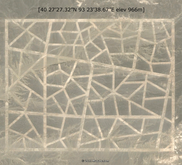
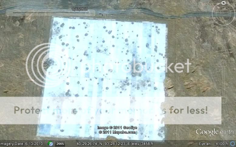
The first image in the series. A strange looking structure that measures over a mile. According to the source, when looking at the same coordinates giong back to 2005, it was shown in various stages of construction, and before 2005 the area was blurred out.
When we zoom out, this is what we see:
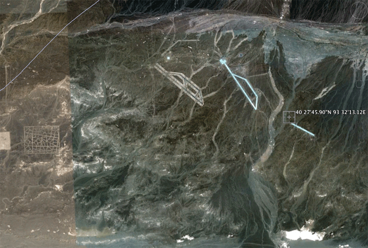
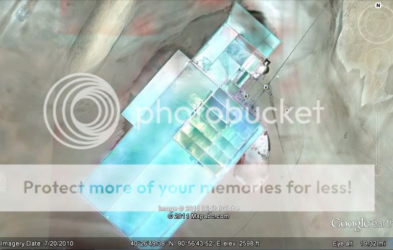
Looks like runways in the remote sections of China. When zoomed in at the end oof the runway looking structure, other building have cropped up through the years. Starting in 2006 with a small trailer looking building, then in 2007 with a round structure, describedin the article as, well lets just quote it here:
The photos seem to show something happened here, I am not sure what however.

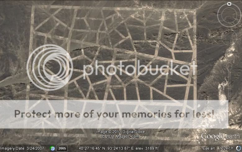
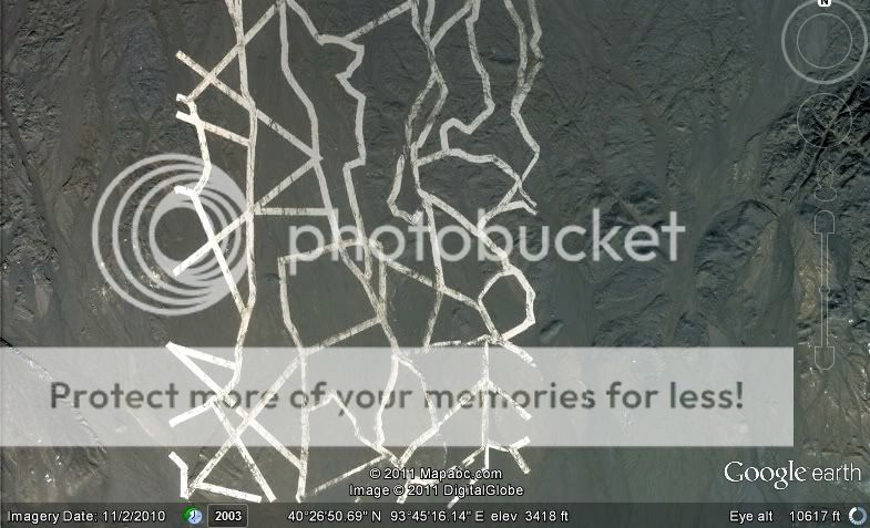
When looking at another section one can see these weird shapes, laid out and over a mile long again.
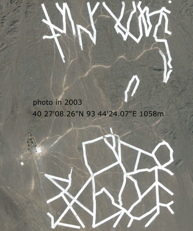
There is another photo of similar patterns in the source article, I saved it but its over 500k, and my imaging software is acting up tonight, i will try to resize it and post it here, if not here is a direct link: photo
An image described as 'HAARP-like' was also captured by Google Earth:
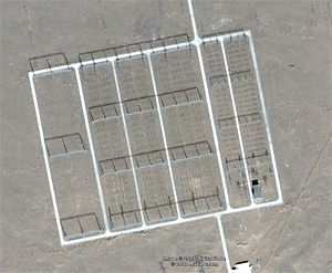
The coordinates are not provided on the photo but are given in the text: 40 24'17.50"N 93 38'15.75"E
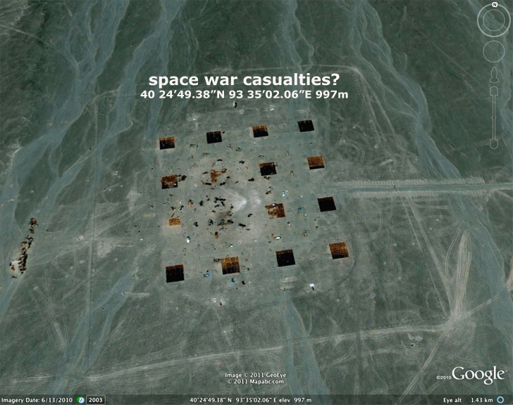
There is one last image in the piece, it is a liitle less believable looking than the rest, it almost looks to me as if it has been altered, but I will include it here out of being all inclusive too the original source:
I have not cross-checked these images (any of them) with Google Earth, I recently uninstalled the program to save some room on my old and dying hard drive, so if someone checks these coordinates and find something else, please let me know.
In the source article, the editors included this one speculative paragraph, presumably from their own source and I will include it here:
I don't know what to make of this. I know that source puts out a fair amount of material that is questionable, if not downright misleading, but if these images can be found via Google Earth, the only misleading going on here is purporting that this is somehow the 'Area 51 of China.' They are interesting nonetheless, no matter what they are.
Like I had said previously, I have not verified the coordinates myself using Google Earth, so if someone goes to these coordinates (let me rephrase, I know someone here will do it very quickly) and the images are way off, please accet my apolgies here. I simply found this article interesting and wanted to share it with my ATS brethren.
These photos are a real puzzle. We have verified that the most recent ones are definitely on Google Earth, but what has happened here is as much of a mystery as the site itself. It is located in the area known as China's 'Area 51' and it appears that the installations, whatever they were, have been destroyed from above. But what are they, and why were they blown apart and the buildings ransacked?
That is the first paragraph here at the source, before you even see the first photo, so immediately I was intrigued.
I will attempt to save the photos and uplad here, might have to resize them due to the new upload size limit.

The first image in the series. A strange looking structure that measures over a mile. According to the source, when looking at the same coordinates giong back to 2005, it was shown in various stages of construction, and before 2005 the area was blurred out.
When we zoom out, this is what we see:

Looks like runways in the remote sections of China. When zoomed in at the end oof the runway looking structure, other building have cropped up through the years. Starting in 2006 with a small trailer looking building, then in 2007 with a round structure, describedin the article as, well lets just quote it here:
Orange blocks, as big as cargo containers, are stacked in a circular manner around a small house. Then, sometime after 2007, there is a powerful explosion and the containers are scattered as much as a three miles from their original site. What happened? What is this place?
The photos seem to show something happened here, I am not sure what however.

When looking at another section one can see these weird shapes, laid out and over a mile long again.

There is another photo of similar patterns in the source article, I saved it but its over 500k, and my imaging software is acting up tonight, i will try to resize it and post it here, if not here is a direct link: photo
An image described as 'HAARP-like' was also captured by Google Earth:

The coordinates are not provided on the photo but are given in the text: 40 24'17.50"N 93 38'15.75"E
There is one last image in the piece, it is a liitle less believable looking than the rest, it almost looks to me as if it has been altered, but I will include it here out of being all inclusive too the original source:

I have not cross-checked these images (any of them) with Google Earth, I recently uninstalled the program to save some room on my old and dying hard drive, so if someone checks these coordinates and find something else, please let me know.
In the source article, the editors included this one speculative paragraph, presumably from their own source and I will include it here:
The reader says this is Top Secret area in a remote part of China. This is the Chinese "Area 51" where captured (alien?) technology is kept and tested. It is also near by where the nuclear bombs were detonated many years ago. Supposedly the main laboratories are underground. You can see the entrances if you look at the images. Contact has been made with other "technology" (?). A new propulsion system was being tested. But it was not well controlled and could not be stabilized. An accident happened and the device blew up. The area is very contaminated now.
I don't know what to make of this. I know that source puts out a fair amount of material that is questionable, if not downright misleading, but if these images can be found via Google Earth, the only misleading going on here is purporting that this is somehow the 'Area 51 of China.' They are interesting nonetheless, no matter what they are.
Like I had said previously, I have not verified the coordinates myself using Google Earth, so if someone goes to these coordinates (let me rephrase, I know someone here will do it very quickly) and the images are way off, please accet my apolgies here. I simply found this article interesting and wanted to share it with my ATS brethren.
This was also covered on Gizmodo.com today and there is a concurrent thread on ATS. But there is some additional information in this one. The main
speculation for several of the patterns are bombing targets, which I find highly plausible. The HAARP-like antenna array and the random geometric
patterns I find to be much more mysterious. Hopefully one of our resident AREA51/satellite imagery specialists can look into this more..
I love the intrigue of this thread and its mysterious possibilities! Cant wait for the others to lend some light on the subject.
Personally maybe it was because of the thread title but my instinct was that something was inside that orange building and it got out. Could full knowledge of ET life have been why China seeks to destroy all religious monuments, denies the Bible in its country even by tourists, collapses Buddha statues and is killing all the Tibetan monks and Nuns?
Are they being controlled by something other worldly? Those beehive looking structures makes me think that they housed many Non terrestrial beings. They do not feel like benevolent ones either...
If USA has area 51 and kept such benevolent beings as the EBEs they have been known to hold, than perhaps in the balance of things china has had the opposite types. If they made deals with them which I have always thought happened somewhere in the world, then this explains alot.
Nice , your image of the Haarp looks similar but smaller than the one at Groom Lake .
36°45'48.09"N 115°59'26.20"W
Whether they were powering it up or powering it down , it has some residual glow to it .
Going to venture a guess on the space war image that they over charge their panels and cooked them good enough to explode a few , and the rest got scorched ? There is also the odd spray pattern in the middle from an impact of sorts too , debris thrown away from it .
Dam they really messed up there on the 2010 accident ? Debris is roughly 1/2 mile out there .
36°45'48.09"N 115°59'26.20"W
Whether they were powering it up or powering it down , it has some residual glow to it .
Going to venture a guess on the space war image that they over charge their panels and cooked them good enough to explode a few , and the rest got scorched ? There is also the odd spray pattern in the middle from an impact of sorts too , debris thrown away from it .
edit on 13-11-2011 by
watchdog8110 because: (no reason given)
Dam they really messed up there on the 2010 accident ? Debris is roughly 1/2 mile out there .
edit on 13-11-2011 by watchdog8110 because:
(no reason given)
reply to post by youdidntseeme
Very cool indeed !
I too ,would love to know what our
ATS satellite recon experts think .
I want to speculate Direct Energy weapons?
Very cool indeed !
I too ,would love to know what our
ATS satellite recon experts think .
I want to speculate Direct Energy weapons?
reply to post by youdidntseeme
I've said it before, and I'll say it again:
[color=B7DEAB]No phenomenal breakthrough discovery (especially one of a 'Top Secret' nature) will ever be found with Google Earth.
These photos are a real puzzle. We have verified that the most recent ones are definitely on Google Earth......
.....Top Secret area in a remote part of China......
I've said it before, and I'll say it again:
[color=B7DEAB]No phenomenal breakthrough discovery (especially one of a 'Top Secret' nature) will ever be found with Google Earth.
edit on 11/13/11 by BrokenCircles because: (no reason given)
Looks to me as if they have created a mock up of a city section for bomb testing.
Maybe there is a sharp member here on ATS that can find a map of what city this is supposed to be depicting.
Maybe there is a sharp member here on ATS that can find a map of what city this is supposed to be depicting.
the exploded cargo containers are almost a butterfly pattern.my guess is a elevator to a bomb that went off by mistake.the orange was not used as
target but as warning.the array is probly their version of haarp.
my personal belief is all major countries are in on this .they are going to agree on population reduction through war.the rich ptb will be the winners.no country will win the war.only destruction of the lower cast.increased riches and power for the upper cast.we are pawns.
the pattern is different bomb bunkers for different bombs and similtaneous landings.the odd layout is because of the uneven tourain.this is probly a hardened site in a granite deposit.just my theory
China built a ton of ghost cities.....these are probably pictures of them before houses were put on top.
www.dailymail.co.uk...
www.dailymail.co.uk...
These amazing satellite images show sprawling cities built in remote parts of China that have been left completely abandoned, sometimes years after their construction. Elaborate public buildings and open spaces are completely unused, with the exception of a few government vehicles near communist authority offices. Some estimates put the number of empty homes at as many as 64 million, with up to 20 new cities being built every year in the country's vast swathes of free land.
That's interesting! I just did a fun little google earth recon...although I agree we will never find out anything secret via google earth! Idk what
is going on there, it could be nothing, an elaborate hydro system, weapons testing or who knows, it is interesting to look at though. Here are a
couple screenshots
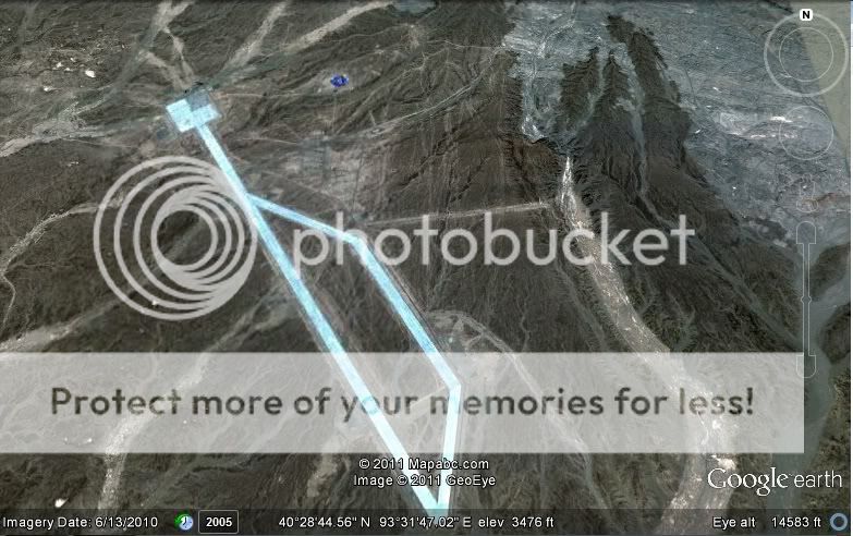
Zoomed in the top left area
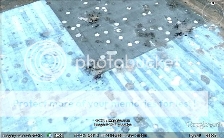
There was a little 'blue' area next to the one above, here is a zoomed look:
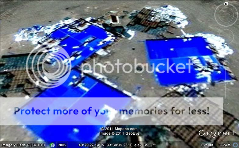
Another light blue area:
These light blue areas are full of water:
Zoomed area of the photo above:

2 different areas with the weird white lines:
Close up of the photo above:
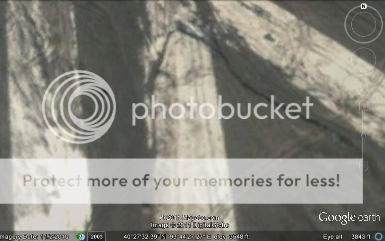
This looks like some sort of trench?:
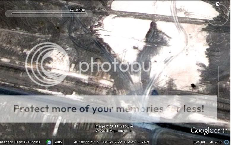
I followed the 'trench' to the west and took this screenshot:
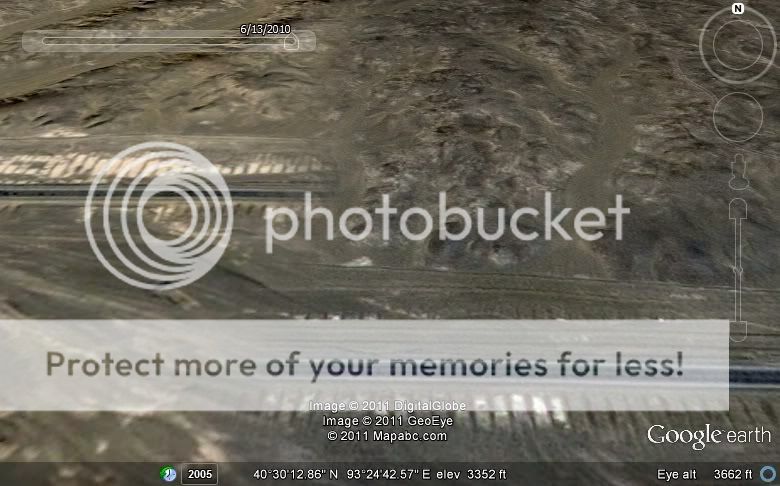
This trench goes on for hundreds of miles to the west. I'll probably look into this more but I thought I would share what I found

Zoomed in the top left area

There was a little 'blue' area next to the one above, here is a zoomed look:

Another light blue area:

These light blue areas are full of water:

Zoomed area of the photo above:

2 different areas with the weird white lines:


Close up of the photo above:

This looks like some sort of trench?:

I followed the 'trench' to the west and took this screenshot:

This trench goes on for hundreds of miles to the west. I'll probably look into this more but I thought I would share what I found
edit on
13-11-2011 by KristinLynnxo because: link
OK I know that it is a stretch but does this thread tie this together with a possible ET intervention?
www.abovetopsecret.com...
www.abovetopsecret.com...
reply to post by youdidntseeme
Here is a thread I posted you may find interesting:
Doomsday Bunker/Facility Hidden In The Mountains Of Tibet?
www.abovetopsecret.com...
Here is a thread I posted you may find interesting:
Doomsday Bunker/Facility Hidden In The Mountains Of Tibet?
www.abovetopsecret.com...
edit on 11/14/2011 by this_is_who_we_are because: typo
Looks like their anti-matter craft had a fatal error.
That's my guess. There's a mad rush to get the next powersource.
I wonder if they even got their anti-matter craft off the ground yet? I've seen one flying, but I think it is Europe's.
That's my guess. There's a mad rush to get the next powersource.
I wonder if they even got their anti-matter craft off the ground yet? I've seen one flying, but I think it is Europe's.
Irrigation systems, ever heard of chinas water problems?
Also there are some opposition to these constructions since alot of farmers and wildlife get too little water to survive since their water is robbed from them, diverted to more "needing" areas.
Also there are some opposition to these constructions since alot of farmers and wildlife get too little water to survive since their water is robbed from them, diverted to more "needing" areas.
reply to post by KristinLynnxo
KristinLynnxo,
Thank you for your contribution here. This is exactly what I had hoped some awesome ATS member would go ahead and do. I havnt really gone through the net yet looking for what to make of any of this but i plan on doing so today. These images just add fuel to my fire.
As to what any of it is, one can only speculate unless we get some official reports handed our way with an explanation, but even then, if this truly is China's 'Area 51' what are the chances of that happeneing?
The final image in the OP IS on Google Earth. What the hell are these things? What the hell happened?!?!?!
Originally posted by CrashUnderride
The final image in the OP IS on Google Earth. What the hell are these things? What the hell happened?!?!?!
That is exactly why I brought these images to this forum. Not so much to find specific answers, as not many things ever have a definitive answer here, but its something for us ATSers to chew on for awhile, and is interesting nonetheless!
The HAARP like place is the China Research Institute of Radiowave Propagation (CRIRP), The other places are missile test sites and a couple of
runways, There is also a military base around there somewhere, Although I don't think it's really used anymore.
These have been visable on Google Earth for some years now. Here is another article, we have been debating it all day as well.
www.slashgear.com...
www.slashgear.com...
edit on 14-11-2011 by moondancer811 because: (no reason given)
Is it that hard to realize that what we are seeing in these images is nothing more than military training areas?
What we are seeing in these images are bombing ranges, particularly the first image, and other training areas and various military infrastructure.
Lots of countries have these sorts of sites, but certainly not for nefarious reasons.
What we are seeing in these images are bombing ranges, particularly the first image, and other training areas and various military infrastructure.
Lots of countries have these sorts of sites, but certainly not for nefarious reasons.
new topics
-
USSS Agent Fired for Having Sex In Michelle Obama's Bathroom
US Political Madness: 1 hours ago -
Watching TV
Jokes, Puns, & Pranks: 3 hours ago
top topics
-
RFK is Trumps health pick
2024 Elections: 12 hours ago, 18 flags -
Watching TV
Jokes, Puns, & Pranks: 3 hours ago, 5 flags -
USSS Agent Fired for Having Sex In Michelle Obama's Bathroom
US Political Madness: 1 hours ago, 5 flags
active topics
-
The Reactionary Conspiracy 13. The plot’s theology.
General Conspiracies • 296 • : MarxistDebunker2 -
USSS Agent Fired for Having Sex In Michelle Obama's Bathroom
US Political Madness • 11 • : theatreboy -
WATCH LIVE: US Congress hearing on UFOs, unidentified anomalous phenomena
Aliens and UFOs • 67 • : putnam6 -
FLORIDA Sues Biden-Harris FEMA for Denying Disaster Assistance to Homeowners with TRUMP Signs.
US Political Madness • 45 • : grey580 -
Thune selected as Senate Republican Leader
US Political Madness • 72 • : CriticalStinker -
The art of being offended
Social Issues and Civil Unrest • 38 • : bastion -
Post A Funny (T&C Friendly) Pic Part IV: The LOL awakens!
General Chit Chat • 7774 • : underpass61 -
The Acronym Game .. Pt.4
General Chit Chat • 955 • : tinkerbell99 -
RFK is Trumps health pick
2024 Elections • 8 • : marg6043 -
Qatar kicks out HAMAS
Middle East Issues • 20 • : bastion
