It looks like you're using an Ad Blocker.
Please white-list or disable AboveTopSecret.com in your ad-blocking tool.
Thank you.
Some features of ATS will be disabled while you continue to use an ad-blocker.
www.inplanesight.org...
direct link
Do a "save as". I don't block right clicks. Normally I ask people not to upload my files to other sites, but since this was pulled from a FOIA, it isn't my image so uploads are fine.
Searching the Library of Congress, it turns out they have hard copies of range maps. Now of course hard copy is kind of useless unless you are in DC. But the existence of such maps makes them FOIA-able or outright purchased. You need to know what exists in order to request it. Here are a few:
Nellis
Edwards
UTTR
KVBG
Years ago you could do a FOIA and get the NTTR map for free. The government finally wised up and directed people where to buy them.
There is often confusion between the USAF NTTR and the FAA sectional that covers the NTTR. They are different maps.
I have noticed that in addition to the Nellis Range maps quite a lot of the flight planning databases (including Foreflight) have a lot of new(ish) waypoints within the Nellis Airspace and in particular within R4808N.
Waypoints to the south of Groom Lake are SCUZZ, CODMI, HILVI, SHIES, WODIK, and FEGUG.
Interestingly WODIK has the below data associated with it:
Lat/Long: N37° 07.5', W115° 44.1' Name: WODIK Airport: KXTA Additional Data: RNAV Waypoint Final Approach Fix Approach
Usage Terminal Usage Magnetic Variation: 11.9°E Sectional Chart: Las Vegas
Waypoints to the mid and north of Groom Lake are FIRBA, ENITE, ZIMLU, ZEGAB, JUSOX, PEBDE, and WUPAV.
Another side note is the MCY VOR (identified as Mickey VORTAC) has now appeared within some flight planning databases and the data for that is below (including the frequency).
Frequency: 115.7 MHz (Channel 104)
Type: VORTAC
Lat/Long: N37° 14.6', W115° 47.5'
Location: MERCURY NV USA
Declination: 12.5° E
Morse Code: – – – • – • – • – –
M C Y
Usage: Terminal
Magnetic Variation: 12.0° E
Sectional Chart: Las Vegas
Elevation: 4458 ft
Additional Data: VOR
TACAN
Voice Transmission Capability
Here's a screenshot for the area to put things in perspective. Not sure if anyone has heard any ATC call these waypoints out or if they are used? All this confirms Groom Lake has RNAV approach routes to both runways 32 and 14 which appear in onboard flight navigation systems.

originally posted by: Asktheanimals
I saw on the news recently they had opened up air space over some installations for commercial traffic to help the thanksgiving rush of flyers. would that have anything to do with those changes?
From looking at the nav data all these waypoints are flagged as arrival routes (or terminal) and not overflights (or airways). If anyone has an RNAV/GPS database would they be able to verify the below I have extracted from my GPS database?
Runway 14 RNAV Approach, FIRBA 10,000ft, ZIMLU 9,100ft, ZEGAB 8,000ft, PEBDE 6,200ft, WUPAV 5,300ft, Threshold 4,490ft, Go Around procedure to HILVI 10,500ft and hold.
Runway 32 RNAV Approach,SCUZZ 10,000ft, CODMI 8,400ft, SHIES 7,300ft, WODIK 6,600ft, FEGUG 5,220ft, Threshold 4,490ft, Go Around procedure to JUSOX (no altitude provided), ENITE (no altitude provided), SCUZZ 10,000ft-14,000ft and hold.
originally posted by: SHRMark
Apologies for bumping an old thread however I cannot create a new post until I get my five replies.
I have noticed that in addition to the Nellis Range maps quite a lot of the flight planning databases (including Foreflight) have a lot of new(ish) waypoints within the Nellis Airspace and in particular within R4808N.
I've had those in one of my Google Earth KMZ files for a while, a number of them are in a line with the Tonopah Test Range airport.
Also the targets near there, used for among other things static drops of dummy nuclear gravity bombs.
ETA: here's the list of waypoints I have in my file
HUGER/OSRIE, TOGE/WATLU, FALAK, WEBEL, HOSER, RUDII, TAVE, MODME, DRAKO, IRAVE, JIREM, HUBON, JELGO, SANND, MAKZI, TUNDY, EXITT, FLUSH, KL42K, JAYSN, CENIT, KICHI, JANAV/PEMVE, LOZMO
This image is from the Navigraph Charts Desktop demo.
Waypoints I've never heard of! Must add these to my Google Earth.

INTERESTING - NAV beacon at Groom Lake marked as MKEEE
37° 14'33.0"N, 115° 47'32.6"W
originally posted by: FosterVS
a reply to: FosterVS
INTERESTING - NAV beacon at Groom Lake marked as MKEEE
37° 14'33.0"N, 115° 47'32.6"W
Yeah, same. CYKLE and TUNDY are new to me.
The MKEEE thing is a little perplexing as there is a valid navigation fix to the east that is ID'd as MKEEE @ 37-14-33.0200N 115-17-32.6400W according to the FAA database.
originally posted by: SHRMark
From looking at the nav data all these waypoints are flagged as arrival routes (or terminal) and not overflights (or airways). If anyone has an RNAV/GPS database would they be able to verify the below I have extracted from my GPS database?
Runway 14 RNAV Approach, FIRBA 10,000ft, ZIMLU 9,100ft, ZEGAB 8,000ft, PEBDE 6,200ft, WUPAV 5,300ft, Threshold 4,490ft, Go Around procedure to HILVI 10,500ft and hold.
Runway 32 RNAV Approach,SCUZZ 10,000ft, CODMI 8,400ft, SHIES 7,300ft, WODIK 6,600ft, FEGUG 5,220ft, Threshold 4,490ft, Go Around procedure to JUSOX (no altitude provided), ENITE (no altitude provided), SCUZZ 10,000ft-14,000ft and hold.
I think this is an awesome find and quiet useful for an avid flight simmer such as myself. I'd sure like to know where they got that data to come up with that RNAV info. Would it be possible for you to dig out the lat and long positions of the fixes so I can more accurately place them?
Either way, your find has helped me with my own project I've been doing off and on now for many years to help dial in my own approaches into Groom.
After comparing your fixes to flight tracking data of Janets and adding your fixes with my own, it plugged a few holes and these are my findings.
So to start, when flying to Groom, Janets typically file MCCRN5->FIDOE->JAYSN->EXITT publicly. After crossing EXITT (or WSKEE) they either turn off or swap their transponder. However sometimes they forget to do this and we get tracking data almost all the way to the ground, giving us a better look at how they fly into Groom. MCCRN5 is a published standard instrument departure(SID) at McCarron.
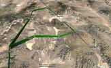
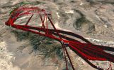
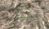
When looking at your RNAV data in Google earth we get this kind of picture.

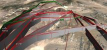
We then load in the tracking data from Janet flights and we see this.


To me, this clearly shows that they do in fact use the RNAV data you found, but also have 3 other very common routes. They probably use what's best based on what all is going on in the ranges around Groom.
I also find it interesting that they seemingly never use EXITT like they file, but rather, use WSKEE. They seem to use EXITT when leaving the range (makes more sense) along with SESAE and WAXIE.
In all, we commonly see something like this. Note: they probably don't plug in every fix of each path into their FMC, I just included each fix under the common paths when they seem to cross it at an identical altitude.
RWY32 (the first four seem the most used)
MCCRN5->FIDOE->JAYSN->SCUZZ->BGZEE->WODIK->FEGUG
MCCRN5->FIDOE->SMKEE->DRRLA->SHIES->WODIK->FEGUG
MCCRN5->FIDOE->JAYSN->WSKEE->SCUZZ->CODMI->SHIES->WODIK->FEGUG
MCCRN5->FIDOE->JAYSN->STYME->DARRLA->SHIES->WODIK->FEGUG
MCCRN5->FIDOE->WODIK or FEGUG
MCCRN5->FIDOE->SMKEE->DRRLA->SHIES->WODIK->FEGUG
MCCRN5->FIDOE at or after FIDOE->WODIK->FEGUG
MCCRN5->FIDOE->JAYSN->WSKEE->SCUZZ->WODIK->FEGUE
MCCRN5->FIDOE->JAYSN->WSKEE->BGZEE->WODIK->FEGUE
RWY14 (lacks data)
MCCRN5->FIDOE->JAYSN->SCUZZ->BGZEE->WUPAV
Unfortunately, they seem to be more on their game with dumping the transponder tracking when flying into runway 14 as you can probably see in the photos above.
Common FIX crossing altitudes:
FIDOE @FL 140
SMKEE @FL 105
DRRLA @FL 100
SHIES @FL 073
WODIK @FL 060
FEGUG @FL 052
BGZEE @FL 100 (When flying to BGZEE they tend to cross SCUZZ @FL 110)
JAYSN @FL 140
WSKEE @FL 120
WUPAV @FL 053
SCUZZ @FL 100
CODMI @FL 084
SHIES @FL 073
STYME @FL 135
More fixes in the area. Still need to add CYKLE and TUNDY.

Anyway, that's where I'm at. Maybe someone who knows a bit more and can help out. And maybe a mod can split your post along with the comments into its own thread?
Cheers
-
Smartest Man in the World Tells His Theory About What Happens At Death
Philosophy and Metaphysics: 2 hours ago -
Covid....... Again.
Diseases and Pandemics: 4 hours ago -
US Federal Funding set to Expire December 20th. Massive CR on the way.
Mainstream News: 4 hours ago -
and14263 New Account Not the Same Old Me
Introductions: 6 hours ago
-
Covid....... Again.
Diseases and Pandemics: 4 hours ago, 9 flags -
US Federal Funding set to Expire December 20th. Massive CR on the way.
Mainstream News: 4 hours ago, 8 flags -
Smartest Man in the World Tells His Theory About What Happens At Death
Philosophy and Metaphysics: 2 hours ago, 7 flags -
Just spotted an unusual aircraft Melbourne Australia
Aliens and UFOs: 13 hours ago, 6 flags -
and14263 New Account Not the Same Old Me
Introductions: 6 hours ago, 2 flags
-
Smartest Man in the World Tells His Theory About What Happens At Death
Philosophy and Metaphysics • 11 • : and14263a -
and14263 New Account Not the Same Old Me
Introductions • 10 • : ksihkahe -
The truth lets admit it
Aliens and UFOs • 54 • : andy06shake -
Covid....... Again.
Diseases and Pandemics • 17 • : Naftalin -
US Federal Funding set to Expire December 20th. Massive CR on the way.
Mainstream News • 9 • : BeyondKnowledge3 -
School shooting in Madison Wi.
Social Issues and Civil Unrest • 71 • : DeadlyStaringFrog -
The Acronym Game .. Pt.4
General Chit Chat • 1022 • : tinkerbell99 -
Trump Cancel trip to New Jersey because of drones
Aliens and UFOs • 72 • : ARM19688 -
Russias War Against Religion in Ukraine
World War Three • 34 • : andy06shake -
Could rampant land speculation have caused the Civil War?
History • 41 • : Solvedit
