It looks like you're using an Ad Blocker.
Please white-list or disable AboveTopSecret.com in your ad-blocking tool.
Thank you.
Some features of ATS will be disabled while you continue to use an ad-blocker.
5
share:
NTTR (Nevada Test and Training Range)
If you go to
37°49'33.86"N 116° 1'59.70"W
on Google Earth on the latest 2016 imagery, you can see a small structure. It sort of looks like a helicopter. However I'm sure it is the odd crank up tower I encountered in 2015.
tower on google maps
crank up tower
This is in free territory. The small sand pit of sorts nearby is where a F-15 crashed.
www.lazygranch.com...
Looking for this old crash site is how we wandered into the crank up tower. The tower is mobile, so I doubt they left it there an entire year. Probably the location is useful for whatever they use it for, that is they set up there often.
originally posted by: gariac
NTTR (Nevada Test and Training Range)
If you go to
37°49'33.86"N 116° 1'59.70"W
on Google Earth on the latest 2016 imagery, you can see a small structure. It sort of looks like a helicopter. However I'm sure it is the odd crank up tower I encountered in 2015.
tower on google maps
crank up tower
This is in free territory. The small sand pit of sorts nearby is where a F-15 crashed.
www.lazygranch.com...
Looking for this old crash site is how we wandered into the crank up tower. The tower is mobile, so I doubt they left it there an entire year. Probably the location is useful for whatever they use it for, that is they set up there often.
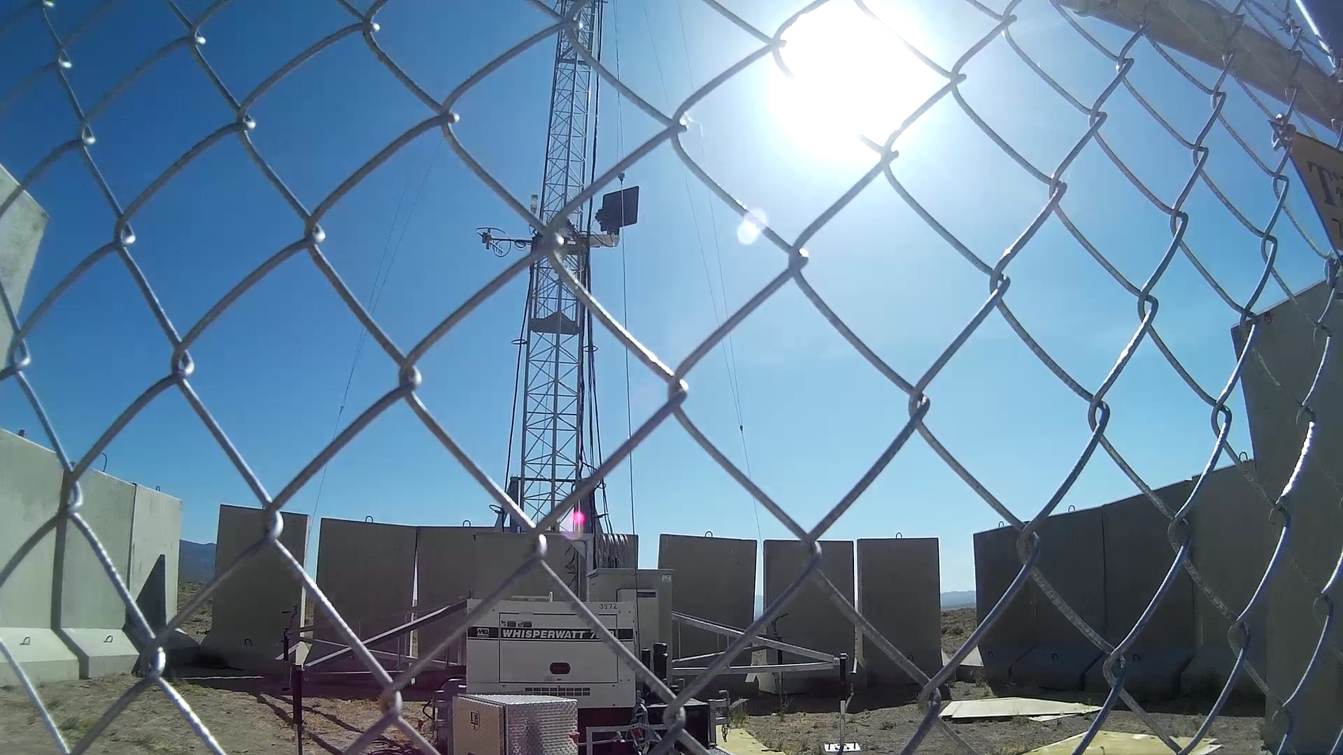
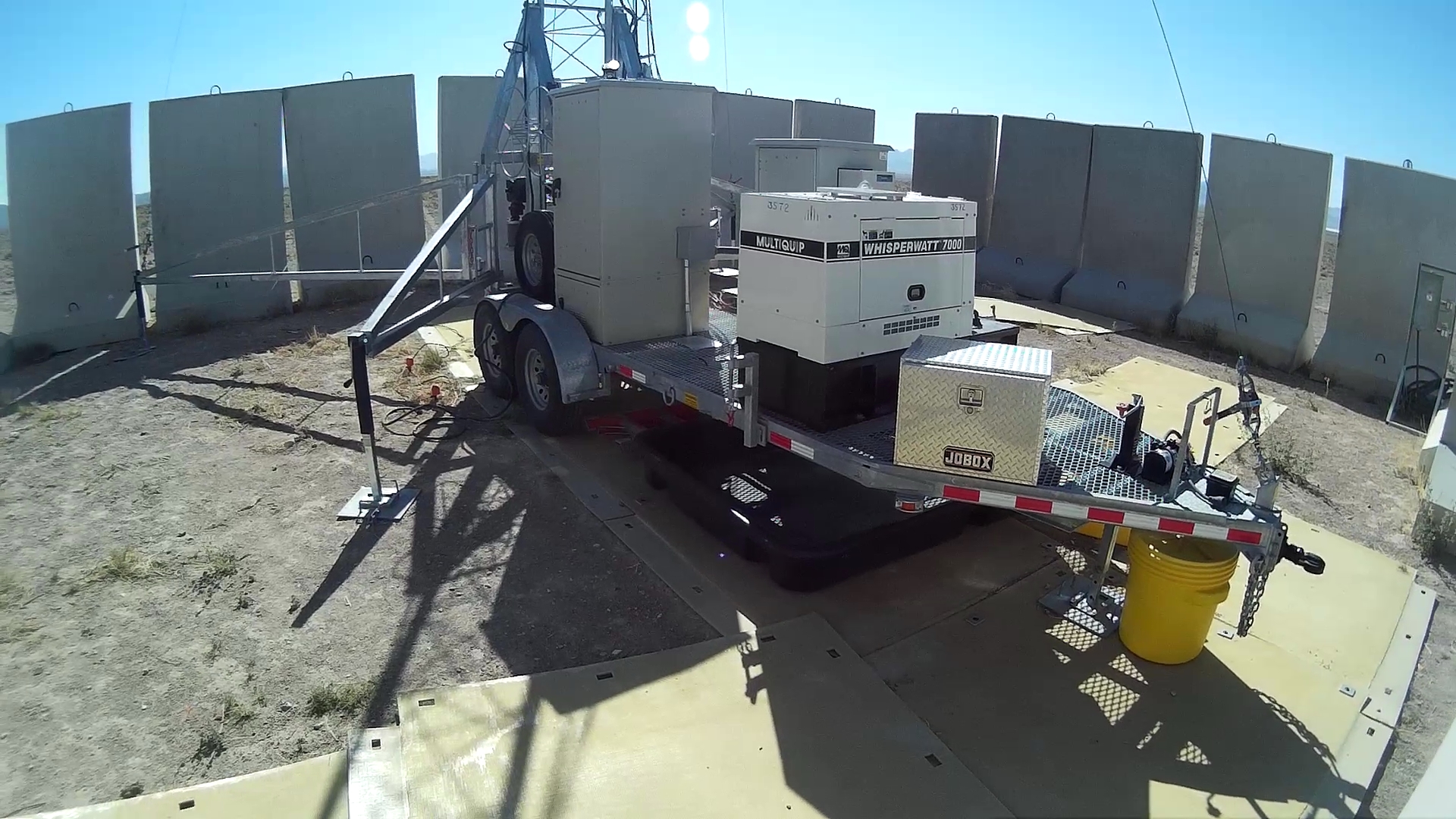
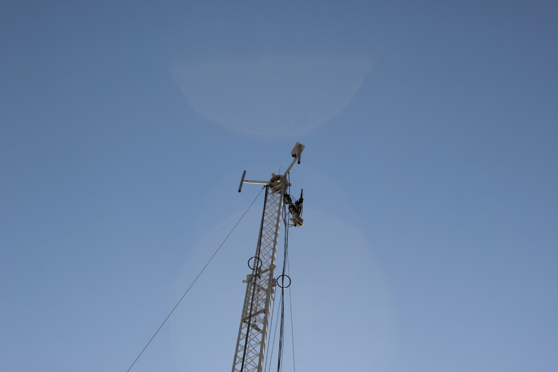
There is a "crank-up tower" here as well, I took some pictures of it last week, will post here soon.
Another Tower
edit on 20-6-2017 by FosterVS because: (no reason given)
Gotta love their "secure" concrete wall. You can just walk in there at any of 4 corners.
If anyone wants higher res pictures, contact me.


If anyone wants higher res pictures, contact me.


edit on 24-6-2017 by FosterVS because: (no reason given)
edit on 24-6-2017 by FosterVS because: (no
reason given)
a reply to: FosterVS
The gap might indicate that they are only trying to discourage visitors of the bovine kind. It has been said that only in North America is a chain link fence considered a security fence. Supposedly it is a 15 minute job to make a man sized hole, presuming you don't just climb it.
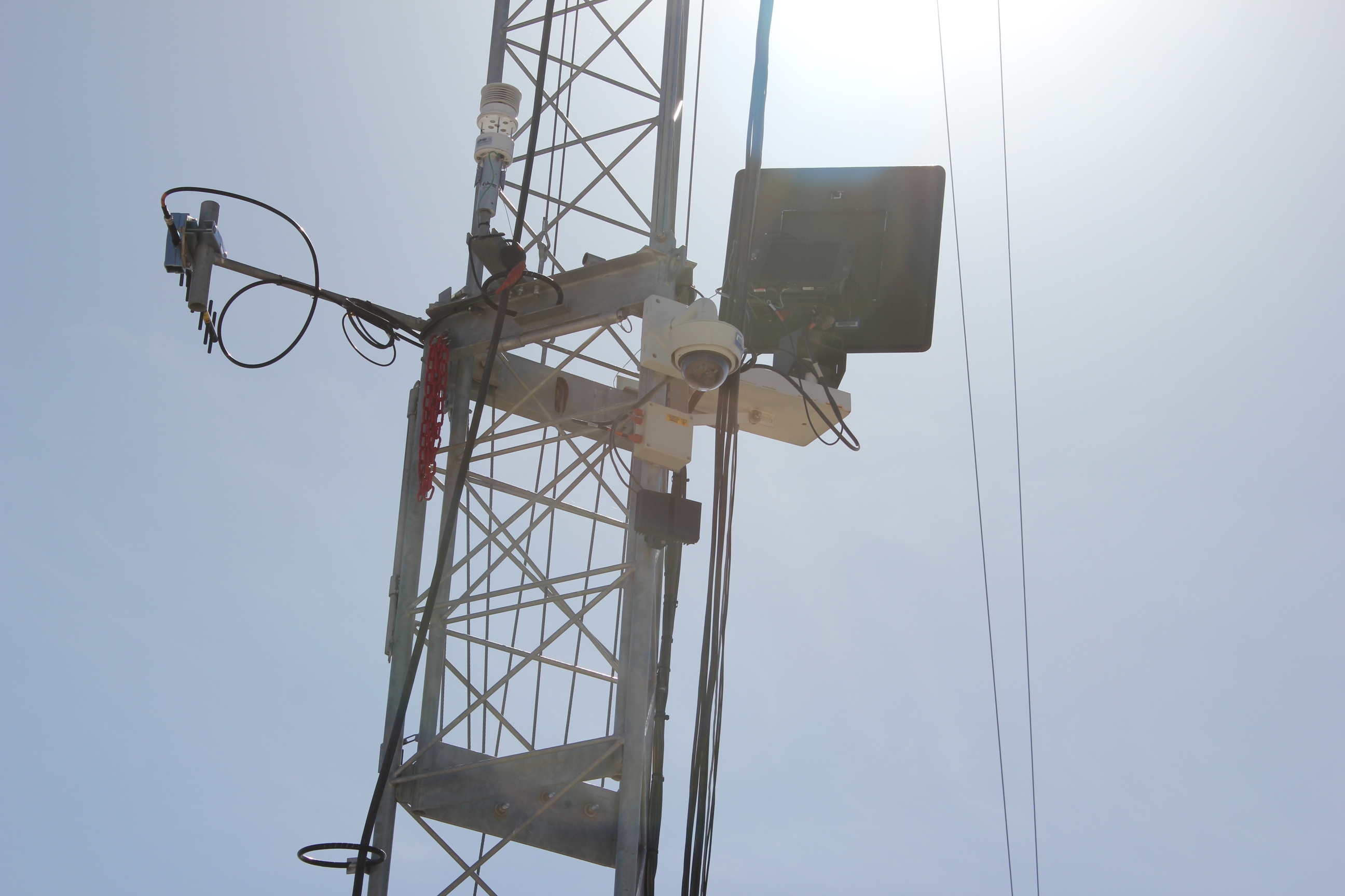
Do you have any markings off the gear for identification?
originally posted by: gariac
a reply to: FosterVS
Most antennas are labeled, but you will generally need a 300 to 400mm telephoto lens to get a decent image.
A lot of this what looks like cellular but is military is 3.5GHz.
And guess who had a 300mm telephoto lens for his Canon. Right there.
edit on 24-6-2017 by FosterVS because: (no reason given)
a reply to: FosterVS
If your goal is to satisfy all the wankers, you need a wide shot showing something in the background so they believe the photo location is valid. Then the mid and telephoto shots.
This location should of led to a few dozens of photo essays since it can be seen from the ET Highway and probably Rachel. It never ceases to amaze me at how much actual news the locals miss.
Then again, I'm amazed at how some tourists see a UFO on every visit.
You can research the numbers off my post. I never found anything conclusive, but haven't looked lately.
new topics
top topics
-
Marvin Gabrion's sentence commuted by Biden
US Political Madness: 15 hours ago, 14 flags -
London Christmas Market BANS Word ‘Christmas’
Social Issues and Civil Unrest: 15 hours ago, 12 flags -
1 Billion dollars
General Entertainment: 13 hours ago, 6 flags -
Parker Solar Probe is about to Kiss the Sun
Space Exploration: 16 hours ago, 4 flags
active topics
-
RIP Merrily Harpur British Big Cat Realist
Cryptozoology • 4 • : TimBurr -
London Christmas Market BANS Word ‘Christmas’
Social Issues and Civil Unrest • 31 • : WeMustCare -
Statements of Intent from Incoming Trump Administration Members - 2025 to 2029.
2024 Elections • 51 • : WeMustCare -
JILL BIDEN Wants JOE to Punish Democrats Who Forced Him to Leave Office in Disgrace on 1.20.2025.
2024 Elections • 15 • : Electriccowboy -
Christmas Dinner ??
Food and Cooking • 15 • : Mantiss2021 -
U.S. Govt Agencies That Protect Criminals in Government - National Archives Records Admin-NARA.
Political Conspiracies • 9 • : 777Vader -
NYPD arrests migrant who allegedly set woman on fire on subway train, watched her burn to death
Breaking Alternative News • 51 • : QET0110 -
Merry Christmas !!
General Chit Chat • 17 • : rickymouse -
1 Billion dollars
General Entertainment • 11 • : rickymouse -
Mood Music Part VI
Music • 3763 • : MRTrismegistus
5
