It looks like you're using an Ad Blocker.
Please white-list or disable AboveTopSecret.com in your ad-blocking tool.
Thank you.
Some features of ATS will be disabled while you continue to use an ad-blocker.

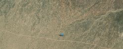
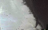
Helicopter caught on a landing approach to S4
page: 15
share:
Although I intend to use these images as part of a larger reveal this month, I need some help identifying what type of helicopter this is and whether
or not it could be used to transport a handful of S4's employees.
files.abovetopsecret.com...

files.abovetopsecret.com...
files.abovetopsecret.com...
files.abovetopsecret.com...
Aircraft usually don't produce a shadow at a certain elevation, and given how close this shadow is, they are on a very low approach. Directly toward S4, taking into account mountains. Any measurement specialists here able to give me an idea of its altitude based on either the shadow or known information?
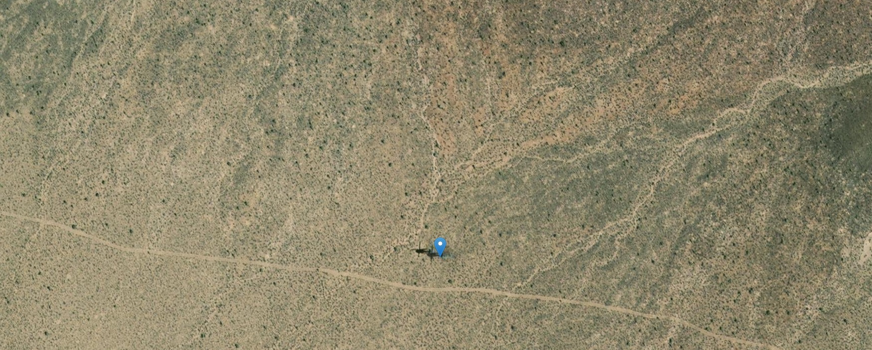
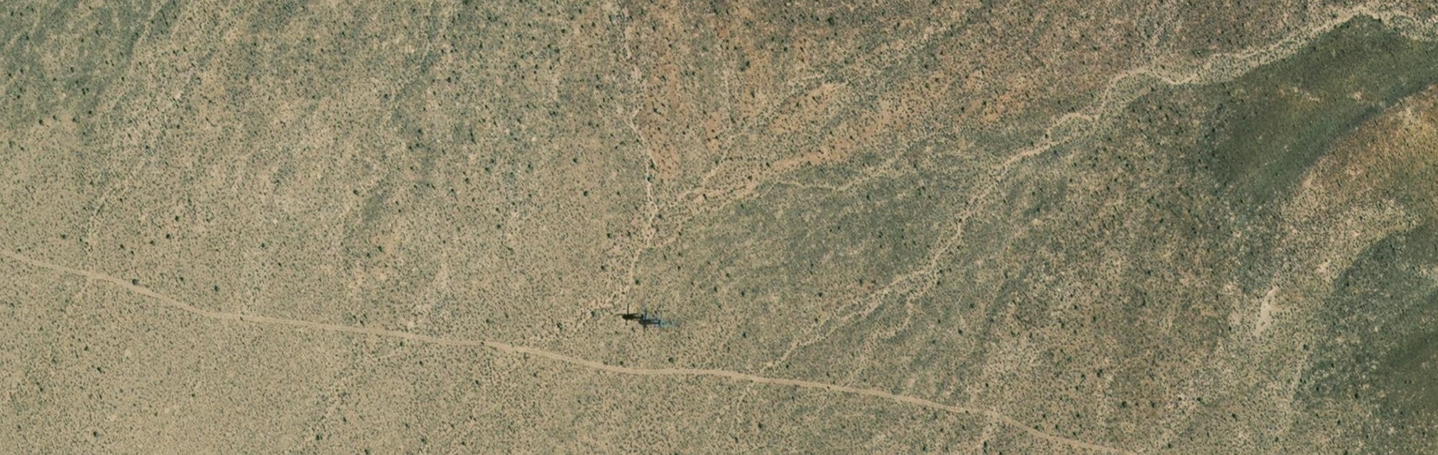
Although they may be used for transportation, its also possible they are conducting a security sweep by air to make sure the bus can roll to Papoose lake, over the variety of "Good dirt roads" that head directly to S4.
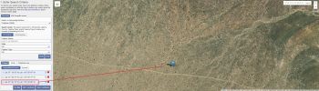
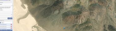
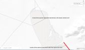
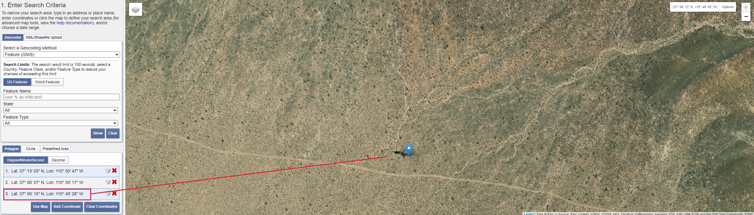
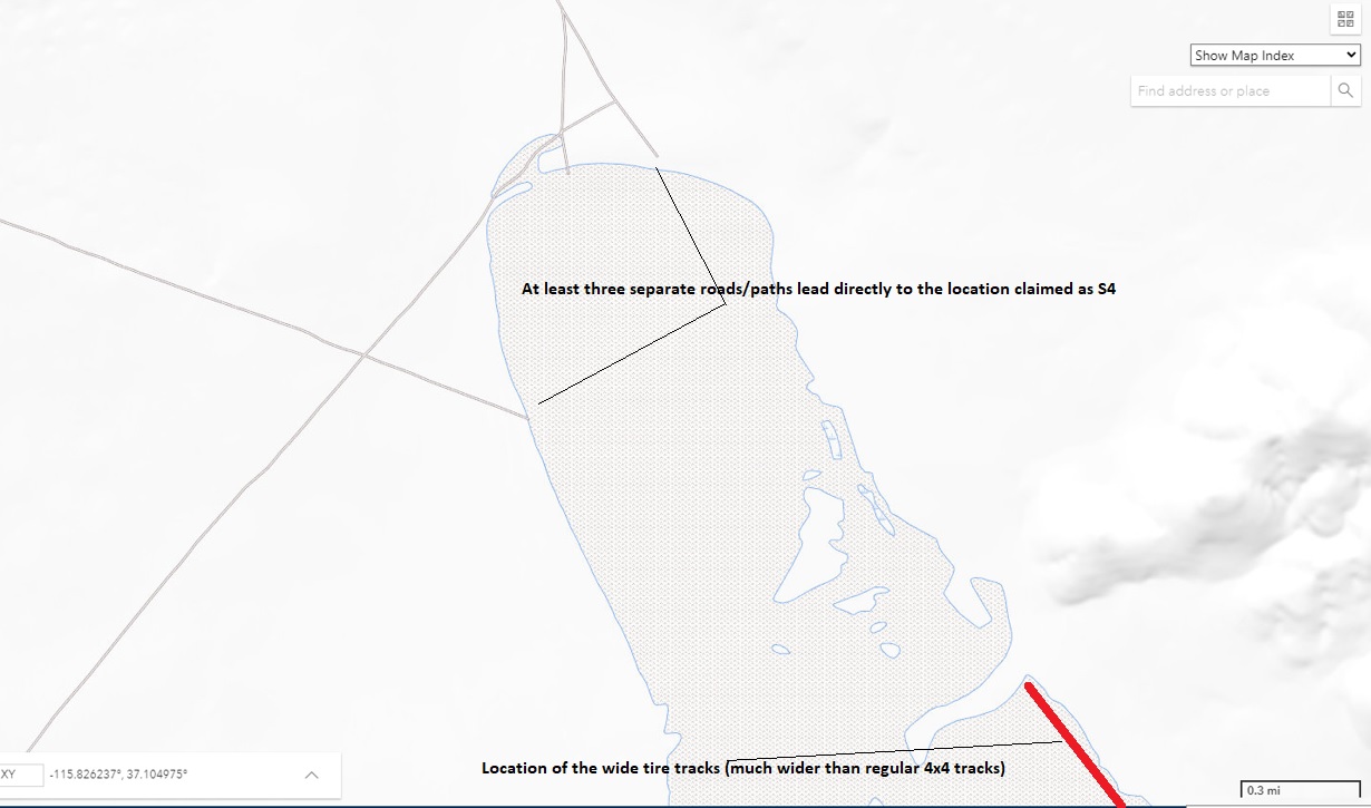
Just to give you an idea of the helicopter's location compared to the roads leading that way, here is another USGS map/resource:
files.abovetopsecret.com...
^I've also included the location of the "wide double tracks" leading into the "tear drop"
files.abovetopsecret.com...
files.abovetopsecret.com...
files.abovetopsecret.com...
files.abovetopsecret.com...
files.abovetopsecret.com...
Aircraft usually don't produce a shadow at a certain elevation, and given how close this shadow is, they are on a very low approach. Directly toward S4, taking into account mountains. Any measurement specialists here able to give me an idea of its altitude based on either the shadow or known information?
Although they may be used for transportation, its also possible they are conducting a security sweep by air to make sure the bus can roll to Papoose lake, over the variety of "Good dirt roads" that head directly to S4.
Just to give you an idea of the helicopter's location compared to the roads leading that way, here is another USGS map/resource:
files.abovetopsecret.com...
^I've also included the location of the "wide double tracks" leading into the "tear drop"

files.abovetopsecret.com...
edit on 3/2/2022 by JBurns because: (no reason given)
a reply to: JBurns
I agree, from looking at the shadow and it's size and sharpness, the helicopter would have to be very low over the ground, but still high enough for the dust on the ground not being blown up.
The dust road nearby looks single lane, compared to the size of the helicopter, it has to be flying very low. But why? If it was a transportation flight, sure they would fly higher to not risk anything.
Maybe training low level flights?
It's a Blackhawk variant. They probably wouldn't use them to transport employees on routine movements, but might use them to transport military
personnel to remote areas. Employees would go on one of the Janet flights.
a reply to: ThatDamnDuckAgain
Fascinating analysis!! Thank you!
I knew there was a few things (OK...a bucket heap of things) I would miss
You are probably right. Just struck me how close/low it was compared to where Bob Lazar claimed the S4 location was. Of course this could have nothing to do with that, or maybe even the USAF guys operating that lovely vehicle have a sense of humor....or curiosity
Fascinating analysis!! Thank you!
I knew there was a few things (OK...a bucket heap of things) I would miss
Maybe training low level flights?
You are probably right. Just struck me how close/low it was compared to where Bob Lazar claimed the S4 location was. Of course this could have nothing to do with that, or maybe even the USAF guys operating that lovely vehicle have a sense of humor....or curiosity
a reply to: Zaphod58
Thank you! I knew somebody would be able to just say "Oh its such and such"
The aviation knowledge here never ceases to amaze me. Do you think they would be flying toward the Area 6 strip (I envision them entering through the NTS/Indian Springs area or using their own built in airstrip) or does their altitude indicate their target is closer? Or did the pilot simply see something interesting and decide to come down to take a look?
edit on 3/2/2022 by JBurns because: (no reason given)
a reply to: JBurns
I was about to write that we could calculate the approx. height from the difference in shadow length from the rotor tips and the original ones plus taking the sun's angle (offset of shadow) into consideration.
But then I noticed the helicopter isn't flying level and the ground isn't flat, it's actually kind of looking like it's banking right over the slope on the right of the road.
No idea about it's mission, but it was fun to look at it and get an idea.
originally posted by: Zaphod58
It's a Blackhawk variant. They probably wouldn't use them to transport employees on routine movements, but might use them to transport military personnel to remote areas. Employees would go on one of the Janet flights.
Those are the "Tylenol" planes out of McCarran, right?
a reply to: JBurns
Photogrammetric analysis with the given images suggests an altitude of not more than 200 feet AGL, a mean of 100' AGL would be a reasonable estimate.
Any measurement specialists here able to give me an idea of its altitude based on either the shadow or known information?
Photogrammetric analysis with the given images suggests an altitude of not more than 200 feet AGL, a mean of 100' AGL would be a reasonable estimate.
new topics
-
This is getting ridiculous...
US Political Madness: 1 hours ago -
Almost run over in a parking lot…
General Chit Chat: 2 hours ago -
Women in MX City has screaming fit in public about cannibals. Arrested and then disappeared.
Secret Societies: 6 hours ago -
China's Chang'e-6 will Attempt Lunar South Pole Landing Tomorrow
Space Exploration: 7 hours ago -
Death Penalty for Chad Daybell! woohoo
People: 9 hours ago
top topics
-
Furious Malaysians Demand Accountability for People Killed & Injured By COVID-19 Vaccines!
Social Issues and Civil Unrest: 16 hours ago, 16 flags -
Why are the American media silent?
World War Three: 15 hours ago, 7 flags -
China's Chang'e-6 will Attempt Lunar South Pole Landing Tomorrow
Space Exploration: 7 hours ago, 7 flags -
This is getting ridiculous...
US Political Madness: 1 hours ago, 7 flags -
Women in MX City has screaming fit in public about cannibals. Arrested and then disappeared.
Secret Societies: 6 hours ago, 6 flags -
Death Penalty for Chad Daybell! woohoo
People: 9 hours ago, 5 flags -
Almost run over in a parking lot…
General Chit Chat: 2 hours ago, 3 flags -
We must redefine our duality.
Philosophy and Metaphysics: 16 hours ago, 1 flags
active topics
-
Paul McCartney conspiracy
General Conspiracies • 138 • : daskakik -
Death Penalty for Chad Daybell! woohoo
People • 9 • : Flyingclaydisk -
Robert De Niro Anti-Trump Campaign Ad for Biden
2024 Elections • 185 • : 777Vader -
This is getting ridiculous...
US Political Madness • 2 • : theatreboy -
Can anyone explain the crime Trump did?
US Political Madness • 261 • : Annee -
I’m sure this will kill, I mean save many lives. New cancer vaccine being tested in UK
Diseases and Pandemics • 130 • : G1111B1234 -
-@TH3WH17ERABB17- -Q- ---TIME TO SHOW THE WORLD--- -Part- --44--
Dissecting Disinformation • 1250 • : daskakik -
Russia became the 4th largest economy in the world and overtook Japan
Global Meltdown • 60 • : CriticalStinker -
What will the sentence be for Donald J Trump - Convicted Felon
US Political Madness • 82 • : burritocat -
Almost run over in a parking lot…
General Chit Chat • 6 • : Boomer1947
5