It looks like you're using an Ad Blocker.
Please white-list or disable AboveTopSecret.com in your ad-blocking tool.
Thank you.
Some features of ATS will be disabled while you continue to use an ad-blocker.
share:
www.esa.int..." target="_blank" class="postlink" rel="nofollow">Linkswww.esa.int..." target="_blank" class="postlink" rel="nofollow">Link2
www.esa.int...
www.esa.int...
[edit on 15-11-2009 by rhdpre]
www.esa.int...
www.esa.int...
[edit on 15-11-2009 by rhdpre]
google translator
silly question ...
if .....¿ compression effect because it is the same pattern "compression" in the rest of pictures that were taken and compressed?
Why are not more pictures with the same pattern of compression?
I have not found this pattern in any other image, and I "kicked" a lot ....
silly question ...
if .....¿ compression effect because it is the same pattern "compression" in the rest of pictures that were taken and compressed?
Why are not more pictures with the same pattern of compression?
I have not found this pattern in any other image, and I "kicked" a lot ....
reply to post by rhdpre
I said that too some pages back, as far as I have seen this is the only image in which this effect is so noticeable, and, in my opinion, the result of having so few shades of grey in the original image, making that stripes effect.
PS: I have found bigger versions of the images you used, but they are not much better. I am still looking.
It's time to address the 800 pound gorilla in the room.
If another country like China or Russia pulls the pin on the story of the millennium and comes up with irrefutable documented proof that we are not alone and especially taken from places where we (USA) have been like the moon, mars, especially the moon.. We as a nation will have to step aside to make room for the new leaders who will set the tone/agenda for man's future !!!
If another country like China or Russia pulls the pin on the story of the millennium and comes up with irrefutable documented proof that we are not alone and especially taken from places where we (USA) have been like the moon, mars, especially the moon.. We as a nation will have to step aside to make room for the new leaders who will set the tone/agenda for man's future !!!
Since I am new here I will be trying to get my post count up to 20 somewhat quick since I have an AMAZING picture to share (if it hasn't already been
shared)...I have seen these photo's before and find them most intriguing...many people have tried to debunk them but to no avail...they could
possibly some sort of camera malfunction (even though I personally doubt it) but they were DEFINITELY taken on Mars...I felt I should point that out
since someone on the first page said they were from Earth...
Originally posted by Sirez
I have seen these photo's before and find them most intriguing...many people have tried to debunk them but to no avail...
This very thread most definately debunkes the idea that the images show anything out of the ordinary.
they could possibly some sort of camera malfunction (even though I personally doubt it) but they were DEFINITELY taken on Mars...
There's no malfunction. Please read the whole thread.
reply to post by pencilnev
3 things:
1 - What was hidden? The photo in your link is too small and suffers from some kind of processing that reduced the quality even further.
2 - Do not write in ALL CAPS, that's the same as shouting and considered bad etiquette.
3 - Welcome to ATS.
3 things:
1 - What was hidden? The photo in your link is too small and suffers from some kind of processing that reduced the quality even further.
2 - Do not write in ALL CAPS, that's the same as shouting and considered bad etiquette.
3 - Welcome to ATS.
When you add Ernest Norman's account, Lonnie Zamora, Gary Wilcox and the mars artifact images of mars. You get a great possibility of Mars living
underground. Not sure if the cities are in operation. I think their is a better chance of a civilization living underground. But a long time ago there
could of been a flourishing civilization living top side. Just too many mars images that are legit to think otherwise. So much is hidden from us. It
is for our own protection I am not sure. But how can you blame anybody for not getting very curious!
Originally posted by thetiler
But how can you blame anybody for not getting very curious!
Curiosity is good, but using imagination to find alternate explanations to things that are already explained is, in my opinion, not good, and that is what happens in cases like this, in which people look at composite images, imagine an explanation to what they see and ignore the original photos that do not show any of the things seen on the composite.
reply to post by mikesingh
I was wondering if you have gotton any further with these photos....have you had and replies yet with a satifactory explination?
reply to post by thetiler
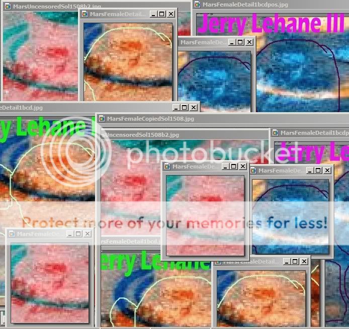
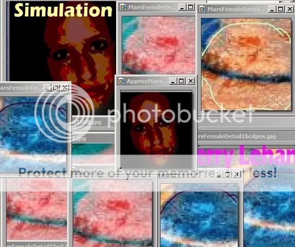
Yes a long time ago like Sol 1508 there could have been PEOPLE on Mars the size 1 1/2 Barbie dolls high and no-one would be able to SEE them,until now. Mars Female. i12.photobucket.com...
s12.photobucket.com...
 finally got it to show correctly
Yes a long time ago like Sol 1508 there could have been PEOPLE on Mars the size 1 1/2 Barbie dolls high and no-one would be able to SEE them,until now. Mars Female.

s12.photobucket.com...
edit on 22-1-2012 by vze2xjjk because: duplicate pic deletion
i12.photobucket.com...edit on 22-1-2012 by vze2xjjk because: found a simulation
face

edit on 22-1-2012 by
vze2xjjk because: I wanted to show a similar Earth Face simulation
reply to post by pencilnev
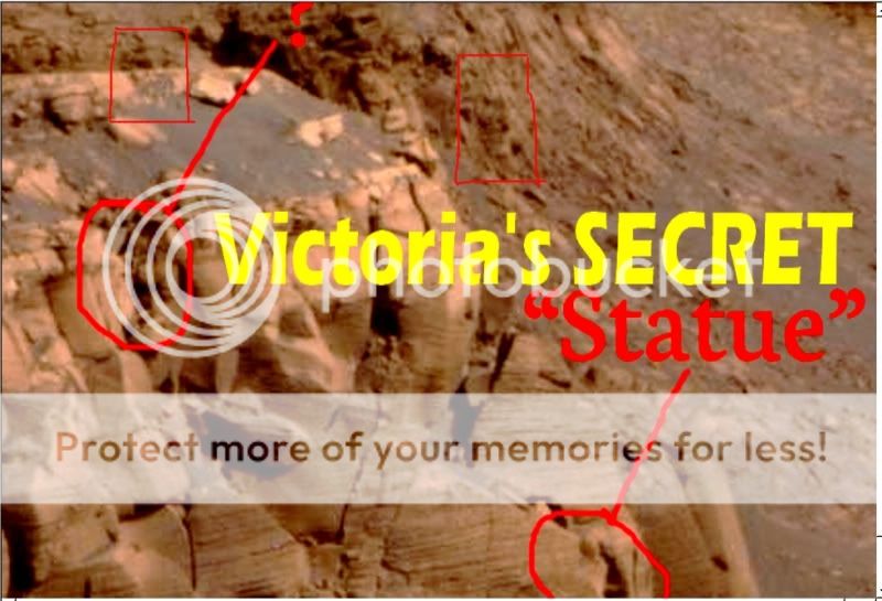
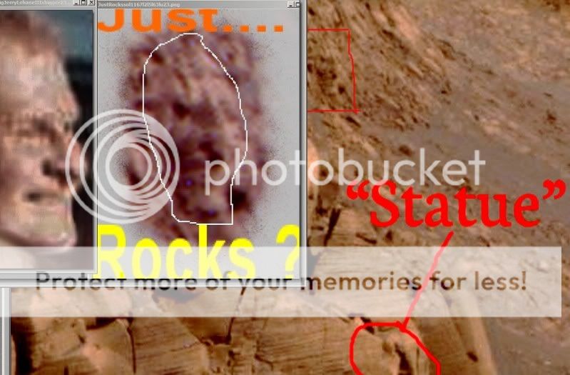
Thanks Pencilnev for supplying a new mystery pic to check out.Here is a review of an old area,Opportunity Victoria crater.It continues to yield a goldmine of worked stone on crater walls/cliffs.


Thanks Pencilnev for supplying a new mystery pic to check out.Here is a review of an old area,Opportunity Victoria crater.It continues to yield a goldmine of worked stone on crater walls/cliffs.


Originally posted by ArMaP
Originally posted by thetiler
But how can you blame anybody for not getting very curious!
Curiosity is good, but using imagination to find alternate explanations to things that are already explained is, in my opinion, not good, and that is what happens in cases like this, in which people look at composite images, imagine an explanation to what they see and ignore the original photos that do not show any of the things seen on the composite.
imagination, when I see the photos that have been given to us is certainly not the right word.
People can keep denying the truth about the leaked photos. The reality is, is that there are truly photos on mars that do have un natural artifacts. It may take time but the heads of nasa knows that they will have to give way to the truth of artifacts, structures, buildings, gadgets and the list goes on by the tons.
Originally posted by thetiler
People can keep denying the truth about the leaked photos.
What leaked photos?
The reality is, is that there are truly photos on mars that do have un natural artifacts. It may take time but the heads of nasa knows that they will have to give way to the truth of artifacts, structures, buildings, gadgets and the list goes on by the tons.
I haven't seen any of those, at least not yet.
hi - wanted to answer this with examples of non-mars images and other examples of close-up ones of mars - next to the original TIFF files and the
JPEGS used in the google earth / mars / moon programs and your examples...
its simply jpeg compression anomalies that you are bringing to light by changing the colour values and exposing where the image-compression has made similar colours the same to make files smaller for web and internet use.
those images with anomalies are then mapped onto the surface of mars and mapped over the terrain to follow its curves...
...you can do the same on an image taken of a piece of paper saved as a lossy-jpeg
s3-eu-west-1.amazonaws.com...
...here's another of a random image of mars - a close-up of a rock and surrounding dirt in the right, you have the uncompressed TIFF image taken of the surface - and on the left - the JPEG that has been saved to make the file size smaller (by throwing away information on colours that are very similar next to each other but which the eye cannot discern). I've then changed the colour values of the image to bring out and show the compression anomalies. on the left - smack bang in the middle almost - is a square. its not on the original because the original has all its colour information - the jpeg on the left is showing the same checker boarding effects inherent to jpeg compression.
s3-eu-west-1.amazonaws.com...
heres one of a portion the grand canyon
s3-eu-west-1.amazonaws.com...
here are a couple on jpeg images of paintings
s3-eu-west-1.amazonaws.com...
s3-eu-west-1.amazonaws.com...
...the google earth images follow contours (they don't look flat and follow the terrain) - this is because the flat (like my image examples) images with the compression artefacts already there, are mapped onto the surface topography of the mars (or google earth - try it in google earth on areas of dessert or fields too - does the same as would google moon and even the google sky program on a non-black area) - and so have the appearance of following the terrain.
the issue is compounded on your example with google beacause you are looking at a compressed image of the planet as you zoom - which is itself already made of successive images that are also already compressed.
to prove this - find an area of mars you see this artifact on - then use the NASA or ESA websites to find the original imagery; you will specifically need the TIFF versions of the images of that area - not the jpegs.
These "TIFF" format versions of the images are of a format where you get all the dots of colour and none of the compression anomalies.
Then try the same thing.
All the images used on the mars globe are available in their original format from the above sites (ESA or NASA).
You will get similar results to my first example when using uncompressed versions of the same areas and the geometric anomalies will disappear.
Yesterday I found The Murray Lab website (CalTech) with quite high resolution imagery of Mars. And I stumbled upon something interesting. A 4 km long
"wall".
edit on 18-11-2023 by 50Shades because: Messed up YouTube-link.
new topics
-
New UK Petition - Close the borders! Suspend ALL immigration for 5 years!
Regional Politics: 2 minutes ago -
The Looking Glass - Episode 3: The Path of Least Resistance
Short Stories: 2 hours ago -
Credit card debt
Relationships: 4 hours ago -
President-elect Trump asks the Supreme Court to Let Tik-Tok Continue Operating in the U.S..
Mainstream News: 4 hours ago -
Treasury Secretary Janet Yellen Says The USA Will Be in Debt Default in Jan 2025 - Unless...
Mainstream News: 8 hours ago -
Trash To Treasure: Dumpster Diving With Mike The Scavenger
General Chit Chat: 9 hours ago -
Danish Prime Minister said to keep 3 days worth of canned goods on hand
World War Three: 9 hours ago
top topics
-
The hunter has become the hunted
Politicians & People: 12 hours ago, 19 flags -
Trump's idea to make Canada the 51st US state: 'Potential is massive'
Mainstream News: 13 hours ago, 14 flags -
Danish Prime Minister said to keep 3 days worth of canned goods on hand
World War Three: 9 hours ago, 5 flags -
Treasury Secretary Janet Yellen Says The USA Will Be in Debt Default in Jan 2025 - Unless...
Mainstream News: 8 hours ago, 5 flags -
Trash To Treasure: Dumpster Diving With Mike The Scavenger
General Chit Chat: 9 hours ago, 3 flags -
Credit card debt
Relationships: 4 hours ago, 2 flags -
President-elect Trump asks the Supreme Court to Let Tik-Tok Continue Operating in the U.S..
Mainstream News: 4 hours ago, 1 flags -
The Looking Glass - Episode 3: The Path of Least Resistance
Short Stories: 2 hours ago, 1 flags -
New UK Petition - Close the borders! Suspend ALL immigration for 5 years!
Regional Politics: 2 minutes ago, 0 flags
active topics
-
New UK Petition - Close the borders! Suspend ALL immigration for 5 years!
Regional Politics • 0 • : gortex -
Trump's idea to make Canada the 51st US state: 'Potential is massive'
Mainstream News • 44 • : Freeborn -
-@TH3WH17ERABB17- -Q- ---TIME TO SHOW THE WORLD--- -Part- --44--
Dissecting Disinformation • 3829 • : Crazierfox -
The Looking Glass - Episode 3: The Path of Least Resistance
Short Stories • 3 • : JJproductions -
Credit card debt
Relationships • 2 • : JJproductions -
Danish Prime Minister said to keep 3 days worth of canned goods on hand
World War Three • 5 • : DerBeobachter2 -
No Wonder We Are In Such INSANE Debt- Americans MUST Put a Stop to This
US Political Madness • 68 • : BernnieJGato -
President-elect Trump asks the Supreme Court to Let Tik-Tok Continue Operating in the U.S..
Mainstream News • 15 • : TheMisguidedAngel -
Elon Musk futurist?
Dreams & Predictions • 21 • : cherokeetroy -
Treasury Secretary Janet Yellen Says The USA Will Be in Debt Default in Jan 2025 - Unless...
Mainstream News • 21 • : WeMustCare
