It looks like you're using an Ad Blocker.
Please white-list or disable AboveTopSecret.com in your ad-blocking tool.
Thank you.
Some features of ATS will be disabled while you continue to use an ad-blocker.

Area52
page: 12
share:
If this has already received a post, I apologize in advance.
I was searching GoogleEarth for Area51 today. After I went to Google and searched "Area51" and "Google Earth" and that's how I came across this message board. I've been to ATS several times, but never knew they had message boards. Guess this is a good place to ask this question.
On to the point:
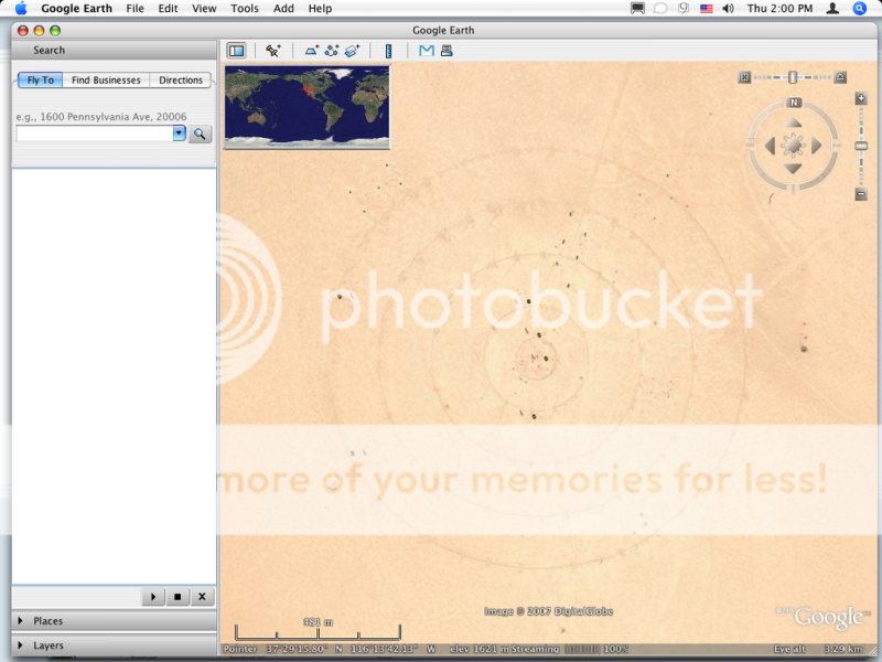
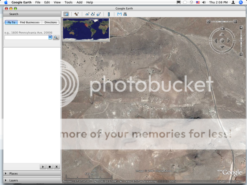
I know many people have prodded around Area51 on GoogleEarth, but did anyone notice the are to the West that's blurred. In the middle of a perfectly mapped dessert there's remains a small area that's convienetly unmapped? In the day and age of the Patriot Act, I find it hard to beleive the government would even allow arial photos to be taken of this area, let alone allow them to be streamed on GoogleEarth.
Blurred Area adjacent to Area52:
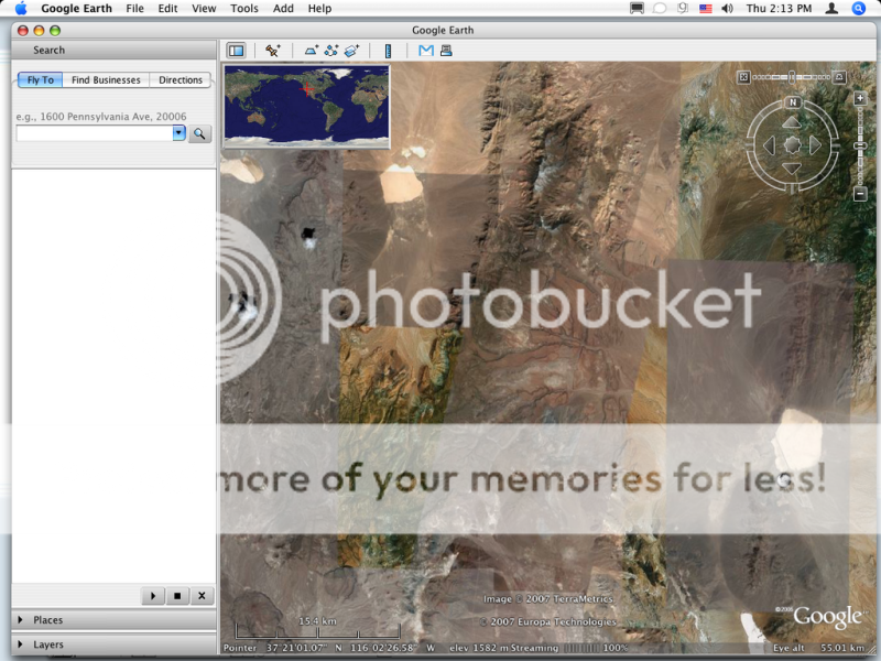
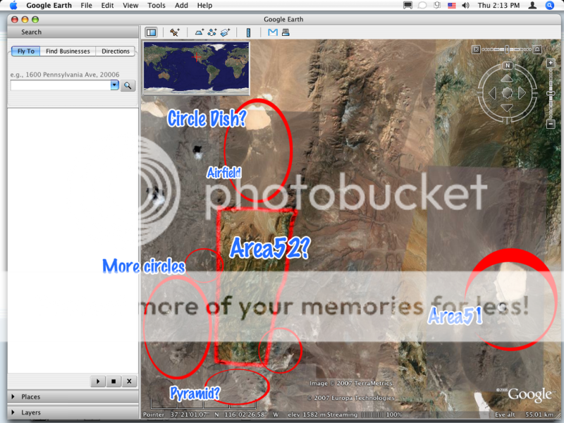
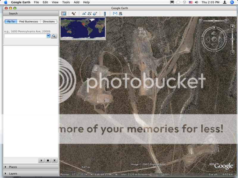
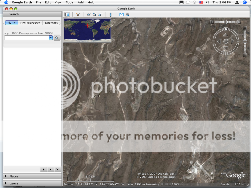
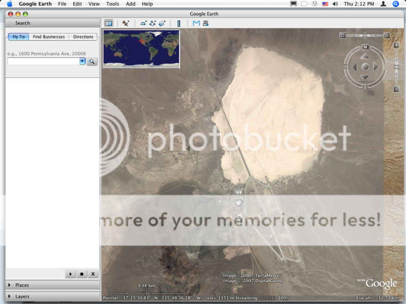
Above the blurred area is a Test Bombing Airfield with a mock building to the southeast. Nothing special about this. But, what the hell is in the dry lake bed to the North? This "target" looking area is nearly 3/4 of a mile! This Arecibo Observatory has a dish that is 1,000 feet wide. - the "world's largest". Might this dry lake bed act as a satellite dish for out military? That would make it nearly 3 times larger than the Arecibo Observatory's.
Other than that, there are several other facilities surrounding the blurred area.
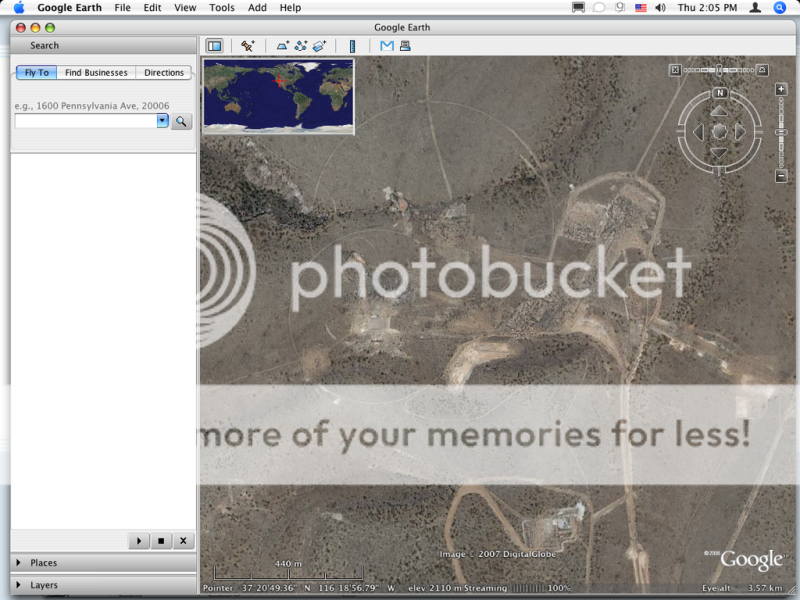
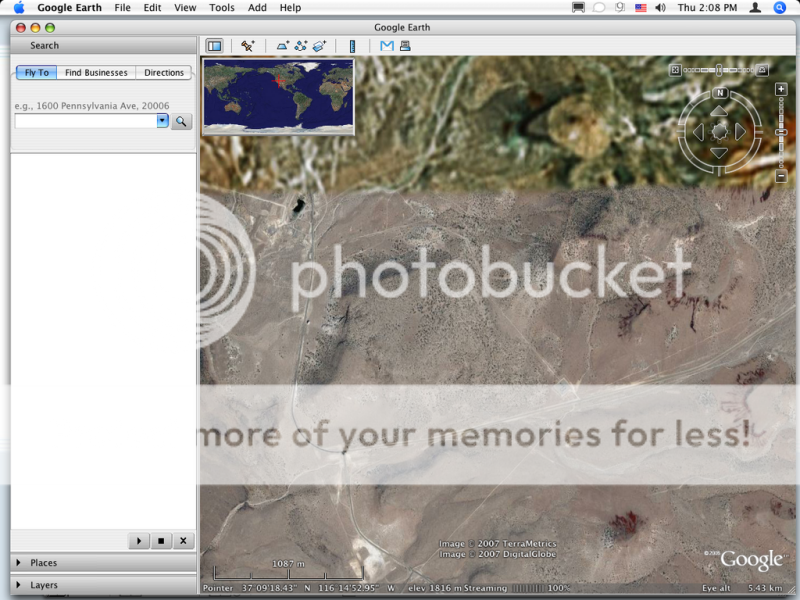
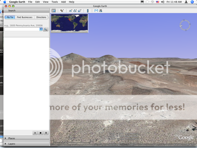
Peculiar looking "Pyramid" formation in this photo. I may go back and do the 3D view to see exactly what this was. Didn't think to do 3D at the time.
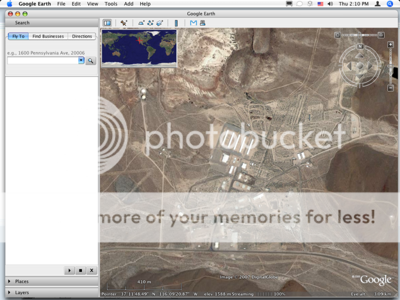
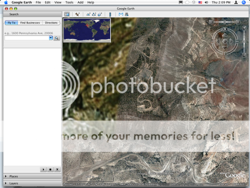
And of course most of the massive Area51. It's larger than I thought.
[edit on 22-2-2007 by tyranny22]
I was searching GoogleEarth for Area51 today. After I went to Google and searched "Area51" and "Google Earth" and that's how I came across this message board. I've been to ATS several times, but never knew they had message boards. Guess this is a good place to ask this question.
On to the point:
I know many people have prodded around Area51 on GoogleEarth, but did anyone notice the are to the West that's blurred. In the middle of a perfectly mapped dessert there's remains a small area that's convienetly unmapped? In the day and age of the Patriot Act, I find it hard to beleive the government would even allow arial photos to be taken of this area, let alone allow them to be streamed on GoogleEarth.
Blurred Area adjacent to Area52:
Above the blurred area is a Test Bombing Airfield with a mock building to the southeast. Nothing special about this. But, what the hell is in the dry lake bed to the North? This "target" looking area is nearly 3/4 of a mile! This Arecibo Observatory has a dish that is 1,000 feet wide. - the "world's largest". Might this dry lake bed act as a satellite dish for out military? That would make it nearly 3 times larger than the Arecibo Observatory's.
Other than that, there are several other facilities surrounding the blurred area.
Peculiar looking "Pyramid" formation in this photo. I may go back and do the 3D view to see exactly what this was. Didn't think to do 3D at the time.
And of course most of the massive Area51. It's larger than I thought.
[edit on 22-2-2007 by tyranny22]
I have to say that that pyramid looks interesting. It looks like it was built out of the side of the hill. Or it could just be an oddity. It's
pretty interesting though.

Firstly the rings on that lake bed are just another bombing target (though John Lear may disagree). Sorry to disapoint. A radio telescope like the
kind at Arecibo require a smooth dish in a very carefully calculated parabola, you cant just make one out of a flat lakebed.
The area that you describe as conveniently unmapped is also conveniently empty. Check out the area on Yahoo Maps HERE.
On another note, Tonapah Test Range is occasionally known as Area 52.
The circles you draw attention to are part of Tolicha Peak Electronic Combat Range (TPECR). This is a large installation spread out over an even larger area. Little is known about it, yet it is visible from a few places on the ground and from the air. There are a few hangars there an several antenna arrays. It has also grown quite a bit recently and is quite secret.
Hope this answers some of your questions
it would appear so. thanks for the info.
althought in the day of laser guided missles and gps that can pinpoint an object to with-in an inch, why our military would need a bombing target that's 3/4 of a mile wide is beyond my comprehension. maybe an outdated target? but these objects located within and outside of the circles don't look too much like bomb craters like you see around the rest of the dessert. infact several that were located along the "line" that goes to the center looked as if they were casting a tall shadow.
anyway, I'm just a curious civilian. I have no knowledge of military technology other than what was used way back in '42. everything I've posted here is nothing but paranoid speculation
[edit on 23-2-2007 by tyranny22]
as an update, I went back to take a look at the mysterious "pyramid" and it appears to be an actual moonbase prototype:
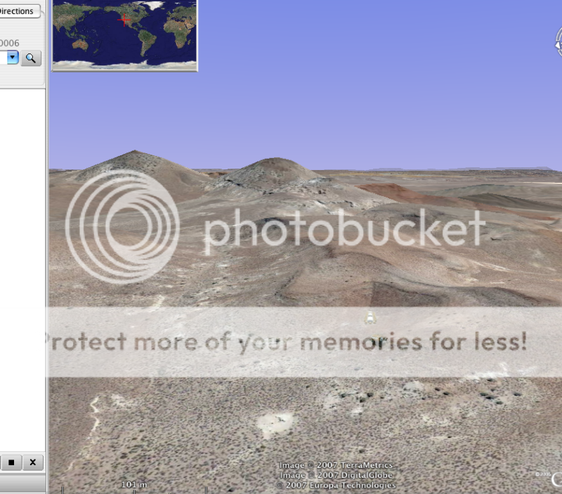
seriously thought ... it was just landscape that would appear odd when looking straight down on it:
[edit on 23-2-2007 by tyranny22]
seriously thought ... it was just landscape that would appear odd when looking straight down on it:
[edit on 23-2-2007 by tyranny22]
The information I provided in my last post was false. Sorry.
Tolicha Peak Electronic Combat Range is actually located further west. The area with all the circles on it is Areas 19 and 20 of the NTS on Pahute Mesa. They are used for high yield underground nuclear testing. Turn on the earthquake data on Google Earth and you can see each test registers on the Seisometers. Turn on the Google Earth Community and almost every blast site is labelled with the tests name, date and yield.
Tolicha Peak Electronic Combat Range is actually located further west. The area with all the circles on it is Areas 19 and 20 of the NTS on Pahute Mesa. They are used for high yield underground nuclear testing. Turn on the earthquake data on Google Earth and you can see each test registers on the Seisometers. Turn on the Google Earth Community and almost every blast site is labelled with the tests name, date and yield.
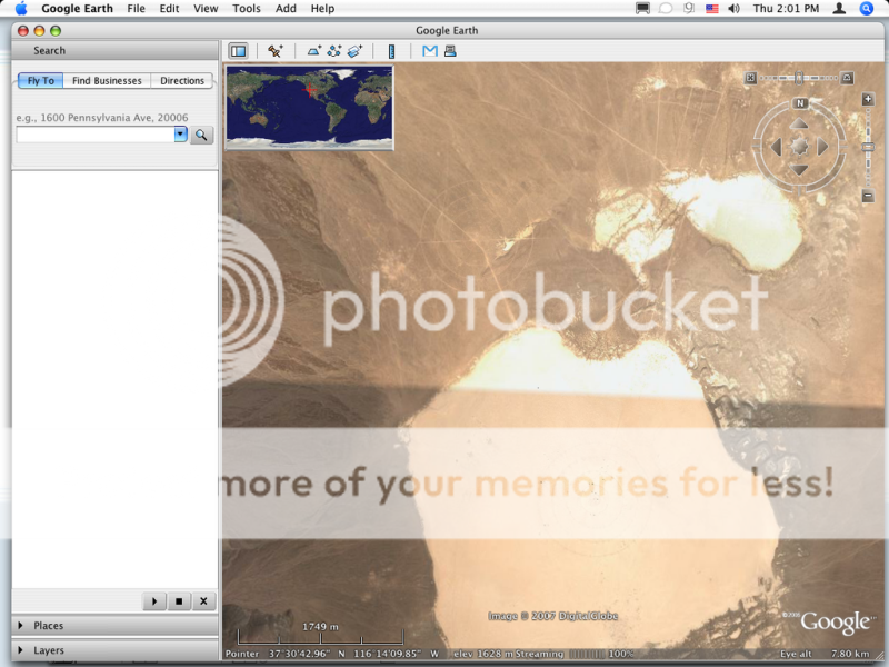
Photo number 5 is Lamb's Pond, a dry lake bed used for bomb testing.
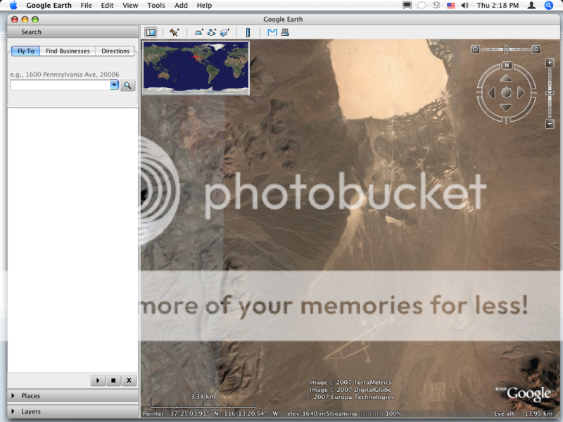
Photo number 12 is Area 19, a random airstrip in the Nevada desert.
A cool thing about Area 19 is that there is a huge, thick power line that will run into the middle of the airfield and just terminate into the ground. Wierd.
Love the iMac, btw.
Photo number 12 is Area 19, a random airstrip in the Nevada desert.
A cool thing about Area 19 is that there is a huge, thick power line that will run into the middle of the airfield and just terminate into the ground. Wierd.
Love the iMac, btw.
Originally posted by TheRanchMan
Photo number 12 is Area 19, a random airstrip in the Nevada desert.
A cool thing about Area 19 is that there is a huge, thick power line that will run into the middle of the airfield and just terminate into the ground. Wierd.
Wrong on both points, though you are right about Lambs Pond.
Photo number 12 DOES NOT show area 19. Photo number 12 is of the Pahute Mesa Airstrip in area 18 of the NTS. It was originally built in 1968 for transport planes to support the nuclear testing in the area. Since the testing stopped in 1992 the airstrip has fallen into disrepair and is now listed as unusable.
Area 19 is a few miles north of the Pahute Mesa airstrip. There is not a "huge, thick power line" any more, and I'm not sure there ever was. The power line supposedly terminated in the middle of nowhere, it just stopped. This was false, the area where the power line was marked as finishing on the NTS map was infact in the middle of a nuclear testing ground that had been used since 1962.
Coincidentally, the area where the power line was supposed to have stopped is shown in photo 7 of the OP.
tyranny22,
You seem to be new to our forum, so let me start be sayingWelcome to Above Top Secret!
Now about your refrence to Area 52. As others have said, what you are looking at on that map is Area 19 and Area 20. Area 52 is the Tonapha Test Range, where they used to fly the F-117 Nighthawk from. Here's a quick history of Tonapha for you:
Tonapha Test Range
This will give you a better idea of what your looking at, and some of the history behind it!
It started out as a weapons test facility for Sandia National Labratories in the 60's and 70's. Around 1982-3 they began to upgrade the site for the forthcoming F-117 Nighthawk.
Tim

IMG]http://i50.photobucket.com/albums/f305/miguelbmx/untitled2.jpg[/IMG]

It looks like a microwave reflector.
It's obviously something that doesn't need much maintenance since there are no roads or helipads nearby.
It's obviously something that doesn't need much maintenance since there are no roads or helipads nearby.
miguelbmx,
Those are pictures of the Top Secret Dreamland research facility at Groom Lake. Nice shot of Area 51!
As for the object in the bottom picture, I have a feeling it might be a temporary set up for some kind of test. To me, the lack of an access road and it's location suggest that it was never intentded to be permenant. Maybe a moble Radar or communication setup of some kind!
Tim
new topics
-
Exhausted Donald has a Mic Malfunction
2024 Elections: 1 hours ago -
Stealth Reissue Of DOD Directive 5240.01 Expands Military Power To Kill Americans
Social Issues and Civil Unrest: 8 hours ago -
Oct 18th 2024 - Desperate Attempt by Obama Judge and Biden-Harris DOJ to Stop Candidate Trump.
2024 Elections: 8 hours ago -
Dark yellow brick road…
Short Stories: 9 hours ago -
Euclid’s 208-Gigapixel glimpse into the Universe - Space is Big.
Space Exploration: 9 hours ago
top topics
-
Kamala besmirches The Al Smith Dinner - appears to mock Catholics
2024 Elections: 13 hours ago, 19 flags -
25 illegal immigrants, 3 Disney employees 157 suspects arrested in human trafficking ring
Social Issues and Civil Unrest: 16 hours ago, 16 flags -
Euclid’s 208-Gigapixel glimpse into the Universe - Space is Big.
Space Exploration: 9 hours ago, 16 flags -
Oct 18th 2024 - Desperate Attempt by Obama Judge and Biden-Harris DOJ to Stop Candidate Trump.
2024 Elections: 8 hours ago, 15 flags -
Stealth Reissue Of DOD Directive 5240.01 Expands Military Power To Kill Americans
Social Issues and Civil Unrest: 8 hours ago, 8 flags -
Dark yellow brick road…
Short Stories: 9 hours ago, 6 flags -
Exhausted Donald has a Mic Malfunction
2024 Elections: 1 hours ago, 2 flags
active topics
-
Exhausted Donald has a Mic Malfunction
2024 Elections • 13 • : Kallipygywiggy -
Keanu Reeves and Graham Hancock!
Ancient & Lost Civilizations • 17 • : Astrocometus -
Donald Cuts A Rug, Crowd Leaves.
Politicians & People • 90 • : Kallipygywiggy -
Dark yellow brick road…
Short Stories • 1 • : BingoMcGoof -
Mood Music Part VI
Music • 3656 • : MRTrismegistus -
The October Surprise has arrived
General Conspiracies • 24 • : WeMustCare -
Oct 18th 2024 - Desperate Attempt by Obama Judge and Biden-Harris DOJ to Stop Candidate Trump.
2024 Elections • 29 • : Astrocometus -
KAMALA HARRIS and Democrats - Acts of Desperation with less than 25 days till Nov 5th 2024.
2024 Elections • 105 • : WeMustCare -
DONALD J. TRUMP - 2024 Candidate for President - His Communications to Americans and the World.
2024 Elections • 542 • : Electriccowboy -
DoD Directive 5240.01 has been Renewed - Includes Lethal Force against Civilians?
Posse Comitatus • 62 • : 777Vader
2