It looks like you're using an Ad Blocker.
Please white-list or disable AboveTopSecret.com in your ad-blocking tool.
Thank you.
Some features of ATS will be disabled while you continue to use an ad-blocker.
share:
reply to post by JJRichey
Figured out what this one is! Its just a water tank
Heres a link that talks about it some: hikearizona.com...
Figured out what this one is! Its just a water tank
Heres a link that talks about it some: hikearizona.com...
cramble up the slope about 615 feet until you achieve the top of the ridge. Look forward and down and you'll see what the water tank looks like from above.
reply to post by JohnDoe11
In case anyone is wondering what post I'm talking about, it was in response to this one talking about a facility in the phoenix mountains preserve in Arizona (I think he called it shadow mountain).
In case anyone is wondering what post I'm talking about, it was in response to this one talking about a facility in the phoenix mountains preserve in Arizona (I think he called it shadow mountain).
Yesterday while on google earth I found two pictures of the universe in the ocean one was close to the Gulf of Alaska the other was close to Peru.
Each picture was of a different section of the sky. The one showed our galaxy the other a section that I'm not aware of. I copied both images.The Lat.
on the one is 41 1807.57N Lon.167 5835.59W the other is Lat. 16 2631.26S Lon.78 394162631.26S. I don't know how to place a copy here maybe someone
could help me with that. Ihave both images on my google earth that I saved.
Lynn12
Lynn12
edit on 26-2-2012 by Lynn12 because: forget to add my name to post Lynn12
Great find guys! I was wondering what the hell that thing was!! lol.. Just a REALLY odd shape, don't ya think?!
2 i thought were neat. look at the previous years to see the difference. =P
29°55'16.27"N, 30°10'40.74"E
and
20° 4'17.31"N,
155°27'53.30"W (2004)
29°55'16.27"N, 30°10'40.74"E
and
20° 4'17.31"N,
155°27'53.30"W (2004)
Huntsville, Alabama. I went here as a boy scout. Pretty cool place.
34°42'36.80"N
86°39'12.79"W
34°42'36.80"N
86°39'12.79"W
reply to post by matrix 333
I came across this site and found it pretty interesting. Considering the vast number of people on here, I'm kind of curios as to anyone else's thoughts on this. What do you make of this and is there a conventional explanation or what? Since I don't live in the area, it's not something I can check out first hand. marsanomalyresearch.com...
I came across this site and found it pretty interesting. Considering the vast number of people on here, I'm kind of curios as to anyone else's thoughts on this. What do you make of this and is there a conventional explanation or what? Since I don't live in the area, it's not something I can check out first hand. marsanomalyresearch.com...
canDarian
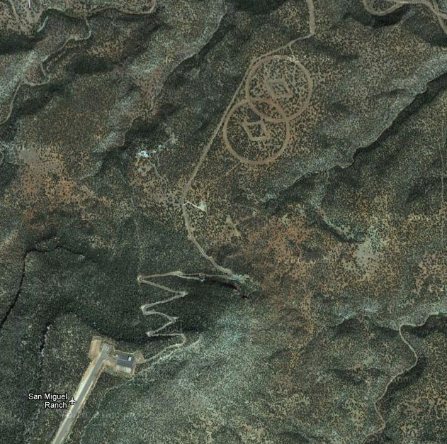
I believe that is Scientology related, a landing pad for L. Ron, or Xenu, or some such nonsense.
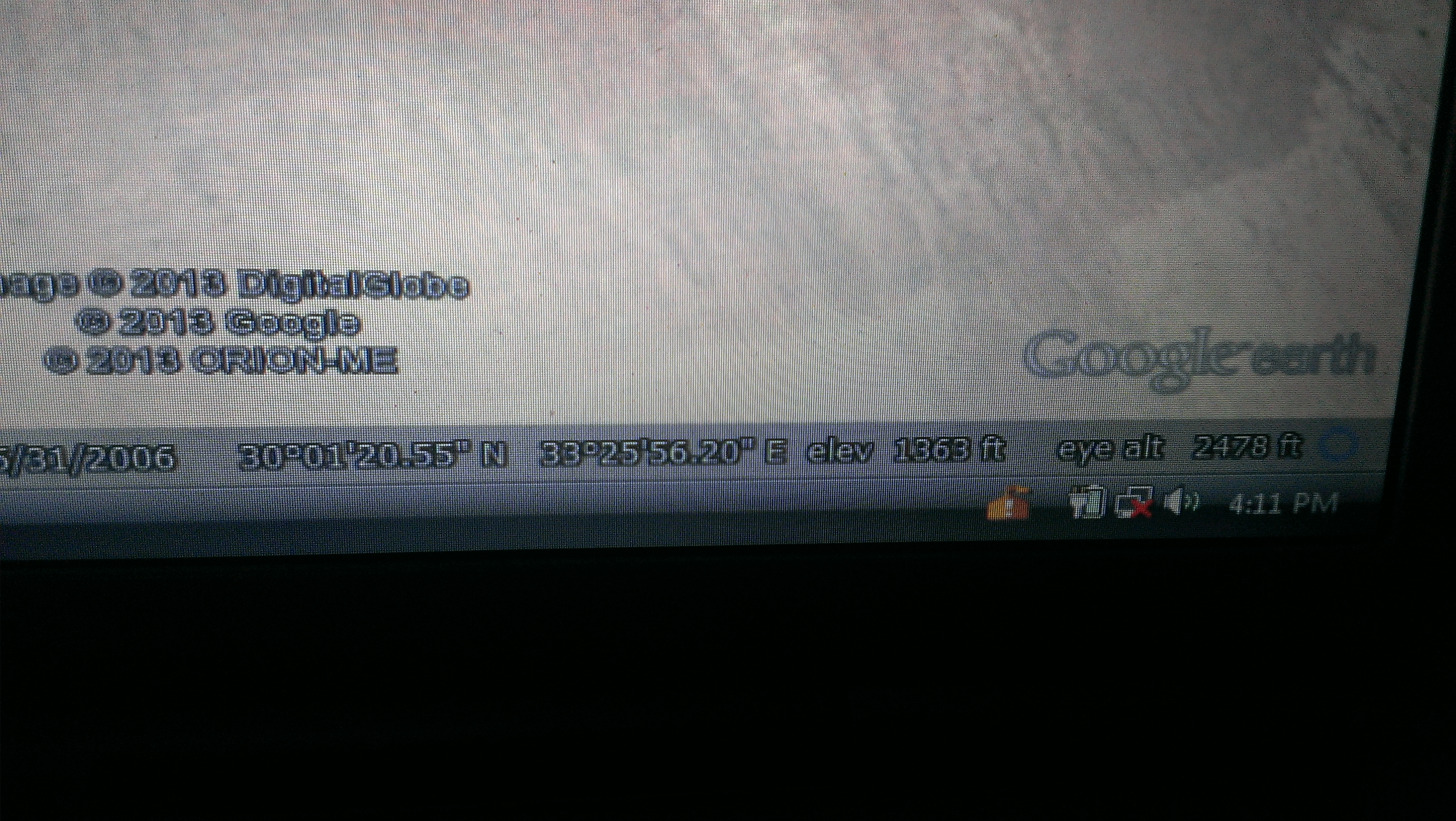
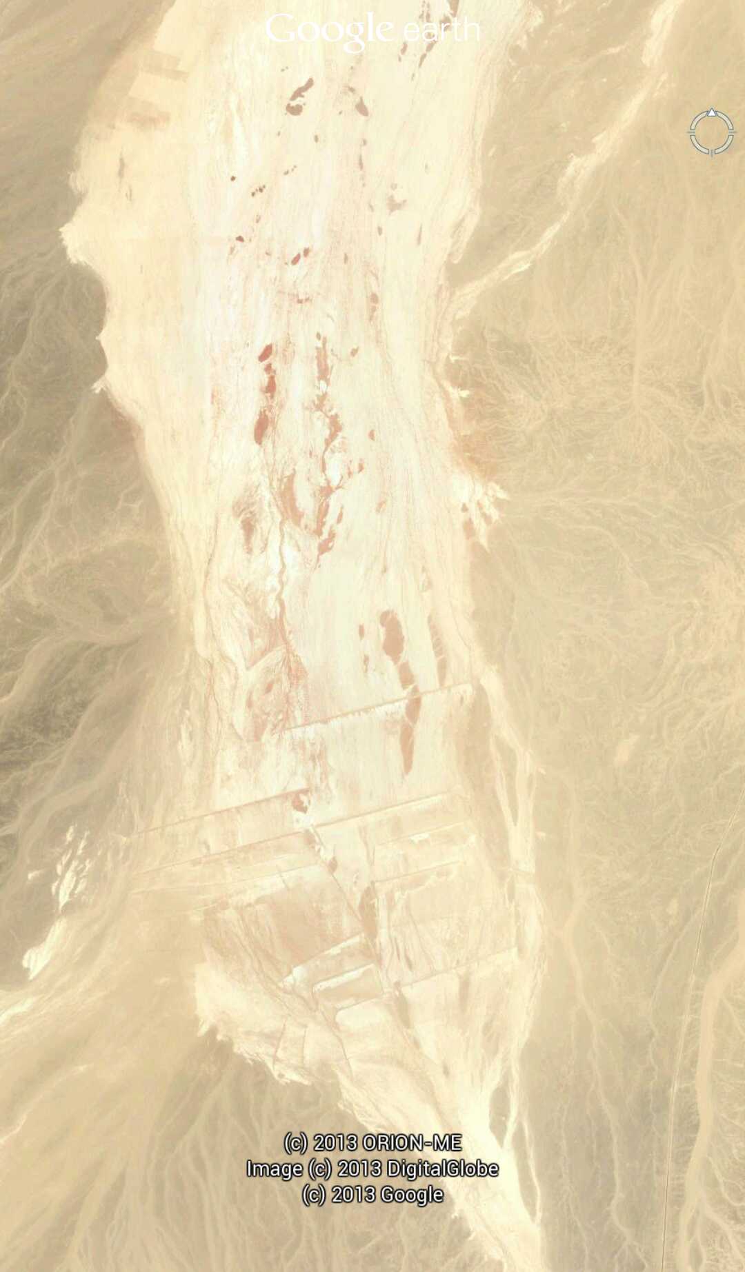
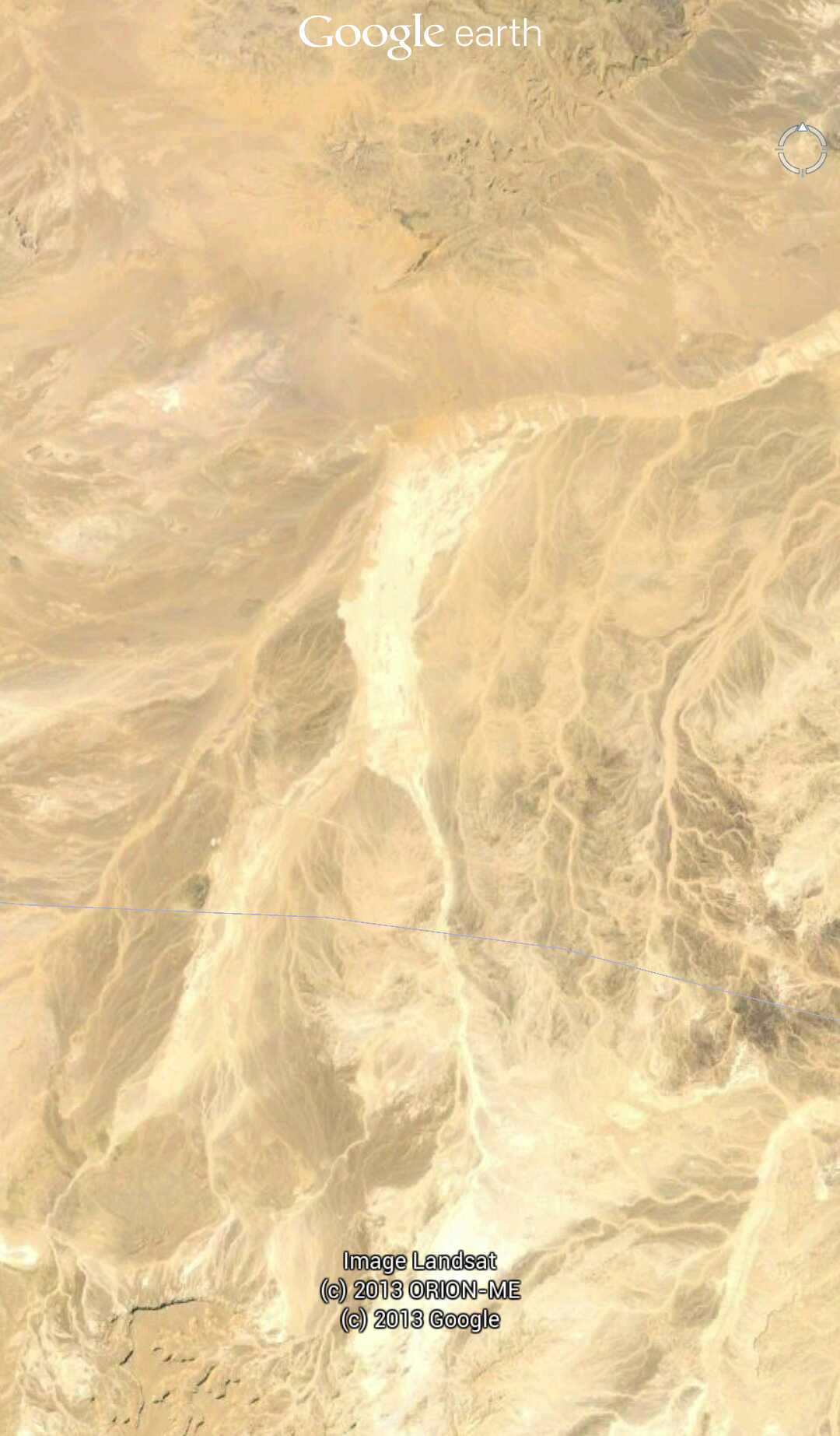
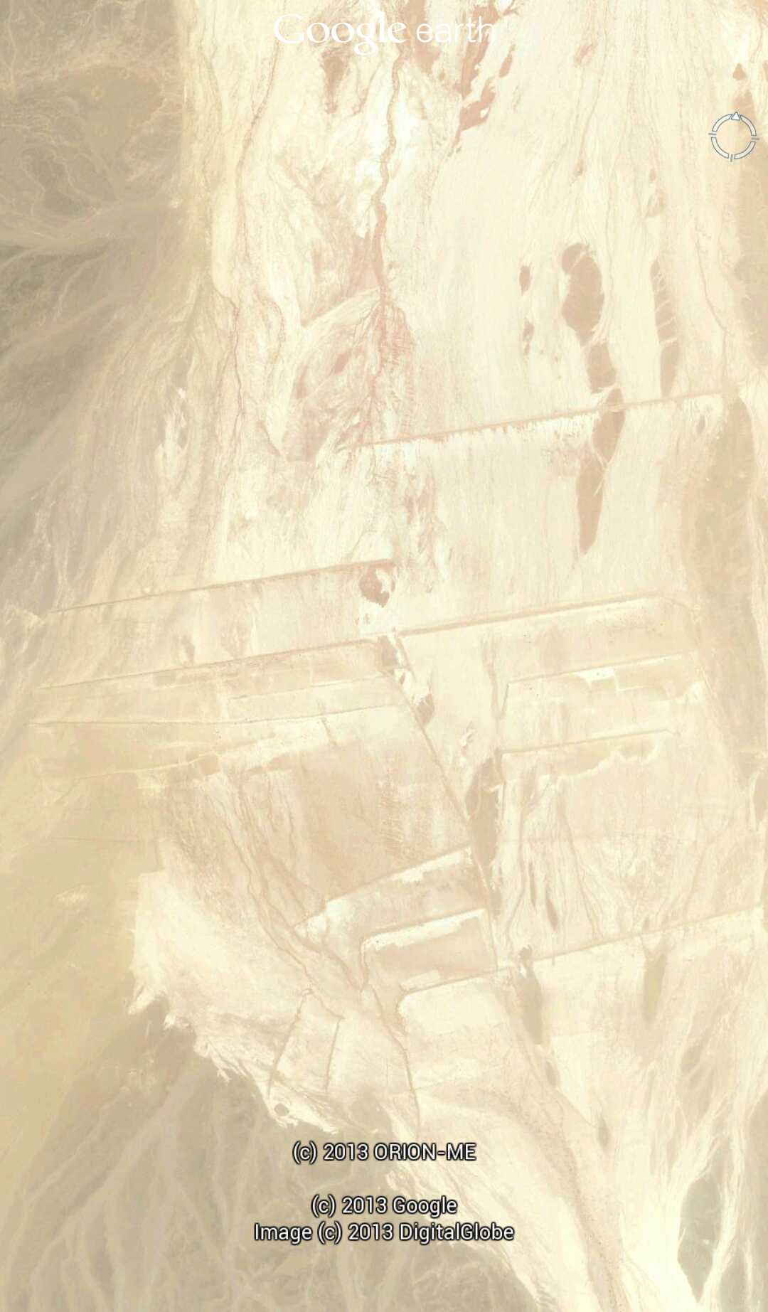
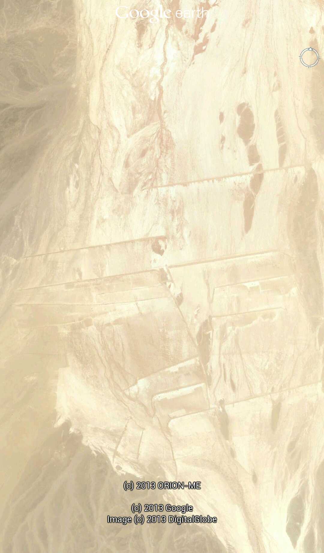
This is an unusual site that I found on Google earth that is as far as I know is my discovery and a completely unexplored site in Saudi Arabia near the north side of the Sinai peninsula the coordinates can be seen in one of the pictures is anyone aware of anything about this site
reply to post by parad0x122
Well the straight lines stretching for about amile or two, considering there are no natural straight lines in nature. They seem to be carved out roads so to speak similar to the nazca lines.
I'll probably get flamed for even saying this, but I found that site a couple of years ago after reading one of the stories about the sphinx being a pointer to the annunaki spaceport. I have no evidence either way, but that was how I found it.
Found an interesting place yesterday when out exploring (in the physical world). It shows up in Google Maps as well. It looks like a warehouse with
three inflatable radomes on it. It's behind a cemetery near the corner of route 92 and US 101, south of San Francisco. At the end of a maintenance
road in the cemetery, there are a number of "road closed' "trespassing prohibited" "authorized vehicles only" signs that get progressively more
strident. The structure itself is in a valley that hides it from view from any public space (that I could find). The land it's in is part of a
water reservoir that is secured. Anyway - thought I'd put it out there. The coordinates are 37.5153321,-122.3797264
reply to post by corwin
Looks interesting. It can't be too clandestine though if all they have are signs to keep people away (no gates, fences, guard shacks, ect.). There really isn't anything stopping one from hiking there on foot if one chose to. Most likely it may be a weather radar station, it does have a view to the West over the Pacific.
Looks interesting. It can't be too clandestine though if all they have are signs to keep people away (no gates, fences, guard shacks, ect.). There really isn't anything stopping one from hiking there on foot if one chose to. Most likely it may be a weather radar station, it does have a view to the West over the Pacific.
reply to post by DonVoigt
Woah, now I see why you found them strange. Pretty interesting too that you were able to locate them using that method, I wonder if there's any other anomalies that could be found using the same technique?
Woah, now I see why you found them strange. Pretty interesting too that you were able to locate them using that method, I wonder if there's any other anomalies that could be found using the same technique?
reply to post by parad0x122
The have actually been a couple of interesting finds in the area of archeology using Google earth in recent history. They even made it to the mainstream media, that was the first time that I ever posted any of my finds
The have actually been a couple of interesting finds in the area of archeology using Google earth in recent history. They even made it to the mainstream media, that was the first time that I ever posted any of my finds
corwin
Found an interesting place yesterday when out exploring (in the physical world). It shows up in Google Maps as well. It looks like a warehouse with three inflatable radomes on it. It's behind a cemetery near the corner of route 92 and US 101, south of San Francisco. At the end of a maintenance road in the cemetery, there are a number of "road closed' "trespassing prohibited" "authorized vehicles only" signs that get progressively more strident. The structure itself is in a valley that hides it from view from any public space (that I could find). The land it's in is part of a water reservoir that is secured. Anyway - thought I'd put it out there. The coordinates are 37.5153321,-122.3797264
A bit of digging on Google turned up this: epa-sites.findthedata.org...
It's owned by a company called Rantron Antenna Systems.
Further info... see item 6 on page 3 of this PDF showing zoning/planning applications: www.smcgov.org...
"Consideration of a Use Permit Amendment, pursuant to Section 6500, a Coastal Development
Permit, pursuant to Section 6328.4, and a Resource Management District Permit, pursuant to
Section 6903 of the County Zoning Regulations, for the addition of a third antenna to an existing
radar test range facility"
There's another company called Randtron Antenna Systems, based in Menlo Park, but I don't think the two are related. It appears that Rantron might be associated with L-3 Communications, which is a major US government contractor.
The info is out there if you look - it took me less than 10 mins to find all that.
edit on 5-3-2014 by Rob48 because: (no reason given)
new topics
-
Stalker 2 - Review from a Veteran
Video Games: 40 minutes ago -
Does anyone have a link to download apple pay for androids
General Chit Chat: 1 hours ago -
Most INSANE internet rabbit hole
Secret Societies: 1 hours ago -
Joe Rogan conspiracy (maybe)
ATS Skunk Works: 5 hours ago -
Results of the use of the Oreshnik missile system in Dnepropetrovsk
World War Three: 7 hours ago -
Nigel Farage now the Most Favoured UK Politician
Regional Politics: 9 hours ago
top topics
-
Little Johnny and Larry should team up
General Chit Chat: 15 hours ago, 13 flags -
Results of the use of the Oreshnik missile system in Dnepropetrovsk
World War Three: 7 hours ago, 11 flags -
Most INSANE internet rabbit hole
Secret Societies: 1 hours ago, 6 flags -
Nigel Farage now the Most Favoured UK Politician
Regional Politics: 9 hours ago, 4 flags -
Will Us use alien technology to fight in ww3?
World War Three: 16 hours ago, 3 flags -
Joe Rogan conspiracy (maybe)
ATS Skunk Works: 5 hours ago, 3 flags -
Does anyone have a link to download apple pay for androids
General Chit Chat: 1 hours ago, 0 flags -
Stalker 2 - Review from a Veteran
Video Games: 40 minutes ago, 0 flags
active topics
-
Results of the use of the Oreshnik missile system in Dnepropetrovsk
World War Three • 155 • : RickyD -
President-Elect DONALD TRUMP's 2nd-Term Administration Takes Shape.
Political Ideology • 241 • : WeMustCare -
-@TH3WH17ERABB17- -Q- ---TIME TO SHOW THE WORLD--- -Part- --44--
Dissecting Disinformation • 3358 • : Thoughtful3 -
Will Us use alien technology to fight in ww3?
World War Three • 14 • : DaydreamerX -
Does anyone have a link to download apple pay for androids
General Chit Chat • 6 • : bluemooone44 -
Stalker 2 - Review from a Veteran
Video Games • 0 • : gortex -
Most INSANE internet rabbit hole
Secret Societies • 2 • : BeyondKnowledge3 -
Nigel Farage now the Most Favoured UK Politician
Regional Politics • 8 • : angelchemuel -
Inca stone masonry at Sacsayhuaman, Ollantaytambo and the Sun Temple
Ancient & Lost Civilizations • 9 • : Astrocometus -
Post A Funny (T&C Friendly) Pic Part IV: The LOL awakens!
General Chit Chat • 7816 • : baddmove

