It looks like you're using an Ad Blocker.
Please white-list or disable AboveTopSecret.com in your ad-blocking tool.
Thank you.
Some features of ATS will be disabled while you continue to use an ad-blocker.
2
share:
If there is one overriding purpose to the way this world has been designed, it is to awaken Mankind to not only the existence, but also the love &
care of the Creator God. Who, being a person/s beyond our understanding, has made this world understandable to our minds; to a certain extent, yet
with mystery intertwined such that no human can boast of his knowledge when asked for an ultimate explanation concerning the “How..?” and the
“Why..?” In this way, God leaves room for the questioning heart, for the one reaching out for answers beyond the realm of scientific research &
modern psychology, which are the organs of belief for the atheistic heart in these present times.

The one who is unafraid to depend on faith is blessed indeed, but the beauty of the situation is that we don’t have to depend on faith, if only we will awaken to the reality laid out so bountifully before us, in the true shape of this world, which is all we need to know in order to be assured of the truth of the existence of God, who created this wonderful realm for us, as we are instructed in Scripture. Once we are awakened to the true conception of the shape of our world, the facts of the matter underline that only a vast & benevolent Creator could have made all of this world’s wonders available for Humanity. Knowing the facts of our reality, were we to become aware of them, would emphasize once & for all time that this world could not have been created naturally, in some ‘Big Bang’ moment; it would highlight the obvious artificiality of our realm, pointing out plainly that it was an engineered realm, a built environment, custom-made for Humanity to express our dominion.
The truth is, much of what modern science appears to have accomplished is a smokescreen, indeed great works such as the Theory of Relativity were nothing more than mathematical exercises, with the truth being stretched through hypothetical hither & yon in order to make the apparent facts which they were generating with this mathematical mambo fit the reality that the elites, under the dominance of Satan, intended to portray to us all. We have been force-fed a diet of unrestricted deception for several hundred years, the mythos of a globe Earth spinning through 'space', which is the crux of Satan's lies & deceit, ensuring that we give truth to a lie, that the Earth arose naturally, independent of any creative agency on the part of our divine Creator God. If we could only view this world as it really is, we would immediately know that the Earth was not a globe, and therefore that SOMEONE has been lying to us for at least several hundred years. We are thus in Satan's 'little season' of deception, described in the Book of Revelation, and the Millennial reign of Christ (the thousand years of peace on Earth through the rulership of Jesus) as well as the rapture of all believers, have already occurred.
The more I think of it, the more sense it makes (it is thus when you already have the luxury of fully believing that the Earth is flat, and thus knowing that the globe deception is the most insidious mass deception in the history of the Earth, which could only have been perpetuated with VERY REAL threats of torture & death originating with Satan, the Dark Lord..)
What is the great delusion that Satan wanted to commit into the heart of Mankind, if he had only, as Scripture puts it, “..a little time” in order to accomplish everything he intended to accomplish with as many humans as possible under his boot heel? Well, it is simply this: That the Earth is a spinning globe within an infinite, dark, cold, uncaring & godless abyss, one that should terrify faithless children everywhere as they fear at the thought of the eventual heat death of the universe, and the fact that there is no God to rescue them from their nightmares either now, or at any time into the future. As humans, we are small, inconsequential, and irrelevant to the universe in every conceivable way, and when we die, that’s it. Infinite blackness forever. Nothing to save them from their nightmares.
You see the diabolical poetry he has woven into his mythology concerning the shape of the Earth & the infinite abyssal black of ‘Space’ extending out & away forever more..? He hides this terrible deception despite the vast intricacies needed to sustain it, and indeed he is able to spin ever more diabolical fictions through his captured scientific & political institutions. Because ALL of the highest ranking authorities in this world are members of a particular club, and when a man rises to a position of high authority within that club (which he can only do if he has proven himself amenable to deception, being insidious & merciless in his character), then he is offered an invitation, accompanied by the threat of all the tortures he swore fealty under in his former oaths, if he fails to perpetuate the delivery of every facet of information under his career authority that has been spun as part of a web of woven lies in service to the Beast System, which he is now told (by & by) is in fact ruled over by the Great Beast himself, the ruler of all demonic hosts, the Dark Lord Satan, the rebel & autocrat who leads all things of ANY political consequence on the Earth.
As Jesus said, “the prince of this world is coming..” and he roots for our destruction. But if you are in Christ, you can say with Christ “he has no claim on Me” - and that is the great salvation that is passed onto us when we commit our hearts to God. Because Satan lays claim to every human born under the authority of his Beast System, which by now you should have realised, in some manner pulls strings at the highest level of every professional body in the world, including the nation state. Bear in mind though that God is merciful, and true hearts that turn to Him are never sent away, if they are penitent & wishing to start anew. Although it may seem controversial to say, that also extends to those who are surprised after death to discover that their consciousness continues, who suddenly realise the peril they face if they do not seek to redress the claim of the Maker of Heaven & Earth to their very life essence, their soul. They too are delivered away from the hands of demons when they turn to God, taken into the spacious & wondrous Heavenly realms, to be taught as it were a newborn in the Kingdom of Heaven, learning everything about the spiritual life for which they should ideally have spent time on Earth getting in a head start. But every believer too has some need of education in the Heavenly realms, nobody has the perfect teachers on Earth, so the Angels must polish our learning in that marvellous Great Beyond.

A few years ago, just when the flat Earth revival was taking off online, I had a dream. In that dream, God spoke to me & counselled me regarding my
questions having to do with the flat Earth debate. He told me to purchase a silver signet ring, with an emerald set within its face, to represent the
system in which the Earth is set. He stated that whenever I looked at this ring, and contemplated the beauty of the encarved flat green stone, then I
would remember that the system within which we live cannot be fully understood whilst one is living within the system; there are unseen
supports holding that stone fixed in its place, and only after we leave the Earth, one fine day, will we ever totally understand the realm of the
Earth.
Since having that dream, I eventually came to be a fully paid up member of the true flat Earth believing society within our civilisation – an unaffiliated, informal group of individuals sparsely dotted around the world, with no direct support network, no communal get-together events, no full conferences of any merit, no forums in which one is easily satiated with online community activity based on flat Earth belief, and no ability to any longer enjoy the BS science fiction that Hollywood pumps out (this is more distressing than you might think; I used to love films like Apollo 13 & shows like Battlestar Galactica). It’s difficult to even locate Telegram groups which properly assuage the drive to more fully understand the flat Earth reality. After years of uncertainty & doubt, as we learn of the truth from scattered YouTube & Telegram videos, we eventually find ourselves so roundly mocked, disparaged & ridiculed, all the world over, that we live secret lives; believing in private, satisfied in the knowledge that the theory is true, yet forever moribund at the knowledge that nobody will ever believe us in our immediate family & regular circle of friends.

The great illusion of the globe Earth, which the elites have deliberately fooled us with over the past approximately 150 years, is refuted easily one would think; I mean, one needs only to swivel & point a camera from one of the many geosynchronous satellites at a suitable distance from our ‘planet’ Earth, and take a snapshot of the Earth in all its fullness, then distribute it in Time Magazine with an article debunking each position that the flat earth team utilise in the furtherance of their delusion. Surely, it is not difficult to snap a photo like that?
NASA receives over $50,000,000 each & every day in funding, so surely they can stretch to sticking a gimbal onto one of their satellites, enabling a camera to swivel once in a while?

However, it has proven difficult. Indeed, it is impossible, as Robert Simmons, image curator at NASA has explained publicly. Every single photograph of the Earth is a composite, many strips stitched together & doctored so it looks real – at least to Rob Simmons. Because, undeniably, once you start to hear of the myriad facts proving it, the Earth is as flat as a pancake & space as it has been described to us by authorities such as NASA & every Hollywood movie does not exist.
The mountain ranges which pepper the Earth are like the risings of a pie crust in the oven; cracks & rilles, mounds & craters – yet the crust is generally extremely flat. Whatever processes formed the Earth in ancient times; the heating & cooling of the tectonic plates, glaciers flowing & cascading across their vast expanses in many & diverse places, led eventually to the varied landscapes, and by extension, the myriad nuanced ecosystems that we study & enjoy today – but it’s all flat. NASA is nothing more than an expensive money laundering operation for certain members of the upper echelon elites of the United States, with a sideline in film-making & special effects, set decoration, cartoons & animation. These days they leave the upper atmospheric flight & research to the military.
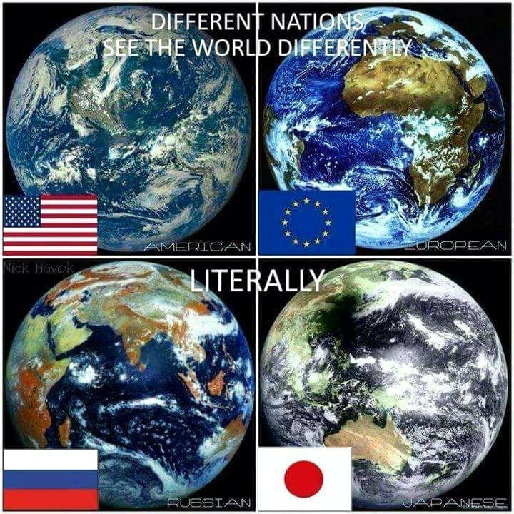
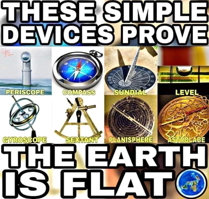
Some facts to put this into perspective, to hopefully convince you that you need to apply discernment, rather than just believing the authorities who tell you (& possibly everyone in your industry) lies about the true shape of the Earth. The following numbered list are quotes taken from the book Flat Earth FAQs written by (famed atheist) Eric Dubay. I don’t align even remotely with the spiritual attitude of Eric Dubay, but he does like a good Flat Earth Fact, and has gathered lots of good information for this book. Indeed, these quotes are from the first 45 pages of a 303 page book, which is very simple to read & even has fun memes to break the monotony of the text!
Since having that dream, I eventually came to be a fully paid up member of the true flat Earth believing society within our civilisation – an unaffiliated, informal group of individuals sparsely dotted around the world, with no direct support network, no communal get-together events, no full conferences of any merit, no forums in which one is easily satiated with online community activity based on flat Earth belief, and no ability to any longer enjoy the BS science fiction that Hollywood pumps out (this is more distressing than you might think; I used to love films like Apollo 13 & shows like Battlestar Galactica). It’s difficult to even locate Telegram groups which properly assuage the drive to more fully understand the flat Earth reality. After years of uncertainty & doubt, as we learn of the truth from scattered YouTube & Telegram videos, we eventually find ourselves so roundly mocked, disparaged & ridiculed, all the world over, that we live secret lives; believing in private, satisfied in the knowledge that the theory is true, yet forever moribund at the knowledge that nobody will ever believe us in our immediate family & regular circle of friends.

The great illusion of the globe Earth, which the elites have deliberately fooled us with over the past approximately 150 years, is refuted easily one would think; I mean, one needs only to swivel & point a camera from one of the many geosynchronous satellites at a suitable distance from our ‘planet’ Earth, and take a snapshot of the Earth in all its fullness, then distribute it in Time Magazine with an article debunking each position that the flat earth team utilise in the furtherance of their delusion. Surely, it is not difficult to snap a photo like that?
NASA receives over $50,000,000 each & every day in funding, so surely they can stretch to sticking a gimbal onto one of their satellites, enabling a camera to swivel once in a while?

However, it has proven difficult. Indeed, it is impossible, as Robert Simmons, image curator at NASA has explained publicly. Every single photograph of the Earth is a composite, many strips stitched together & doctored so it looks real – at least to Rob Simmons. Because, undeniably, once you start to hear of the myriad facts proving it, the Earth is as flat as a pancake & space as it has been described to us by authorities such as NASA & every Hollywood movie does not exist.
The mountain ranges which pepper the Earth are like the risings of a pie crust in the oven; cracks & rilles, mounds & craters – yet the crust is generally extremely flat. Whatever processes formed the Earth in ancient times; the heating & cooling of the tectonic plates, glaciers flowing & cascading across their vast expanses in many & diverse places, led eventually to the varied landscapes, and by extension, the myriad nuanced ecosystems that we study & enjoy today – but it’s all flat. NASA is nothing more than an expensive money laundering operation for certain members of the upper echelon elites of the United States, with a sideline in film-making & special effects, set decoration, cartoons & animation. These days they leave the upper atmospheric flight & research to the military.

Some facts to put this into perspective, to hopefully convince you that you need to apply discernment, rather than just believing the authorities who tell you (& possibly everyone in your industry) lies about the true shape of the Earth. The following numbered list are quotes taken from the book Flat Earth FAQs written by (famed atheist) Eric Dubay. I don’t align even remotely with the spiritual attitude of Eric Dubay, but he does like a good Flat Earth Fact, and has gathered lots of good information for this book. Indeed, these quotes are from the first 45 pages of a 303 page book, which is very simple to read & even has fun memes to break the monotony of the text!
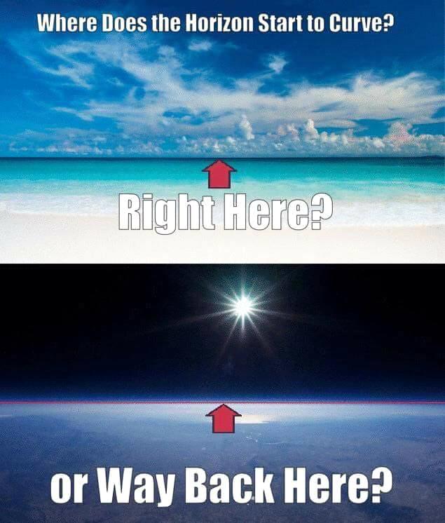
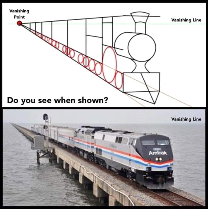
1. PERSPECTIVE. The horizon is not an objective physical phenomenon at all, but rather a subjective optical phenomenon based on an individual observer's perspective. If the horizon was actually the objective physical curvature of a globe, then objects receding beyond it could not be zoomed back into view, and it would remain fixed as an observer ascended. In reality, however, the horizon rises along with the observer no matter how high, and modern zoom technology can bring objects receding beyond it back into full view. This proves the horizon line is not some objective point of curvature on a convex Earth, but rather the subjective vanishing line of perspective from a given observer's point of view.
2. ARTIFICIAL HORIZON INDICATORS. If Earth was truly a sphere, by simply flying level, aeroplane artificial horizon indicators should show a steady decline unless pilots constantly correct their altitudes downwards so as not to fly straight off into so-called "outer-space." For example, a pilot travelling 500mph over a globe Earth 24,900 miles in circumference would have to descend an average of 2,777 feet, or over half a mile per minute, otherwise in one hour's time the plane would be 31.5 miles higher than desired. In fact, if Earth was really a ball, there should be no reason to use rockets for flying into "outer-space" because simply flying an aeroplane straight at any altitude for long enough would already inevitably send you there.
3. PLANE SAILING. Both Plane Sailing and Great Circle Sailing, the most popular navigation methods, use plane, not spherical trigonometry, making all mathematical calculations on the assumption that the Earth is perfectly flat. If the Earth were in fact a sphere, such an errant assumption would lead to constant glaring inaccuracies. Plane Sailing has worked perfectly fine in both theory and practice for thousands of years, however, and plane trigonometry has time and again proven more accurate than spherical trigonometry in determining distances across the oceans. It is so commonly used at sea "Navigation in Theory and Practice," states that "In practice, scarcely any other rules are used but those derived from plane sailing. The great and serious objection to plane sailing is that longitude cannot be found by it accurately, although in practice, it is more frequently found by it than any other method." So, both latitude and longitude are found most often and most accurately by assuming Earth to be flat, more accurately even than assuming the Earth to be spherical.
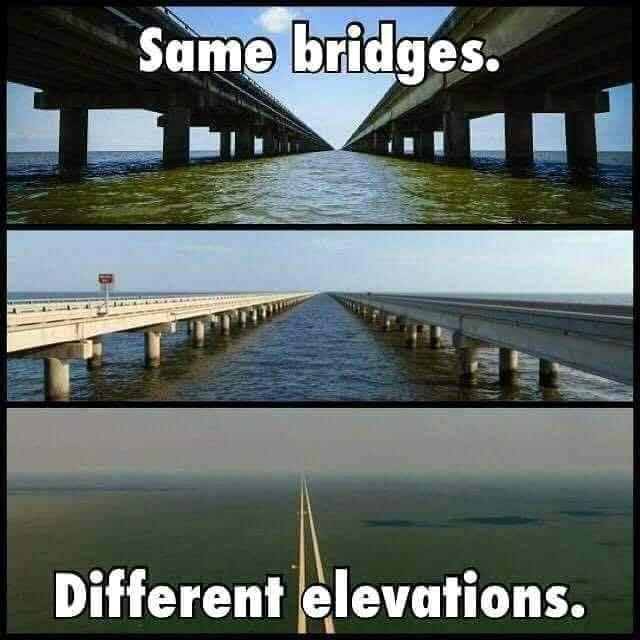
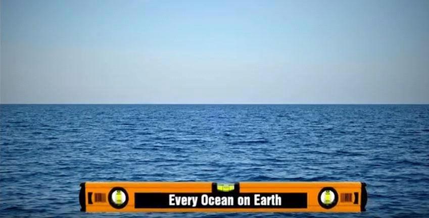
4. DATUM LINES. If Earth was actually a globe of given proportions, builders would find themselves constantly deviating from both their established vertical and horizontal datum lines, but in reality, canals, railways, bridges, tunnels and other large projects are always cut and laid horizontally, often over hundreds of miles, without any allowance for curvature and no deviation from the established datum. As stated by surveyor T. Westwood in Earth Review magazine, "In levelling, I work from ordinance marks, or canal levels, to get the height above sea level. The puzzle to me used to be, that over several miles each level was and is treated throughout its whole length as the same level from end to end; not the least allowance being made for curvature."
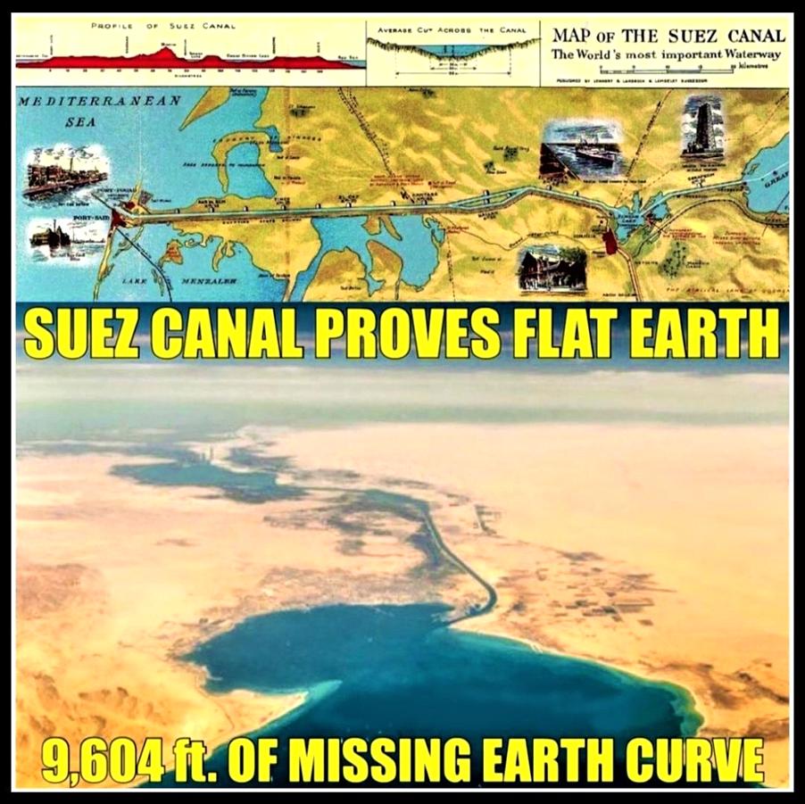
5. SUEZ CANAL. The Suez Canal is over 100 miles long and without any locks so the water within is an uninterrupted continuation of the Mediterranean Sea to the Red Sea. When it was constructed, the Earth's supposed curvature was not taken into account, it was dug along a horizontal datum line 26 feet below sea-level, passing through several lakes from one sea to the other, with the datum line and the water's surface running perfectly parallel over the 100 miles. Another good example is the Dunyang-Kunshan Bridge, the longest bridge in the world just over 102 miles long, which runs parallel to the Yangtze river and connects the Shanghai and Nanjing provinces. This bridge is approximately the same length as the Suez Canal and was also built without factoring the alleged curvature of the Earth.
6. ENGINEER COMMENTS. Engineer W. Winckler was published in the Earth Review regarding the use of spherical trigonometric allowances for the Earth’s supposed curvature, stating, "As an engineer of many years standing, I saw that this absurd allowance is only permitted in school books. No engineer would dream of allowing anything of the kind. I have projected many miles of railways and many more of canals and the allowance has not even been thought of, much less allowed for. This allowance for curvature means this: that it is 8" for the first mile of a canal, and increasing at the ratio by the square of the distance in miles; thus a small navigable canal for boats, say 30 miles long, will have, by the above rule an allowance for curvature of 600 feet. Think of that and then please credit engineers as not being quite such fools. Nothing of the sort is allowed. We no more think of allowing 600 feet for a line of 30 miles of railway or canal, than of wasting our time trying to square the circle."
7. RAILWAYS. The London & Northwestern Railway forms a straight line 180 miles long between London & Liverpool. The railway’s highest point, midway at Birmingham Station, is only 240 feet above the datum line known as ‘sea level’, but if the Earth was actually a globe of given proportions, the 180 mile stretch of rail would form an arc with its centre point at Birmingham raising over a mile, a full 5,400 feet, above London & Liverpool.
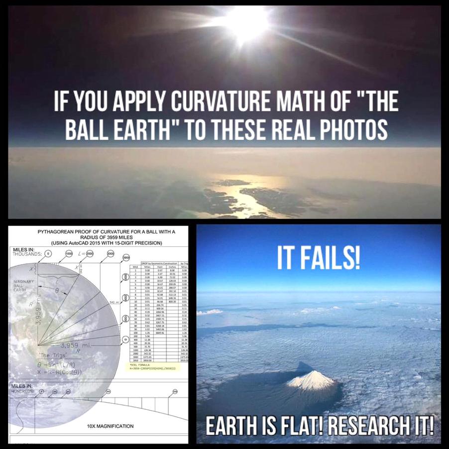
8. FARSIGHT. It is often possible to see the Chicago skyline from sea-level 60 miles away across Lake Michigan. In 2015 after photographer Joshua Nowicki photographed this phenomenon several news channels quickly claimed his picture to be a “superior mirage”, an atmospheric anomaly caused by a temperature inversion. While these certainly do occur, the skyline in question was facing the right way up & was clearly seen, unlike the upside-down, hazy illusory image of a mirage. The actual skyline, on a spherical Earth 24,900 miles in circumference, should be a full 2,400 feet below the horizon. In Genoa, Italy, from only 70 feet above sea level, on clear days it is possible to see the distant islands of Elba, Gorgona, Capraia & Corsica which are 81, 99, 102 & 125 miles away respectively. If Earth were truly a globe of the given proportions, all four islands could never be visible for such an observer and would be hidden behind 3,300, 5,200, 5,600 & 8,700 feet of curved water respectively.
FLAT EARTH FAQ, ERIC DUBAY
edit on NovemberSaturday24011CST07America/Chicago-060030 by FlyInTheOintment because: Adding source link
It is my hope that this thread will have made you think a little about WHY we are living in 'Satan's Little Season of Deception' - that the Millennial
reign of Christ has already occurred, that the rapture of the church has already occurred. The level & intensity of the globe Earth deception could
only have been engineered & perpetuated by an entity as malign & disgusting as Satan, because it literally robs children's hearts of their fondest
dreams, and crushes them into a spiraling nightmare of hellish proportions as they grow up thoroughly deluded, deceived by the rulers in countless
ways, unable to see clearly the path to God, which is so easy when you realise the true shape of the Earth. This is & always has been a built
environment. Knowing that puts you on the express elevator to Heaven, because you realise it was created by a God who cares for us.
Even the abysmal natural disasters which we presently experience can potentially be explained as being worse than ever before, the birth pains of the Kingdom, as Jesus prophesied - though our dating of all prophecies needs to be looked at again by people more learned than myself. I am convinced that we are living in the 'little season' of Satan, which occurs just prior to the final Apocalypse, and then, the White Throne judgement, when the Books will be opened, and we all will receive our due. I saw the Book of Life once, in a dream, in which I had been shown that society will devolve into chaos, and then I would die & be raised to Heaven. In that representation of Heaven I saw my ideal home: a cabin, in a forest by a lake. And on a desk in that cabin I saw the Book of Life, the pages filling with images & text as I watched, though no pen was being traced upon the pages by any person.
I know that what God intends for us is good, and I only hope I might convince mighty Bible scholars to consider that just maybe, we are living in the 'little season of Satan', and that there will be no rapture at the tribulation, instead there will be only the final Apocalypse, prior to the White Throne judgement. I pray that people would start to consider this possibility, because the Time of Trouble of Daniel 12 may almost be upon us.
a reply to: FlyInTheOintment
I’m not sure the earth is flat, but I am personally convinced it isn’t what they tell us it is.
Same goes for space.
I just became aware of the Satans little season theory so I’m still looking into that.
Things like the pictures in these two links and many like them sure make me wonder…
www.stereotheque.fr...
www.flickr.com...
new topics
-
Swedish Minister for Gender Equality is Seeking Treatment for Phobia of Bananas
Other Current Events: 1 hours ago -
Satanic ‘Little Season’ of Deception.. Awaken to the Handiwork of the Creator.
ATS Skunk Works: 2 hours ago -
USA-BIDEN and CHINA-Xi Agree Not To Let Artificial Intelligence Decide Nuclear Weapons Use.
World War Three: 2 hours ago -
The mysterious death of Aileen Conway
General Chit Chat: 5 hours ago -
Half-Life 2 is 20 Years Old - its Also Free on Steam until the 18th
Video Games: 9 hours ago
top topics
-
Does the Trump win mean No More Taylor Swift??
Politicians & People: 13 hours ago, 12 flags -
Trump-appointed judge blocks Biden administration overtime rule
Social Issues and Civil Unrest: 15 hours ago, 9 flags -
The mysterious death of Aileen Conway
General Chit Chat: 5 hours ago, 6 flags -
USA-BIDEN and CHINA-Xi Agree Not To Let Artificial Intelligence Decide Nuclear Weapons Use.
World War Three: 2 hours ago, 2 flags -
Satanic ‘Little Season’ of Deception.. Awaken to the Handiwork of the Creator.
ATS Skunk Works: 2 hours ago, 2 flags -
Half-Life 2 is 20 Years Old - its Also Free on Steam until the 18th
Video Games: 9 hours ago, 1 flags -
Swedish Minister for Gender Equality is Seeking Treatment for Phobia of Bananas
Other Current Events: 1 hours ago, 1 flags
2

