It looks like you're using an Ad Blocker.
Please white-list or disable AboveTopSecret.com in your ad-blocking tool.
Thank you.
Some features of ATS will be disabled while you continue to use an ad-blocker.
share:
originally posted by: kwakakev
A reply to: LaBTop
For me it's an indication that some fiddling with the vertical GIMP settings are to be tested on their influence on an eventual observable changing of the plane's length in GIMP. All vertical and horizontal lines should be straight then.
The GIMP Lens Distortion filter settings are:
Main: 30
Edge: -7
Zoom: 0
Shift X: 60
Shift Y:70
It is good to see you are starting to get it. Raising the Shift Y setting does fiddle with the vertical setting. Having this value in line with the object flight path will reduce the distortion the most along this axis.
With the Shift X value I aimed for an area between the object and the building wall to reduce the distortion the most in this area of the image and aim for a more accurate object measurement.
By centering the lens distortion this way, the main setting does not have to be too strong to just focus on the main part of the picture in question.
My numbers will be off a small fraction, I wanted to round the numbers of to help with others wanting to try this technique and have somewhere to start in experimenting with the lens distortion tool and how it affects the image.
With the ATS image upload still in a glitch for me, it is going to take a few days to help present the case I am trying to argue better.
Up till now, you haven't presented any "butterfly-with-spread-wings" image of your own, like the ones David Chandler presents on his website, and he says there, that those are the GIMP'ed ones, resulting from GIMP'ing the original DoD video frames, with his data settings.
Your till now posted oblong pictures resemble however a thinly warped version of some very vague oblong DoD video frame one, while I gave you lots of sharp links to the original DoD video frames, and posted lots of reasonable sharp ones.
Do you have and use the GIMP software package in your possession, or not, and do you use Photoshop or Paint-3D instead.? And are you using one of them 3, and understand how to use it.? Since you only came up with oblong pictures, and those are not GIMP'ed ones.
And, there is a simple way to get your pictures posted :
Just send them by PM to another member, or Mod or Admin, who knows how to attach pics in ATS, by this link, that gives every member only his own uploaded pictures page at ATS :
img.abovetopsecret.com...
Then he must upload this picture f.ex. in his PC its picture files window, and then, as his source, upload it in his uploaded ATS-pictures page. Then he can click it there and use/post the ATS-pic-link he'll then see there. [pic ]...[/pic ]
Ask them to post it for you, in your name.
And then to delete it, when you have solved your problems, and post it yourself.
.
Originally posted by : kwakakev
A reply to: LaBTop
LaBTop : I try to explain that the 45 degree internal damage path can or must have been created with TB's.
Kwakatev :I don't know much about what happened behind the Pentagon wall that day. Seen some photos and drawings, not enough for a clear picture of the damage inside and help find the likely flight angle that way.
LaBTop : No need to embark again on a years long 9/11 proof-finding adventure.
Just prove that David's original DoD video-frame and then GIMP'ed camera-1 picture with the right-leaning camera-2 pedestal present in it, can be fine-tuned to a straight vertical pedestal again, and not loosing lots of straight horizontal lines in that process. You have to start with that same camera-1 DoD video frame with that pedestal in it...!
I just start the camera-1 DoD video, play it, stop or start it with the "k" keyboard key, make a screenshot, import that in my PC's pictures file, then I start my (or, if you're doing it, your) uploaded pictures page at ATS :
img.abovetopsecret.com...
Then I upload this picture f.ex. in my PC its picture files window, and then, as my source, upload it in my uploaded ATS-pictures page. Then I can click it there and use/post the ATS-pic-link I'll then see there. [pic ]...[/pic ]
Then we have positively proven to the world outside, that AA77, the recorded plane, showed a to be expected length, comparable to the West Wall's height at column 14, nearing its known length of ~ 154 ft, to perhaps a 140 ft length.
Or, negatively proven, that its length shrinks to a near to 104 ft length, and then we have proven, that the 45 degrees attack path is right.
Of which I'm 100 % sure that it was not a 45 degrees flight-path, but a near 90 to 80 degrees one, based on all the witness statements on Washington Boulevard, around the CITGO gas station, the Nat.Cemetery parking and around and inside the Navy Annex buildings.
Kwakatev :As for trying to define the flight angle another way, how the contrail sits on the ground and slowly dissipates after the overexposed frame might be one way? It does leave a reference line along the ground. As for getting no distortion, an accurate measure and what kind or error rate it will have?
LaBTop : 100 % error rate. I thought of that too, right when I saw David's GIMP pictures video, and later his other 85 videos on his website.
First small problem : The smoke trail is too dispersed and vague, and could be overlapped by the perhaps longer and broader huge impact explosion cloud. Then we are left with the depth of view perspective problem, and arrive at :
Second huge problem : Can not be compared to another, in sight, measurable known artifact with a known length, of which we have indeed a few, because we have no known length of that smoke trail. And then it could follow 90 or 45 degrees, less or more.
Like we have the known plane length of 155 ft, being measured in the GIMP-picture as two times bigger as the known and also measured in David's GIMP picture, Pentagon facade height of 77 ft.
.
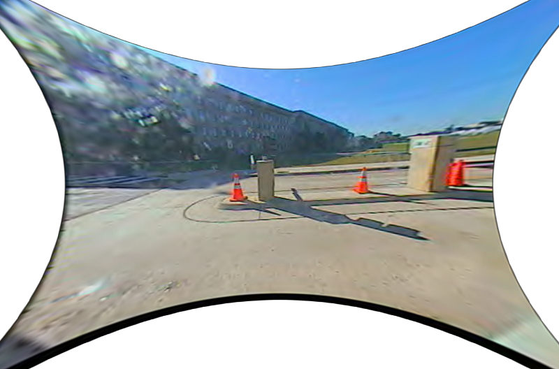
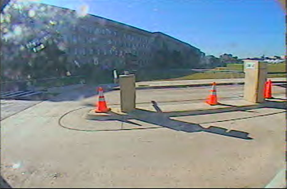
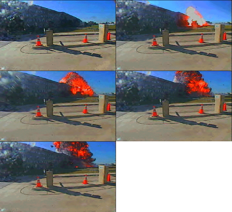
1st is a GIMP'ed DoD picture, second is just a DoD picture.
1st is a Straight roof-line, second is a Bend roof-line.
[pic]nr63938d89.png[/pic ]
[pic]dn5623a6e0.jpg[/pic ]
[pic]mj59005b07.gif[/pic ]
Googled : Lens Distortion filter settings
1. Premiere Pro Tutorial - Remove Lens Distortion :
www.youtube.com...
YouTube · Andy Ford Video 4 Oct 2020
2. gimp.org
docs.gimp.org...
4.8. Lens Distortion
This filter lets you simulate but also correct the typical distortion effect introduced in photo images by the glasses contained in the camera lenses.
docs.gimp.org...
5.5. Lens Distortion Prev 5. Distort Filters
5.5.1. Overview
Try with these settings, one after another :
Main . -70 to -100 , - go concave ) ( + go convex ( )
Edge . -60 ev.try -100 to 0.0 to +100
Zoom . 0.0 ev.try -100 to 0.0 to +100
Shift X . try 0.0 , ev.try -100 to +100
Shift Y . try 0.0 , ev.try -100 to +100
Brighten . try -100 to 0.0 to +100
The allowed range of all options is from -100.0 to +100.0.
.
1st is a Straight roof-line, second is a Bend roof-line.
[pic]nr63938d89.png[/pic ]

[pic]dn5623a6e0.jpg[/pic ]

[pic]mj59005b07.gif[/pic ]

Googled : Lens Distortion filter settings
1. Premiere Pro Tutorial - Remove Lens Distortion :
www.youtube.com...
YouTube · Andy Ford Video 4 Oct 2020
2. gimp.org
docs.gimp.org...
4.8. Lens Distortion
This filter lets you simulate but also correct the typical distortion effect introduced in photo images by the glasses contained in the camera lenses.
docs.gimp.org...
5.5. Lens Distortion Prev 5. Distort Filters
5.5.1. Overview
Try with these settings, one after another :
Main . -70 to -100 , - go concave ) ( + go convex ( )
Edge . -60 ev.try -100 to 0.0 to +100
Zoom . 0.0 ev.try -100 to 0.0 to +100
Shift X . try 0.0 , ev.try -100 to +100
Shift Y . try 0.0 , ev.try -100 to +100
Brighten . try -100 to 0.0 to +100
The allowed range of all options is from -100.0 to +100.0.
.
Kwakatev
The GIMP Lens Distortion filter settings are:
Main: 30
Edge: -7
Zoom: 0
Shift X: 60
Shift Y:70
It is good to see you are starting to get it. Raising the Shift Y setting does fiddle with the vertical setting. Having this value in line with the object flight path will reduce the distortion the most along this axis
To get near to David his GIMP picture, your Main + 30 value must be changed to - 70 to perhaps even - 100
The Shift settings seem not that important, read my GIMP link above, and view its small explanatory pictures.
I have sorted out the upload image issue, a bad file on my end.
In investigation this issue further, I do accept the source files from David as accurate. Trust has been low around the 9/11. As such I will use these images as they do provide better resolution.
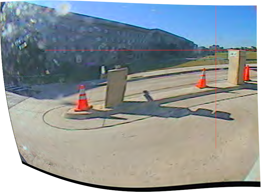
GIMP Lens Distortion Settings:
Main: -100
Edge: 50
Zoom : 0
Shift X: 61
Shift Y: -42
Brighten: 0
Lens distortions work well on polar coordinates. On polar maps there is only one point that has an accurate vector and magnitude to every other point, that is at the center origin, (0,0). The further away from the origin you get, more distortion effects can take place.
Using the Shift X and Y settings allows setting a new image origin for the polar transformation. By placing the origin to the center of the object and wall, this will reduce the distortion effects in this area of the image and allow for a more accurate measurement.
There is a red cross hair in this image to show where the new origin is in polar coordinates.
In investigation this issue further, I do accept the source files from David as accurate. Trust has been low around the 9/11. As such I will use these images as they do provide better resolution.

GIMP Lens Distortion Settings:
Main: -100
Edge: 50
Zoom : 0
Shift X: 61
Shift Y: -42
Brighten: 0
Lens distortions work well on polar coordinates. On polar maps there is only one point that has an accurate vector and magnitude to every other point, that is at the center origin, (0,0). The further away from the origin you get, more distortion effects can take place.
Using the Shift X and Y settings allows setting a new image origin for the polar transformation. By placing the origin to the center of the object and wall, this will reduce the distortion effects in this area of the image and allow for a more accurate measurement.
There is a red cross hair in this image to show where the new origin is in polar coordinates.
edit on 10-4-2023 by kwakakev because:
grammer
edit on 10-4-2023 by kwakakev because: grammer
edit on 10-4-2023 by kwakakev because:
grammer
edit on 10-4-2023 by kwakakev because: grammer
Glad you've sorted the upload problem out, we know that this AA77 issue is very difficult to explain to the readers, without sharp enough, trusted to
be original, pictures.
I do trust David too, that's why we must use his material, since he said he saved it from the two 2006 DoD video frames. That's enough for us (I checked it, then and now, by comparison), I know that he and his pals will defend their pictures origin against any and all opposition. No worry about that.
Why not use the 2006 DoD original picture from David, the second one in my above post.? This below one again :
[pic]dn5623a6e0.jpg[/pic ]

It has a plane above the camera-2 pedestal, a smoke trail, a bended roof line and pavement and 2 pedestals that can be straightened, what more do you want.?
It seems that you are quite obsessed with the 4 big trees in the far background, that's why you placed that red cross hair in there.?
I can't help you with that, since I don't see a problem with those 4 trees, in the DoD picture they stick a bit more up, in the GIMP'ed one they shrunk a bit, it's the GIMP effect.
If your problem is at the far right, nearly invisible trees, then why.?
Your GIMP picture also lacks a plane and a smoke trail.
Your GIMP roof-line looks a bit straightened, until the part that extends a few meter, begins. That part bends suddenly downwards quite a bit.
In fact, what you created down there as a roof-line, is a somewhat flatter form of your black fat bottom line, its bottom is equally convex ( ) , up and down warped :
[pic]mc6433edcd.png[/pic ]

Now back to your picture of what you seem to think is a lookalike of, or effort to get to David's GIMP'ed picture, the one that strongly (Main value set perhaps by him to - 100?) goes concave at all 4 sides, ) ( , so, David's below one again :
[pic]nr63938d89.png[/pic ]

You can not change the center of that DoD picture, because it has only one center origin, (0,0) and its center can be perfectly depicted by just diagonally drawing those two nice thin and red cross-hair lines, from each opposite corner to the other.
The proof that you have to do it that way, rests in the presence of those 4 cut out parts of the ROUND camera fish-eye lens its boundaries, in every DoD oblong-picture corner, forming a perfectly round border of the fish-eye lens, to see for us.
Thus that oblong DoD picture is cut out by its recording software from a much broader square video frame picture.
And when you draw those 2 thin red new lines, you'll find that they cross in a point a bit halfway up the smallest pedestal, and then a bit (~2/3rd of the width of that pedestal) to the right of its right side, and in the middle of the entry-road there.
Note also, that the right-bottom lens-border is not that whitish triangle, that's a part of the just visible whitish pavement.
The lens border triangle there is the smaller, just a tint darker triangle, deeper in that corner.
While you're at drawing thin red lines, draw a few more, very helpful extra ones in the DOD picture.
Along all 4 sides of both pedestals, as long as can be, so extend all 8 lines to top and bottom sides of the picture.
This gives you a very convenient manner of straighten these new red lines vertically up by changing some of the BING software setting value(s), back to hopefully now perfect vertical, BING'ed red pedestal lines.
Do not forget to get to straighten the roof lines and pavement lines.
I wish you success.
Lets now address your polar explanation :
Did you read my 4.8. Lens Distortion GIMP instructions, just a few posts of mine back.?
You would have found this gem :
You have in your first GIMP post, given both, only + values :
Shift X: 60
Shift Y: 70
and for the other values :
Main: 30
Edge: -7
Zoom: 0
In your last post the values were set to :
GIMP Lens Distortion Settings:
Main: -100
Edge: 50
Zoom : 0
Shift X: 61
Shift Y: -42
Brighten: 0
I repeat, one should start with all values set at zero, except the Main value, start that one with - 70, that's a minus sign, and proceed slowly to - 100.
View every GIMP result and save it.
Until at last, I think you'll find one that starts to look like David's GIMP result, of a strongly concave picture.
.
I do trust David too, that's why we must use his material, since he said he saved it from the two 2006 DoD video frames. That's enough for us (I checked it, then and now, by comparison), I know that he and his pals will defend their pictures origin against any and all opposition. No worry about that.
Why not use the 2006 DoD original picture from David, the second one in my above post.? This below one again :
[pic]dn5623a6e0.jpg[/pic ]

It has a plane above the camera-2 pedestal, a smoke trail, a bended roof line and pavement and 2 pedestals that can be straightened, what more do you want.?
It seems that you are quite obsessed with the 4 big trees in the far background, that's why you placed that red cross hair in there.?
I can't help you with that, since I don't see a problem with those 4 trees, in the DoD picture they stick a bit more up, in the GIMP'ed one they shrunk a bit, it's the GIMP effect.
If your problem is at the far right, nearly invisible trees, then why.?
Your GIMP picture also lacks a plane and a smoke trail.
Your GIMP roof-line looks a bit straightened, until the part that extends a few meter, begins. That part bends suddenly downwards quite a bit.
In fact, what you created down there as a roof-line, is a somewhat flatter form of your black fat bottom line, its bottom is equally convex ( ) , up and down warped :
[pic]mc6433edcd.png[/pic ]

Now back to your picture of what you seem to think is a lookalike of, or effort to get to David's GIMP'ed picture, the one that strongly (Main value set perhaps by him to - 100?) goes concave at all 4 sides, ) ( , so, David's below one again :
[pic]nr63938d89.png[/pic ]

You can not change the center of that DoD picture, because it has only one center origin, (0,0) and its center can be perfectly depicted by just diagonally drawing those two nice thin and red cross-hair lines, from each opposite corner to the other.
The proof that you have to do it that way, rests in the presence of those 4 cut out parts of the ROUND camera fish-eye lens its boundaries, in every DoD oblong-picture corner, forming a perfectly round border of the fish-eye lens, to see for us.
Thus that oblong DoD picture is cut out by its recording software from a much broader square video frame picture.
And when you draw those 2 thin red new lines, you'll find that they cross in a point a bit halfway up the smallest pedestal, and then a bit (~2/3rd of the width of that pedestal) to the right of its right side, and in the middle of the entry-road there.
Note also, that the right-bottom lens-border is not that whitish triangle, that's a part of the just visible whitish pavement.
The lens border triangle there is the smaller, just a tint darker triangle, deeper in that corner.
While you're at drawing thin red lines, draw a few more, very helpful extra ones in the DOD picture.
Along all 4 sides of both pedestals, as long as can be, so extend all 8 lines to top and bottom sides of the picture.
This gives you a very convenient manner of straighten these new red lines vertically up by changing some of the BING software setting value(s), back to hopefully now perfect vertical, BING'ed red pedestal lines.
Do not forget to get to straighten the roof lines and pavement lines.
I wish you success.
Lets now address your polar explanation :
Did you read my 4.8. Lens Distortion GIMP instructions, just a few posts of mine back.?
You would have found this gem :
X shift, Y shift
These two options specify the shift of the image produced by not perfectly centered pairs of lenses.
( LT : Thus must NOT be read as changing a vertical Y axis and/or a horizontal X axis line.
And the fish-eye lens is a single lens, not a pair of lenses.
Even if they would be, the fault will always be tiny, since it's a glue problem in a lens pair, it's not even a millimeter shift. )
As above this option produces visible results only if the Main or Edge options are non zero.
Figure 17.55. Example result of X shift option (Main set to 70.0)
You have in your first GIMP post, given both, only + values :
Shift X: 60
Shift Y: 70
and for the other values :
Main: 30
Edge: -7
Zoom: 0
In your last post the values were set to :
GIMP Lens Distortion Settings:
Main: -100
Edge: 50
Zoom : 0
Shift X: 61
Shift Y: -42
Brighten: 0
I repeat, one should start with all values set at zero, except the Main value, start that one with - 70, that's a minus sign, and proceed slowly to - 100.
View every GIMP result and save it.
Until at last, I think you'll find one that starts to look like David's GIMP result, of a strongly concave picture.
.
a reply to: LaBTop
When I talk about the origin, I am referring to the center of the lens distortion. The point where the convex / concave bends around. One way to find this point is to set the Main, Edge and Darken to 100%. Then as you adjust the Shift X & Y it will clearly show the part of the image where to recenter the lens distortion.

This image example is a bit exaggerated, but hopefully clarify the distortion issues I have with David's work. This UN logo map works great if you are at the north pole. When here it clearly details how far and what direction you need to go to get anywhere. If we are in Australia, this map is inaccurate with distance and direction to go anywhere, except back to the north pole. The further away we get from the origin of the lens distortion, in this case the north pole, the worst the distortion effects become. To be in Australia and have a usable map, we do need to adjust the origin of the map to Australia instead of the North Pole.
The barrel distortion images done by David looks great in the center of the image. The road and roof lines look good. There are still distortion issues remaining with the camera pedestal in the Camera 1 image as one example of it. What happens to the tree line on the far right of the image is another example of some image distortion still remaining.
What is important in these Pentagon images is the area between the flying object and where the Pentagon wall got hit. If we can reduce the distortion effects in this part of the image, a more accurate measure of the object size can be performed. This is why I have set the Shift X & Y to this part of the image.
When doing this, the Main setting does not have as much affect on this part of the image, around 10% on the measure of the flying object between -100 and +100 Main setting. This translate to an object size of 70 - 90 feet when using the height of the Pentagon wall where it got hit as a reference.
I still need to do more work to get a clearer Main and Edge setting.
When I talk about the origin, I am referring to the center of the lens distortion. The point where the convex / concave bends around. One way to find this point is to set the Main, Edge and Darken to 100%. Then as you adjust the Shift X & Y it will clearly show the part of the image where to recenter the lens distortion.

This image example is a bit exaggerated, but hopefully clarify the distortion issues I have with David's work. This UN logo map works great if you are at the north pole. When here it clearly details how far and what direction you need to go to get anywhere. If we are in Australia, this map is inaccurate with distance and direction to go anywhere, except back to the north pole. The further away we get from the origin of the lens distortion, in this case the north pole, the worst the distortion effects become. To be in Australia and have a usable map, we do need to adjust the origin of the map to Australia instead of the North Pole.
The barrel distortion images done by David looks great in the center of the image. The road and roof lines look good. There are still distortion issues remaining with the camera pedestal in the Camera 1 image as one example of it. What happens to the tree line on the far right of the image is another example of some image distortion still remaining.
What is important in these Pentagon images is the area between the flying object and where the Pentagon wall got hit. If we can reduce the distortion effects in this part of the image, a more accurate measure of the object size can be performed. This is why I have set the Shift X & Y to this part of the image.
When doing this, the Main setting does not have as much affect on this part of the image, around 10% on the measure of the flying object between -100 and +100 Main setting. This translate to an object size of 70 - 90 feet when using the height of the Pentagon wall where it got hit as a reference.
I still need to do more work to get a clearer Main and Edge setting.
edit on 11-4-2023 by kwakakev because: spelling
edit on 11-4-2023 by kwakakev because: grammer
Explanation of the Evidence at the Pentagon on
9/11
This is the full playlist by David Chandler 4 years ago on this topic.
1/ I agree being skeptical of the FDR data, lot of problems around that one.
2/ No point contradicting a large plane theory adopted. This one hurts, but I get the political environment he has to work in.
The only thing supporting a large plane 45 degree approach is the damage to the Pentagon wall. Not even one witness came close to this angle. I am staying out of that thermobaric bomb mess for now, especially at the Pentagon.
One angle I have been looking at:
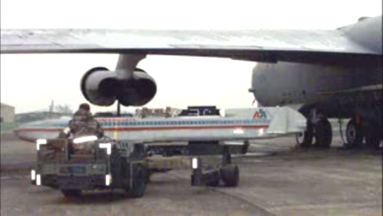
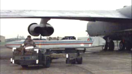
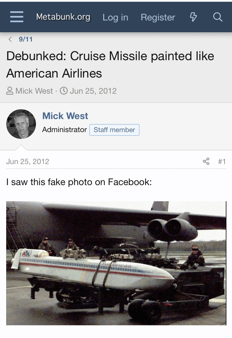
With my first Pentagon analysis, the size was coming close. The colors do not match so it was not this specific object that hit the Pentagon. As a general concept of warfare, something like this is still an option. The tone and shade of blue used in this missile image is getting close to a similar tone and shade of blue that was used on the object that hit the pentagon. There was just a lot more blue painted than a thin stripe in this image.
3/ David defending the lack of damage to the offices behind the collapsed walls. Maybe the Pentagon was built a bit tougher than the WTC? Even still, to be that close to a jet fuel fire ball, hmm... It has that believe me look.
4/ This wing damage for a 45 degree angle ain't' adding up. When things have momentum it hits hard. Like a full flying jet just takes off some marble, only busts a few windows. When seeing what these wings done to the steal reinforced WTC outer wall, went through it like butter.
5/ I do agree the that the C Ring exit hole is not due to the flying object pathway.
Only up to chapter 3 for now.
This is the full playlist by David Chandler 4 years ago on this topic.
1/ I agree being skeptical of the FDR data, lot of problems around that one.
2/ No point contradicting a large plane theory adopted. This one hurts, but I get the political environment he has to work in.
The only thing supporting a large plane 45 degree approach is the damage to the Pentagon wall. Not even one witness came close to this angle. I am staying out of that thermobaric bomb mess for now, especially at the Pentagon.
One angle I have been looking at:

With my first Pentagon analysis, the size was coming close. The colors do not match so it was not this specific object that hit the Pentagon. As a general concept of warfare, something like this is still an option. The tone and shade of blue used in this missile image is getting close to a similar tone and shade of blue that was used on the object that hit the pentagon. There was just a lot more blue painted than a thin stripe in this image.
3/ David defending the lack of damage to the offices behind the collapsed walls. Maybe the Pentagon was built a bit tougher than the WTC? Even still, to be that close to a jet fuel fire ball, hmm... It has that believe me look.
4/ This wing damage for a 45 degree angle ain't' adding up. When things have momentum it hits hard. Like a full flying jet just takes off some marble, only busts a few windows. When seeing what these wings done to the steal reinforced WTC outer wall, went through it like butter.
5/ I do agree the that the C Ring exit hole is not due to the flying object pathway.
Only up to chapter 3 for now.
It seems I have to find my own GIMP and BLINK software, since you, Kwakatev, are stuck with a few huge misconceptions.
That's gonna cost me precious time again. There are no shops around here, sadly. And no post-office. Funny idea.
It's just a safe, pleasant but tiny and lonesome place.
I'll have to go on a long journey to get GIMP's newest software version, but I will then let the vendor first explain its inner workings extensively first, so that I will not miss anything of importance, before I buy it. I'll have my laptop with me.
I'm btw at the top of page 44 in the "Trying to Resolve 9/11" thread, a post by neutronflux, posted Sep, 14 2019 :
www.abovetopsecret.com...
And there at last, appears the first mention of David Chandler's and Ken Jenkings "Blink Comparator Views of the Plane at the Pentagon" web-page, in that huge thread.
Now I get really interested, since in 2019 this subject came already up at the ATS 9/11 Forum, thus I'm very curious how that discussion was going to develop, in the next 133 pages there, after 19 Sept 2019, up till now, 12 April 2023, 3 1/2 years long.
Therefor, I go first read a lot more pages in that thread.
Possibly misconceptions by Kwakatev :
1. Can it be that you think that David enlarged the DoD video frames with a visible plane in them, zoomed those 2 DoD frames to the max. zoom of 500 %, then cut these two below pics out, and only then let the GIMP software loose on these cut-outs.? Like you seem to try to do.?
While he took the oblong DoD pic, GIMP'ed it, and then zoomed the GIMP'ed fully concave pic to 500 %, then cut a piece out of it at the upper middle right side, and showed that cut out picture on his web site. With the slightly bended, slightly cut-out right side, the GIMP effect. From a pic with a nice straight roof line and pavement borders.
Your pic does not even get near those straight lines.
Your strangely warped picture, with its now double bended roof line and bottom side, its totally bended pavement border sections, no plane and no smoke trail and still leaning pedestals :
[pic]mc6433edcd.png[/pic ]

Because you, Kwakatev, keep coming up with your warped, oblong above pics, instead of at last showing us a comparable one as David shows as his GIMP created ones, the probably minus 70, to perhaps a max minus 100 Main value set, strongly concave pictures with thinned outwards stretching corner parts :
[pic]nr63938d89.png[/pic ]

These below two David pics I copied from the above neutronflux post on top of that page 44 (note the black dot again) :
files.abovetopsecret.com...
[pic]zg5d0fa7fc.gif[/pic ]
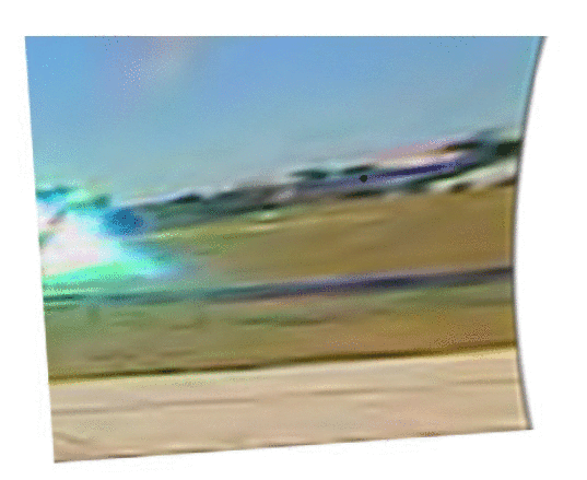
files.abovetopsecret.com...
[pic]rj5d0fa7fd.gif[/pic ]
2. You ask us to believe, that when you, with the same camera with which you took the UN picture with the North pole as its center point, take a new UN picture, which is however now drawn with the center of Australia as that pics center point, you can then GIMP both pictures, and then you can compare all Australian picture features in both UN pictures.? Really ..?
Because that's what you are doing with David's posted original DoD and then GIMP'ed picture.
You are altering a part of his GIMP'ed concave picture, the one with the corrected, now straight lines in it, and then you try to GIMP it with new setting values, so, GIMP that new picture with that new, altered specific part in it, again.
But, that's not what I asked you to do, you should FIRST try to create your own lookalike for David's strongly concave, but full of straight lines, GIMP'ed version of the original DoD video-frame with both pedestals in it, and also straight lines in it, like the one, I showed above.
You did not even come near at all with your try-outs.
3. You can not try to alter David's concave picture, by changing its center point in the original DoD video frame, that's ridiculous, then your resulting picture is totally false, since the fish-eye lens is perfectly round and has thus just one focus point and picture center point, the exact center of that lens.
And you want to tell us, that if you suppose that such a fish-eye lens has another center point, near a stretch that you want to alter, that you via the GIMP settings can change to such a new center, far away from the real center .? Not a fraction of a mm, where those X and Y axis settings are meant for, but cm's aside from the real center of such a round single fish-eye lens.
Then your outcome is a falsification.
If the GIMP software (can?) do that, you are wrong to do so, I told you already where the X and Y axis settings are for, a tiny minuscule change for eventually badly glued together lens pairs, and this is ONE of two cameras with ROUND fish-eye lenses, with both, just one center.
.
That's gonna cost me precious time again. There are no shops around here, sadly. And no post-office. Funny idea.
It's just a safe, pleasant but tiny and lonesome place.
I'll have to go on a long journey to get GIMP's newest software version, but I will then let the vendor first explain its inner workings extensively first, so that I will not miss anything of importance, before I buy it. I'll have my laptop with me.
I'm btw at the top of page 44 in the "Trying to Resolve 9/11" thread, a post by neutronflux, posted Sep, 14 2019 :
www.abovetopsecret.com...
And there at last, appears the first mention of David Chandler's and Ken Jenkings "Blink Comparator Views of the Plane at the Pentagon" web-page, in that huge thread.
Now I get really interested, since in 2019 this subject came already up at the ATS 9/11 Forum, thus I'm very curious how that discussion was going to develop, in the next 133 pages there, after 19 Sept 2019, up till now, 12 April 2023, 3 1/2 years long.
Therefor, I go first read a lot more pages in that thread.
Possibly misconceptions by Kwakatev :
1. Can it be that you think that David enlarged the DoD video frames with a visible plane in them, zoomed those 2 DoD frames to the max. zoom of 500 %, then cut these two below pics out, and only then let the GIMP software loose on these cut-outs.? Like you seem to try to do.?
While he took the oblong DoD pic, GIMP'ed it, and then zoomed the GIMP'ed fully concave pic to 500 %, then cut a piece out of it at the upper middle right side, and showed that cut out picture on his web site. With the slightly bended, slightly cut-out right side, the GIMP effect. From a pic with a nice straight roof line and pavement borders.
Your pic does not even get near those straight lines.
Your strangely warped picture, with its now double bended roof line and bottom side, its totally bended pavement border sections, no plane and no smoke trail and still leaning pedestals :
[pic]mc6433edcd.png[/pic ]

Because you, Kwakatev, keep coming up with your warped, oblong above pics, instead of at last showing us a comparable one as David shows as his GIMP created ones, the probably minus 70, to perhaps a max minus 100 Main value set, strongly concave pictures with thinned outwards stretching corner parts :
[pic]nr63938d89.png[/pic ]

These below two David pics I copied from the above neutronflux post on top of that page 44 (note the black dot again) :
files.abovetopsecret.com...
[pic]zg5d0fa7fc.gif[/pic ]

files.abovetopsecret.com...
[pic]rj5d0fa7fd.gif[/pic ]

2. You ask us to believe, that when you, with the same camera with which you took the UN picture with the North pole as its center point, take a new UN picture, which is however now drawn with the center of Australia as that pics center point, you can then GIMP both pictures, and then you can compare all Australian picture features in both UN pictures.? Really ..?
Because that's what you are doing with David's posted original DoD and then GIMP'ed picture.
You are altering a part of his GIMP'ed concave picture, the one with the corrected, now straight lines in it, and then you try to GIMP it with new setting values, so, GIMP that new picture with that new, altered specific part in it, again.
But, that's not what I asked you to do, you should FIRST try to create your own lookalike for David's strongly concave, but full of straight lines, GIMP'ed version of the original DoD video-frame with both pedestals in it, and also straight lines in it, like the one, I showed above.
You did not even come near at all with your try-outs.
3. You can not try to alter David's concave picture, by changing its center point in the original DoD video frame, that's ridiculous, then your resulting picture is totally false, since the fish-eye lens is perfectly round and has thus just one focus point and picture center point, the exact center of that lens.
And you want to tell us, that if you suppose that such a fish-eye lens has another center point, near a stretch that you want to alter, that you via the GIMP settings can change to such a new center, far away from the real center .? Not a fraction of a mm, where those X and Y axis settings are meant for, but cm's aside from the real center of such a round single fish-eye lens.
Then your outcome is a falsification.
If the GIMP software (can?) do that, you are wrong to do so, I told you already where the X and Y axis settings are for, a tiny minuscule change for eventually badly glued together lens pairs, and this is ONE of two cameras with ROUND fish-eye lenses, with both, just one center.
.
I miss the cooperation with all my old friends on this board dearly, they always swiftly helped me out.
Nowadays, they don't even post in here, I get a bad feeling about what's going on here at ATS its 9/11 Forum.
And in the world's populace in total, regarding 9/11.
I have a feeling that PM'ing me, will not help anymore too, in here.
I find it damn strange that only WhatItIs and Kwakatev interact in this thread in the last 4 months.
And nobody contacted David or Ken, or Wayne...do I miss something.?
Is David's GIMP'íng perhaps already countered in the years after 2015, and did I miss that perhaps, since I sparely checked in here in those 7,5 years, and seldomly read just a few posts, and now everybody in the know, chuckles.?...But David's site is still up and he is clearly checking and now and then repairing things.
I tend to get paranoid at times. A lot, lately.
.
a reply to: LaBTop
GIMP is free, open source software. You don't have to pay for it to get it. As for learning how to use it does take time.
GIMP Downloads
With you interest in this issue, I recommend checking it out yourself. One thing to account in using GIMP and its Lens Distortion tool is to increase the canvas size and the layer size of each image imported. This will allow you to better see the settings effects. This will also alter the Shift X & Y settings as this calculation is based on the layer size.
I have been thinking about getting in contact with David, but not until I have a clear and concise argument to present. I am getting closer to this with your help. We are already +20 years into this mess, better to be patient and get it right than rush it and cause more confusion. In considering what Main and Edge settings to use after X & Y is realigned, I am leaning towards the butterfly effect David came up with.
Once the Shift X & Y is reset to the red crosshair area, the practical difference that a main setting of -70 to -100 is very minor to the region where the flying object and Pentagon wall is. The Edge setting does not affect this region. I know these settings are important in selling the overall picture, but have a minor role in finding a true measurement through a lens distortion. Setting the magnification to +100 also looks reasonable to get a clearer perspective of the image area in question. I expect this magnification will do a better job than the usual scale image.
When going through my uni IT studies in multimedia, part of that included working with the dome screen at the planetarium and mirrordome software, Link
Firstly, not all fisheye lens are perfectly round. They do have a curved and rounded surface. Then there are also refraction issues of the lens material, different materials bend light differently. Some fisheye lens bend and have a greater Field of View than others. Each case on its own merits.
If you want an accurate measure of this flying object, I am giving my best professional opinion.
There are others watching and will pop up occasionally. For now battle fatigue looks to have set in from the royal rumble going on 10 - 15 years ago.
In going through the rest of David's Explanation of the Evidence at the Pentagon, it brought some flashbacks to the past debates on this site. I can see he is trying. With Floyd's lack of candor about what happened with his taxi and the light pole, trust is low on the light pole data.
With your aim in looking for an accurate impact speed in this mess looks like a tough job.
It seems I have to find my own GIMP and BLINK software, since you, Kwakatev, are stuck with a few huge misconceptions. That's gonna cost me precious time again. There are no shops around here, sadly. And no post-office.
GIMP is free, open source software. You don't have to pay for it to get it. As for learning how to use it does take time.
GIMP Downloads
With you interest in this issue, I recommend checking it out yourself. One thing to account in using GIMP and its Lens Distortion tool is to increase the canvas size and the layer size of each image imported. This will allow you to better see the settings effects. This will also alter the Shift X & Y settings as this calculation is based on the layer size.
I have been thinking about getting in contact with David, but not until I have a clear and concise argument to present. I am getting closer to this with your help. We are already +20 years into this mess, better to be patient and get it right than rush it and cause more confusion. In considering what Main and Edge settings to use after X & Y is realigned, I am leaning towards the butterfly effect David came up with.
Once the Shift X & Y is reset to the red crosshair area, the practical difference that a main setting of -70 to -100 is very minor to the region where the flying object and Pentagon wall is. The Edge setting does not affect this region. I know these settings are important in selling the overall picture, but have a minor role in finding a true measurement through a lens distortion. Setting the magnification to +100 also looks reasonable to get a clearer perspective of the image area in question. I expect this magnification will do a better job than the usual scale image.
3. You can not try to alter David's concave picture, by changing its center point in the original DoD video frame, that's ridiculous, then your resulting picture is totally false, since the fish-eye lens is perfectly round and has thus just one focus point and picture center point, the exact center of that lens.
When going through my uni IT studies in multimedia, part of that included working with the dome screen at the planetarium and mirrordome software, Link
Firstly, not all fisheye lens are perfectly round. They do have a curved and rounded surface. Then there are also refraction issues of the lens material, different materials bend light differently. Some fisheye lens bend and have a greater Field of View than others. Each case on its own merits.
If you want an accurate measure of this flying object, I am giving my best professional opinion.
I find it damn strange that only WhatItIs and Kwakatev interact in this thread in the last 4 months.
There are others watching and will pop up occasionally. For now battle fatigue looks to have set in from the royal rumble going on 10 - 15 years ago.
In going through the rest of David's Explanation of the Evidence at the Pentagon, it brought some flashbacks to the past debates on this site. I can see he is trying. With Floyd's lack of candor about what happened with his taxi and the light pole, trust is low on the light pole data.
With your aim in looking for an accurate impact speed in this mess looks like a tough job.
originally posted by: kwakakev
.
One angle I have been looking at:
Why? Oh why. It’s a fraud. And not even a good one.
originally posted by: WhatItIs
originally posted by: kwakakev
As one suspect for what this object is:
With whatever hit the Pentagon, the hole it left was not big enough to put an airplane the size in the official story. The bright while light on impact is what missiles do. There was none of this bright white light as the planes hit WTC 1 & 2.
You know that is a fake imagine….
That is a good post.
Your link to that dome page is interesting, but does not relate to the problem at hand, we want to stretch a flat, but distorted picture, in fact a DoD video frame, we don't want to project it via a mirror on a big dome its inside.
We, and I above all, want to start the job that David, Ken and Wayne should have done, to try to find any proof that their Blink and GIMP results are based perhaps, on wrong assumptions or executions of their GIMP settings.
The fastest results can probably be obtained by asking for help and assistance at the GIMP website.
After searching there in all available linked-to sub-site pages, there is no one I can find that gives a direct email address, or any other mains of contacting and calmly explaining our 9/11 GIMP problem. Not in their open forum. Or, asking without spilling the beans already, just make them curious enough to establish a contact.
Anybody going to have a try at it there.?
Taking the time to learn enough of the GIMP software seems a too lengthy task for me, while the world seems full of expert GIMP users. Anybody knows one.? Then ask him or her to step in this discussion, we need such an expert, fast.
The task :
How can an expert GIMP user or better GIMP-developer, control and prove, that David Chandler used the right GIMP settings, to let any observer come to the conclusion that in his used 2006-published DoD video frame, when GIMP'ed, it shows a visible plane length of 154 ft, since it is really two times the height of the Pentagon's West Wall of 77 ft, when compared to each-other at Flight AA77 its impact point at column 14 in that western Pentagon facade.
Or did he use such incorrect GIMP-settings, that the right length should be ~104 ft compared to the visible wall's height of 77 ft, and thus belongs to a plane, incoming at an ~ 45 degrees attack angle.
In both cases, the ultimate EVIDENCE for the right flight path of Flight AA77 is at last proven to the global populace.
A 45 degrees, or a 90 degrees attack angle.
If proven ~ 90 degrees, a lot of USA and other countries their leaders, civil servants, politicians, top military leaders, media owners, will have to explain a lot of things to their citizens.
If proven ~ 45 degrees, we can all go to sleep a lot better. Tough chance...
.
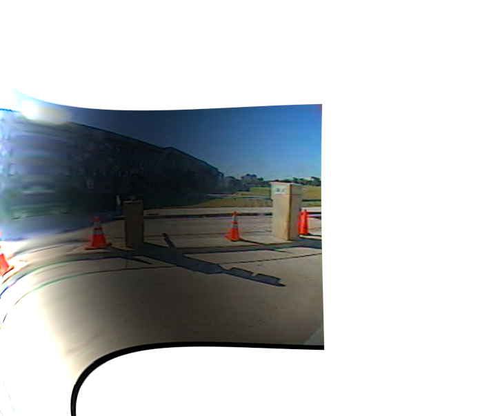
In looking for a more accurate Lens Distortion setting to measure the object, this is where I am up to. The full image is too big to upload to ATS so this image is a scaled down copy.
Main: +100
Edge: -100
Zoom: 100
Shift X: 48
Shift Y: -13
Brighten: 58
Note, the canvas size is +1000 width and height with the image centered. This does affect the Shift X & Y setting as it is calculated on layer size.
To find this Lens Distortion setting, first aligning Shift X & Y over the object. Using the full zoom available from this algorithm is reasonable to help get a clearer picture of the image region in question. Adding some Brighten identifies parts of the image that are undergoing increasing image distortion and helps focus on the important part of the image.
Once this is done, I used the camera pedestal as a reference to find the best Main and Edge settings. This is the part of the picture where we want to eliminate the image distortion. When comparing the camera pedestal in this image to the result David got, it is less distorted. It is reasonable that any measurement of the object in this area of the image will also be less distorted.
The following images are made with these settings, except Brighten is set to 0 so not interfere with color quality.

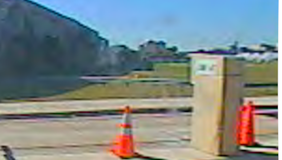
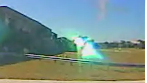
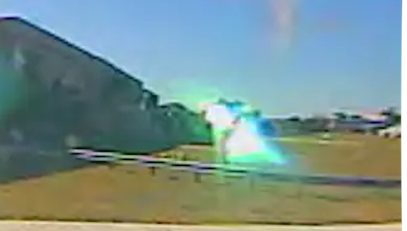
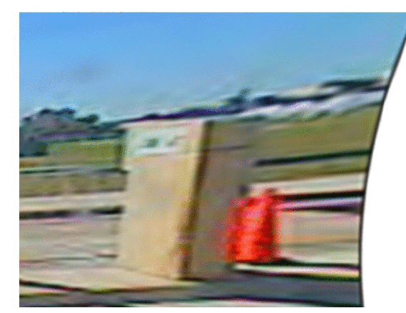
On initial inspection of these images, the size of the object is comparable to the height of the wall. There is some variability on how this is actually measured and sounds like LaBTop has been spending some time on this one. Do you have any comment LaBTop on how these images measure up to what you are looking for?


On initial inspection of these images, the size of the object is comparable to the height of the wall. There is some variability on how this is actually measured and sounds like LaBTop has been spending some time on this one. Do you have any comment LaBTop on how these images measure up to what you are looking for?
The following images have been scaled up in size from the above images. They just focus on the object in question.
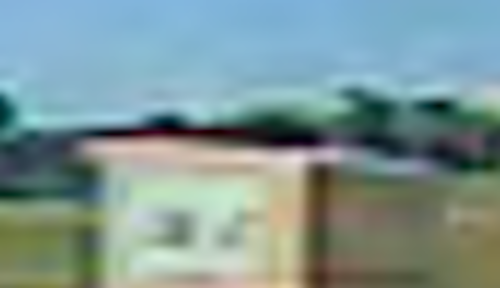
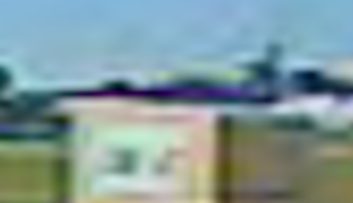
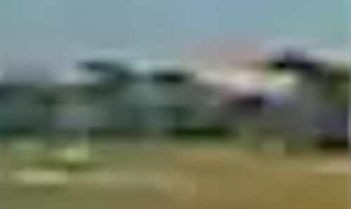
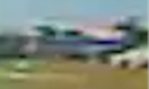


For a side by comparison between David and Kwakakev.
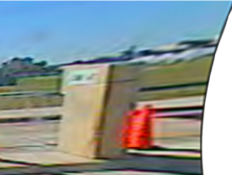
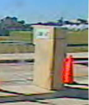
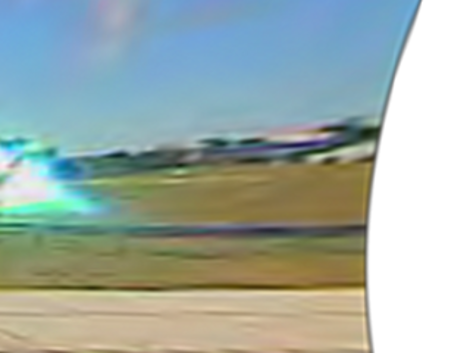

Which ones looks more distorted to you?


Which ones looks more distorted to you?
edit on 13-4-2023 by kwakakev because: added 2 pics
edit on 13-4-2023 by kwakakev
because: camera consistancy
My 2 bits since I have't read any part about elevation yet...
I grew up on S. Courthouse Rd + Columbia Pike, this area is called Columbia Heights for a reason because you are basically looking down on DC from this vantage point and the Pentagon I might add.
It is one continuous downhill slope standing at the intersection of s.courthouse and columbia pike looking towards the Sheraton (you are basically looking at the Sheraton's rooftop.
Your picture does not reflect this...
This is over a 300ft drop in under 3/4 of a mile, as it is 1 full mile from Col Heights intersection to the Pentagon itself.
-Large circle is Columbia Heights (S. Courthouse Rd + Columbia Pike)
-Med circle is the Sheraton
-Small circle is the State Police depot
(same with the red dots on your pic)
I wonder if that large a plane could have leveled out in the time it passed the the first bend on Col Pike at the Police depot to impact that parallel with the side of the building.
From the bend at the police depot to Pentagon is another sharp downhill incline.
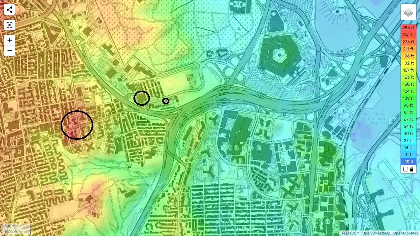
topo-maps
I grew up on S. Courthouse Rd + Columbia Pike, this area is called Columbia Heights for a reason because you are basically looking down on DC from this vantage point and the Pentagon I might add.
It is one continuous downhill slope standing at the intersection of s.courthouse and columbia pike looking towards the Sheraton (you are basically looking at the Sheraton's rooftop.
Your picture does not reflect this...
This is over a 300ft drop in under 3/4 of a mile, as it is 1 full mile from Col Heights intersection to the Pentagon itself.
-Large circle is Columbia Heights (S. Courthouse Rd + Columbia Pike)
-Med circle is the Sheraton
-Small circle is the State Police depot
(same with the red dots on your pic)
I wonder if that large a plane could have leveled out in the time it passed the the first bend on Col Pike at the Police depot to impact that parallel with the side of the building.
From the bend at the police depot to Pentagon is another sharp downhill incline.


topo-maps
edit on 13-4-2023 by
iamthevirus because: (no reason given)
Yes, I addressed the hill, but everybody lately here seems to follow the US Government its official 9/11 view on the Pentagon attack details and
data.
Which I do not, based on ~ 50 witness statements from the day of 9/11/2001 itself, and shortly after or up to weeks and month later.
And now this latest evidence for a 90 degrees impact flight path for AA77, which can only be flown in a curved approach path from the last reliable radar data point and speed, just beside the Sheraton Hotel, and then around the CITGO gas station's northern side and along the southern side of the National Cemetery's South parking.
Such a curved flight path for a B757-203 can only be flown at a maximum possible speed of 260 MPH, and probably at a lower speed.
And then the elevation subject, does not come into play.
And this path could only have been flown in 2001 with a computer steered aircraft in those last 300 meters, to achieve such a precision, to impact on a double line of re-barred columns, and exactly on a huge first floor re-barred concrete slab.
At the ridiculous 542 MPH / 817 KM/hr, proposed by a lot of 9/11 researchers, which is totally impossible, in such a curved flight path.
There is a page full of extra links by Paul Bourke, to fish-eye lens but dome related subjects : paulbourke.net...
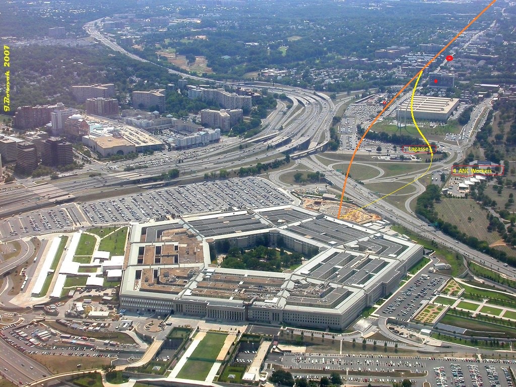
And I found this picture defended seemingly also by David Chandler, in which to me, it seems that David defends strongly, the 45 degrees attack path to the Pentagon's facade, flown by Flight AA77 :
[pic]hh6438e027.JPG[/pic ]

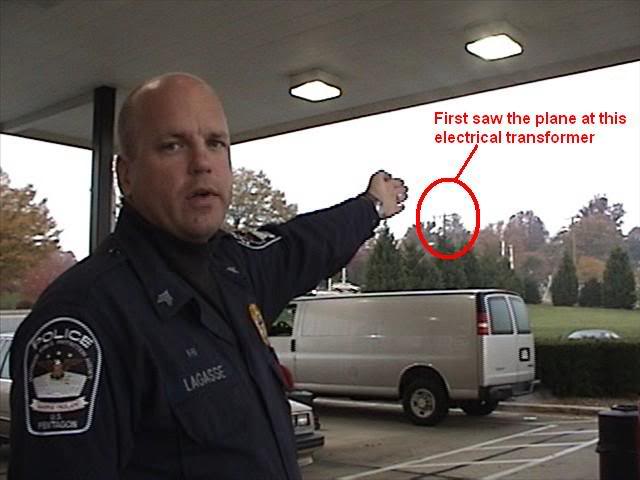
While I showed you in this thread, (search ATS : LaBTop Lagasse) and also in older threads here started by me, and some by others, that Sgt. Lagasse points with his stretched out arm, at the North side of the CITGO gas station, which is situated to the far left, bottom corner of this above picture. In a CIT 9/11 witness video, that all longterm 9/11 researchers know very well :
[pic]nn4ed2847e.jpg[/pic ]
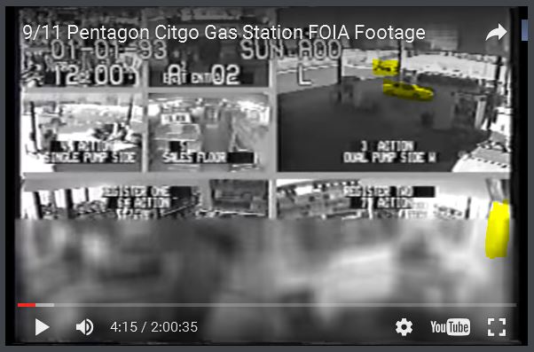
And I posted in there, a lot of 9/11 pictures of the North viewing security camera placed under the northern roof part of the CITGO gas station,
[pic]qu63a718cc.jpg[/pic ]

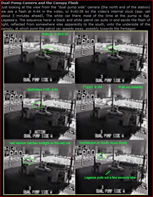
where you can see Lagasse filling up his Police cruiser's gas tank, while he is clearly looking at the petrol pedestal its counting mechanisms, which means he is looking NORTH, where AA77 passed very low on its last 130 meters to the Pentagon impact, and caused that white flash on the northern ceiling roof part :
[pic]zi63a69a65.jpg[/pic ]

[pic]cq577052cc.JPG[/pic ]
[pic]mx58f6faab.JPG[/pic ]
[pic]nx639e5fcc.png[/pic ]

Lagasse also explains in that Citizens Investigation Team video, that he saw it clip some light pole tops, but that were not the ones in the official stories 5 clipped ones, in their defense of a 45 degrees flight path.
It were the ones along that road going from that left bottom corner to under the viaduct under Washington Boulevard, or even the ones along that double curved road along the southern border of the Nat.Cemetery.
Where those 3 workers, also talking in the CIT video, all three witnessed as they say, AA77 fly past them, in a flight path between the northern CITGO roof, and where they stood on the southern parking place of the National Cemetery.
.
And I found this picture defended seemingly also by David Chandler, in which to me, it seems that David defends strongly, the 45 degrees attack path to the Pentagon's facade, flown by Flight AA77 :
[pic]hh6438e027.JPG[/pic ]

While I showed you in this thread, (search ATS : LaBTop Lagasse) and also in older threads here started by me, and some by others, that Sgt. Lagasse points with his stretched out arm, at the North side of the CITGO gas station, which is situated to the far left, bottom corner of this above picture. In a CIT 9/11 witness video, that all longterm 9/11 researchers know very well :
[pic]nn4ed2847e.jpg[/pic ]

And I posted in there, a lot of 9/11 pictures of the North viewing security camera placed under the northern roof part of the CITGO gas station,
[pic]qu63a718cc.jpg[/pic ]

where you can see Lagasse filling up his Police cruiser's gas tank, while he is clearly looking at the petrol pedestal its counting mechanisms, which means he is looking NORTH, where AA77 passed very low on its last 130 meters to the Pentagon impact, and caused that white flash on the northern ceiling roof part :
[pic]zi63a69a65.jpg[/pic ]

[pic]cq577052cc.JPG[/pic ]

[pic]mx58f6faab.JPG[/pic ]

[pic]nx639e5fcc.png[/pic ]

Lagasse also explains in that Citizens Investigation Team video, that he saw it clip some light pole tops, but that were not the ones in the official stories 5 clipped ones, in their defense of a 45 degrees flight path.
It were the ones along that road going from that left bottom corner to under the viaduct under Washington Boulevard, or even the ones along that double curved road along the southern border of the Nat.Cemetery.
Where those 3 workers, also talking in the CIT video, all three witnessed as they say, AA77 fly past them, in a flight path between the northern CITGO roof, and where they stood on the southern parking place of the National Cemetery.
.
new topics
-
Well this is Awkward .....
Mainstream News: 20 minutes ago -
Kurakhove officially falls. Russia takes control of major logistics hub city in the southeast.
World War Three: 1 hours ago -
Liberal Madness and the Constitution of the United States
US Political Madness: 7 hours ago
top topics
-
New York Governor signs Climate Law that Fines Fossil Fuel Companies
US Political Madness: 14 hours ago, 17 flags -
Liberal Madness and the Constitution of the United States
US Political Madness: 7 hours ago, 8 flags -
Kurakhove officially falls. Russia takes control of major logistics hub city in the southeast.
World War Three: 1 hours ago, 5 flags -
Well this is Awkward .....
Mainstream News: 20 minutes ago, 5 flags
active topics
-
Trump says ownership of Greenland 'is an absolute necessity'
Other Current Events • 56 • : cherokeetroy -
Plane Crash Today --Azerbaijanian E190 passenger jet
Mainstream News • 38 • : andy06shake -
UK Borders are NOT Secure!
Social Issues and Civil Unrest • 16 • : angelchemuel -
Well this is Awkward .....
Mainstream News • 0 • : asabuvsobelow -
Elon Musk futurist?
Dreams & Predictions • 17 • : GENERAL EYES -
Kurakhove officially falls. Russia takes control of major logistics hub city in the southeast.
World War Three • 1 • : xuenchen -
Cold Blooded Killers on Christmas!! GRRRRrrr!!
Pets • 14 • : rickymouse -
Post A Funny (T&C Friendly) Pic Part IV: The LOL awakens!
General Chit Chat • 7962 • : underpass61 -
Panamanian President-“every square meter” of the Panama Canal belongs to Panama.
New World Order • 48 • : fringeofthefringe -
New York Governor signs Climate Law that Fines Fossil Fuel Companies
US Political Madness • 22 • : rickymouse

