It looks like you're using an Ad Blocker.
Please white-list or disable AboveTopSecret.com in your ad-blocking tool.
Thank you.
Some features of ATS will be disabled while you continue to use an ad-blocker.

"Chinese Area 51" Still Being Updated
page: 119
share:
Back in 2011 I read this thread and I've been curious about it ever since. I did some
searching but couldn't find anything recent, nor could I find anything confirming what it was.
Today I thought about it again and decided to go back and see if anything changed since, some things have...
If you've already seen this place before, skip to the bottom to see why I thought it was worth bringing up again.

40°29'12.19"N 93°30'0.01"E
This area was built

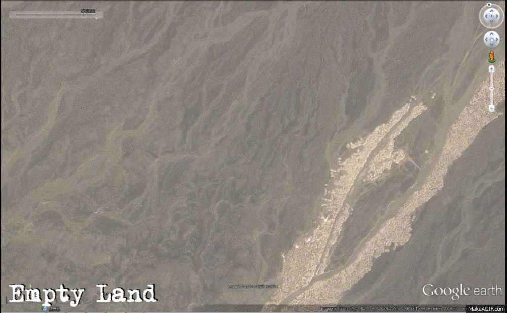
40°28'32.25"N 93°33'13.69"E
These were built earlier and destroyed. But in 2013 they were removed (?) and lots of vehicles appear

40°24'50.21"N 93°35'2.53"E
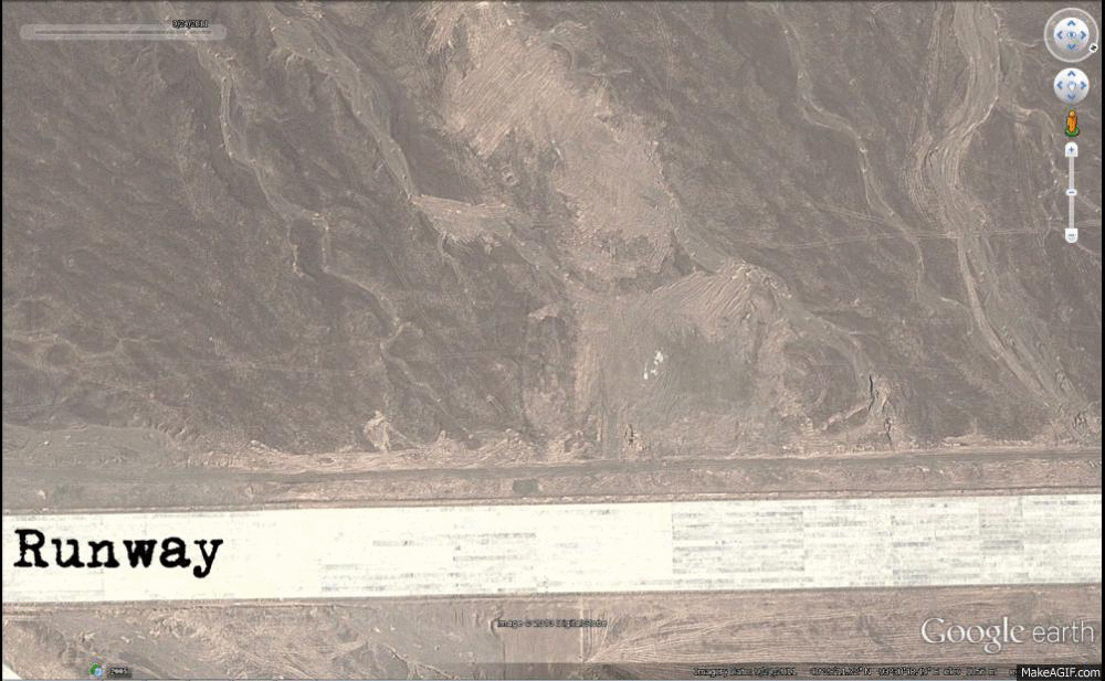
A hangar is built on a runway.

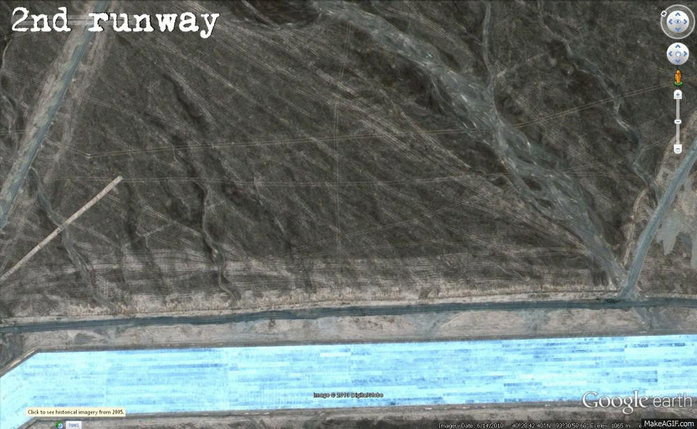
40°28'41.82"N 93°30'58.48"E
This isn't from 2013, but still mystifies me.

40°29'16.55"N 93°27'28.69"E
And then this is why I decided it may be worth making a thread...

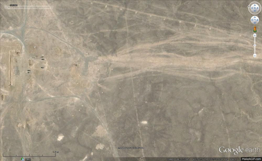
40°28'12.72"N 93°30'50.39"E
I was playing around with the timeline setting and noticed a runway (?) appear... when I zoomed in I noticed some kind of aircraft (I don't know which kind. I know nothing about planes!), then when I went forwards in time the plane was obviously blurred out... then when I went forwards once more it returned.
Here's a close up

Why is there some kind of hole in the road (?) leading towards it?
I don't usually make threads, and I'm sorry if I've done something wrong in this one. I feel like there's already too many pictures, so instead I'll just post coordinates of some of the places that caught my eye.
40°27'32.95"N 93°22'52.44"E - Huge empty square and strange markings.
40°27'2.89"N 93°44'34.61"E - More strange markings
40°29'45.67"N 93°25'47.45"E - To the left are some buildings which appear to be connected with some kind of wire? To the right are some more buildings.
40°31'4.54"N 93°27'22.88"E - I just noticed these now, they remind me of those huge trucks with rockets on the back... I'm probably wrong though.
40°29'26.40"N 93°30'38.70"E - Small set of buildings are built and destroyed.
40°28'9.25"N 93°31'20.16"E - Buildings constructed nearby the runway
40°24'10.56"N 93°38'22.78"E - I'm not sure what this is...
I feel like there's something special about this place, I could be very wrong. Thanks for looking!
Today I thought about it again and decided to go back and see if anything changed since, some things have...
If you've already seen this place before, skip to the bottom to see why I thought it was worth bringing up again.
40°29'12.19"N 93°30'0.01"E
This area was built
40°28'32.25"N 93°33'13.69"E
These were built earlier and destroyed. But in 2013 they were removed (?) and lots of vehicles appear
40°24'50.21"N 93°35'2.53"E
A hangar is built on a runway.
40°28'41.82"N 93°30'58.48"E
This isn't from 2013, but still mystifies me.
40°29'16.55"N 93°27'28.69"E
And then this is why I decided it may be worth making a thread...
40°28'12.72"N 93°30'50.39"E
I was playing around with the timeline setting and noticed a runway (?) appear... when I zoomed in I noticed some kind of aircraft (I don't know which kind. I know nothing about planes!), then when I went forwards in time the plane was obviously blurred out... then when I went forwards once more it returned.
Here's a close up
Why is there some kind of hole in the road (?) leading towards it?
I don't usually make threads, and I'm sorry if I've done something wrong in this one. I feel like there's already too many pictures, so instead I'll just post coordinates of some of the places that caught my eye.
40°27'32.95"N 93°22'52.44"E - Huge empty square and strange markings.
40°27'2.89"N 93°44'34.61"E - More strange markings
40°29'45.67"N 93°25'47.45"E - To the left are some buildings which appear to be connected with some kind of wire? To the right are some more buildings.
40°31'4.54"N 93°27'22.88"E - I just noticed these now, they remind me of those huge trucks with rockets on the back... I'm probably wrong though.
40°29'26.40"N 93°30'38.70"E - Small set of buildings are built and destroyed.
40°28'9.25"N 93°31'20.16"E - Buildings constructed nearby the runway
40°24'10.56"N 93°38'22.78"E - I'm not sure what this is...
I feel like there's something special about this place, I could be very wrong. Thanks for looking!
You don't post that many threads? Jesus. I better step up my game!! Beautifully done. Awesome info. S&F
It looks more like a bombing range than a base like Area 51.
When you try to discover things on Google Earth, it is best to have a baseline. That is a reference of some known place that is similar to that which you are trying to find. For instance, it would help to understand Edwards and Nellis AFB before trying to examine Groom Lake.
Here is the Nanjing base in China. Just a base I picked at random, but at least we know it is actually a base.
N31.998333 E118.813889
For one thing, it is fuel tanks.
You might want to slow down the rate at which your images change slide.
Not directly related to these specific pictures, but I did come across this awhile back when this first came to main stream news (at least I think
this is when it first hit the
scene):
Gobi Desert Anamolies Explained
Some of the grid lines were supposedly used as a fail-safe calibration system. Always wondered about what all of the other things were though, sure as hell looked like some sort of bomb/weapons testing range to me...
Some of the grid lines were supposedly used as a fail-safe calibration system. Always wondered about what all of the other things were though, sure as hell looked like some sort of bomb/weapons testing range to me...
It looks to be a bombing range, I live next to an Artillery and A-10 warthog bombing range, and is very similar, they set up tanks , aircraft,
buildings, strange 6 pointed stars, that must give the operator a better idea of where his projectile hit, and if it needs to be corrected.
Thanks for the replies, a bomb testing site seems reasonable... I'm just curious as to why that plane was erased? It can't be an accident, can it? I
mean... it's the only thing that was changed?
A great thread with a well deserved star
However, i cant follow the information on the pics as it changes too quickly. Please could you slow it down a bit for those of us that like to absorb info a bit slower
You will get a flag as well if you do
However, i cant follow the information on the pics as it changes too quickly. Please could you slow it down a bit for those of us that like to absorb info a bit slower
You will get a flag as well if you do
It says that I'm not allowed to edit my original post as it's been 4 hours so I'll put the slower pictures & originals here. Again, I believe it's
probable that it's just a site for bombing. My question is why the plane is blurred out that one time?
Click the coordinates to see a large picture with the originals, you should be able to zoom in (CTRL + Mousewheel for me.)
Hangar being built:
40°28'41.82"N 93°30'58.48"E
The 4x4 Grid:
40°24'50.21"N 93°35'2.53"E
The 2013 construction:
40°28'32.25"N 93°33'13.69"E
The orange circular building
40°29'16.55"N 93°27'28.69"E
And the plane
40°28'12.72"N 93°30'50.39"E
reply to post by AKindChap
The area defiantly looks like practice bombing ranges (Small craters varying in frequency across the range) and the fake airstrips do resemble a couple of airbases in Taiwan (Taoyuan AB, Taiwan).
The area defiantly looks like practice bombing ranges (Small craters varying in frequency across the range) and the fake airstrips do resemble a couple of airbases in Taiwan (Taoyuan AB, Taiwan).
new topics
-
Former NYT Reporter Attacks Scientists For Misleading Him Over COVID Lab-Leak Theory
Education and Media: 13 minutes ago -
Why did Phizer team with nanobot maker
Medical Issues & Conspiracies: 28 minutes ago -
Pro Hamas protesters at Columbia claim hit with chemical spray
World War Three: 48 minutes ago -
Elites disapearing
Political Conspiracies: 3 hours ago -
A Personal Cigar UFO/UAP Video footage I have held onto and will release it here and now.
Aliens and UFOs: 3 hours ago -
Go Woke, Go Broke--Forbes Confirms Disney Has Lost Money On Star Wars
Movies: 5 hours ago -
Freddie Mercury
Paranormal Studies: 5 hours ago -
Nirvana - Immigrant Song
Music: 9 hours ago -
British TV Presenter Refuses To Use Guest's Preferred Pronouns
Education and Media: 10 hours ago
top topics
-
British TV Presenter Refuses To Use Guest's Preferred Pronouns
Education and Media: 10 hours ago, 16 flags -
Go Woke, Go Broke--Forbes Confirms Disney Has Lost Money On Star Wars
Movies: 5 hours ago, 12 flags -
Trump To Hold Dinner with President of Poland At Trump Tower Tonight
2024 Elections: 13 hours ago, 8 flags -
Tucker Carlson interviews Christian pastor from Bethlehem.
Middle East Issues: 12 hours ago, 7 flags -
Pro Hamas protesters at Columbia claim hit with chemical spray
World War Three: 48 minutes ago, 7 flags -
Elites disapearing
Political Conspiracies: 3 hours ago, 7 flags -
A family from Kansas with six children moved to the Moscow region
Other Current Events: 16 hours ago, 6 flags -
Freddie Mercury
Paranormal Studies: 5 hours ago, 6 flags -
A Personal Cigar UFO/UAP Video footage I have held onto and will release it here and now.
Aliens and UFOs: 3 hours ago, 5 flags -
Nirvana - Immigrant Song
Music: 9 hours ago, 4 flags
active topics
-
Former NYT Reporter Attacks Scientists For Misleading Him Over COVID Lab-Leak Theory
Education and Media • 1 • : Dandandat3 -
Pro Hamas protesters at Columbia claim hit with chemical spray
World War Three • 4 • : StoutBroux -
Trump To Hold Dinner with President of Poland At Trump Tower Tonight
2024 Elections • 31 • : DBCowboy -
Gold and silver prices....woo hoo
History • 75 • : SchrodingersRat -
-@TH3WH17ERABB17- -Q- ---TIME TO SHOW THE WORLD--- -Part- --44--
Dissecting Disinformation • 512 • : cherokeetroy -
A Personal Cigar UFO/UAP Video footage I have held onto and will release it here and now.
Aliens and UFOs • 9 • : Ophiuchus1 -
Terrifying Encounters With The Black Eyed Kids
Paranormal Studies • 42 • : daskakik -
Elites disapearing
Political Conspiracies • 12 • : Degradation33 -
Candidate TRUMP Now Has Crazy Judge JUAN MERCHAN After Him - The Stormy Daniels Hush-Money Case.
Political Conspiracies • 318 • : matafuchs -
The Shed 26
General Chit Chat • 836 • : MRTrismegistus
19