It looks like you're using an Ad Blocker.
Please white-list or disable AboveTopSecret.com in your ad-blocking tool.
Thank you.
Some features of ATS will be disabled while you continue to use an ad-blocker.

Tonopah Test Range Google Earth imagery 7/22/2016
page: 15
share:
7/22/2016
37.793404° -116.771158 new building
37.785314° -116.765487° lots of cars
37.788909° -116.756991° buildings removed
37.803425° -116.761900° landfill expanded
37.807259° -116.776393° new tower
37.761840° -116.760566° new building
37.723731° -116.730658° new radar berm
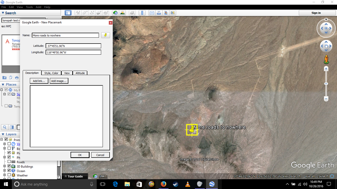
Happy hunting. Note they cut this really close to the north edge of the runway, as if someone ordered this imagery and Google poached it.
37.793404° -116.771158 new building
37.785314° -116.765487° lots of cars
37.788909° -116.756991° buildings removed
37.803425° -116.761900° landfill expanded
37.807259° -116.776393° new tower
37.761840° -116.760566° new building
37.723731° -116.730658° new radar berm
Happy hunting. Note they cut this really close to the north edge of the runway, as if someone ordered this imagery and Google poached it.
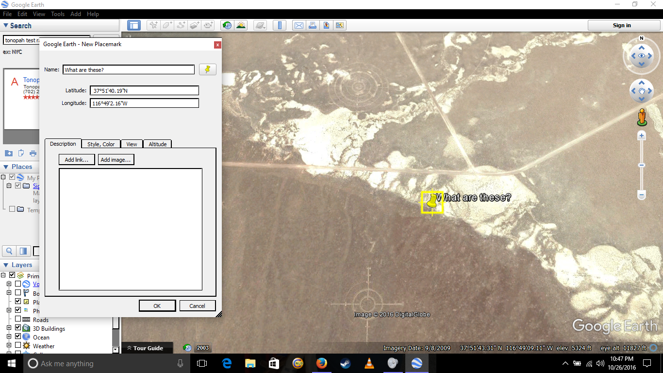
The only things missing are the "commercial gravel pits."
That is how the mining tailings are covered up.
That is how the mining tailings are covered up.

originally posted by: Violater1
The only things missing are the "commercial gravel pits."
That is how the mining tailings are covered up.
I would presume since available imagery would show large amounts of "Muck" which is the technical term for the rock left over (Tailings are actually something else) they would eat the cost associated with trucking it elsewhere or using previously excavated areas on site. Rumors persist that the proposed underground, mobile, MX system was mocked up and extensive tunnels were dug in and around the NTS and Nellis etc. which could also be used for storing the muck.
Otherwise a giant pile of the stuff would be a dead giveaway that something was underground.
Edit: The whole Nellis Range has seen alot of construction in the past 20 years, its also conceivable that the muck generated was then recycled as aggregate for all the concrete needed.
edit on 10/27/16 by FredT because: (no reason given)
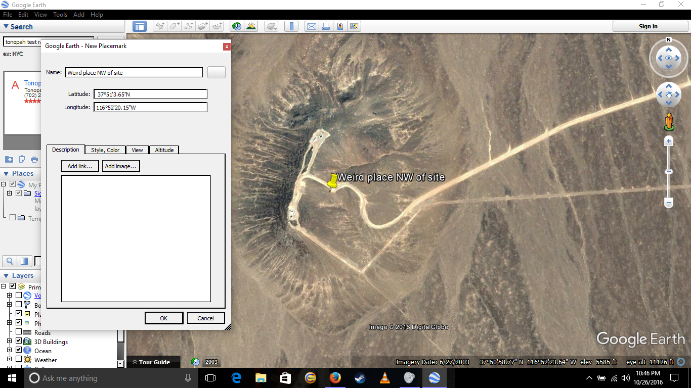
a reply to: BlackDog10
That hangar isn't in the group being used for flyable F-117 aircraft. Not that it matters I suppose. But whatever that stuff is, it certainly isn't very big.
The only other planes officially said to be at the TTR is/are Long EZ for UAV simulators.
That hangar isn't in the group being used for flyable F-117 aircraft. Not that it matters I suppose. But whatever that stuff is, it certainly isn't very big.
The only other planes officially said to be at the TTR is/are Long EZ for UAV simulators.
Is that really a real car park? Its just the colours dont seem right, no reds, blues etc, just white and dark. There are red, green and blue cars at
Groom Lake. I would think TTR probably looks nothing in real life like it does on google maps. Looking on google, there also seems to be a lot less
photos of TTR than Groom.
originally posted by: Moohide
Is that really a real car park? Its just the colours dont seem right, no reds, blues etc, just white and dark. There are red, green and blue cars at Groom Lake. I would think TTR probably looks nothing in real life like it does on google maps. Looking on google, there also seems to be a lot less photos of TTR than Groom.
In theory, no personal vehicles at the TTR. However I know for a fact personal vehicles went through the back gate for Groom Lake. A selling point would be genuine Groom Lake dust in the wheel wells.
When you watch the TTR, most vehicle are white. There are a number of civilian cars parked outside the boundary of the TTR. And of course there is the bowling alley pick up spot.
new topics
-
Maclemore - Hind's Hall (Pro-Palestine protest song)
Music: 3 minutes ago -
Social Security projected to cut benefits in 2035 barring a fix
Global Meltdown: 1 hours ago -
Trump supporters training in the HILLS!!!!
US Political Madness: 2 hours ago -
Is the move to greenwashing solar and wind power set up for money laundering.
The Gray Area: 2 hours ago -
LIVE: Putin inauguration ceremony
Regional Politics: 4 hours ago -
Black kids in the Bronx don't know what the word 'computer' is
People: 6 hours ago -
Aliens and Las Vegas
Aliens and UFOs: 8 hours ago -
This is what it is all about
US Political Madness: 9 hours ago
top topics
-
Trump supporters training in the HILLS!!!!
US Political Madness: 2 hours ago, 9 flags -
Black kids in the Bronx don't know what the word 'computer' is
People: 6 hours ago, 7 flags -
This is what it is all about
US Political Madness: 9 hours ago, 7 flags -
Sweet Home Alabama (metal cover by Leo Moracchioli)
Music: 17 hours ago, 4 flags -
Which chapter of the apocalypse is raining fish?
Jokes, Puns, & Pranks: 16 hours ago, 3 flags -
LIVE: Putin inauguration ceremony
Regional Politics: 4 hours ago, 2 flags -
Social Security projected to cut benefits in 2035 barring a fix
Global Meltdown: 1 hours ago, 2 flags -
Aliens and Las Vegas
Aliens and UFOs: 8 hours ago, 1 flags -
Malls, Music, Monoculture, Decline
Music: 12 hours ago, 1 flags -
Is the move to greenwashing solar and wind power set up for money laundering.
The Gray Area: 2 hours ago, 0 flags
active topics
-
Medvedev: “No one can hide, a global catastrophe is coming”
World War Three • 233 • : andy06shake -
Maclemore - Hind's Hall (Pro-Palestine protest song)
Music • 0 • : JAY1980 -
Post A Funny (T&C Friendly) Pic Part IV: The LOL awakens!
General Chit Chat • 7156 • : baddmove -
Liberal Democrats to Table a Motion of No Confidence in the government Tomorrow
Regional Politics • 12 • : RAY1990 -
Really Unexplained
General Chit Chat • 163 • : Beesnestbomber -
Trump supporters training in the HILLS!!!!
US Political Madness • 17 • : ADVISOR -
Breaking--Hamas Accepts New Cease Fire
Middle East Issues • 189 • : CarlLaFong -
Social Security projected to cut benefits in 2035 barring a fix
Global Meltdown • 10 • : CriticalStinker -
New whistleblower Jason Sands speaks on Twitter Spaces last night.
Aliens and UFOs • 115 • : Jukiodone -
Is the move to greenwashing solar and wind power set up for money laundering.
The Gray Area • 3 • : rdambroso
5